Signs Tagged With Speed Limit
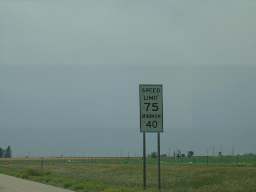
I-70 West - Speed Limit
Speed Limit 70 MPH / Minimum 40 MPH on I-70 West.
Taken 06-20-2026

 Stateline
Sherman County
Kansas
United States
Stateline
Sherman County
Kansas
United States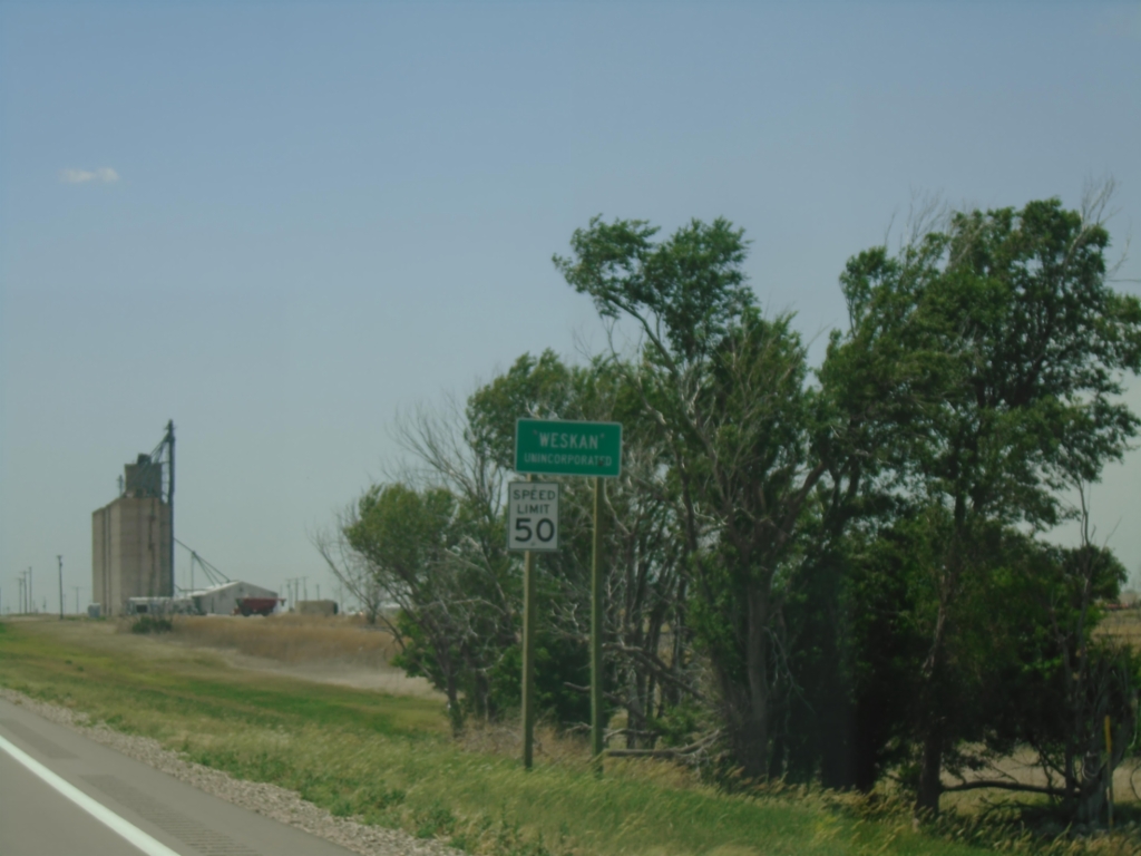
US-40 West - Weskan
Weskan - Unincorporated on US-40 west.
Taken 06-20-2026
 Weskan
Wallace County
Kansas
United States
Weskan
Wallace County
Kansas
United States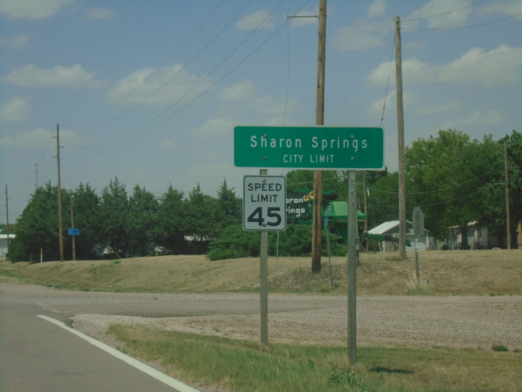
KS-27 North - Sharon Springs
Sharon Springs City Limit on KS-27 North. Sharon Springs is the county seat of Wallace County.
Taken 06-20-2026
 Sharon Springs
Wallace County
Kansas
United States
Sharon Springs
Wallace County
Kansas
United States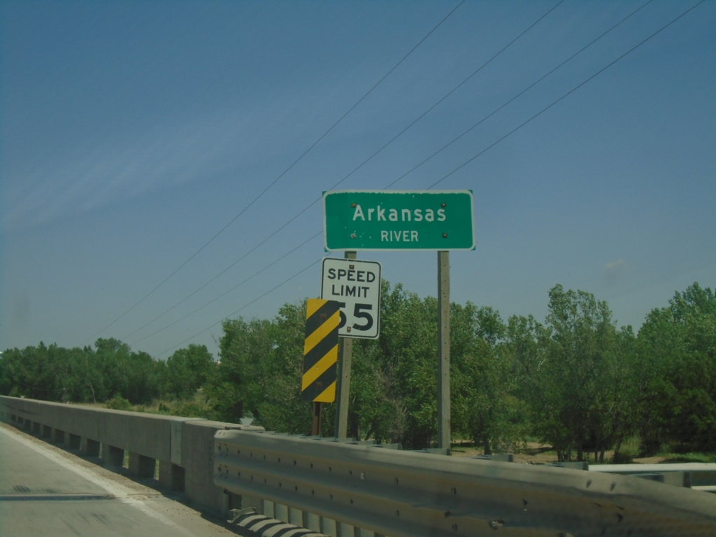
KS-27 North - Arkansas River
Arkansas River bridge on KS-27 North.
Taken 06-20-2026
Syracuse
Hamilton County
Kansas
United States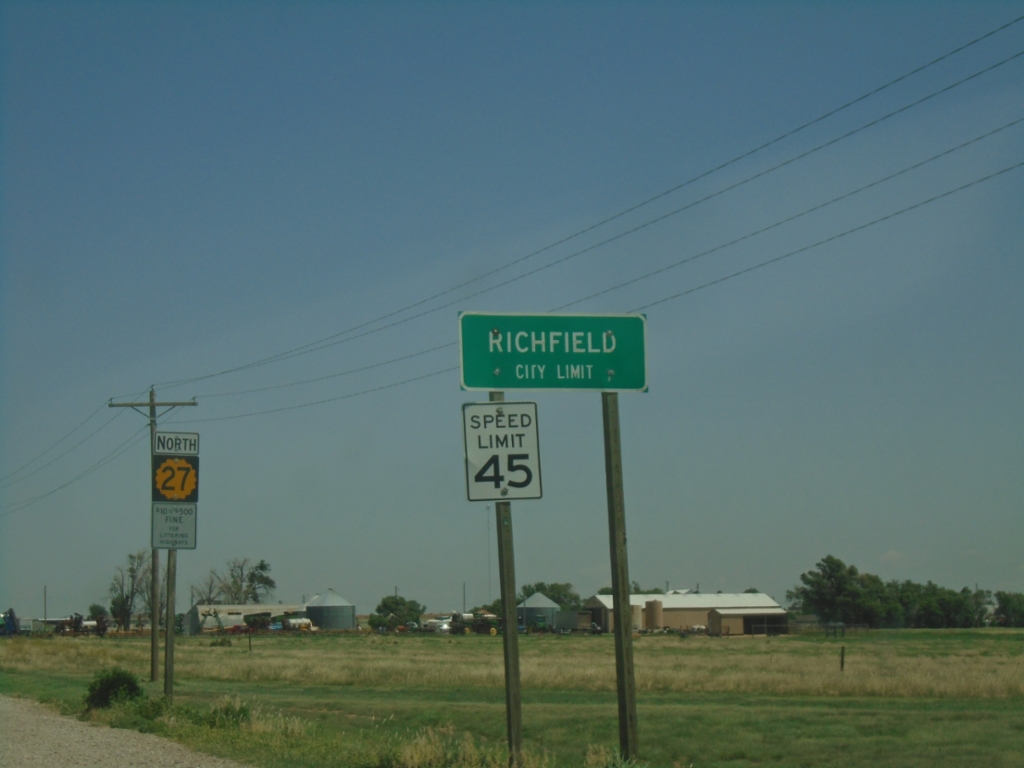
KS-27 North - Richfield
Richfield City Limit on KS-27 North.
Taken 06-20-2026
Richfield
Morton County
Kansas
United States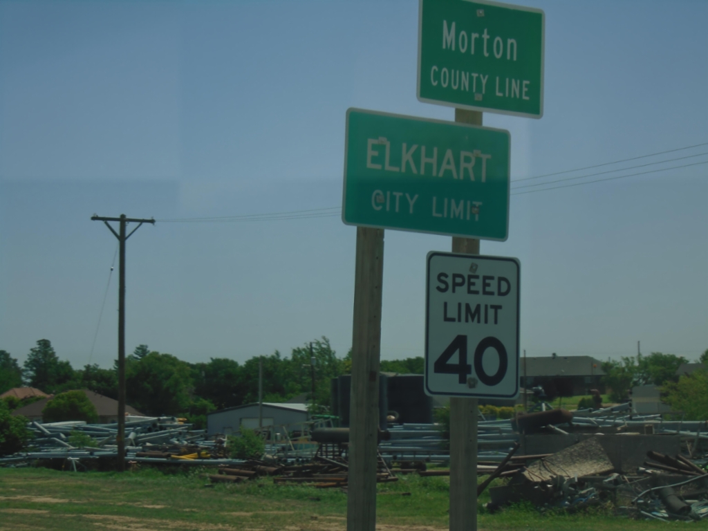
US-56 East - Entering Kansas
US-56 East - Morton County Line / Elkhart City Limit at the Oklahoma/Kansas State Line.
Taken 06-20-2026
 Elkhart
Morton County
Kansas
United States
Elkhart
Morton County
Kansas
United States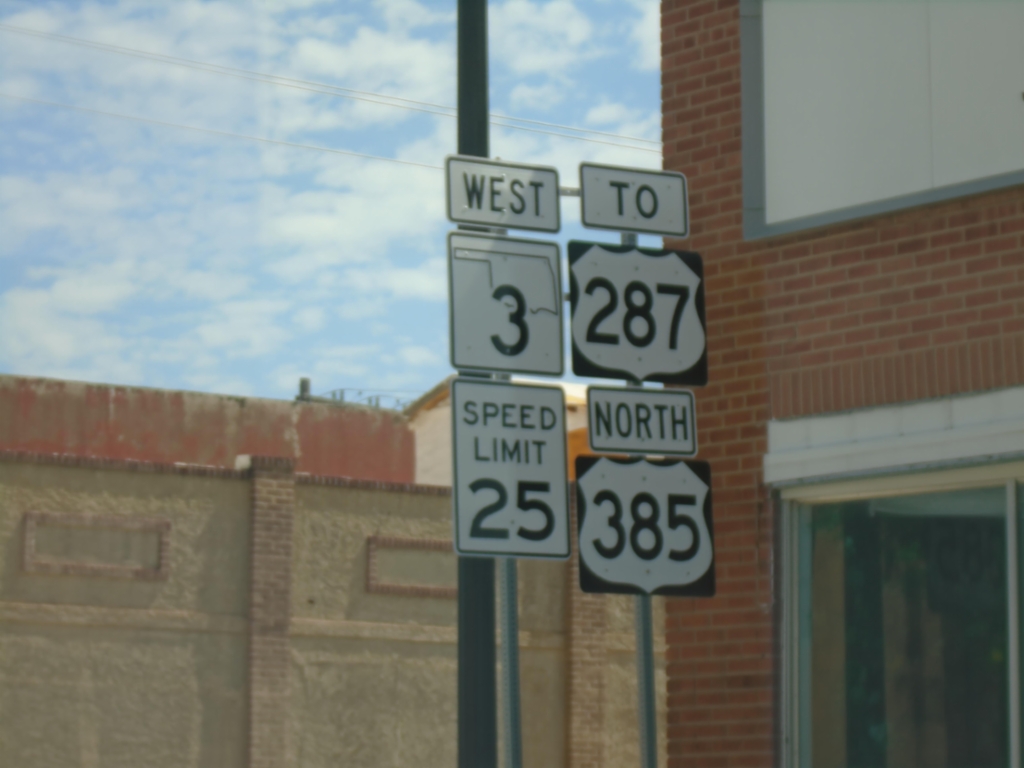
OK-3 West/US-385 North/To US-287 - Boise City
OK-3 West/US-385 North/To US-287 on N. Cimarron Ave. in Boise City. Speed Limit 25.
Taken 06-20-2026


 Boise City
Cimarron County
Oklahoma
United States
Boise City
Cimarron County
Oklahoma
United States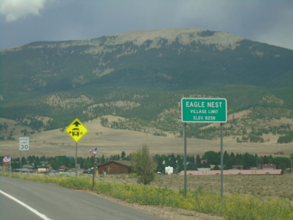
US-64 East - Eagle Nest
Eagle Nest Village Limit on US-64 East. Elevation 8258 Feet.
Taken 06-19-2026
 Eagle Nest
Colfax County
New Mexico
United States
Eagle Nest
Colfax County
New Mexico
United States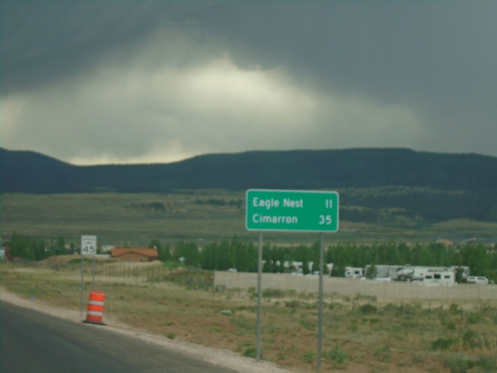
US-64 East - Distance Marker
Distance marker on US-64 east. Distance to Eagle Nest and Cimarron.
Taken 06-19-2026
Eagle Nest
Colfax County
New Mexico
United States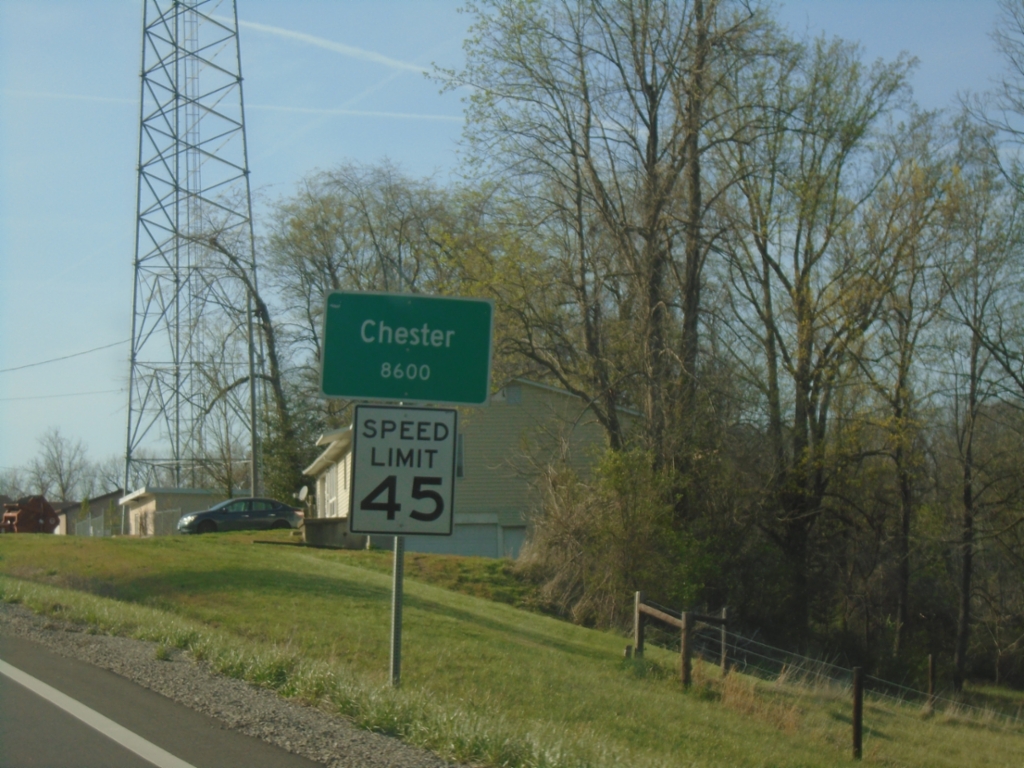
IL-3 North - Chester
Entering Chester on IL-3 North. Chester is the county seat of Randolph County.
Taken 03-29-2026
 Chester
Randolph County
Illinois
United States
Chester
Randolph County
Illinois
United States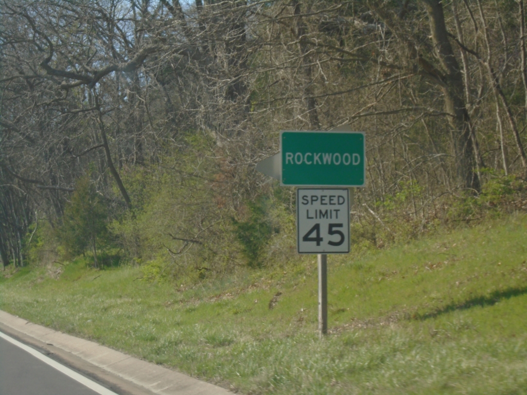
IL-3 North - Rockwood
Entering Rockwood on IL-3 North.
Taken 03-29-2026
Rockwood
Randolph County
Illinois
United States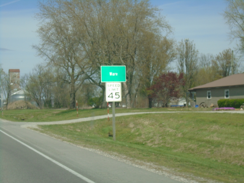
IL-3 North/IL-146 East - Ware
Entering Ware on IL-3 North/IL-146 East
Taken 03-29-2026
 Ware
Union County
Illinois
United States
Ware
Union County
Illinois
United States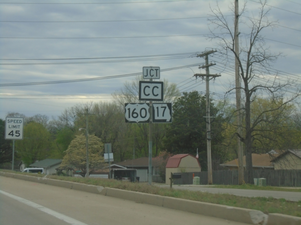
US-63 South Approaching US-160/MO-17/MO-CC
US-63 South Approaching US-160/MO-17/MO-CC in West Plains. US-160 and MO-17 joins US-63 southbound through West Plains.
Taken 03-27-2026


 West Plains
Howell County
Missouri
United States
West Plains
Howell County
Missouri
United States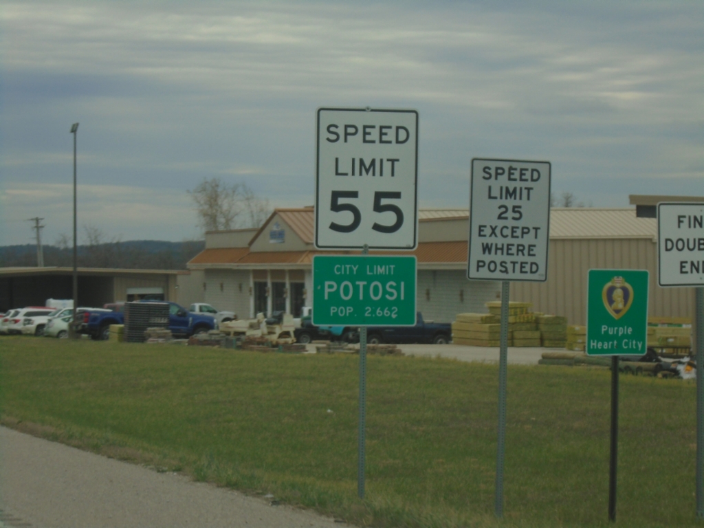
MO-21 South - Potosi
Potosi City Limit on MO-21 South. Potosi is the County Seat of Washington County.
Taken 03-27-2026
 Potosi
Washington County
Missouri
United States
Potosi
Washington County
Missouri
United States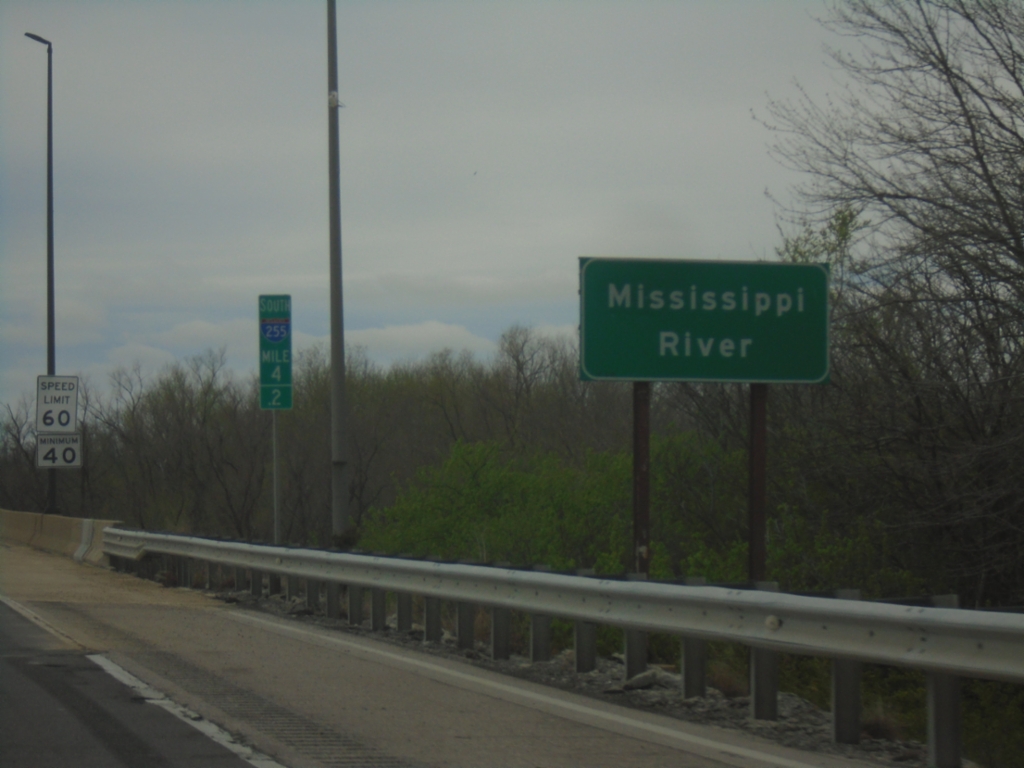
I-255 South - Mississippi River
I-255 South/US-50 West at the Mississippi River at the Missouri/Illinois State Line. This is the southernmost bridge over the Mississippi River in the Saint Louis metro area.
Taken 03-27-2026

 Columbia
Monroe County
Illinois
United States
Columbia
Monroe County
Illinois
United States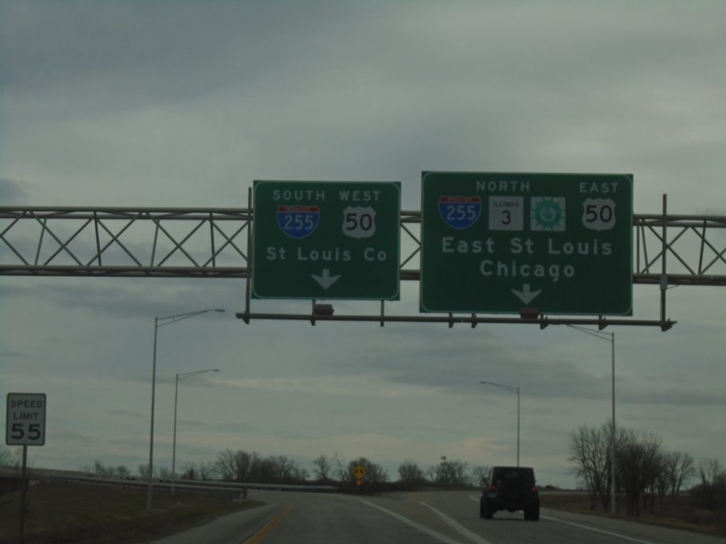
IL-3 North at I-255/US-50 Interchange
IL-3 North at I-255/US-50 interchange in Columbia. Use I-255 South/US-50 West to Saint Louis County (MO). Use I-255/IL-3 North/US-50 East/Great River Road to Chicago and East Saint Louis. IL-3 joins I-255 northbound to Dupo.
Taken 03-27-2026
Columbia
Monroe County
Illinois
United States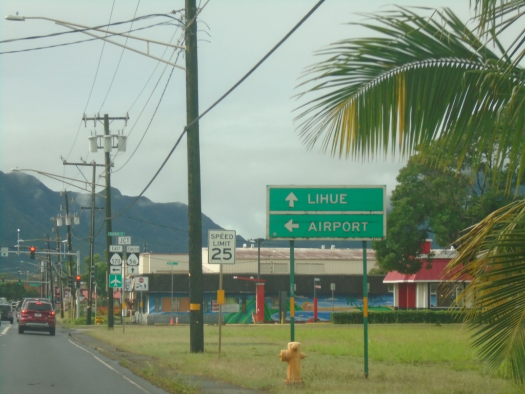
HI-56 South Approaching HI-570 (Ahukini Road)
HI-56 South (Kūhiō Highway) approaching HI-570 (Ahukini Road) to (Līhuʻe) Airport. Continue south on HI-56 to Līhuʻe.
Taken 02-17-2025

 Lihue
Kauai County
Hawaii
United States
Lihue
Kauai County
Hawaii
United States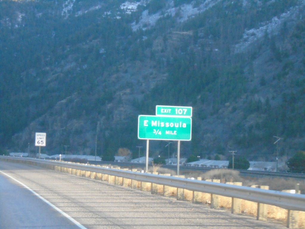
I-90 East - Exit 107
I-90 east approaching Exit 107 - East Missoula.
Taken 11-30-2024


 Missoula
 County
Montana
United States
Missoula
Missoula County
Montana
United States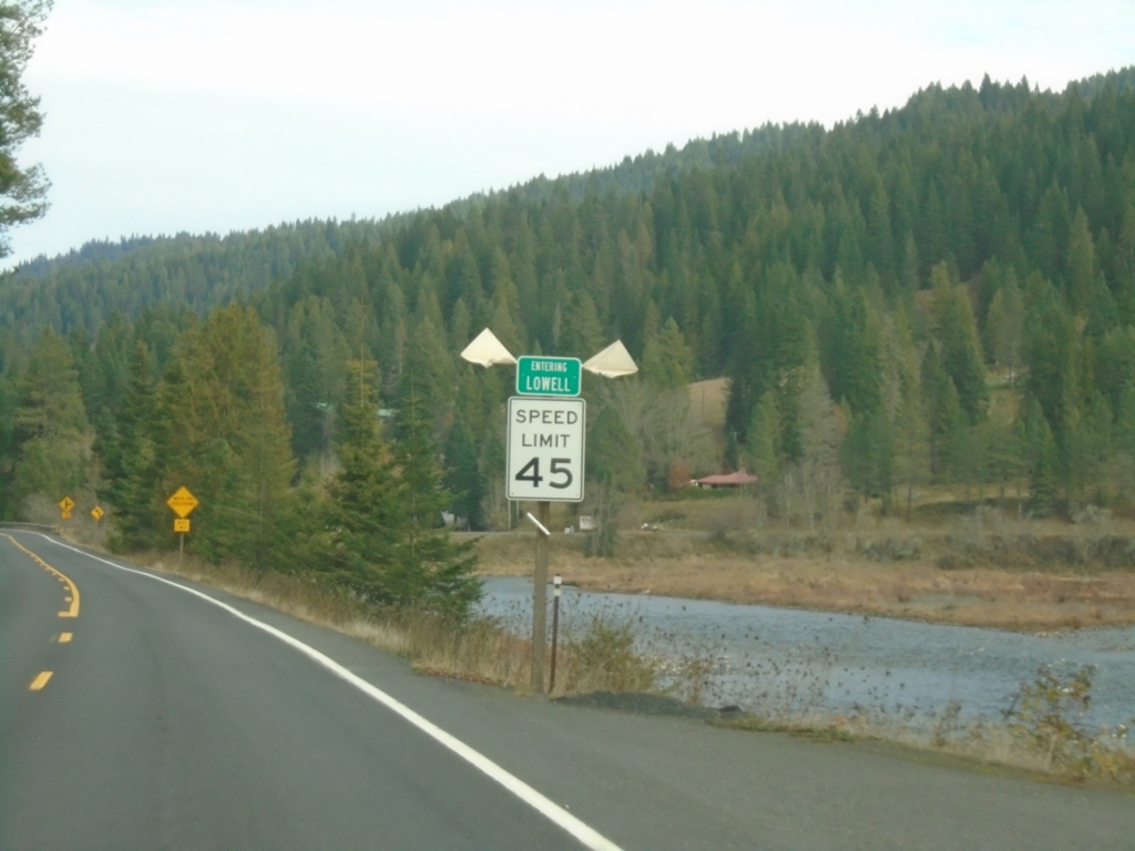
US-12 East - Lowell
Entering Lowell on US-12 east. Lowell is where the Lochsa and Selway Rivers combine to form the Clearwater River.
Taken 11-30-2024
Kooskia
Idaho County
Idaho
United States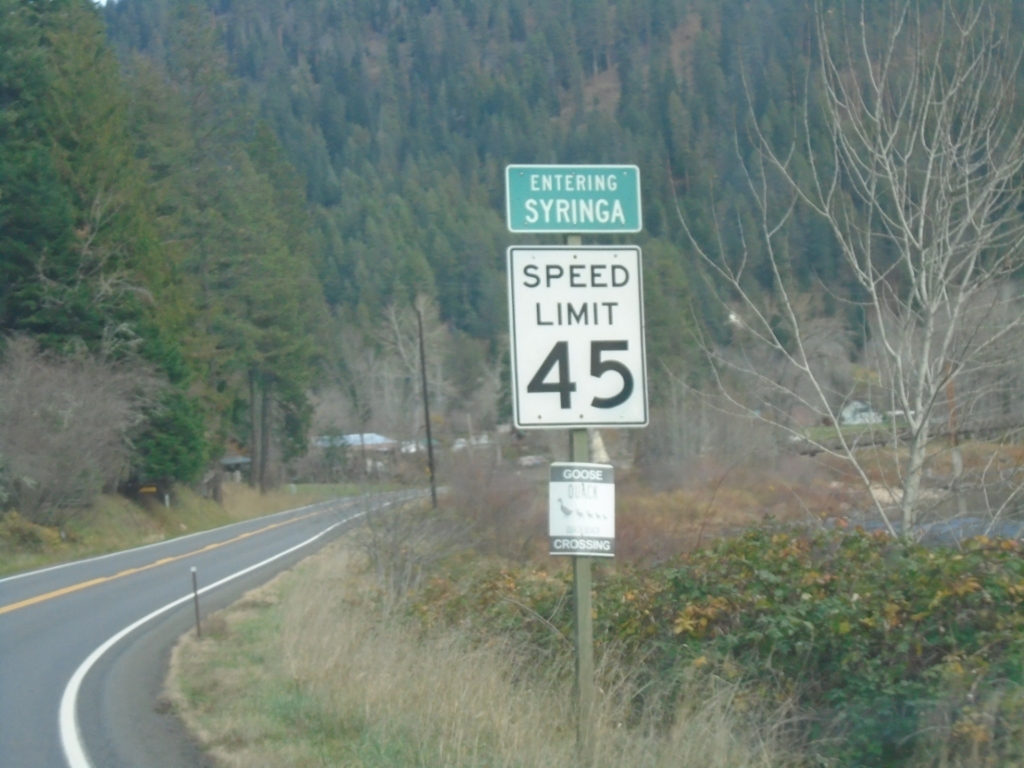
US-12 East - Syringa
Entering Syringa on US-12 east. Syringa is the Idaho state flower.
Taken 11-30-2024
Kooskia
Idaho County
Idaho
United States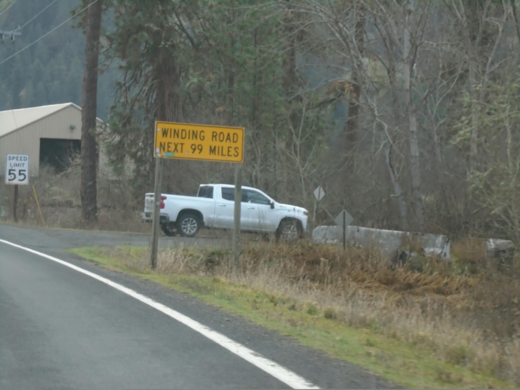
US-12 East - Winding Road
Winding Road Next 99 Miles on US-12 east. The next 99 miles are following the Clearwater and Lochsa River up to Lolo Pass.
Taken 11-30-2024
Kooskia
Idaho County
Idaho
United States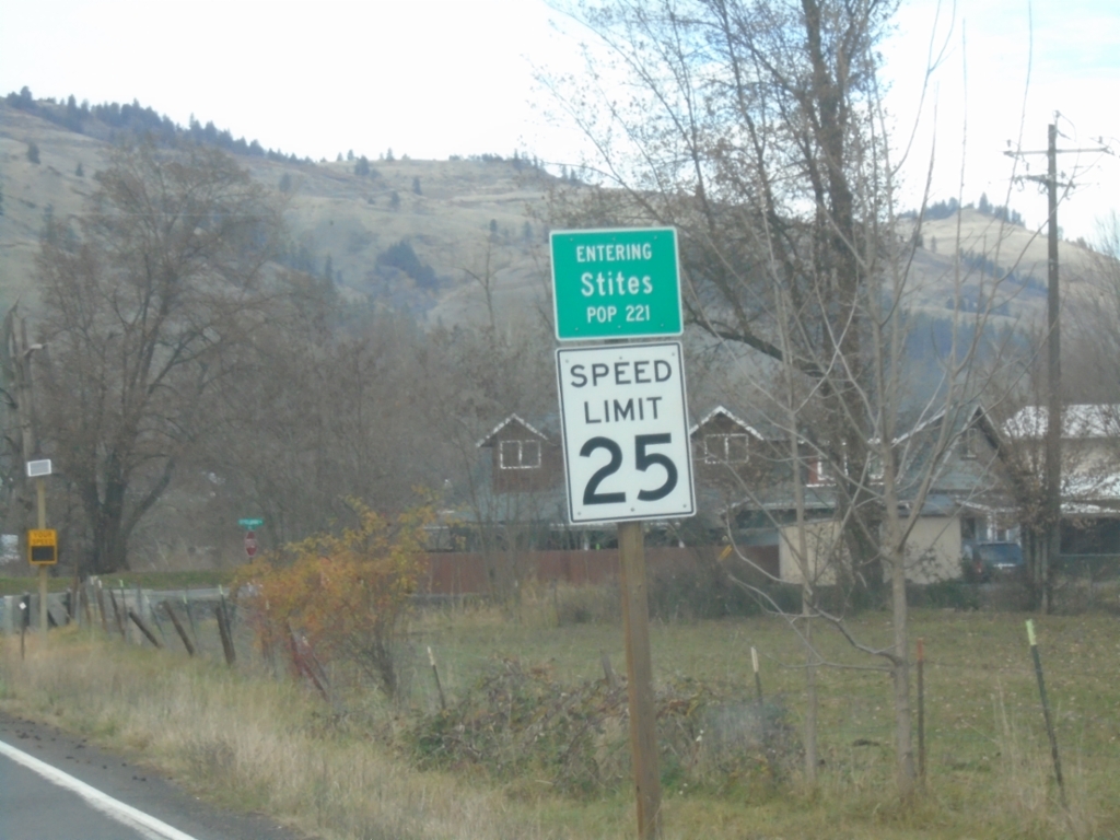
ID-13 North - Stites
Entering Stites on ID-13 North. Population 221.
Taken 11-30-2024
 Stites
Idaho County
Idaho
United States
Stites
Idaho County
Idaho
United States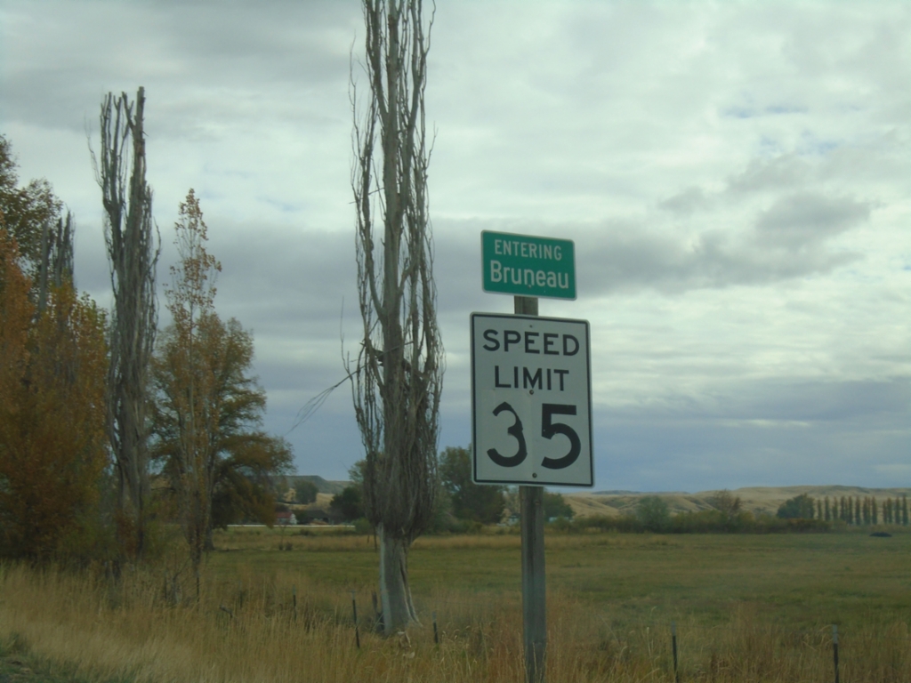
ID-51 North/ID-78 East - Bruneau
Entering Bruneau on ID-51 North/ID-78 East.
Taken 11-02-2024

 Bruneau
Owyhee County
Idaho
United States
Bruneau
Owyhee County
Idaho
United States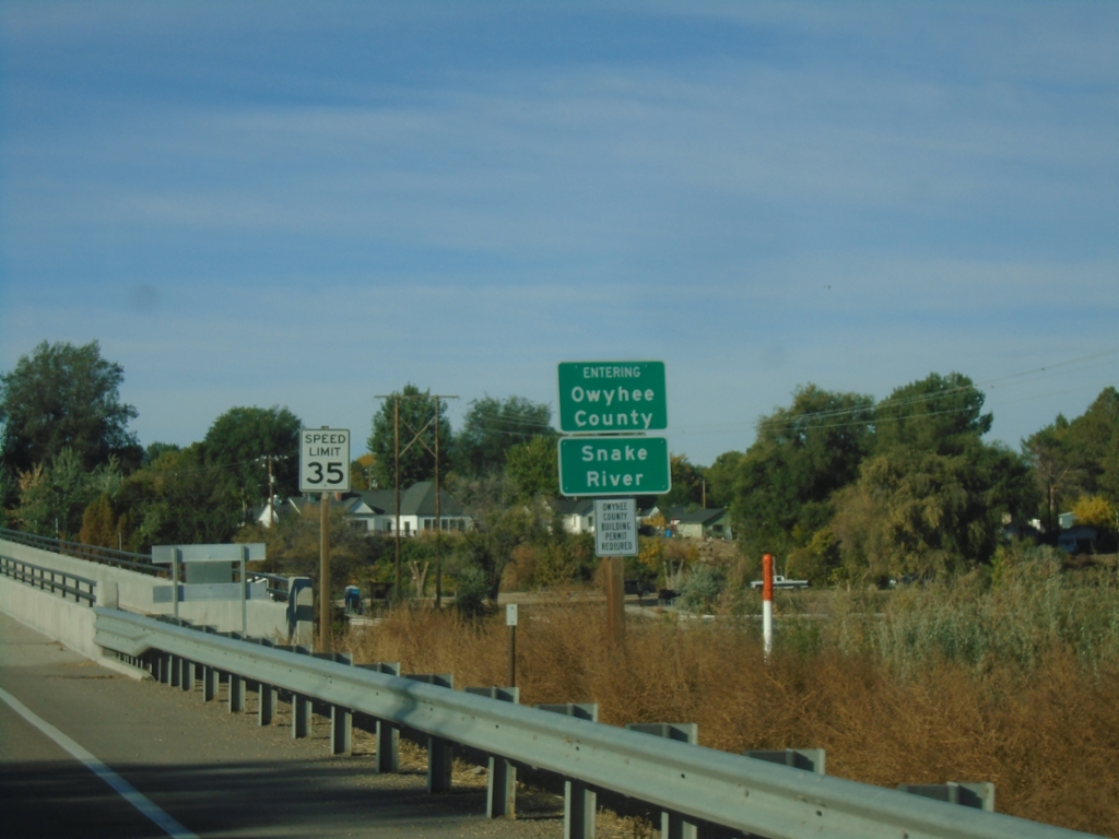
ID-55 South - Entering Owyhee County
ID-55 south - Entering Owyhee County/Snake River.
Taken 10-19-2024
 Caldwell
Canyon County
Idaho
United States
Caldwell
Canyon County
Idaho
United States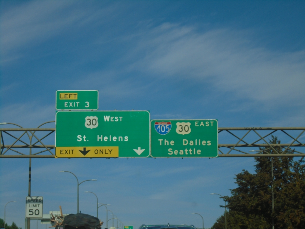
I-405 North - Exit 3
I-405 north approaching Exit 3 - US-30 West/St. Helens. Continue on I-405 North/US-30 West for Seattle (via I-5) and The Dalles (via US-30 and I-84).
Taken 09-28-2024

 Portland
Multnomah County
Oregon
United States
Portland
Multnomah County
Oregon
United States