Signs Tagged With Speed Limit
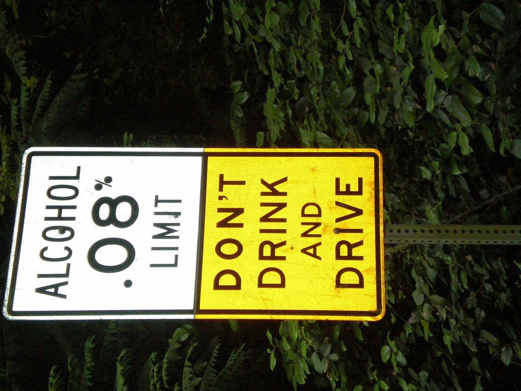
Alcohol Limit 0.08% - Lopez Island
Ferry Road south on Lopez Island. Alcohol Limit 0.08% - Don’t Drink and Drive. This is a standard sign on Washington highways.
Taken 07-25-2008
Lopez Island San Juan County Washington United States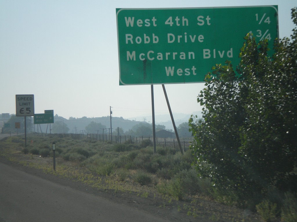
I-80 East - Reno Exits
Exits on I-80 east near Reno.
Taken 07-07-2008
 Reno
Washoe County
Nevada
United States
Reno
Washoe County
Nevada
United States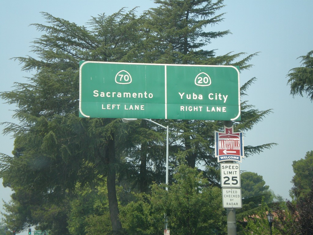
CA-70 South/CA-20 West Split
CA-70 South/CA-20 West approaching split. Use left lane for CA-70 south to Sacramento. Use right lane for CA-20 west to Yuba City.
Taken 07-06-2008

 Marysville
Yuba County
California
United States
Marysville
Yuba County
California
United States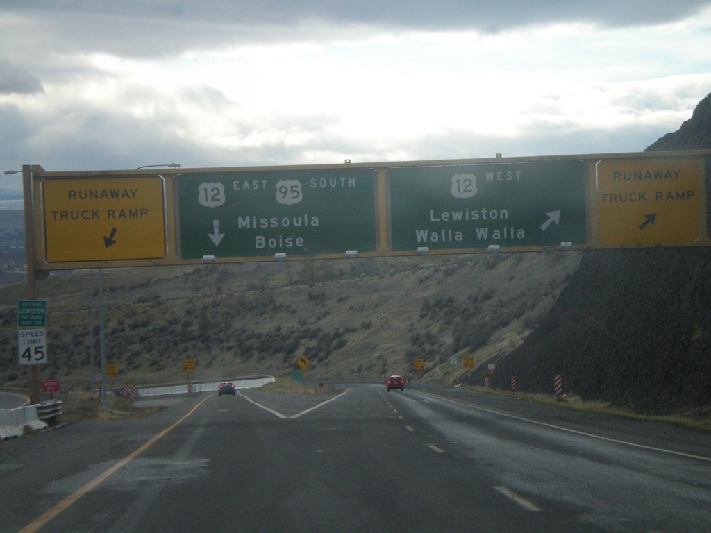
US-95 South at US-12
US-95 south at US-12 at the bottom of the Lewiston Hill. The welcome to Lewiston sign is right above the speed limit sign on the left side of the photo. Lewiston is the lowest city in Idaho - 738 feet. There are Runaway Truck Ramps on either side of the photo.
Taken 12-26-2007

 Lewiston
Nez Perce County
Idaho
United States
Lewiston
Nez Perce County
Idaho
United States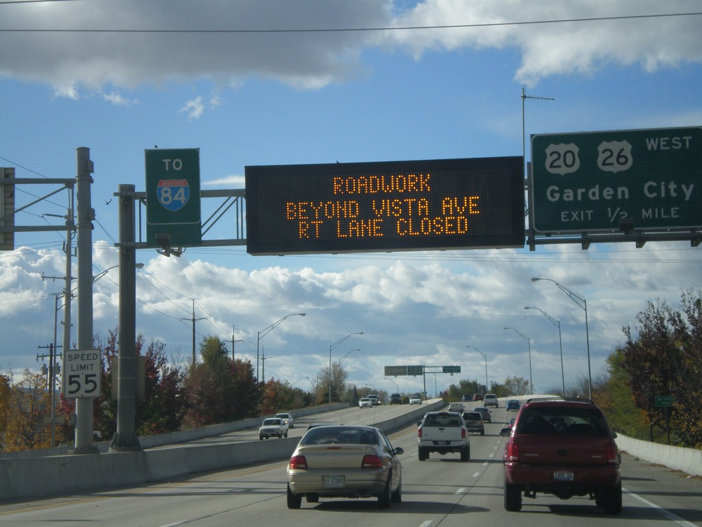
US-20/US-26 West - Garden City Exit
US-20/US-26 West approaching US-20/US-26/Garden City exit. Electronic sign notification of road work on I-84 at the Broadway overpass.
Taken 10-20-2007


 Boise
Ada County
Idaho
United States
Boise
Ada County
Idaho
United States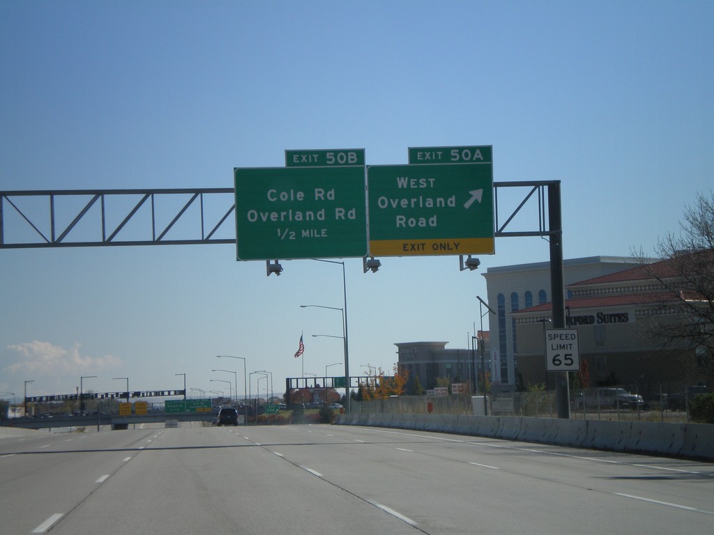
I-84 East Exits 50AB
I-84 east at Exit 50A - West Overland Road. Approaching Exit 50B - Overland Road/Cole Road.
Taken 10-13-2007
 Boise
Ada County
Idaho
United States
Boise
Ada County
Idaho
United States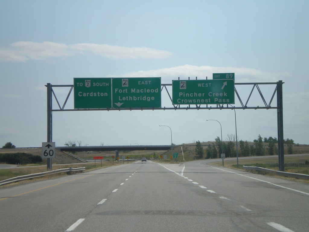
AB-2 South Exit 89
AB-2 south at AB-3 - east to Lethbridge and Fort Macleod. AB-3 west to Pincher Creek and Crowsnest Pass.
Taken 07-19-2007

 Fort Macleod
Willow Creek No. 26
Alberta
Canada
Fort Macleod
Willow Creek No. 26
Alberta
Canada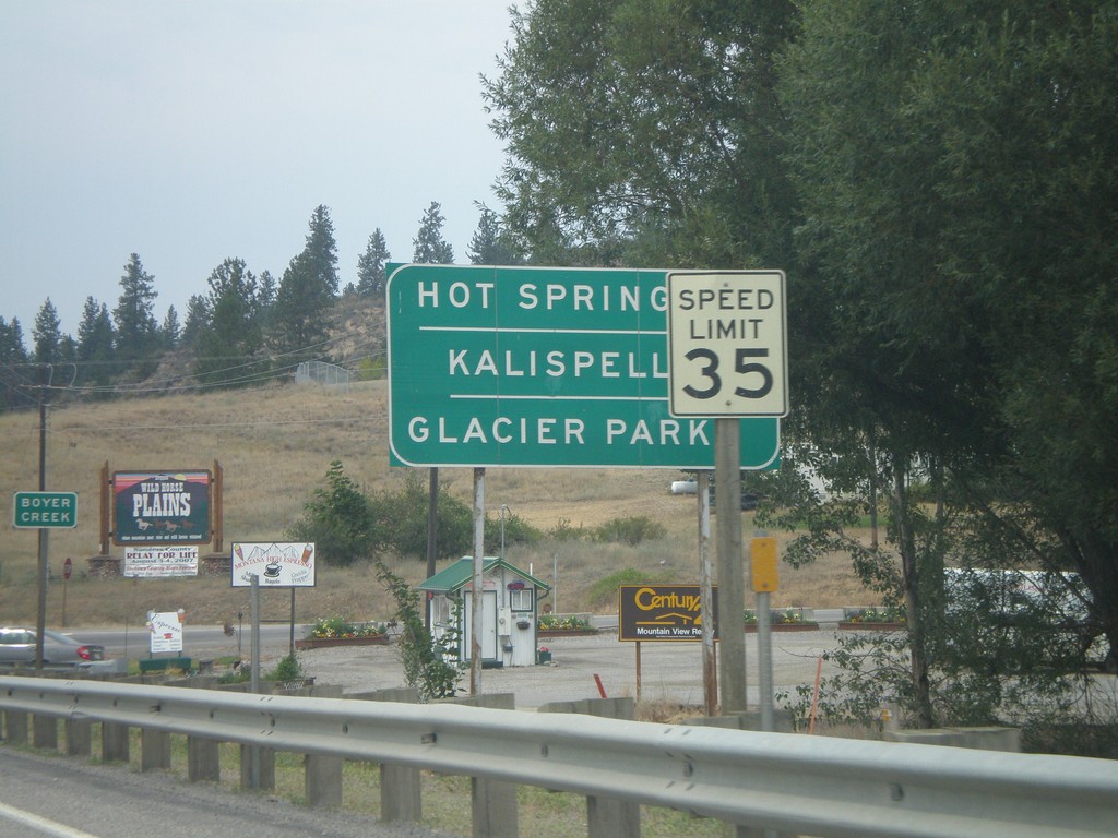
MT-200 West at MT-28
MT-200 west approaching MT-28 to Hot Springs, Kalispell, and Glacier Park.
Taken 07-15-2007
 Plains
Sanders County
Montana
United States
Plains
Sanders County
Montana
United States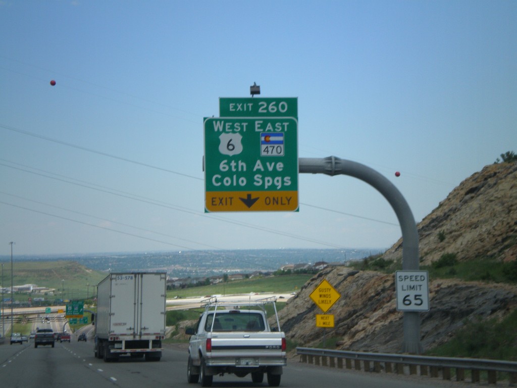
I-70 East - Exit 260
I-70 east at Exit 260, US-6 West/CO-470 East/6th. Ave./Colorado Springs.
Taken 05-25-2007

 Lakewood
Jefferson County
Colorado
United States
Lakewood
Jefferson County
Colorado
United States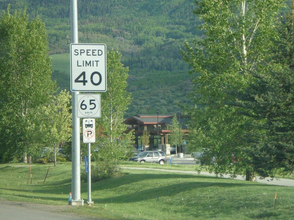
US-40 East - Speed Limits in Imperial and Metric
Speed limit 40 MPH/60 km/h on US-40 east in Steamboat Springs.
Taken 05-24-2007
 Steamboat Springs
Routt County
Colorado
United States
Steamboat Springs
Routt County
Colorado
United States