Signs Tagged With Speed Limit
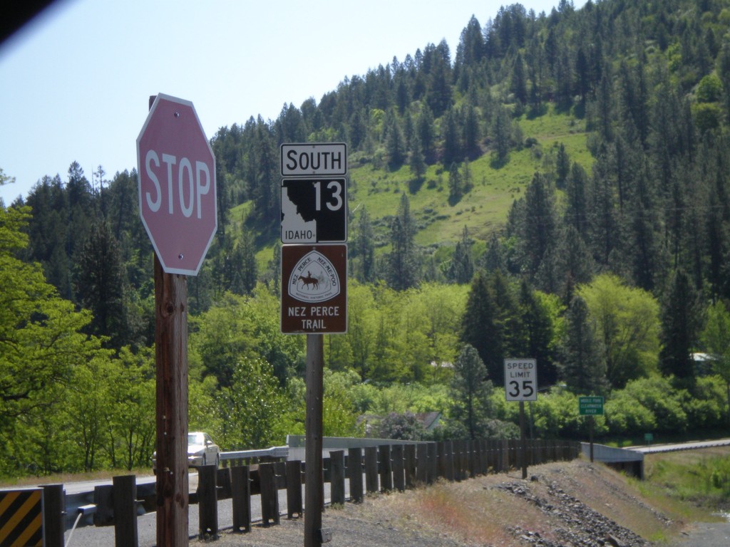
ID-13 South - Nez Perce Trail
Begin ID-13 south. ID-13 is signed as the Nez Perce Trail and Northwest Passage Scenic Byway.
Taken 05-21-2009
 Kooskia
Idaho County
Idaho
United States
Kooskia
Idaho County
Idaho
United States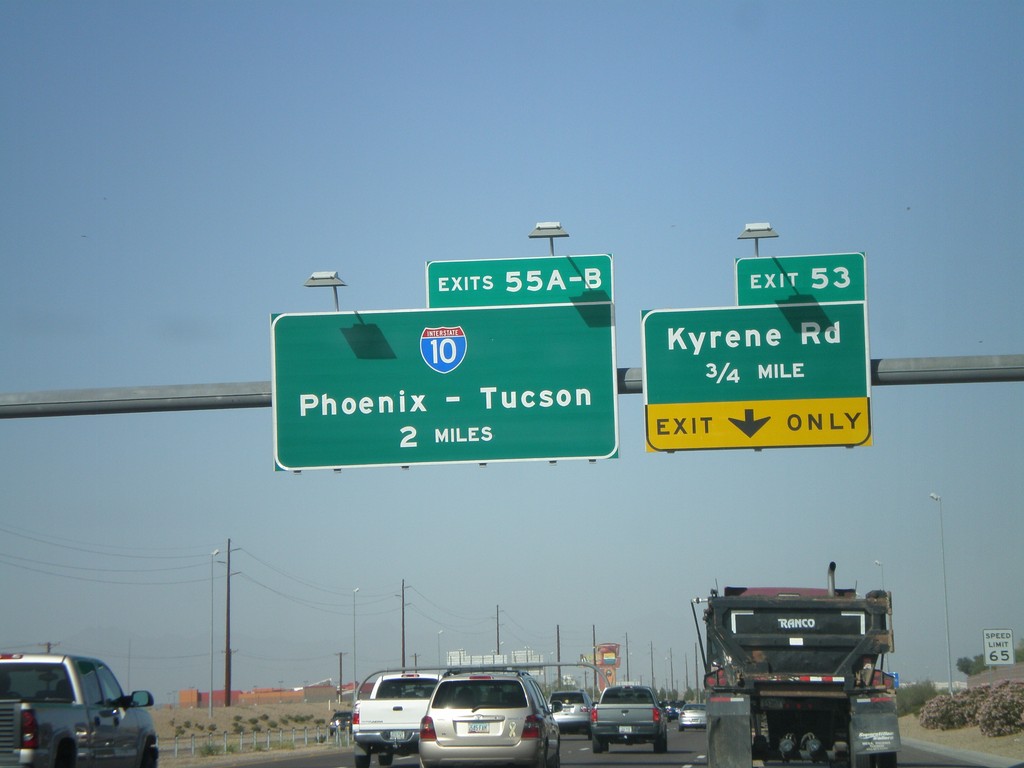
AZ-202 Loop West Approaching Exit 53 and Exit 55AB
AZ-202 Loop west approaching Exit 53 - Kyrene Road. Approaching 55AB - I-10/Phoenix-Tucson.
Taken 03-23-2009

 Chandler
Maricopa County
Arizona
United States
Chandler
Maricopa County
Arizona
United States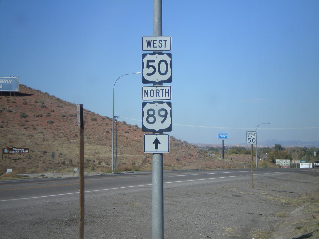
US-50 West/US-89 North - Entering Salina
US-50 west to US-89 north, just north of I-70.
Taken 10-25-2008

 Salina
Sevier County
Utah
United States
Salina
Sevier County
Utah
United States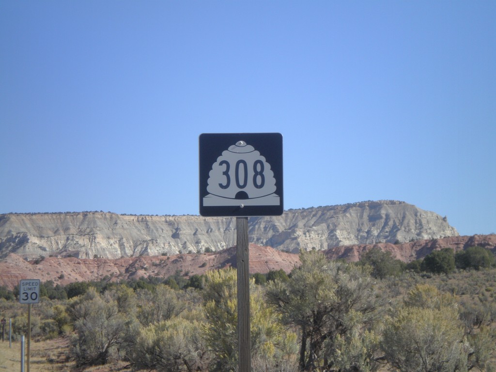
UT-308 North - Kodachrome Basin
UT-308 north on Kodachrome Basin Road. This was taken north of Cottonwood Wash Rd. junction. UT-308 does not connect to the state highway system.
Taken 10-15-2008
 Henrieville
Kane County
Utah
United States
Henrieville
Kane County
Utah
United States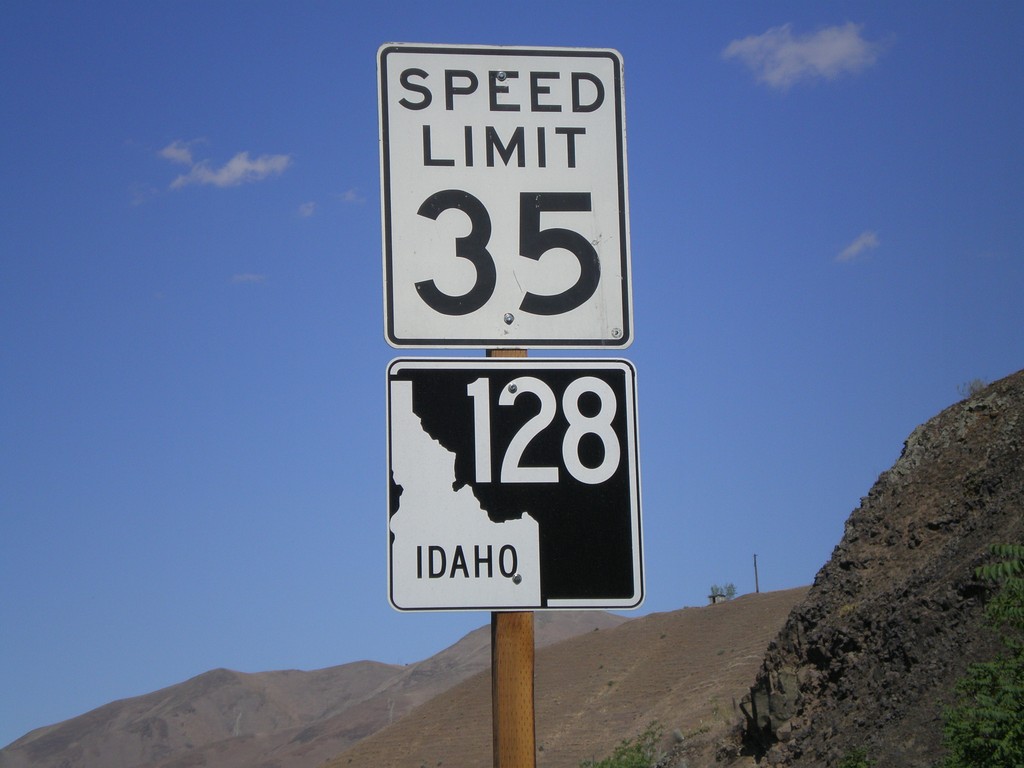
ID-128 West - Lewiston
ID-128 west in Lewiston. ID-128 follows the north side of the Clearwater and Snake River, and connects with WA-128.
Taken 07-27-2008
 Lewiston
Nez Perce County
Idaho
United States
Lewiston
Nez Perce County
Idaho
United States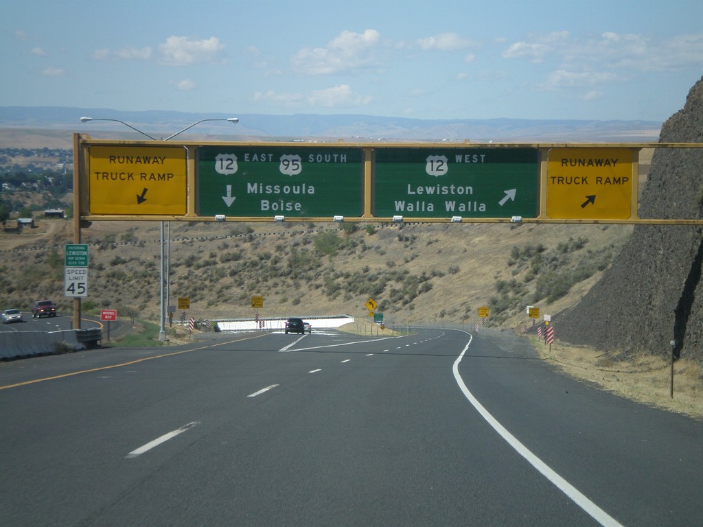
US-95 South at US-12
US-95 south at US-12 junction. Merge right for US-12 West/Lewiston/Walla Walla (Washington). Use left lane for US-95 South/US-12 East/Missoula (Montana)/Boise. Use either lane for access to Runaway Truck Ramps.
Taken 07-27-2008

 Lewiston
Nez Perce County
Idaho
United States
Lewiston
Nez Perce County
Idaho
United States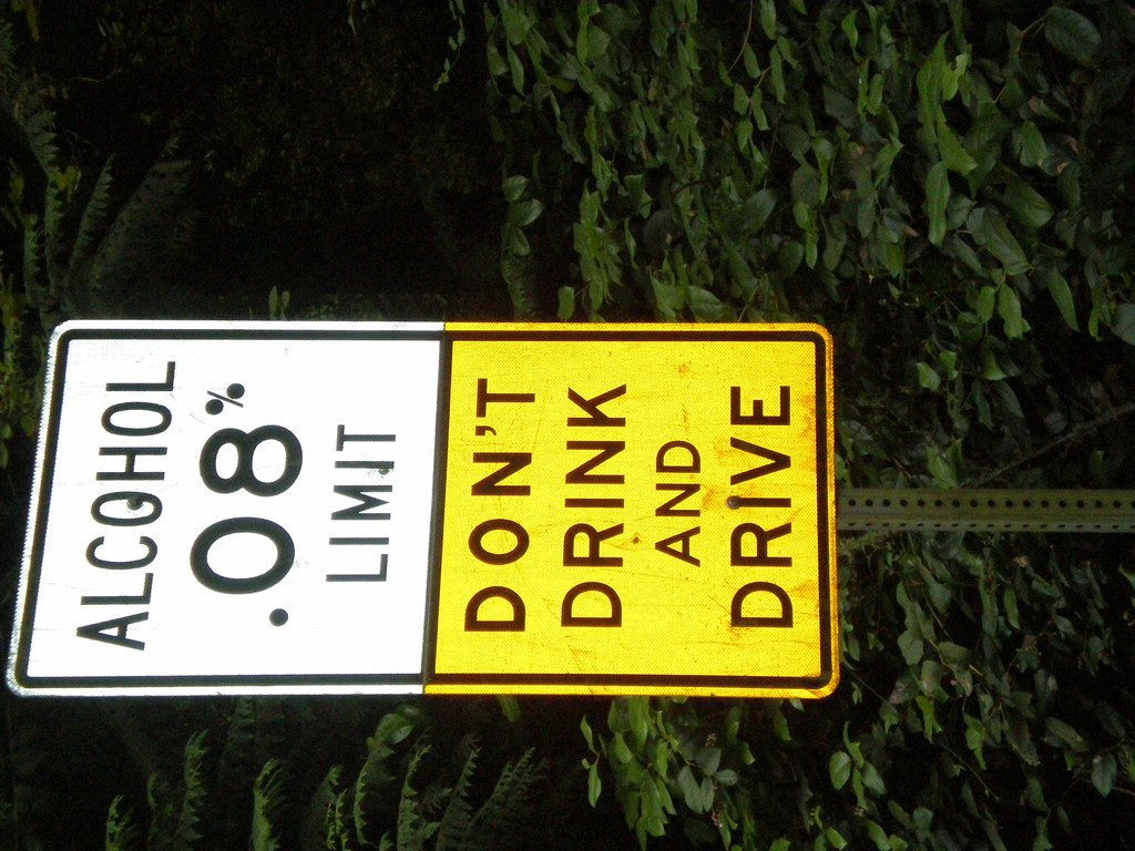
Alcohol Limit 0.08% - Lopez Island
Ferry Road south on Lopez Island. Alcohol Limit 0.08% - Don’t Drink and Drive. This is a standard sign on Washington highways.
Taken 07-25-2008
Lopez Island San Juan County Washington United States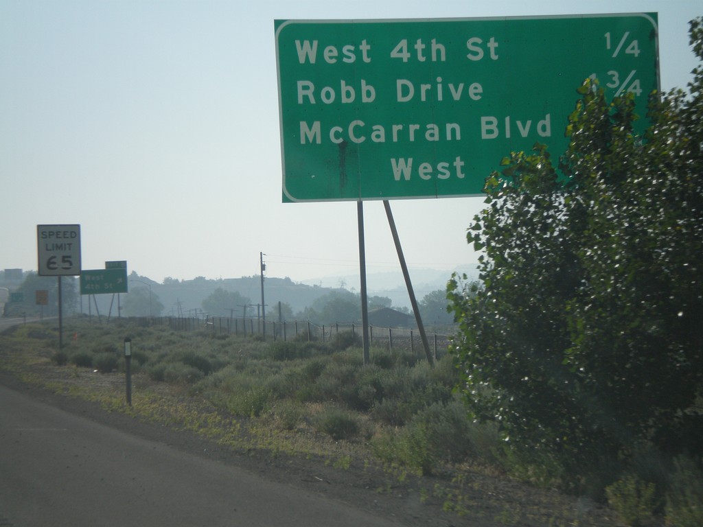
I-80 East - Reno Exits
Exits on I-80 east near Reno.
Taken 07-07-2008
 Reno
Washoe County
Nevada
United States
Reno
Washoe County
Nevada
United States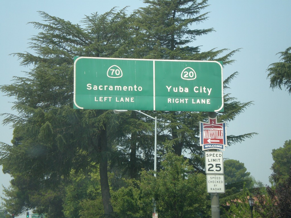
CA-70 South/CA-20 West Split
CA-70 South/CA-20 West approaching split. Use left lane for CA-70 south to Sacramento. Use right lane for CA-20 west to Yuba City.
Taken 07-06-2008

 Marysville
Yuba County
California
United States
Marysville
Yuba County
California
United States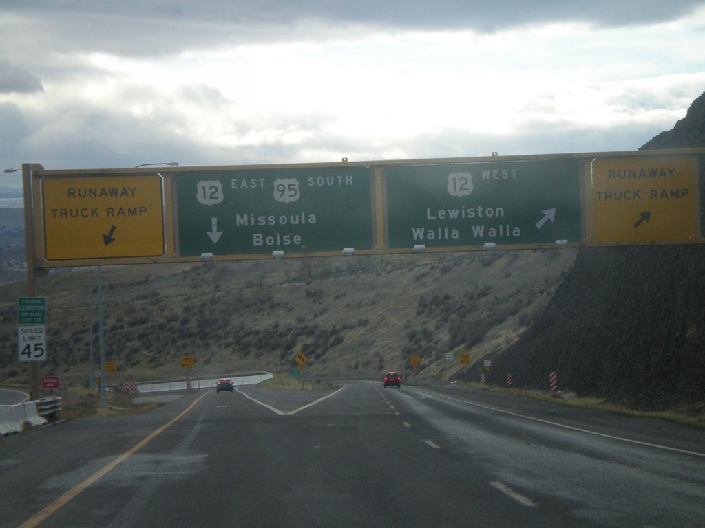
US-95 South at US-12
US-95 south at US-12 at the bottom of the Lewiston Hill. The welcome to Lewiston sign is right above the speed limit sign on the left side of the photo. Lewiston is the lowest city in Idaho - 738 feet. There are Runaway Truck Ramps on either side of the photo.
Taken 12-26-2007
Lewiston
Nez Perce County
Idaho
United States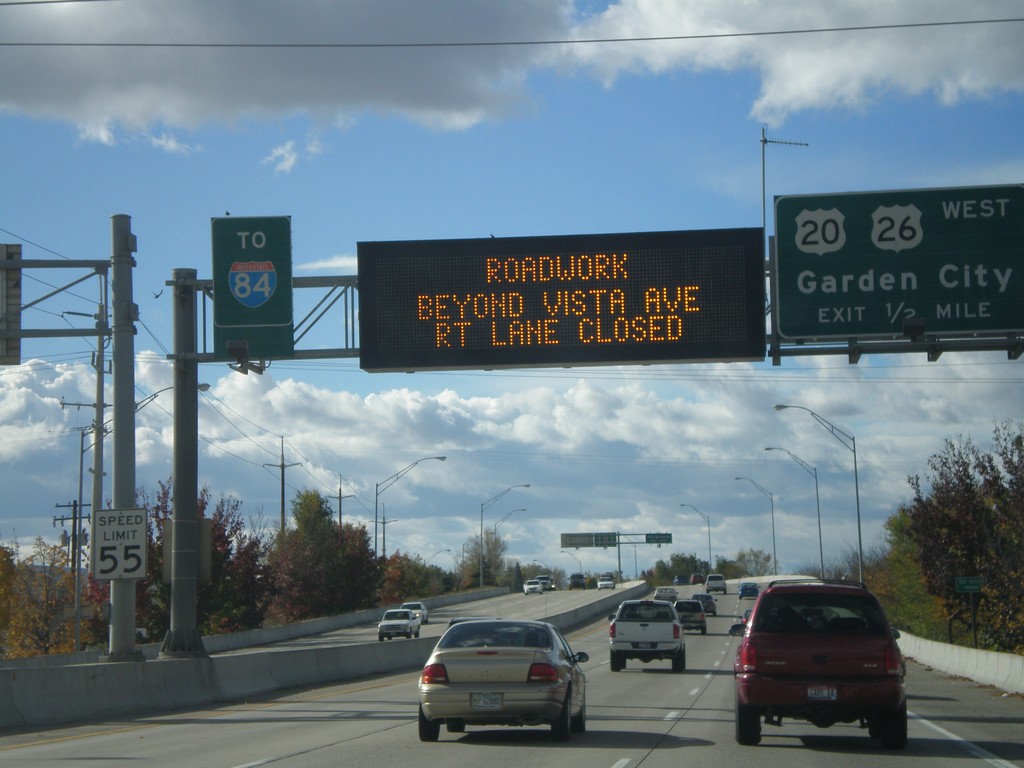
US-20/US-26 West - Garden City Exit
US-20/US-26 West approaching US-20/US-26/Garden City exit. Electronic sign notification of road work on I-84 at the Broadway overpass.
Taken 10-20-2007


 Boise
Ada County
Idaho
United States
Boise
Ada County
Idaho
United States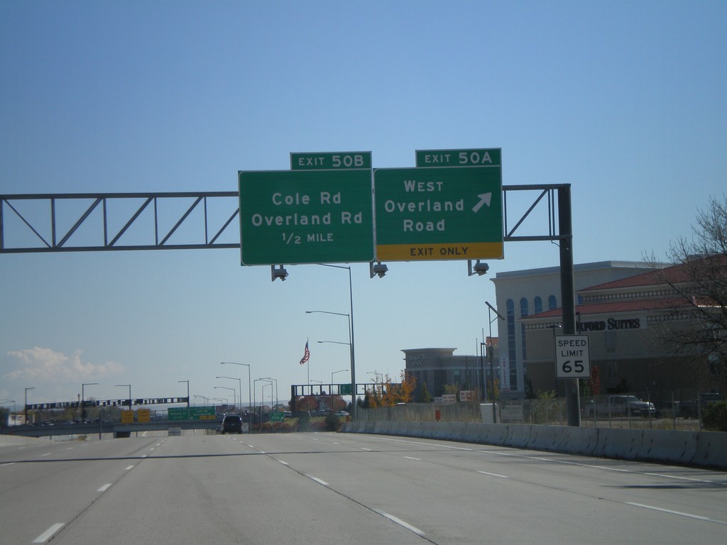
I-84 East Exits 50AB
I-84 east at Exit 50A - West Overland Road. Approaching Exit 50B - Overland Road/Cole Road.
Taken 10-13-2007
 Boise
Ada County
Idaho
United States
Boise
Ada County
Idaho
United States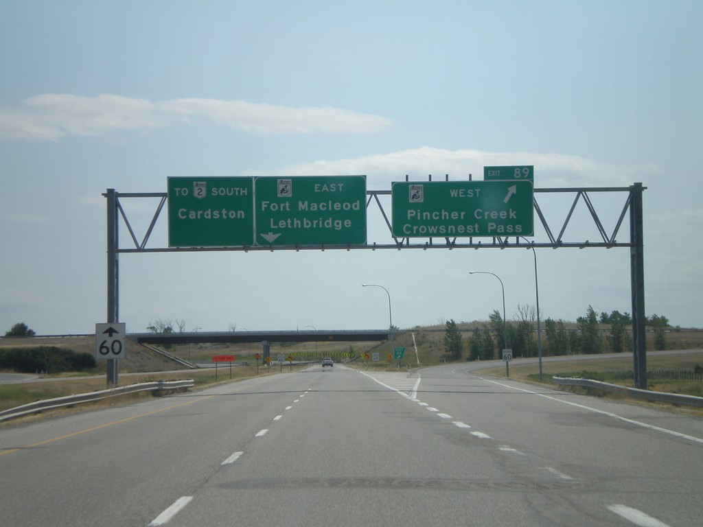
AB-2 South Exit 89
AB-2 south at AB-3 - east to Lethbridge and Fort Macleod. AB-3 west to Pincher Creek and Crowsnest Pass.
Taken 07-19-2007

 Fort Macleod
Willow Creek No. 26
Alberta
Canada
Fort Macleod
Willow Creek No. 26
Alberta
Canada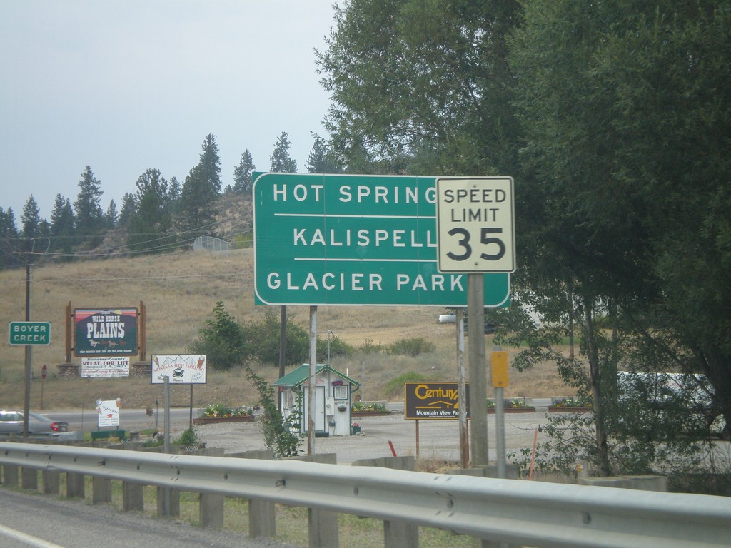
MT-200 West at MT-28
MT-200 west approaching MT-28 to Hot Springs, Kalispell, and Glacier Park.
Taken 07-15-2007
 Plains
Sanders County
Montana
United States
Plains
Sanders County
Montana
United States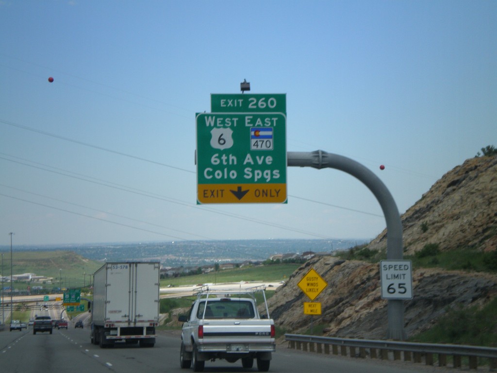
I-70 East - Exit 260
I-70 east at Exit 260, US-6 West/CO-470 East/6th. Ave./Colorado Springs.
Taken 05-25-2007

 Lakewood
Jefferson County
Colorado
United States
Lakewood
Jefferson County
Colorado
United States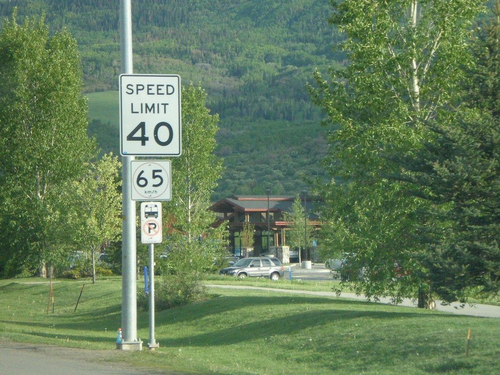
US-40 East - Speed Limits in Imperial and Metric
Speed limit 40 MPH/60 km/h on US-40 east in Steamboat Springs.
Taken 05-24-2007
 Steamboat Springs
Routt County
Colorado
United States
Steamboat Springs
Routt County
Colorado
United States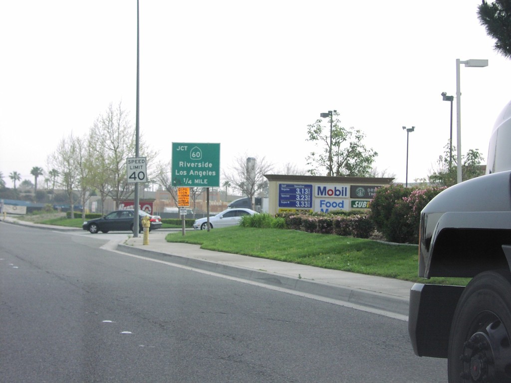
S. Haven Ave. Approaching CA-60
S. Haven Ave. approaching CA-60, Riverside Fwy, to Riverside and Los Angeles.
Taken 03-01-2007
 Ontario
San Bernardino County
California
United States
Ontario
San Bernardino County
California
United States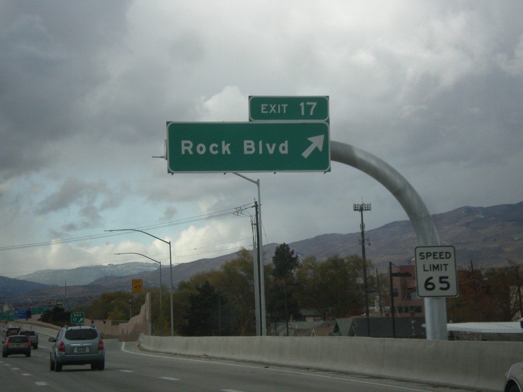
I-80 West - Exit 17
I-80 west at Exit 17 - Rock Blvd.
Taken 01-21-2007
Sparks
Washoe County
Nevada
United States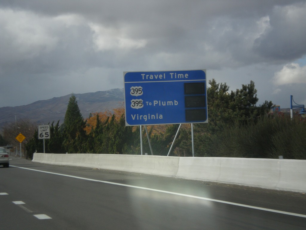
I-80 West - Reno Travel Times
Electronic sign that lists Reno/Sparks area travel times. The sign currently is not displaying times. The sign lists times to US-395, Plumb Lane (via US-395) and Virginia St.
Taken 01-21-2007
Sparks
Washoe County
Nevada
United States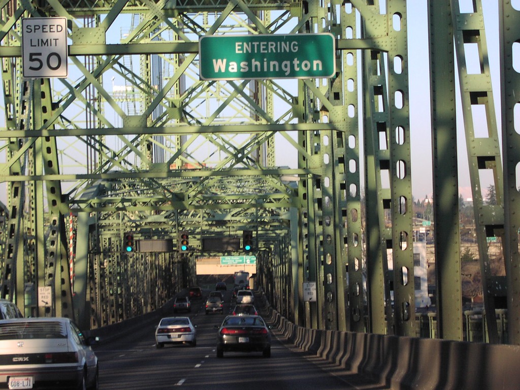
I-5 North - Entering Washington
Entering Washington on I-5 north, on the Interstate Bridge over the Columbia River.
Taken 01-01-2007
 Vancouver
Clark County
Washington
United States
Vancouver
Clark County
Washington
United States
I-84 West - Speed 65
I-84, just west of Oregon-Idaho line - Speed 65. The top speed in Oregon is 65, 10 miles less than Idaho. Notice Oregon does not use the word limit in the speed limit signs.
Taken 12-01-2006
Ontario
Malheur County
Oregon
United States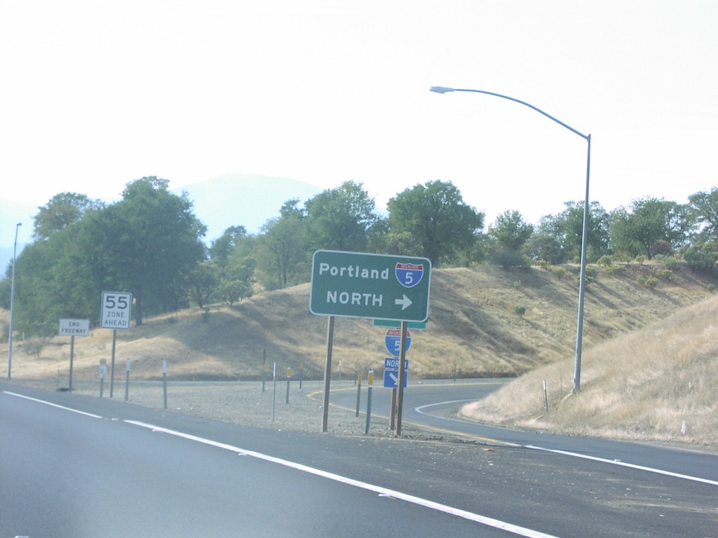
CA-299 West at I-5 North
CA-299 west at I-5 north to Portland.
Taken 10-01-2006
 Redding
Shasta County
California
United States
Redding
Shasta County
California
United States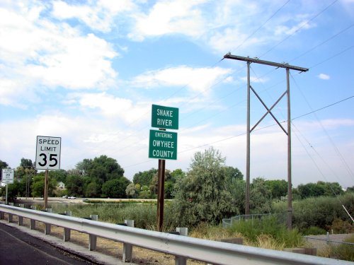
ID-55 South - Owyhee County Line
ID-55 south at Snake River/Owyhee county line.
Taken 09-01-2006
 Caldwell
Canyon County
Idaho
United States
Caldwell
Canyon County
Idaho
United States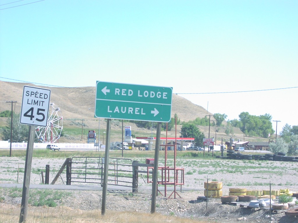
US-310 North at US-212
US-310 north approaching US-212 to Laurel and Bridger.
Taken 07-01-2006
 Joliet
Carbon County
Montana
United States
Joliet
Carbon County
Montana
United States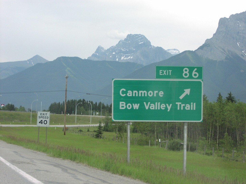
TC-1 East Exit 86
TC-1 east at Exit 86, Canmore/Bow Valley Trail
Taken 06-01-2006
 Canmore
Bighorn No. 8
Alberta
Canada
Canmore
Bighorn No. 8
Alberta
Canada