Signs Tagged With Speed Limit
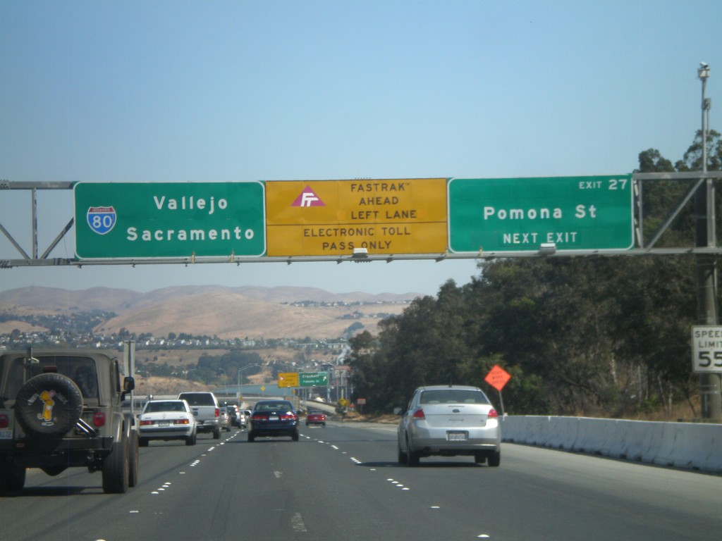
I-80 East - Exit 27
I-80 east approaching Exit 27 - Pomona St. After this exit the highway enters the Carquinez Bridge over the Carquinez Straits, which feeds the Sacramento and San Joaquin Rivers into the San Francisco Bay. Use the left lanes for Fastrak, an electronic tolling system used in California.
Taken 10-01-2010
 Crockett
Contra Costa County
California
United States
Crockett
Contra Costa County
California
United States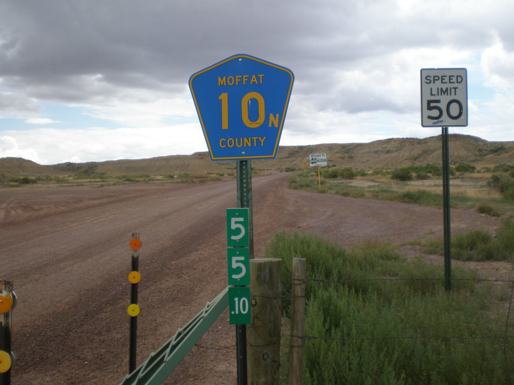
Moffat County 10N - Wyoming-Colorado State Line
Moffat County 10N at the Wyoming-Colorado State Line. The mile marker below the highway shield is a standard Wyoming mile marker, and is for WY-430.
Taken 08-01-2010
 Sweetwater County
Wyoming
United States
Sweetwater County
Wyoming
United States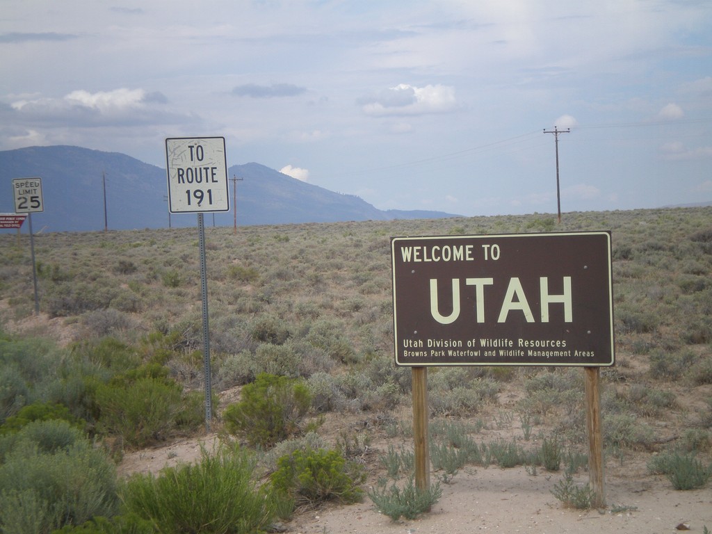
Welcome To Utah - Browns Park
Welcome to Utah on CH-1364 (Browns Park Road). This welcome sign was posted by the Utah Division of Wildlife Resources. Continue west on Browns Park Road for US-191.
Taken 08-01-2010
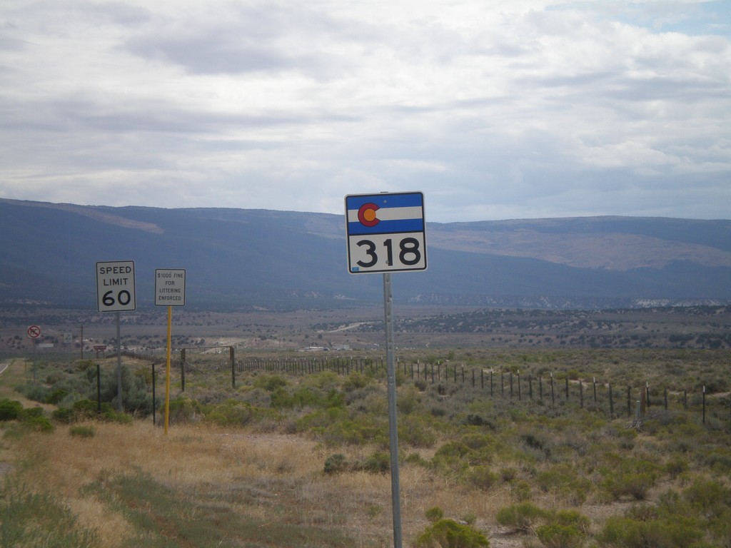
CO-318 East
CO-318 east shield just east of the Utah-Colorado State Line.
Taken 08-01-2010
 Moffat County
Colorado
United States
Moffat County
Colorado
United States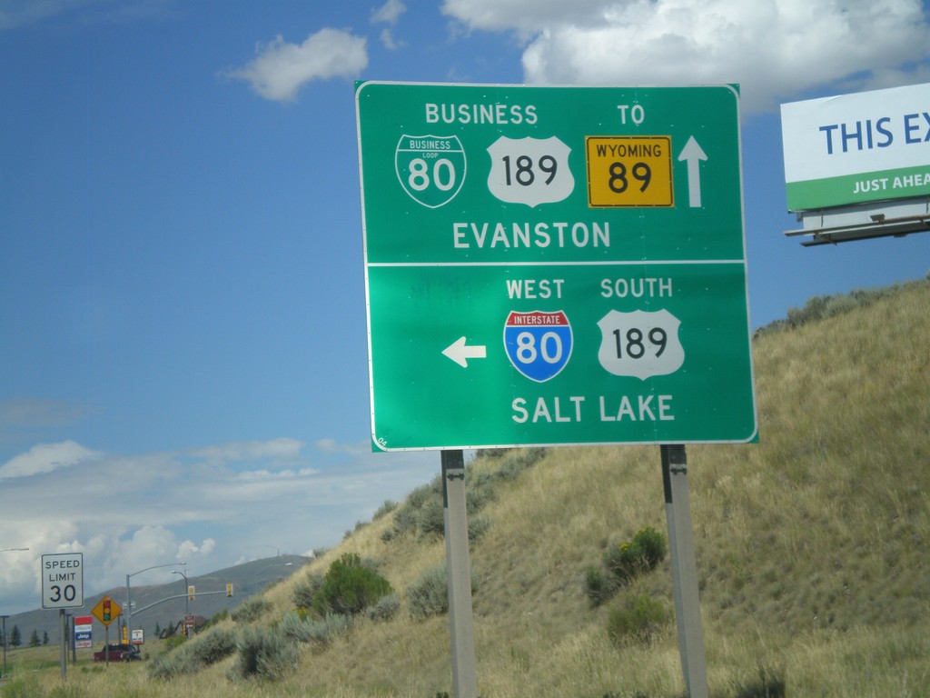
BL-80/Bus. US-189 East at I-80 West
BL-80/Bus. US-189 east at I-80 West/US-189 South (Exit 3) onramp to Salt Lake. Continue east on the business loop for Evanston.
Taken 07-31-2010


 Evanston
Uinta County
Wyoming
United States
Evanston
Uinta County
Wyoming
United States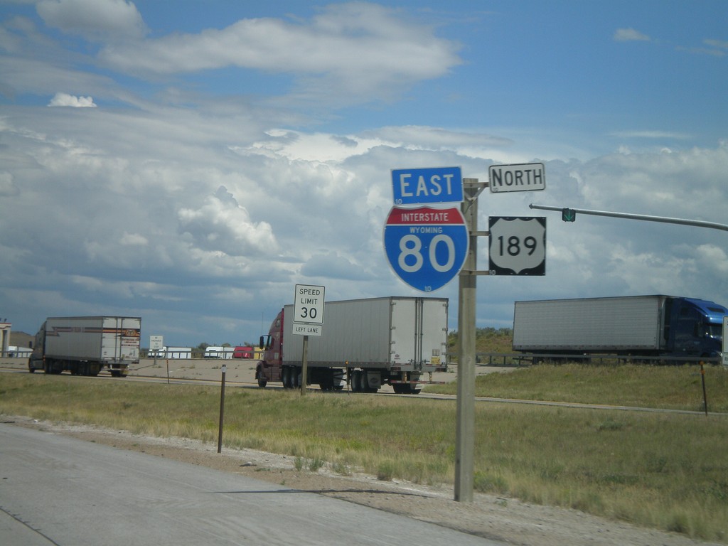
I-80 East/US-189 North
I-80 East/US-189 North at the Utah-Wyoming State Line. The official welcome sign is located after the Wyoming Port of Entry which is located directly on the state line. This is the only indication of the state line.
Taken 07-31-2010
Evanston
Uinta County
Wyoming
United States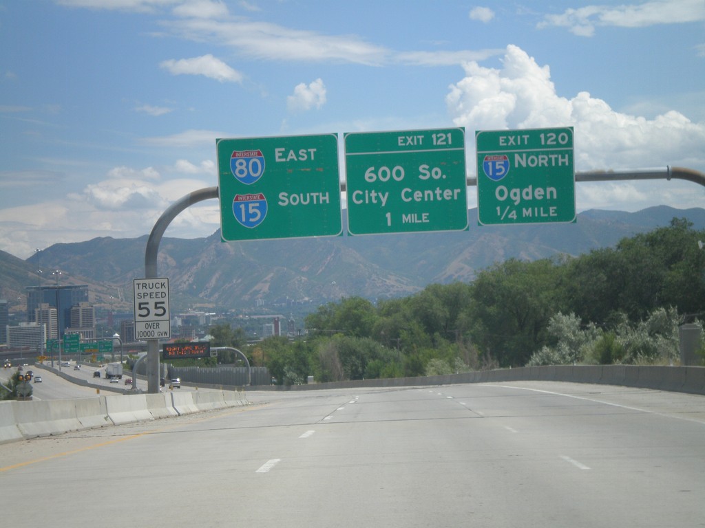
I-80 East - Exits 120 and 121
I-80 east approaching Exit 120 - I-15 North/Ogden. Also approaching Exit 121 - 600 South. Use left lanes for I-80 East and I-15 South.
Taken 07-31-2010
 Salt Lake City
Salt Lake County
Utah
United States
Salt Lake City
Salt Lake County
Utah
United States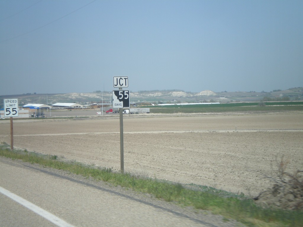
US-95 North Approaching ID-55
US-95 north approaching ID-55.
Taken 04-20-2010

 Marsing
Owyhee County
Idaho
United States
Marsing
Owyhee County
Idaho
United States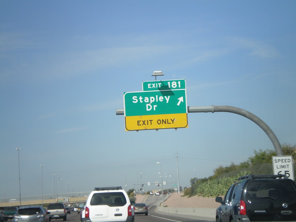
US-60 West - Exit 181
US-60 west at Exit 181 - Stapley Drive
Taken 03-22-2010
 Mesa
Maricopa County
Arizona
United States
Mesa
Maricopa County
Arizona
United States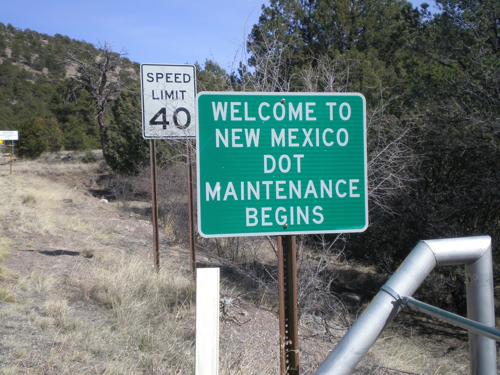
NM-78 East - Welcome To New Mexico
Welcome to New Mexico on NM-78 east. Begin DOT Maintenance.
Taken 03-21-2010
 Mule Creek
Grant County
New Mexico
United States
Mule Creek
Grant County
New Mexico
United States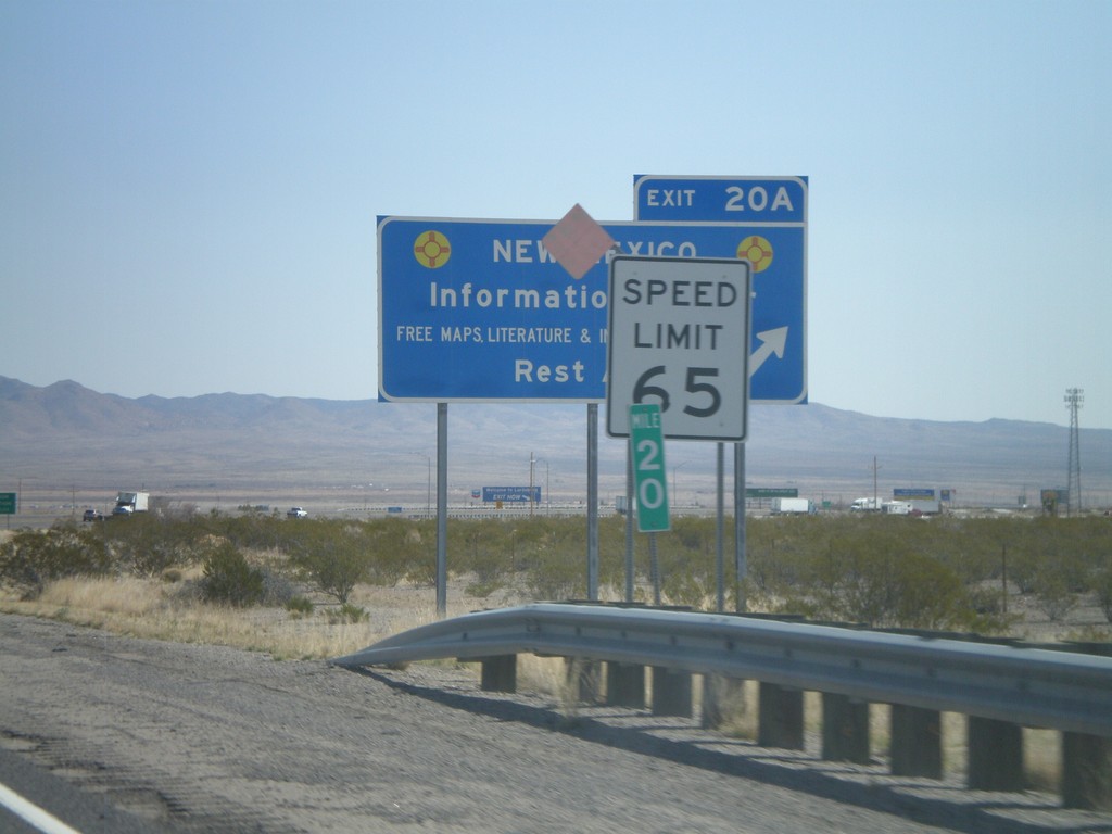
I-10 East - Exit 20A
I-10 west at Exit 20A - New Mexico Information Center/Rest Area. Speed limit drops from 75 MPH to 65 MPH as I-10 enters Lordsburg.
Taken 03-21-2010
 Lordsburg
Hidalgo County
New Mexico
United States
Lordsburg
Hidalgo County
New Mexico
United States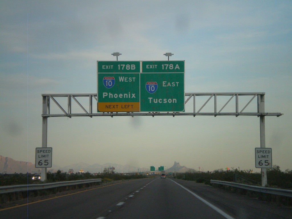
I-8 East Approaching I-10
I-8 east approaching I-10. Exit 178A - I-10 East/Tucson. Exit 178B - I-10 West/Phoenix. This is the eastern end of I-8.
Taken 03-20-2010
 Casa Grande
Pinal County
Arizona
United States
Casa Grande
Pinal County
Arizona
United States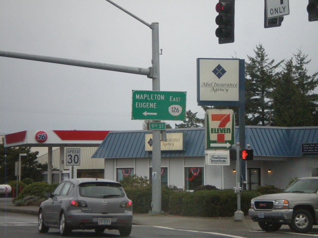
US-101 South at OR-126
US-101 south at OR-126 east to Mapleton and Eugene.
Taken 01-17-2010

 Florence
Lane County
Oregon
United States
Florence
Lane County
Oregon
United States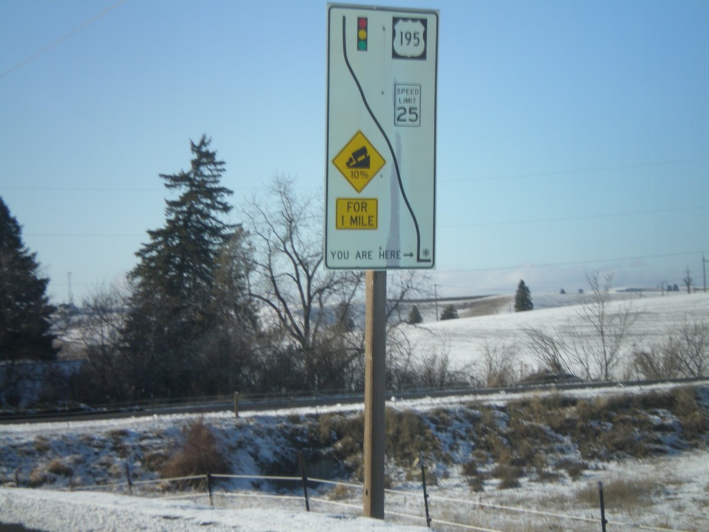
WA-272 East - Grade Information
WA-272 west at the top of a 10% grade above Colfax. Route diagram showing the speed and grade information, and the stoplight at the bottom of the hill at US-195.
Taken 12-26-2009
 Colfax
Whitman County
Washington
United States
Colfax
Whitman County
Washington
United States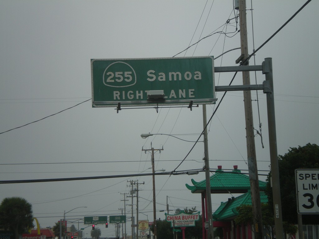
US-101 South Approaching CA-255
US-101 south (4th St.) approaching CA-255/Samoa in downtown Eureka.
Taken 09-25-2009
 Eureka
Humboldt County
California
United States
Eureka
Humboldt County
California
United States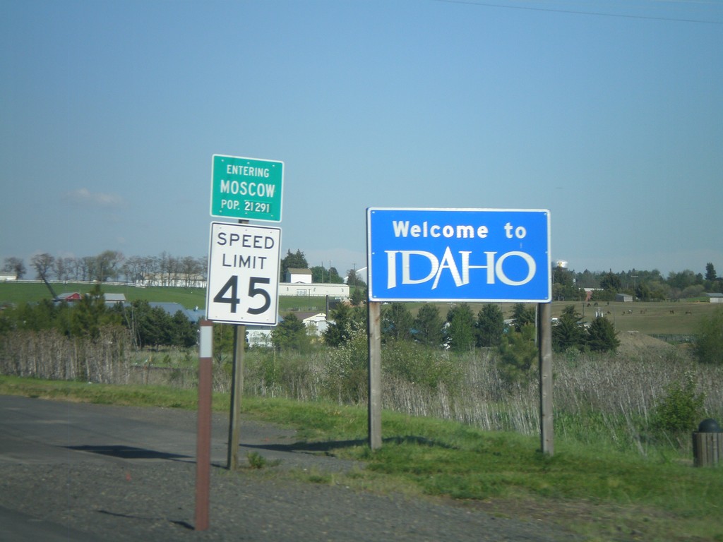
Welcome To Idaho - ID-8 East
Welcome to Idaho on ID-8 east. Entering Moscow. Moscow is home to the University of Idaho.
Taken 05-25-2009
 Moscow
Latah County
Idaho
United States
Moscow
Latah County
Idaho
United States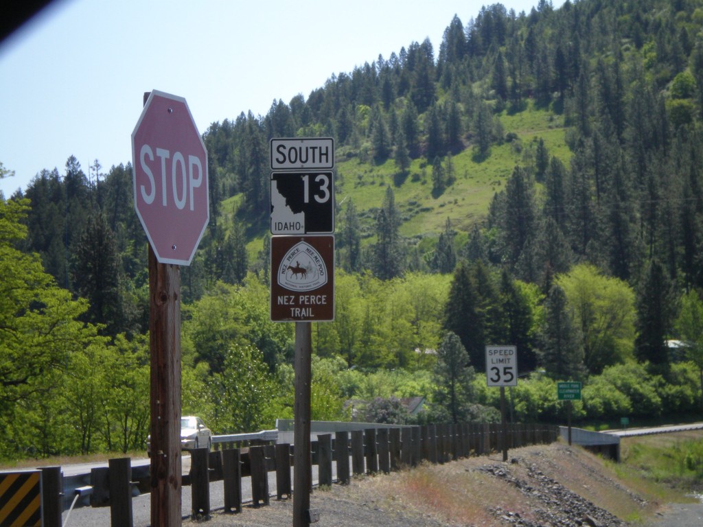
ID-13 South - Nez Perce Trail
Begin ID-13 south. ID-13 is signed as the Nez Perce Trail and Northwest Passage Scenic Byway.
Taken 05-21-2009
 Kooskia
Idaho County
Idaho
United States
Kooskia
Idaho County
Idaho
United States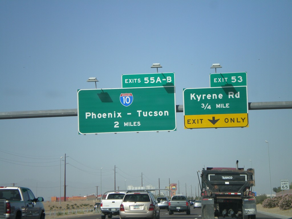
AZ-202 Loop West Approaching Exit 53 and Exit 55AB
AZ-202 Loop west approaching Exit 53 - Kyrene Road. Approaching 55AB - I-10/Phoenix-Tucson.
Taken 03-23-2009
 Chandler
Maricopa County
Arizona
United States
Chandler
Maricopa County
Arizona
United States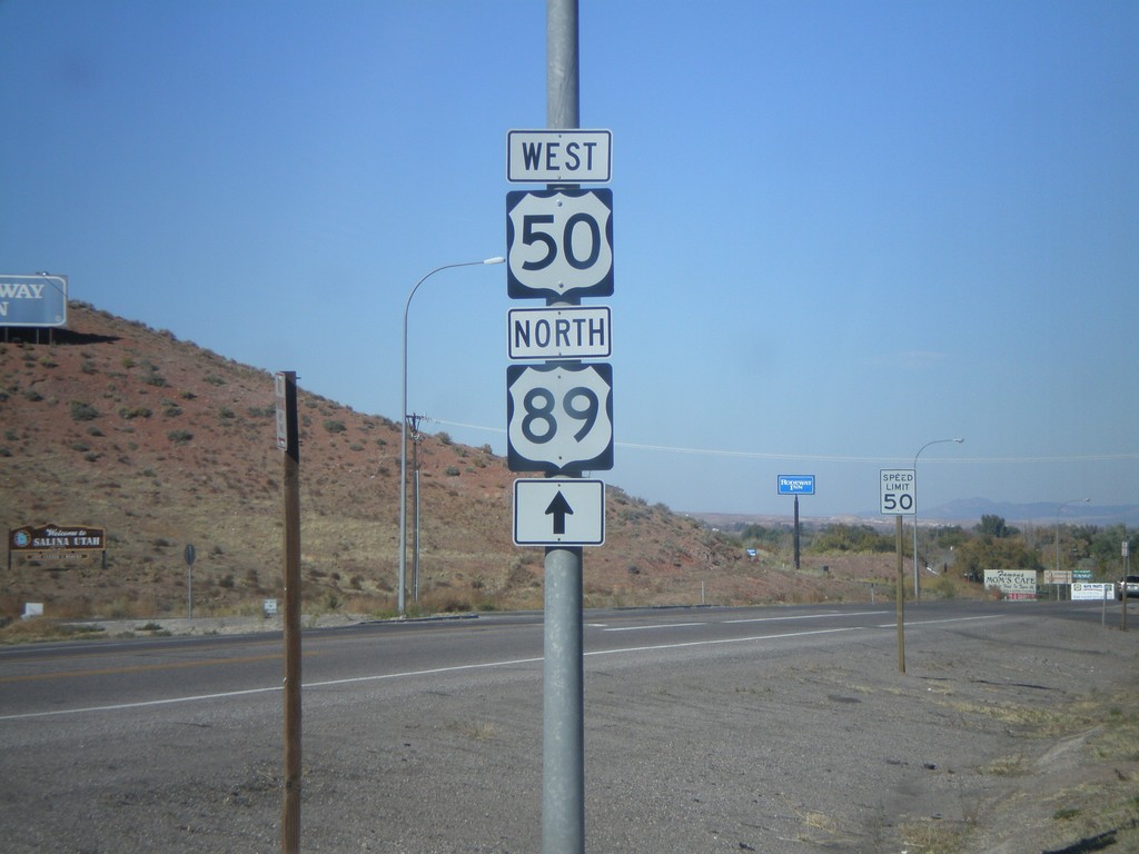
US-50 West/US-89 North - Entering Salina
US-50 west to US-89 north, just north of I-70.
Taken 10-25-2008

 Salina
Sevier County
Utah
United States
Salina
Sevier County
Utah
United States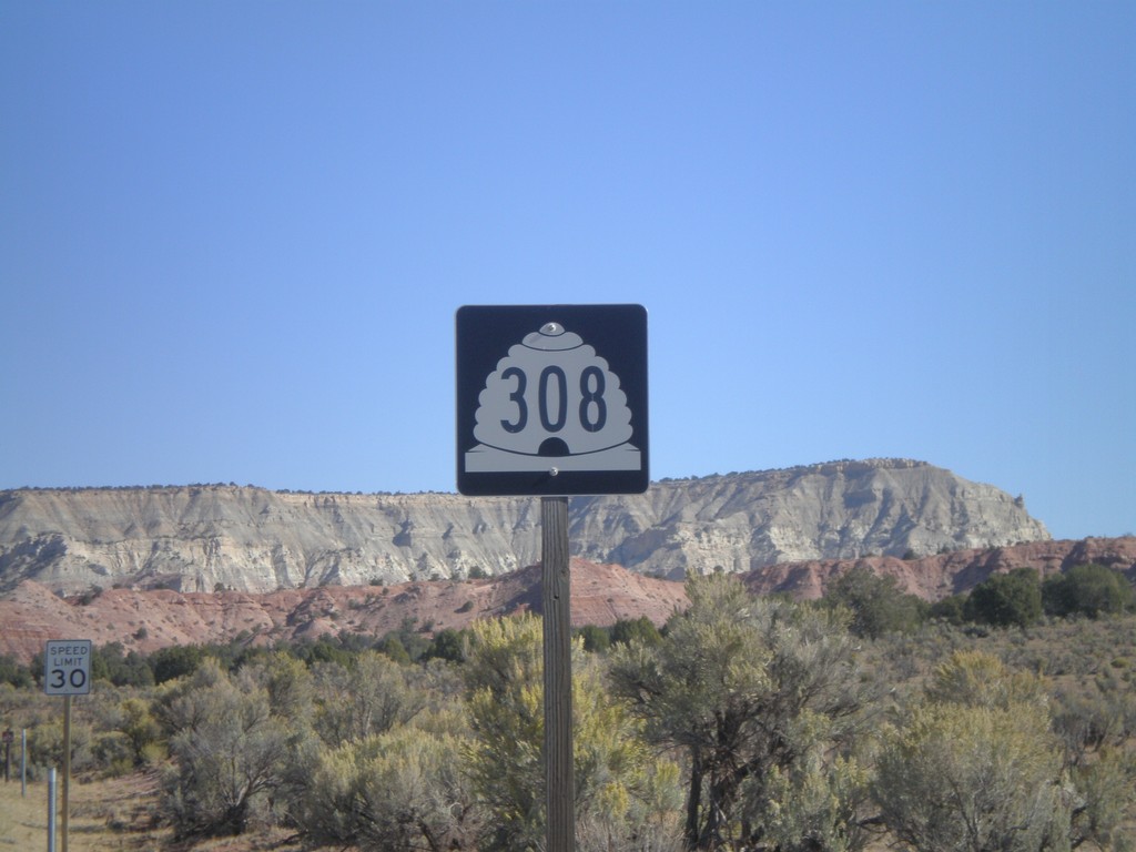
UT-308 North - Kodachrome Basin
UT-308 north on Kodachrome Basin Road. This was taken north of Cottonwood Wash Rd. junction. UT-308 does not connect to the state highway system.
Taken 10-15-2008
 Henrieville
Kane County
Utah
United States
Henrieville
Kane County
Utah
United States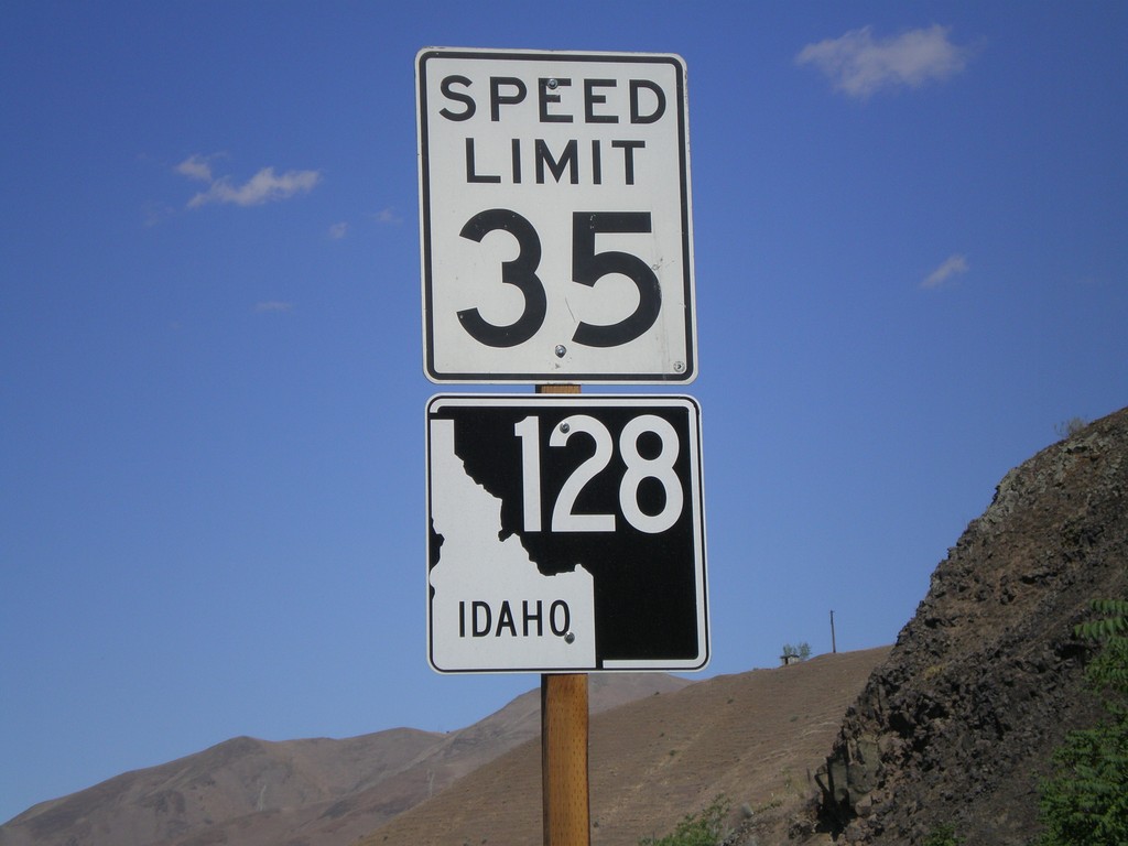
ID-128 West - Lewiston
ID-128 west in Lewiston. ID-128 follows the north side of the Clearwater and Snake River, and connects with WA-128.
Taken 07-27-2008
 Lewiston
Nez Perce County
Idaho
United States
Lewiston
Nez Perce County
Idaho
United States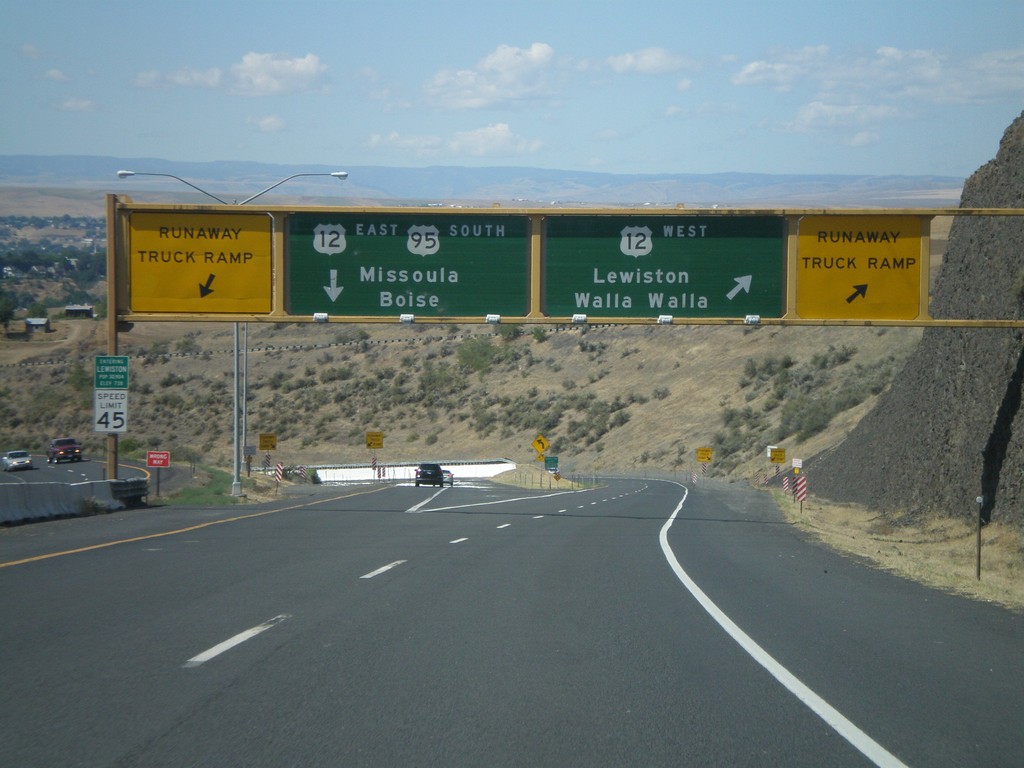
US-95 South at US-12
US-95 south at US-12 junction. Merge right for US-12 West/Lewiston/Walla Walla (Washington). Use left lane for US-95 South/US-12 East/Missoula (Montana)/Boise. Use either lane for access to Runaway Truck Ramps.
Taken 07-27-2008
 Lewiston
Nez Perce County
Idaho
United States
Lewiston
Nez Perce County
Idaho
United States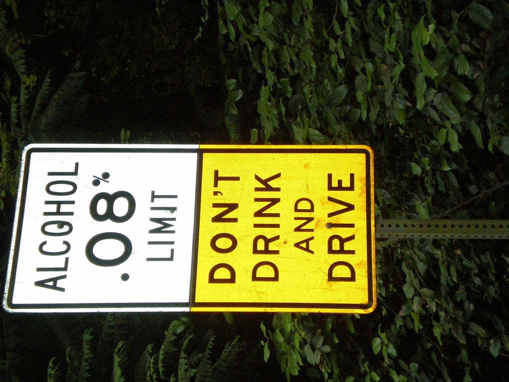
Alcohol Limit 0.08% - Lopez Island
Ferry Road south on Lopez Island. Alcohol Limit 0.08% - Don’t Drink and Drive. This is a standard sign on Washington highways.
Taken 07-25-2008
Lopez Island San Juan County Washington United States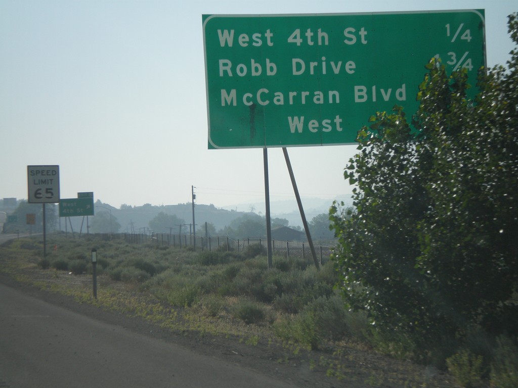
I-80 East - Reno Exits
Exits on I-80 east near Reno.
Taken 07-07-2008
Reno
Washoe County
Nevada
United States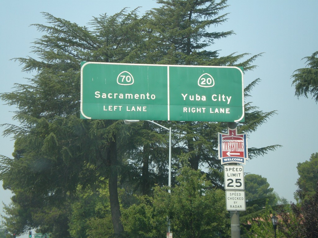
CA-70 South/CA-20 West Split
CA-70 South/CA-20 West approaching split. Use left lane for CA-70 south to Sacramento. Use right lane for CA-20 west to Yuba City.
Taken 07-06-2008

 Marysville
Yuba County
California
United States
Marysville
Yuba County
California
United States