Signs Tagged With Stop
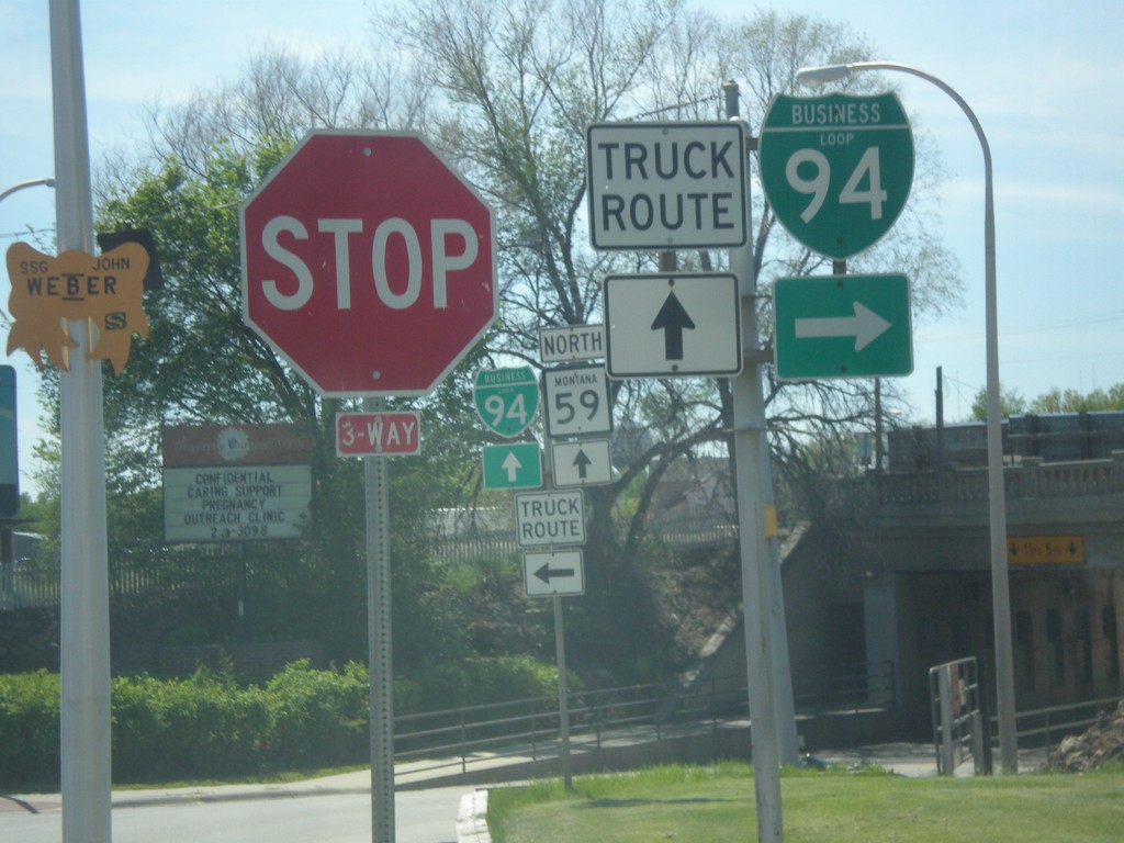
BL-94 West at MT-59 - Miles City
BL-94 West (Valley Drive) at MT-59 (Main St.) in Miles City. Turn right on Main St. to continue west on BL-94.
Taken 05-14-2016

 Miles City
Custer County
Montana
United States
Miles City
Custer County
Montana
United States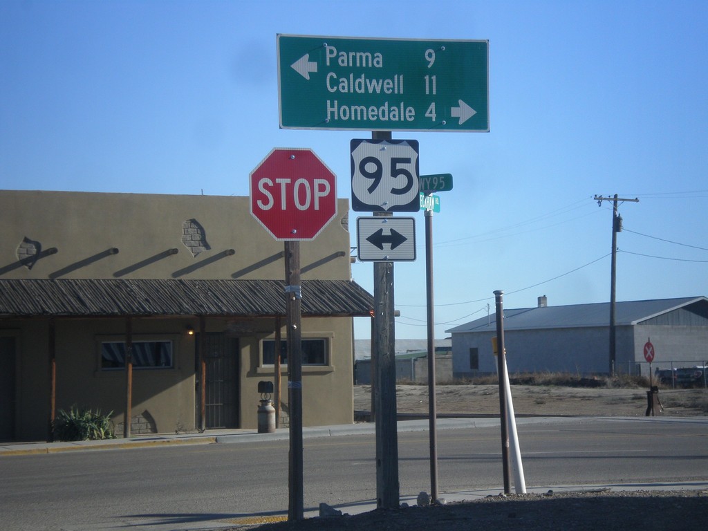
Golden Gate Ave. East at US-95
Golden Gate Ave. East at US-95 in Wilder. Turn right on US-95 south for Caldwell and Homedale. Turn left on US-95 north for Parma.
Taken 12-14-2014
 Wilder
Canyon County
Idaho
United States
Wilder
Canyon County
Idaho
United States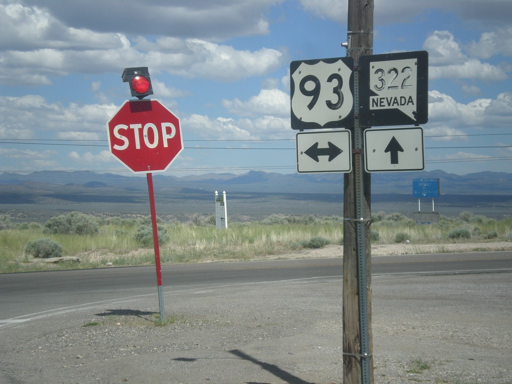
NV-322 East at US-93
NV-322 East at US-93 in Pioche. Both of the shields have fading lettering and almost look like they were hand painted on.
Taken 05-21-2014

 Pioche
Lincoln County
Nevada
United States
Pioche
Lincoln County
Nevada
United States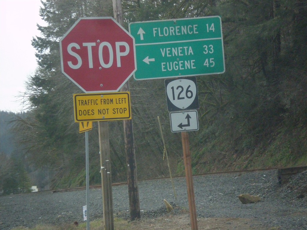
End OR-36 at OR-126
End OR-36 at OR-126. Turn left for OR-126 east to Veneta and Eugene; continue straight for OR-126 west to Florence.
Taken 02-13-2014

 Mapleton
Lane County
Oregon
United States
Mapleton
Lane County
Oregon
United States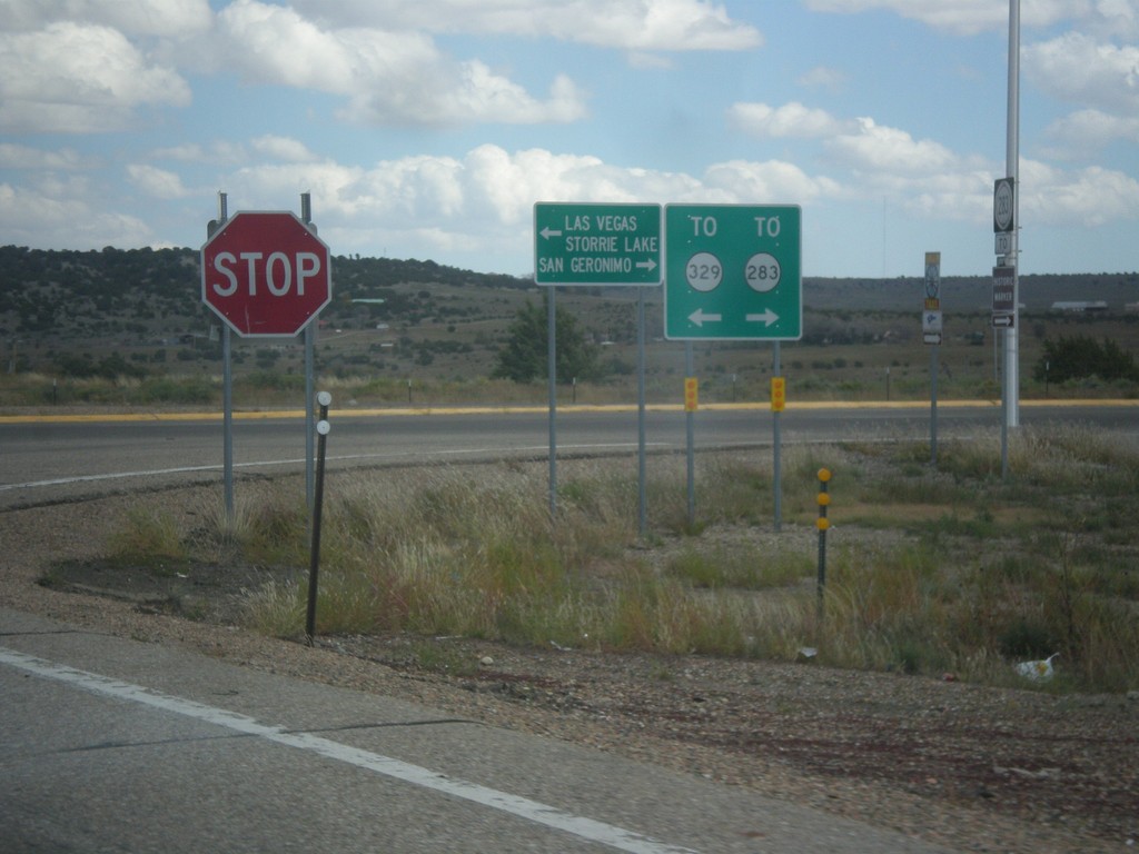
I-25 North at BL-25 - To NM-329/To NM-283
I-25 north, Exit 343 offramp. Turn right for NM-283 to San Geronimo; turn left for BL-25 and NM-329 to Las Vegas and Storrie Lake (State Park).
Taken 10-10-2013


 Las Vegas
San Miguel County
New Mexico
United States
Las Vegas
San Miguel County
New Mexico
United States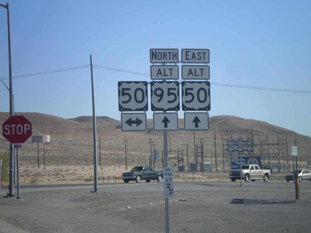
Alt. US-95 North at US-50/Alt. US-50
Alt. US-95 North at US-50/Alt. US-50 in Silver Springs. This is the western end of Alt. US-50. Alt. US-50 follows Alt. US-95 north to Fernley, thence east to outside of Fallon rejoining with US-50.
Taken 05-07-2012


 Silver Springs
Lyon County
Nevada
United States
Silver Springs
Lyon County
Nevada
United States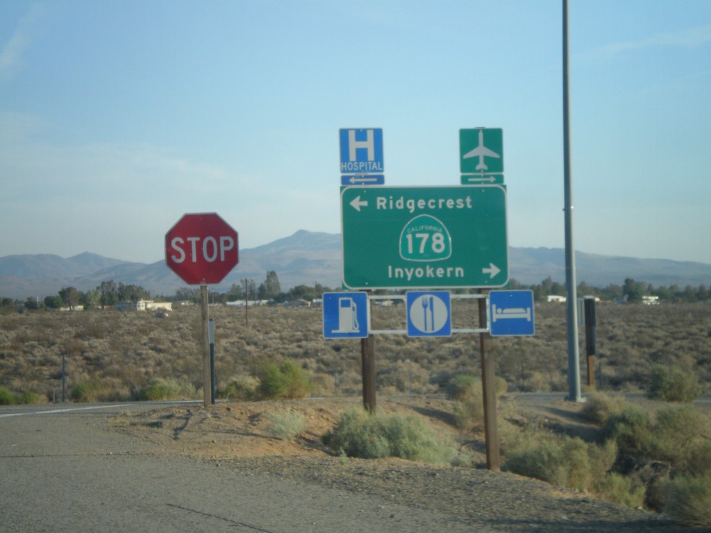
US-395 South Offramp at CA-178
US-395 south offramp at CA-178. Turn right for CA-178 west to Inyokern; left for CA-178 east to Ridgecrest.
Taken 05-04-2012

 Inyokern
Kern County
California
United States
Inyokern
Kern County
California
United States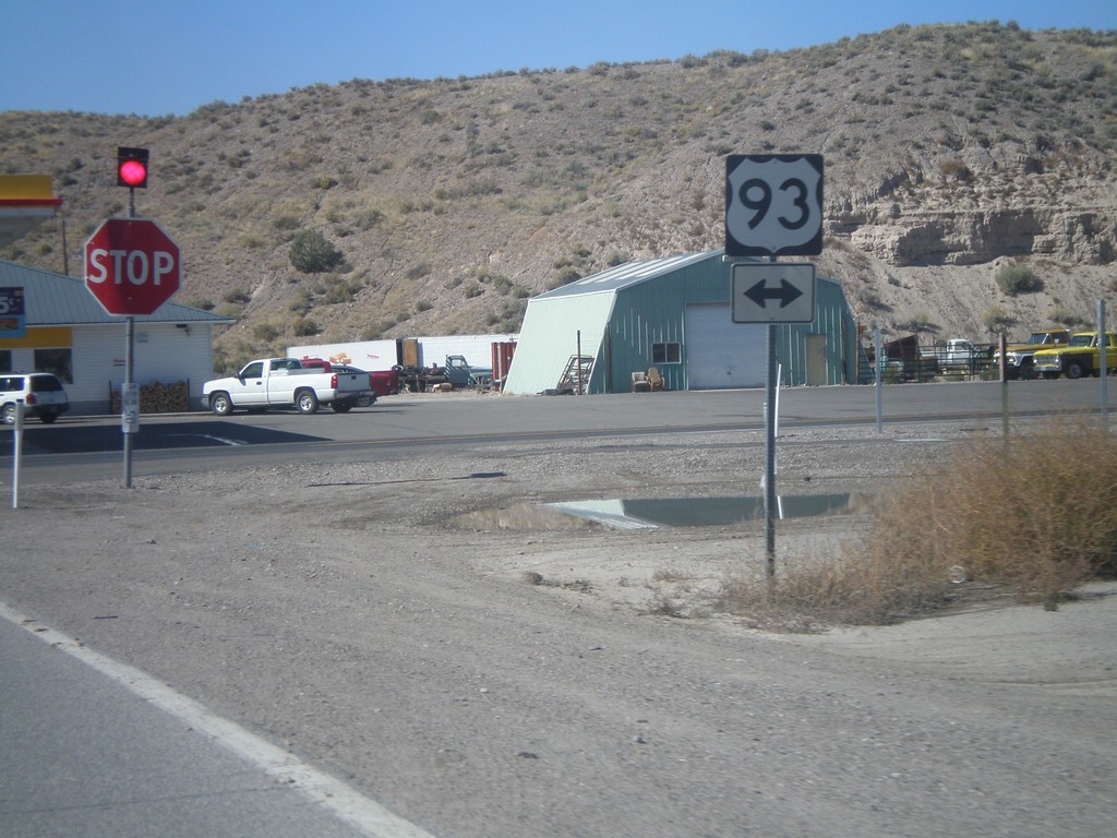
End NV-319 West at US-93
End NV-319 west at US-93.
Taken 10-14-2011
 Panaca
Lincoln County
Nevada
United States
Panaca
Lincoln County
Nevada
United States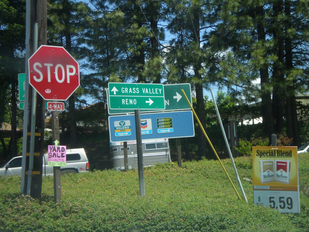
S. Auburn St. at I-80 Onramp and CA-174 Jct.
S. Auburn St. at I-80 East onramp and CA-174. Turn right for I-80 east to Reno; continue ahead for CA-174 West to Grass Valley.
Taken 06-13-2011

 Colfax
Placer County
California
United States
Colfax
Placer County
California
United States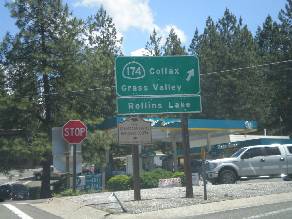
I-80 East at CA-174 (Exit 135)
I-80 east offramp at CA-174. Turn right for CA-174 West to Colfax, Grass Valley, and Rollins Lake. Also turn right for the First Transcontinental Railroad Historical Marker - Colfax.
Taken 06-13-2011
Colfax
Placer County
California
United States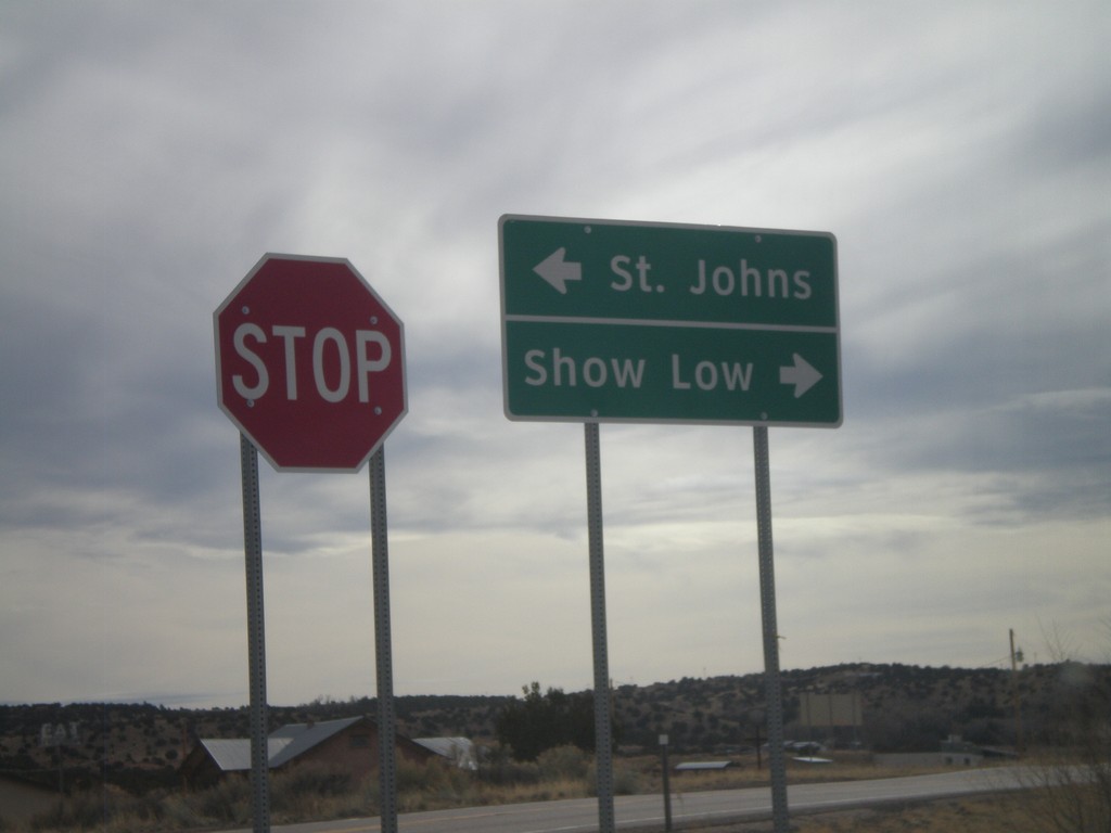
End AZ-180A East at AZ-61
End AZ-180A East at AZ-61. Use AZ-61 west for Show Low; use AZ-61 east for St. Johns.
Taken 02-24-2011

 Concho
Apache County
Arizona
United States
Concho
Apache County
Arizona
United States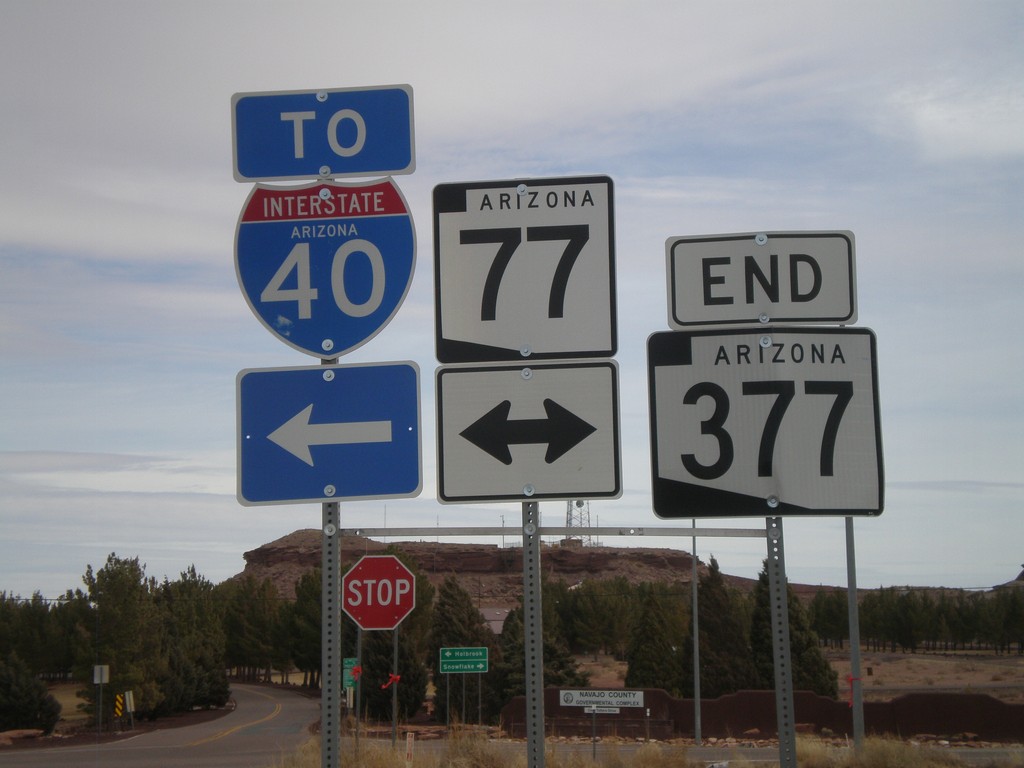
End AZ-377 at AZ-77
End AZ-377 at AZ-77. Use AZ-77 north for I-40.
Taken 02-24-2011


 Holbrook
Navajo County
Arizona
United States
Holbrook
Navajo County
Arizona
United States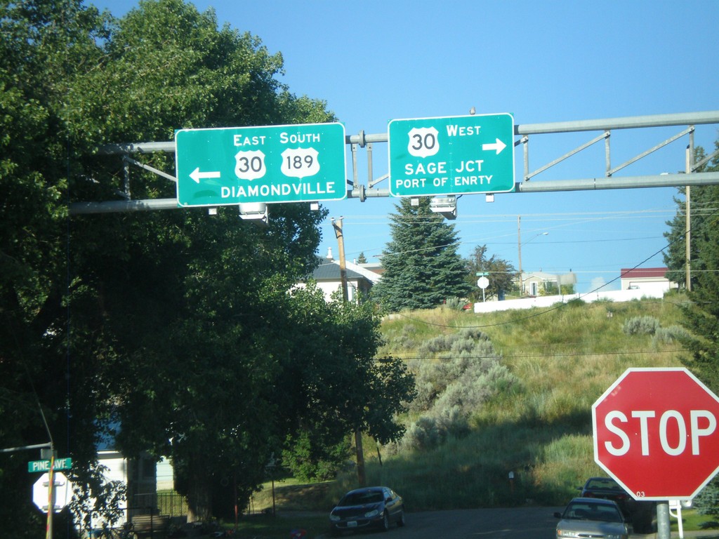
US-189 South at US-30
US-189 south at US-30. Use US-30 west for Sage Jct. and Port of Entry. Use US-30 East/US-189 South for Diamondville. US-189 joins US-30 east through the Kemmerer/Diamondville area.
Taken 08-02-2010

 Kemmerer
Lincoln County
Wyoming
United States
Kemmerer
Lincoln County
Wyoming
United States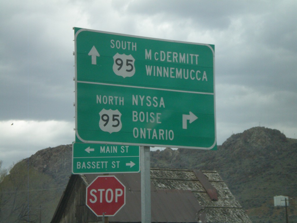
Yturri Blvd. at US-95
Yturri Blvd. at US-95 north to Boise and south to Winnemucca.
Taken 04-20-2010
Jordan Valley
Malheur County
Oregon
United States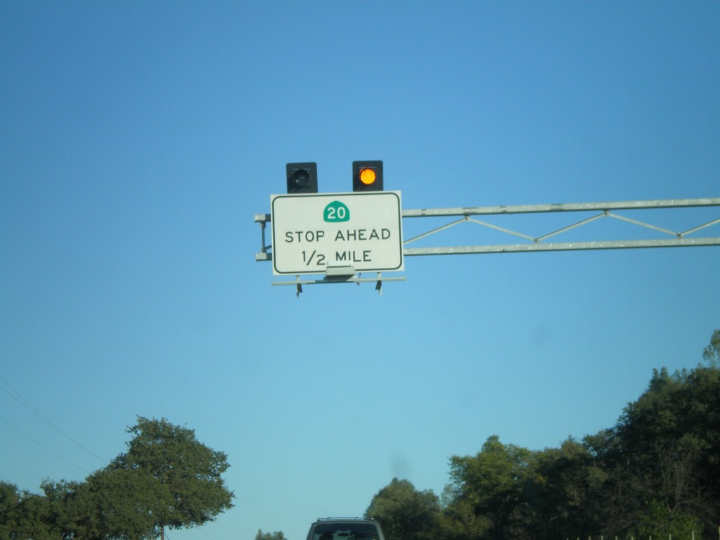
CA-20 East Traffic Must Stop Ahead
CA-20 East approaching CA-53 south. This intersection is controlled by a stop sign on CA-20.
Taken 09-25-2009

 Clearlake Oaks
Lake County
California
United States
Clearlake Oaks
Lake County
California
United States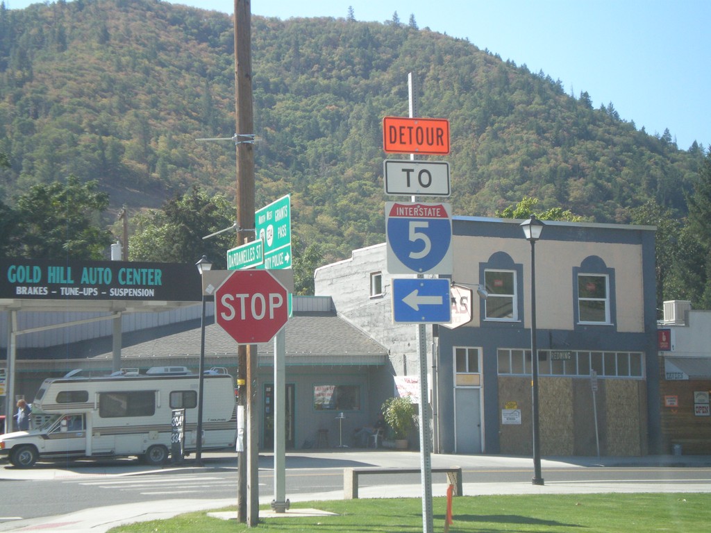
OR-234 West at OR-99 - I-5 Detour
OR-234 west at OR-99 in downtown Gold Hill. There was a detour in place for I-5 when this was taken, because of construction on the I-5 ramp on the west side of Gold Hill.
Taken 09-23-2009


 Gold Hill
Jackson County
Oregon
United States
Gold Hill
Jackson County
Oregon
United States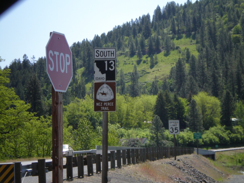
ID-13 South - Nez Perce Trail
Begin ID-13 south. ID-13 is signed as the Nez Perce Trail and Northwest Passage Scenic Byway.
Taken 05-21-2009
 Kooskia
Idaho County
Idaho
United States
Kooskia
Idaho County
Idaho
United States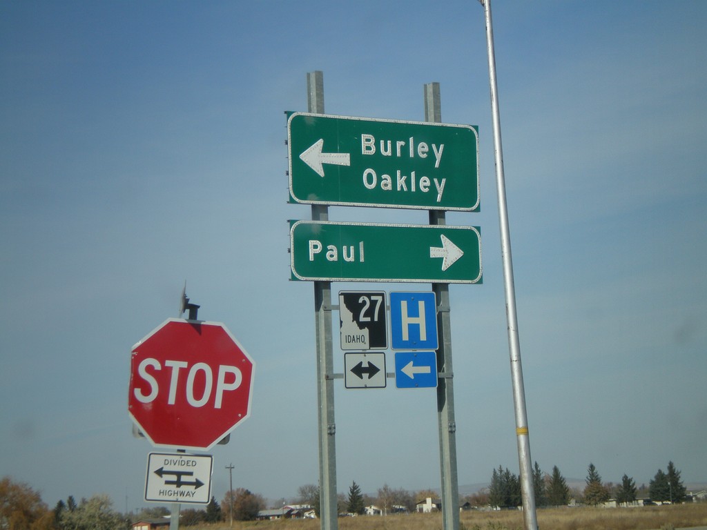
I-84 West Offramp at ID-27
I-84 west Exit 208 offramp at ID-27. Turn right for ID-27 north to Paul; left for BL-84 East/ID-27 south to Burley and Oakley.
Taken 10-26-2008


 Heyburn
Minidoka County
Idaho
United States
Heyburn
Minidoka County
Idaho
United States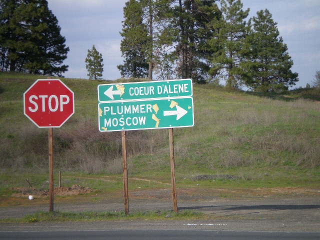
End ID-58 East at US-95
End ID-58 east at US-95 north to Coeur d’Alene and south to Plummer and Moscow.
Taken 05-05-2008
 Worley
Kootenai County
Idaho
United States
Worley
Kootenai County
Idaho
United States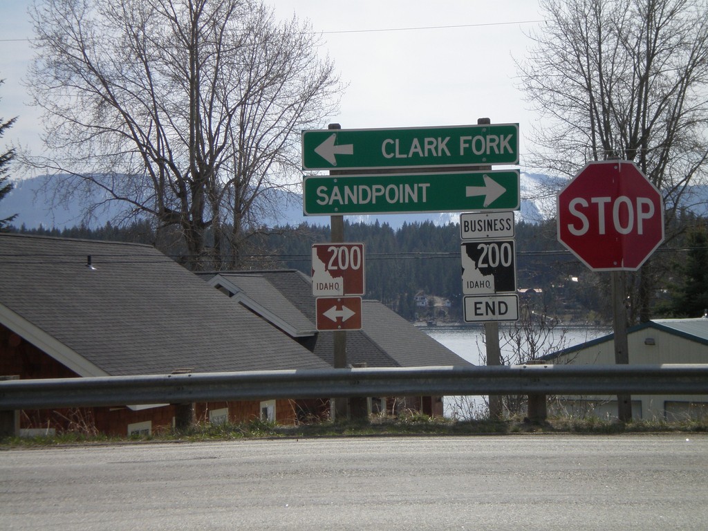
End BL-200 East at ID-200
End BL-200 east at ID-200 to Sandpoint and Clark Fork.
Taken 04-13-2008

 Hope
Bonner County
Idaho
United States
Hope
Bonner County
Idaho
United States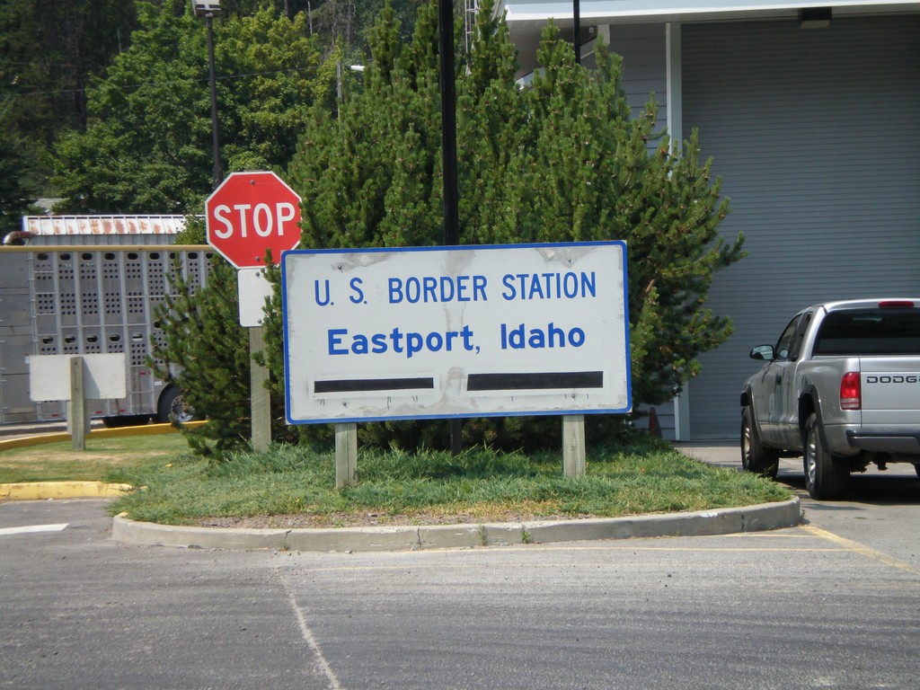
US-95 - U.S. Border Station, Eastport, Idaho
US-95 north at the US Border Station - Eastport, Idaho.
Taken 07-16-2007
Bonners Ferry
Boundary County
Idaho
United States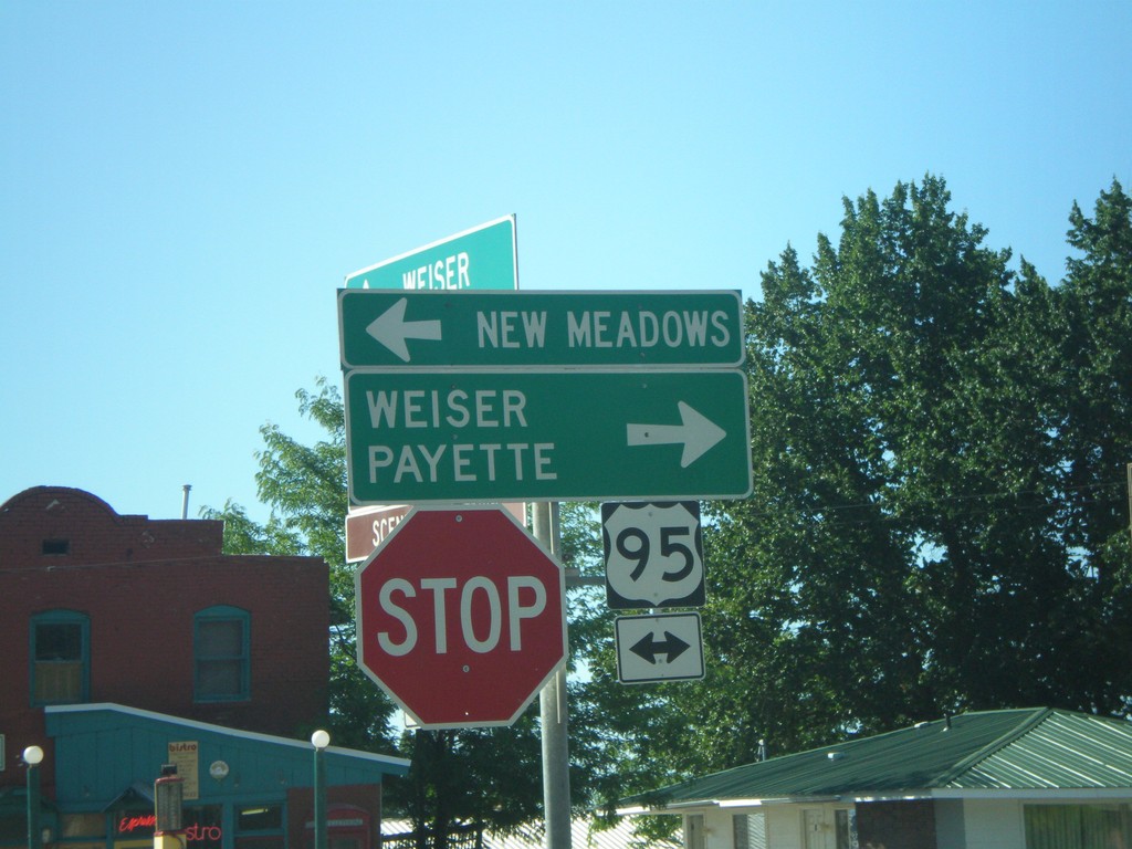
End ID-71 South at US-95
End ID-71 south at US-95 north to New Meadows, and south to Weiser and Payette.
Taken 07-01-2007
 Cambridge
Washington County
Idaho
United States
Cambridge
Washington County
Idaho
United States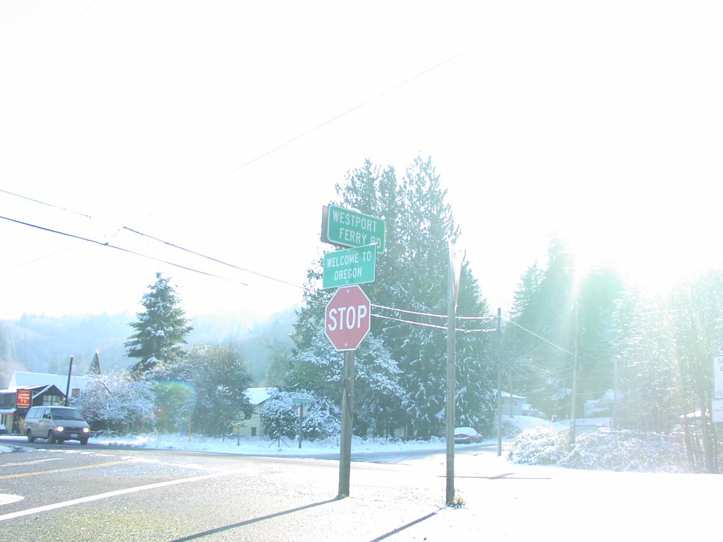
Welcome To Oregon - Westport Ferry Rd/US-30
Welcome To Oregon at southern end of Westport Ferry Road, at US-30. Westport Ferry Road leads to the Puget Island Ferry across the Columbia River.
Taken 01-01-2007
Clatskanie
Clatsop County
Oregon
United States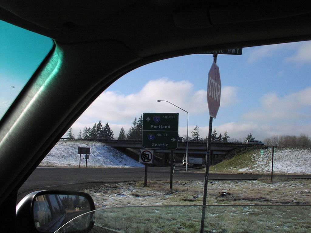
I-5 Freeway Entrance - Exit 27
Todd Road at I-5 to Portland and Seattle.
Taken 01-01-2007
Kalama
Cowlitz County
Washington
United States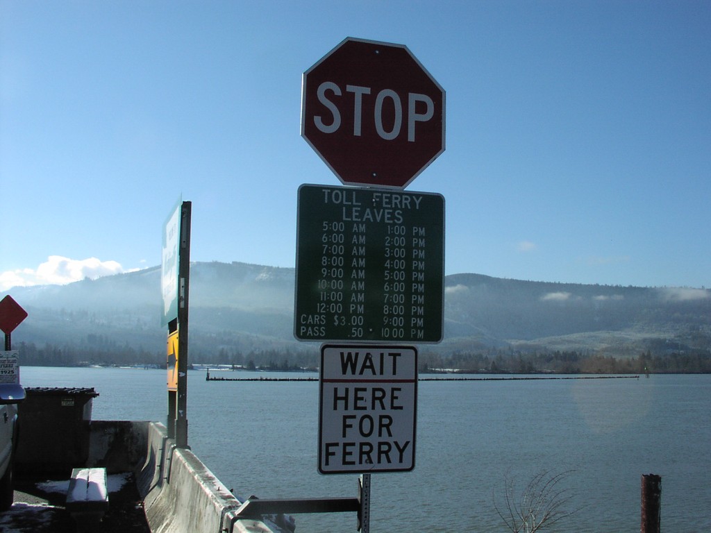
End WA-409 - Puget Island Ferry Fees
Ferry schedule and fares for Puget Island Ferry, which goes across the Columbia River to Westport, OR. Current auto fare: $3.00
Taken 01-01-2007
 Cathlamet
Wahkiakum County
Washington
United States
Cathlamet
Wahkiakum County
Washington
United States