Signs Tagged With Summit
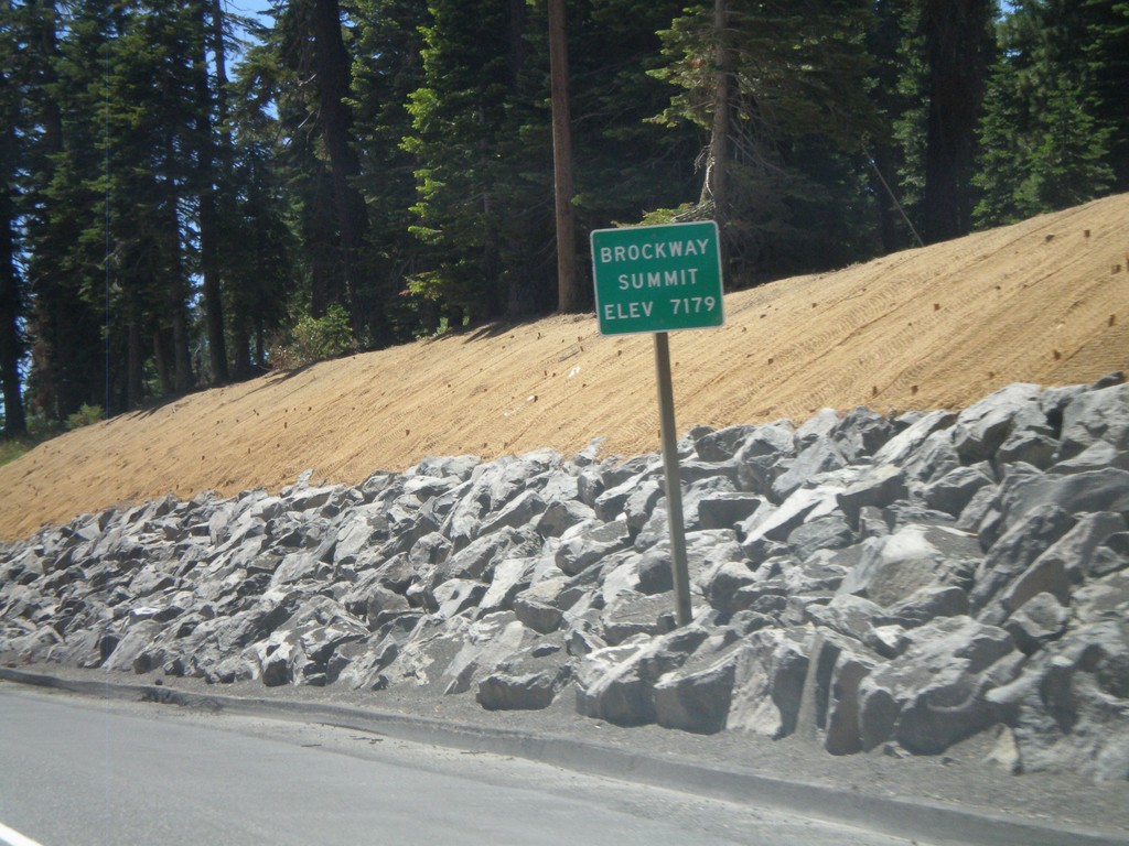
CA-267 South - Brockway Summit
CA-267 South - Brockway Summit (Elevation 7179 Feet). Brockway Summit divides the Truckee area from the Tahoe Basin. CA-267 south quickly descends into Lake Tahoe.
Taken 07-28-2012
 Truckee
Placer County
California
United States
Truckee
Placer County
California
United States
NV-140 East - Sage Hen Hills Summit
NV-140 east -Sage Hen Hills Summit - Elevation 6,349 Feet.
Taken 05-28-2012
 Humboldt County
Nevada
United States
Humboldt County
Nevada
United States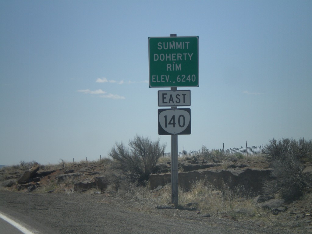
OR-140 East - Summit - Doherty Rim
Doherty Rim Summit, Elevation 6,240 Feet on OR-140 east in rural Lake County.
Taken 05-28-2012
 Adel
Lake County
Oregon
United States
Adel
Lake County
Oregon
United States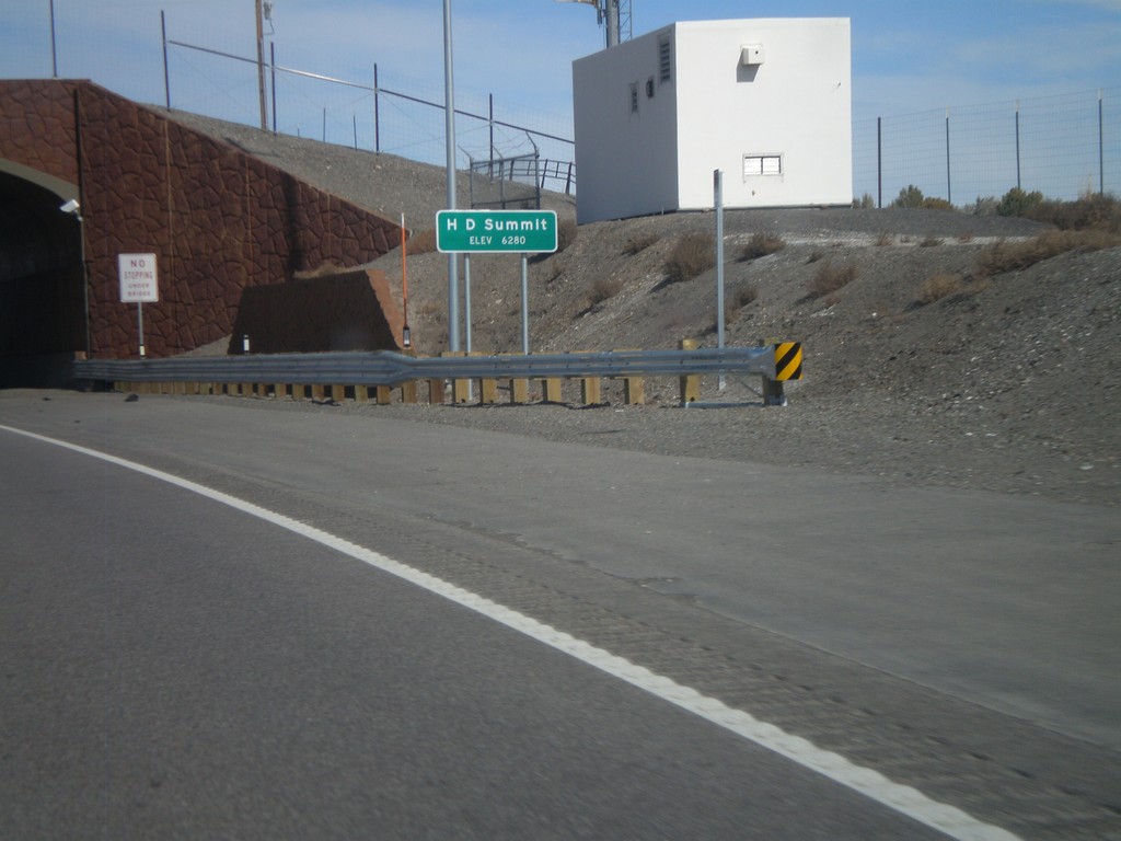
US-93 North - H-D Summit
US-93 north at H-D Summit - Elevation 6,280. The overpass in the background is a recently installed wildlife crossing over the highway. H-D Summit is the northern end of the Great Basin on US-93. North of here all water flows into the Snake River system.
Taken 10-15-2011
 Melandco
Elko County
Nevada
United States
Melandco
Elko County
Nevada
United States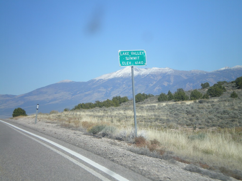
US-93 North - Lake Valley Summit
Lake Valley Summit - Elevation 6,140 Feet on US-93 north. Wheeler Peak is the snow covered mountain in the background.
Taken 10-14-2011
Ely
White Pine County
Nevada
United States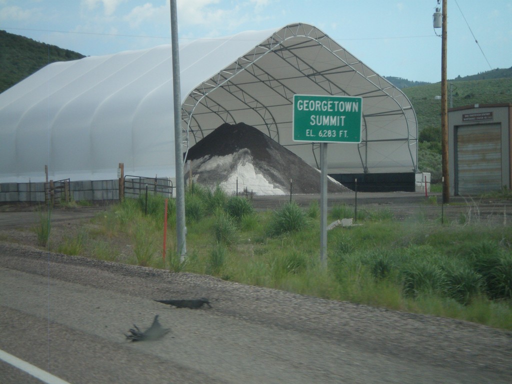
US-30 West - Georgetown Summit
US-30 west at Gorgetown Summit - Elevation 6,283 Feet. Idaho Transportation Maintenance Yard in the background.
Taken 07-05-2011
 Montpelier
Bear Lake County
Idaho
United States
Montpelier
Bear Lake County
Idaho
United States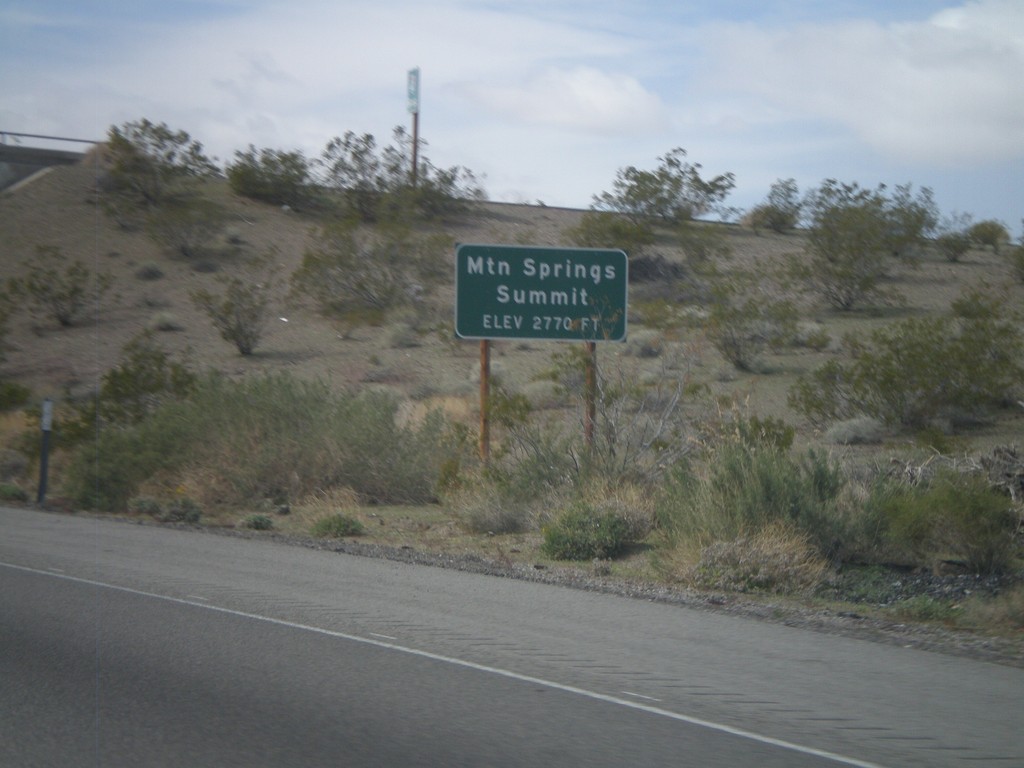
I-40 West - Mountain Springs Summit
I-40 west at Mountain Springs Summit - Elevation 2770 Feet.
Taken 02-25-2011
 Goffs
San Bernardino County
California
United States
Goffs
San Bernardino County
California
United States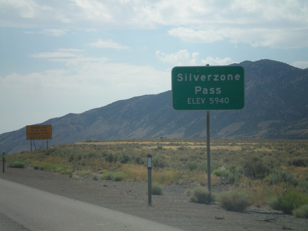
I-80 East - Silverzone Pass
I-80 east at Silverzone Pass - Elevation 5,940 Feet.
Taken 07-31-2010

 Montello
Elko County
Nevada
United States
Montello
Elko County
Nevada
United States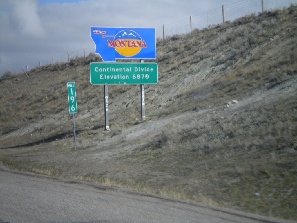
Welcome To Montana - I-15 North
Welcome to Montana on I-15 North at the Idaho-Montana state line on Monida Pass. Monida Pass is the Continental Divide.
Taken 05-02-2010
 Humphrey
Clark County
Idaho
United States
Humphrey
Clark County
Idaho
United States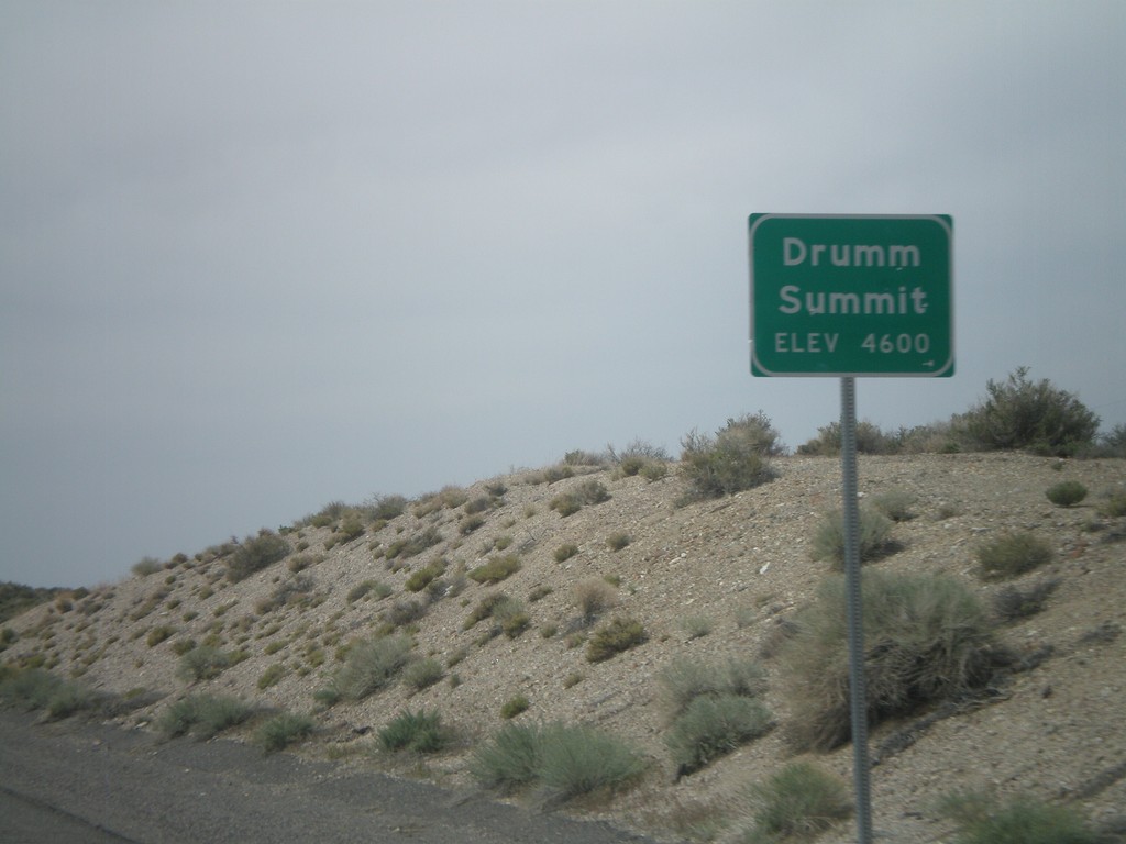
US-50 West - Drumm Summit
US-50 west at Drumm Summit - Elevation 4600 Feet.
Taken 04-15-2010
 Fallon
Churchill County
Nevada
United States
Fallon
Churchill County
Nevada
United States