Signs Tagged With Summit
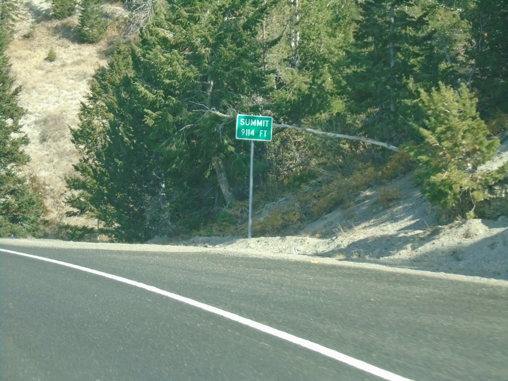
US-191 North - Elevation 9114 Feet
US-191 North - Elevation 9114 Feet. This is the summit of the divide between the Price River basin and the Duchesne River basin.
Taken 10-03-2020
 Duchesne
 County
Utah
United States
Duchesne
Duchesne County
Utah
United States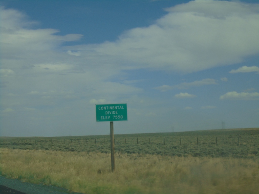
WY-28 East - Continental Divide
WY-28 East - Continental Divide (South Pass) - Elevation 7550 Feet.
Taken 08-13-2020
 Lander
Fremont County
Wyoming
United States
Lander
Fremont County
Wyoming
United States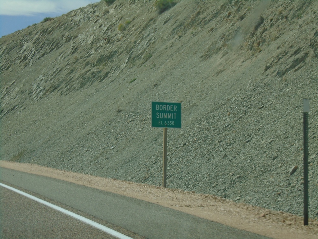
US-30 East - Border Summit
US-30 east at Border Summit - Elevation 6358 Feet.
Taken 08-13-2020
 Montpelier
Bear Lake County
Idaho
United States
Montpelier
Bear Lake County
Idaho
United States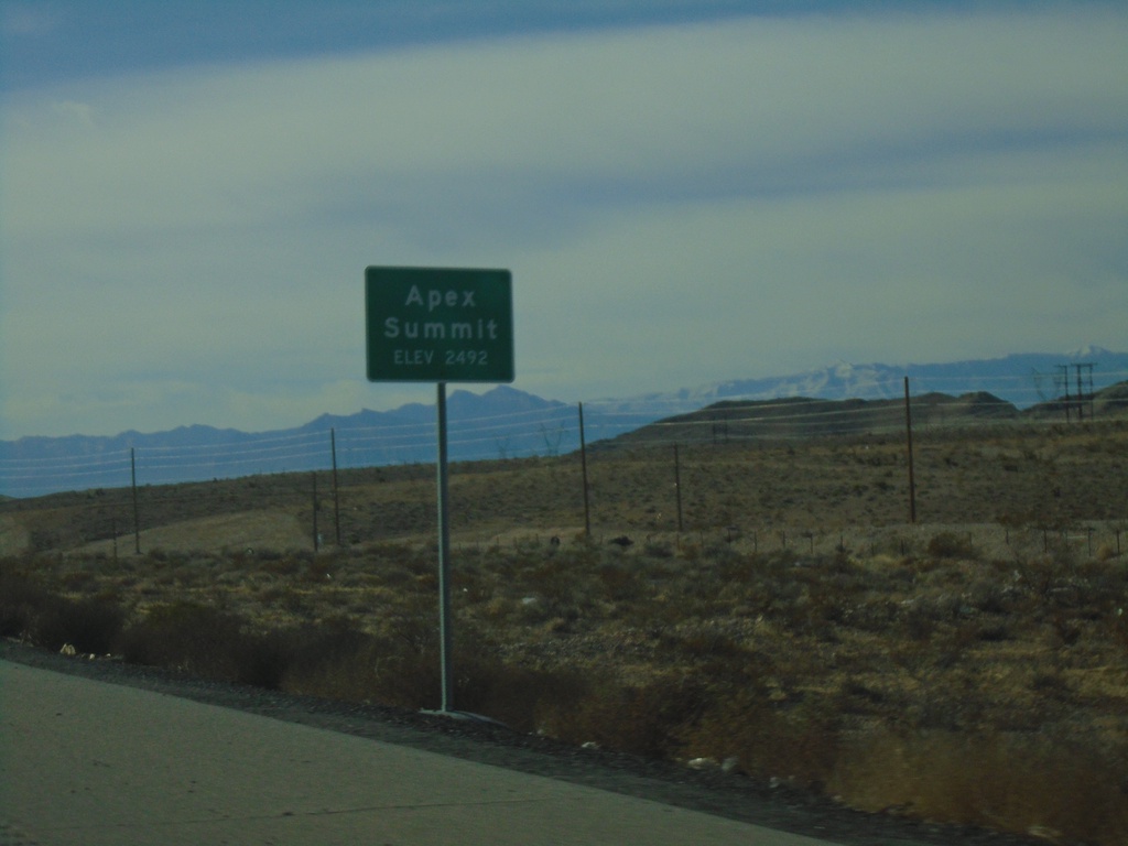
I-15 South - Apex Summit
I-15 south at Apex Summit - Elevation 2492 Feet.
Taken 11-26-2019

 Nellis Air Force Base
Clark County
Nevada
United States
Nellis Air Force Base
Clark County
Nevada
United States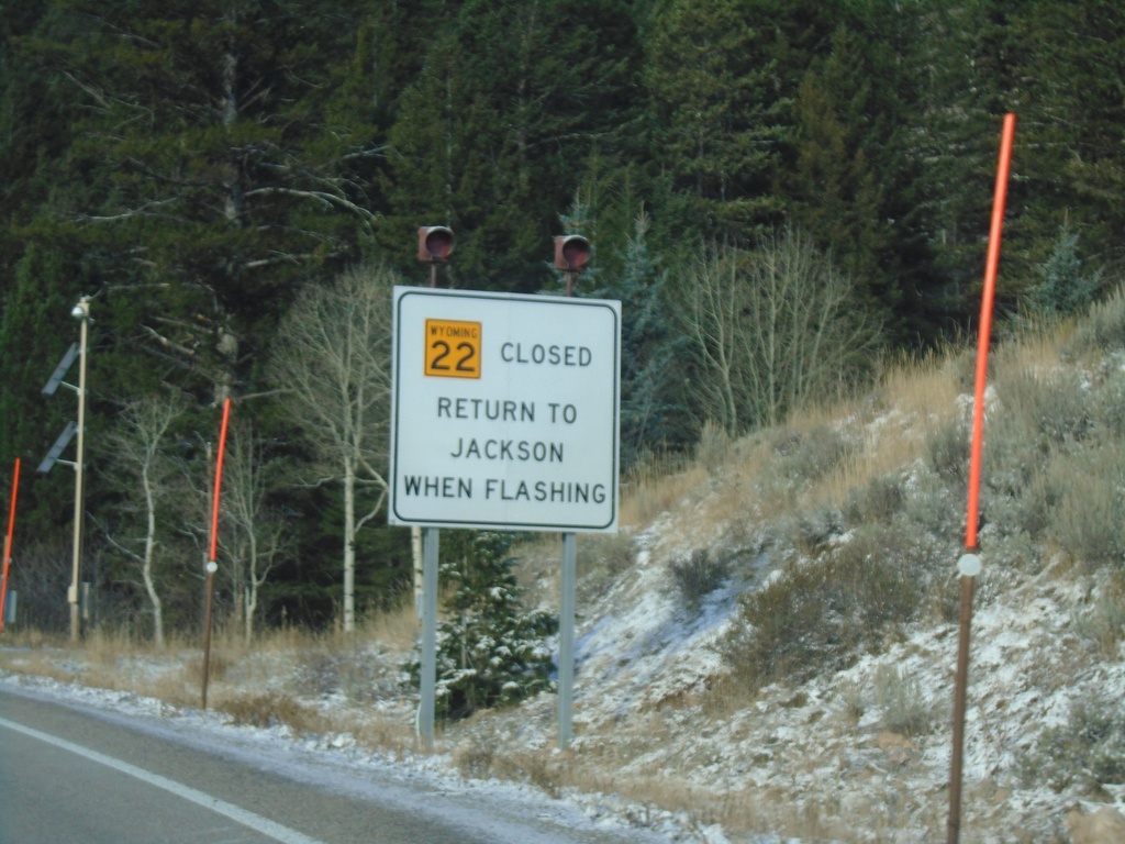
WY-22 West - Return To Jackson When Flashing
WY-22 west at the base of Teton Pass. Return to Jackson When Flashing.
Taken 10-27-2019
 Wilson
Teton County
Wyoming
United States
Wilson
Teton County
Wyoming
United States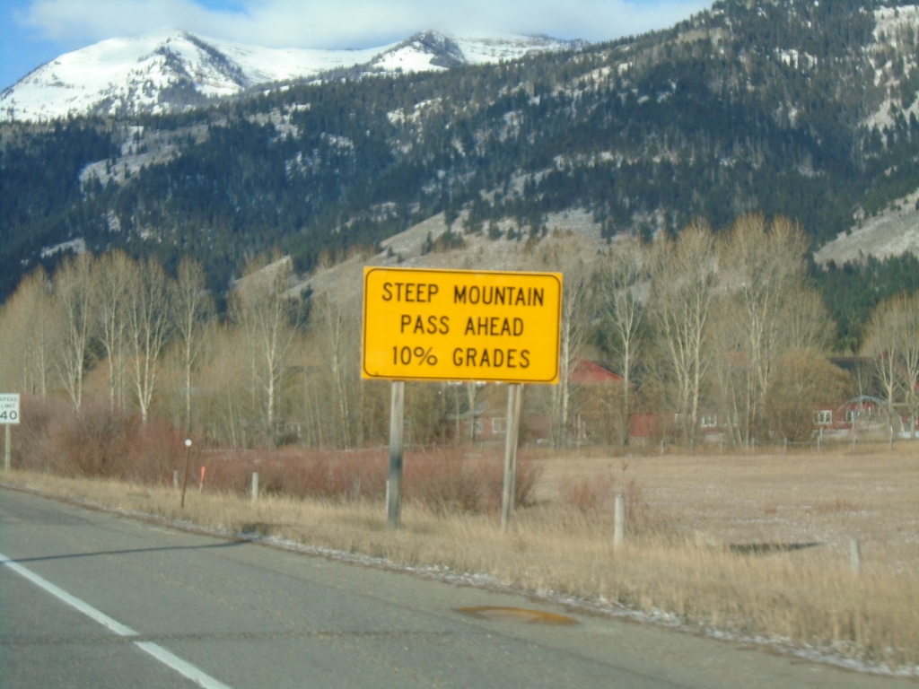
WY-22 West Approaching Teton Pass
WY-22 west approaching Teton Pass. Steep Mountain Pass Ahead - 10% Grades.
Taken 10-27-2019
Wilson
Teton County
Wyoming
United States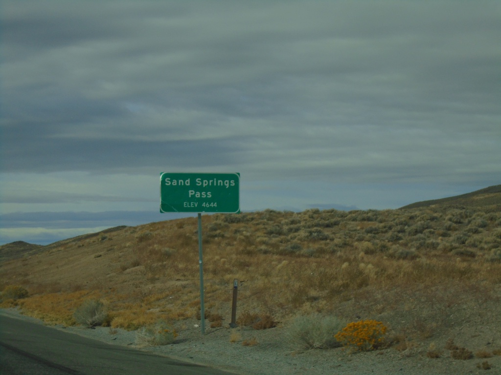
US-50 West - Sand Springs Pass
Sand Springs Pass on US-50 west. Elevation 4644 Feet.
Taken 10-19-2019
 Fallon
Churchill County
Nevada
United States
Fallon
Churchill County
Nevada
United States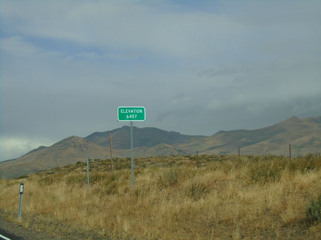
NV-229 North - Secret Pass
NV-229 North at Secret Pass - Elevation 6457 Feet.
Taken 09-28-2019
 Arthur
Elko County
Nevada
United States
Arthur
Elko County
Nevada
United States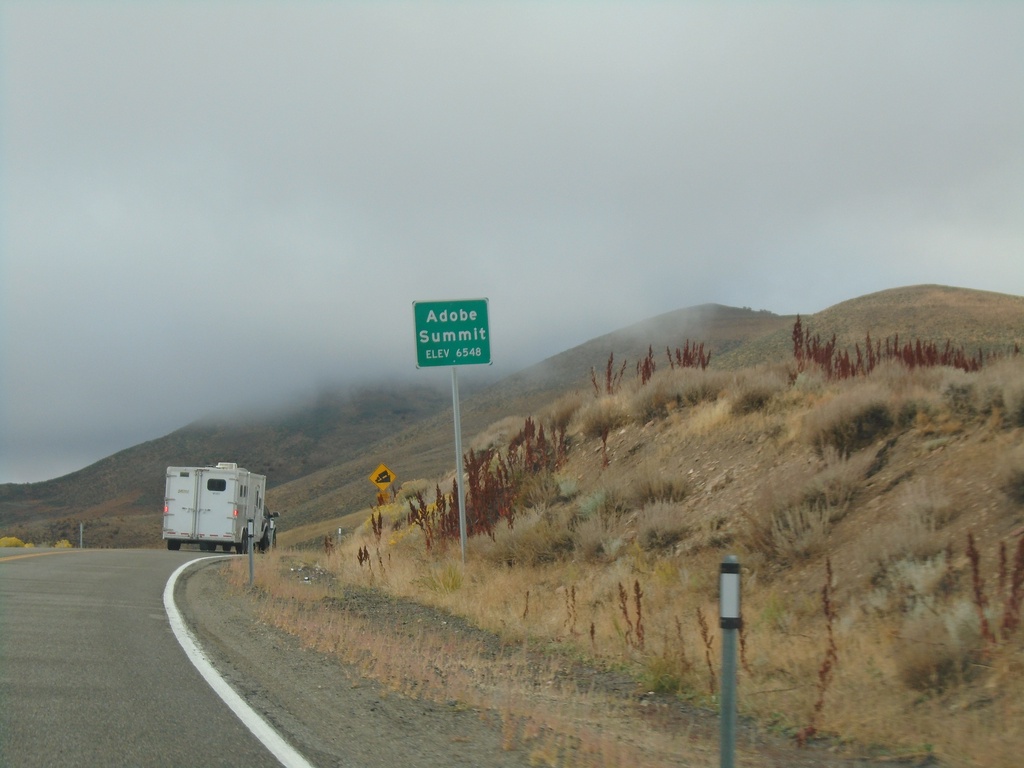
NV-225 South - Adobe Summit
Adobe Summit - Elevation 6548 Feet on NV-225 south.
Taken 09-28-2019
 Elko
Elko County
Nevada
United States
Elko
Elko County
Nevada
United States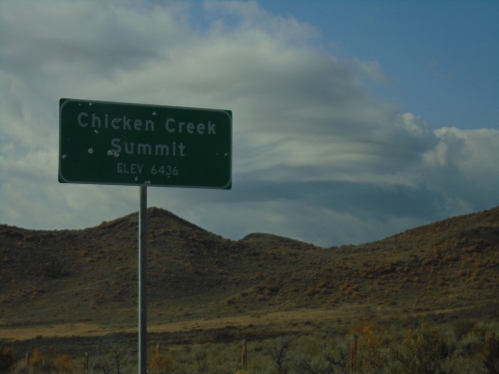
NV-226 South - Chicken Creek Summit
Chicken Creek Summit on NV-226 South. Elevation 6436 Feet.
Taken 09-28-2019
 Tuscarora
Elko County
Nevada
United States
Tuscarora
Elko County
Nevada
United States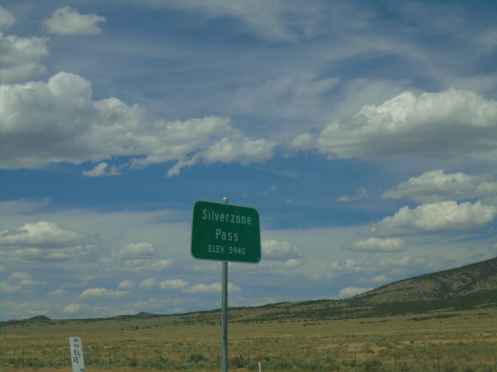
I-80 West - Silver Zone Pass
I-80 west at Silver Zone Pass. Elevation 5940 Feet.
Taken 08-03-2019

 Montello
Elko County
Nevada
United States
Montello
Elko County
Nevada
United States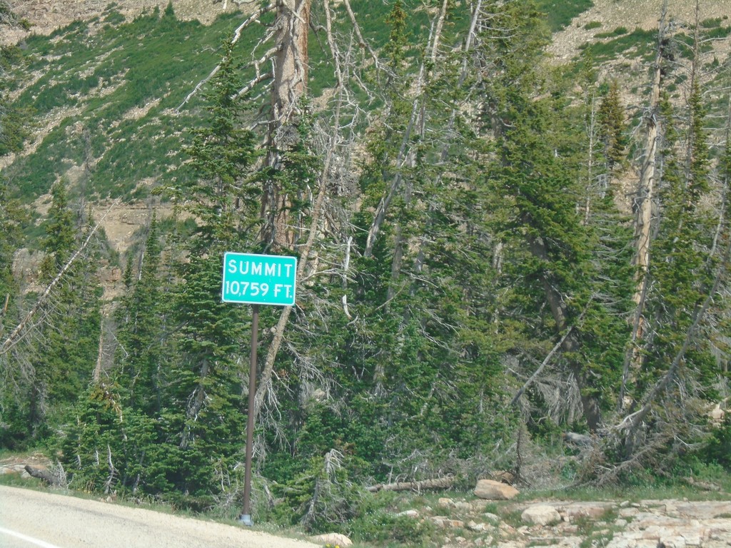
UT-150 South - Bald Mountain Pass
UT-150 South on (Bald Mountain Pass) Elevation 10,759 Feet.
Taken 08-03-2019
 Kamas
Duchesne County
Utah
United States
Kamas
Duchesne County
Utah
United States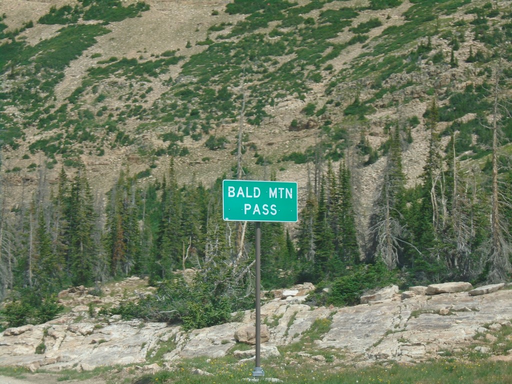
UT-150 South - Bald Mountain Pass
Bald Mountain Pass in the Uinta Mountains (10,715 Feet)
Taken 08-03-2019
Hanna
Duchesne County
Utah
United States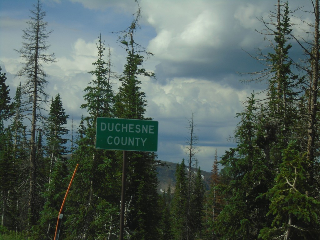
UT-150 South - Duchesne County
Duchesne County on UT-150 south. Taken at Hayden Pass.
Taken 08-03-2019
Hanna
Duchesne County
Utah
United States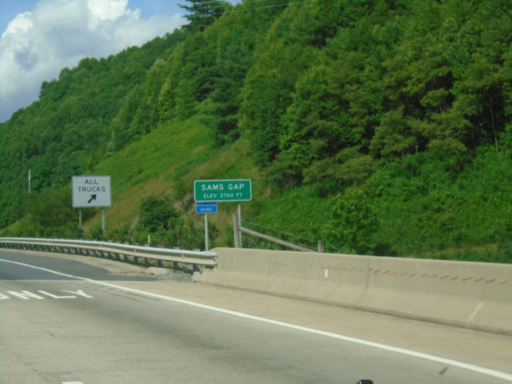
I-26 West - Sams Gap
I-26 west at Sams Gap at the North Carolina - Tennessee state line.
Taken 06-23-2019

 Flag Pond
Unicoi County
Tennessee
United States
Flag Pond
Unicoi County
Tennessee
United States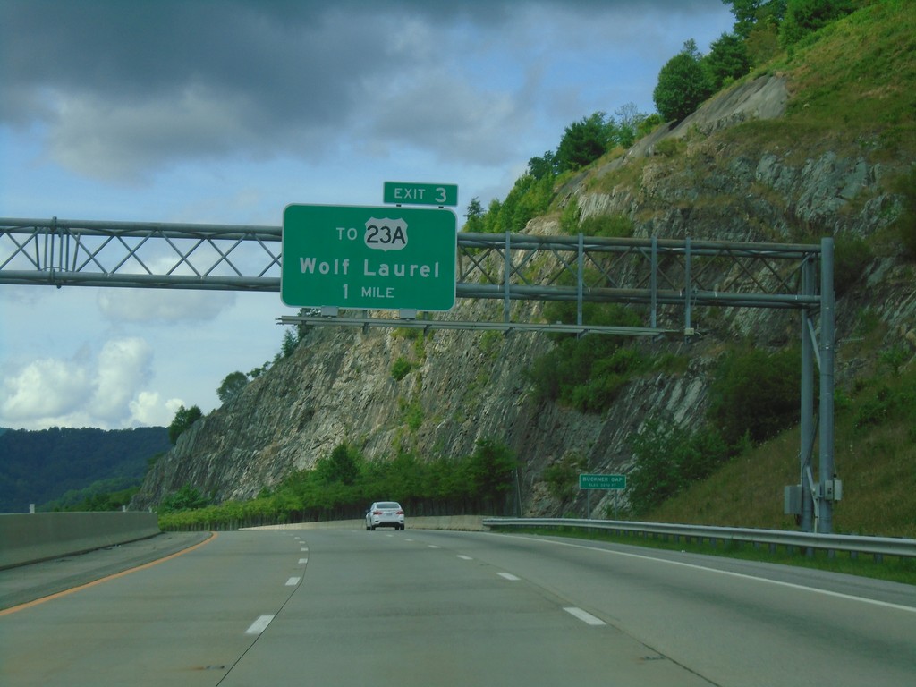
I-26 West - Exit 3
I-26 west approaching Exit 3 - To US-23A/Wolf Laurel.
Taken 06-23-2019
 Mars Hill
Madison County
North Carolina
United States
Mars Hill
Madison County
North Carolina
United States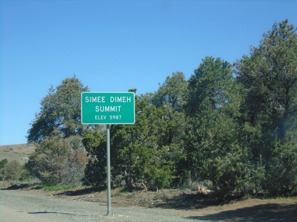
US-395 North - Simee Dimeh Summit
Simee Dimeh Summit on US-395 North - Elevation 5987 Feet.
Taken 04-27-2019
 Gardnerville
Douglas County
Nevada
United States
Gardnerville
Douglas County
Nevada
United States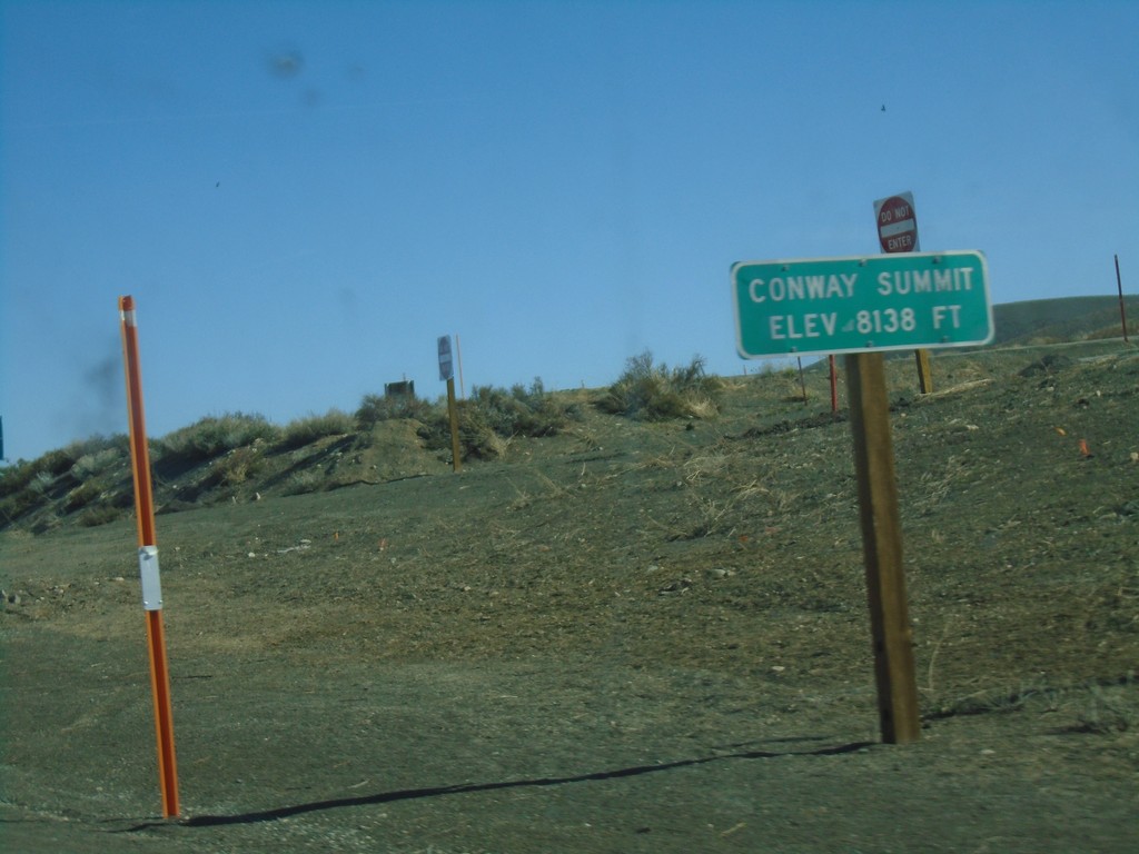
US-395 North - Conway Summit
Conway Summit - Elevation 8138 Feet on US-395 north. Conway Summit is the highest point on US-395.
Taken 04-27-2019
Bridgeport
Mono County
California
United States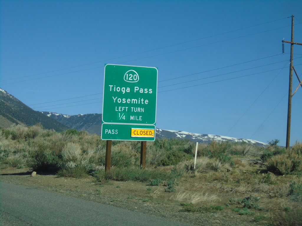
US-395 North Approaching CA-120
US-395 north approaching CA-120 east to Tioga Pass and Yosemite. Tioga Pass is closed when this picture was taken.
Taken 04-27-2019
 Lee Vining
Mono County
California
United States
Lee Vining
Mono County
California
United States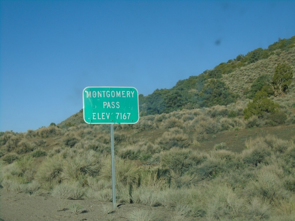
US-6 West - Montgomery Pass
US-6 west at Montgomery Pass - Elevation 7167 Feet.
Taken 04-27-2019
 Dyer
Mineral County
Nevada
United States
Dyer
Mineral County
Nevada
United States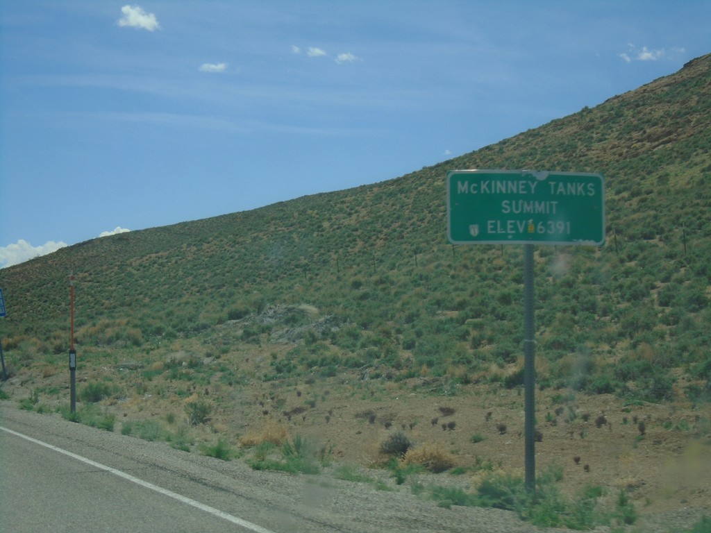
US-6 West - McKinney Tanks Summit
US-6 west at McKinney Tanks Summit - Elevation 6391 Feet.
Taken 04-26-2019
Tonopah
Nye County
Nevada
United States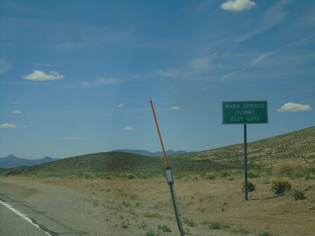
US-6 West - Warm Springs Summit
US-6 west at Warm Springs Summit - Elevation 6293 Feet.
Taken 04-26-2019
Tonopah
Nye County
Nevada
United States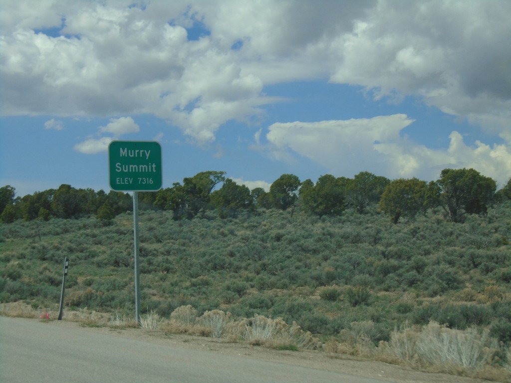
US-6 West - Murry Summit
US-6 west at Murry Summit - Elevation 7316 Feet.
Taken 04-26-2019
Ruth
White Pine County
Nevada
United States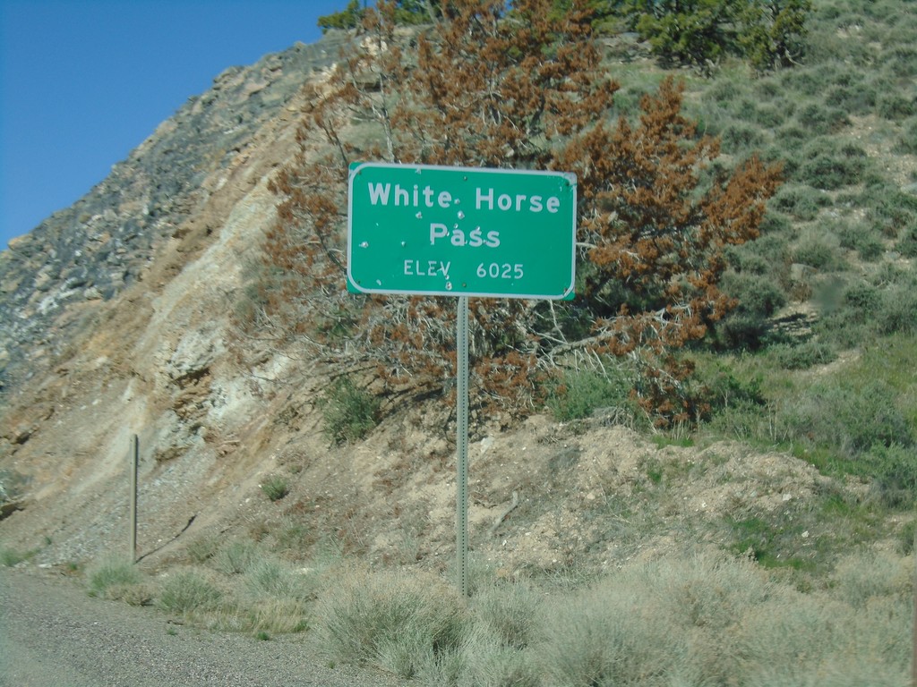
Alt. US-93 South - White Horse Pass
Alt. US-93 South at White Horse Pass - Elevation 6025 Feet.
Taken 04-26-2019
Elko County
Nevada
United States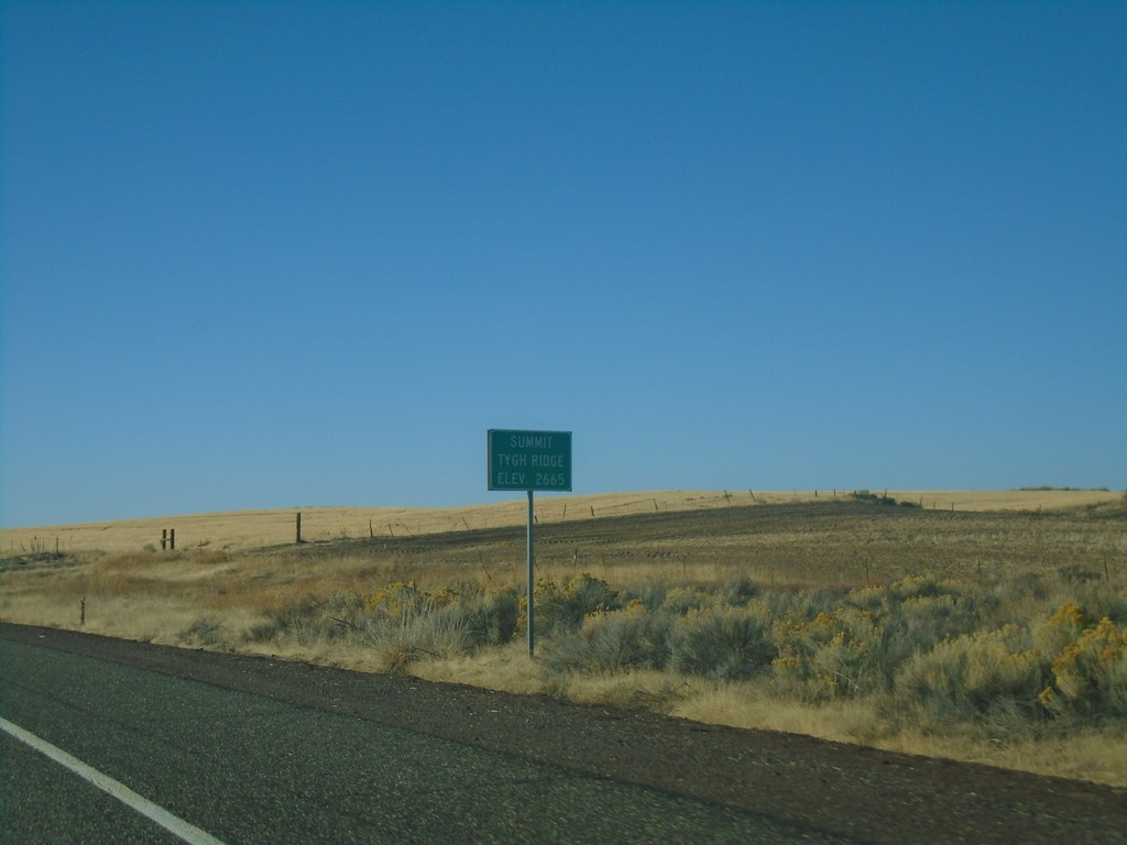
US-197 South - Tygh Ridge Summit
US-197 South at Tygh Ridge Summit - Elevation 2665 Ft.
Taken 10-14-2018
 Dufur
Wasco County
Oregon
United States
Dufur
Wasco County
Oregon
United States