Signs Tagged With Summit
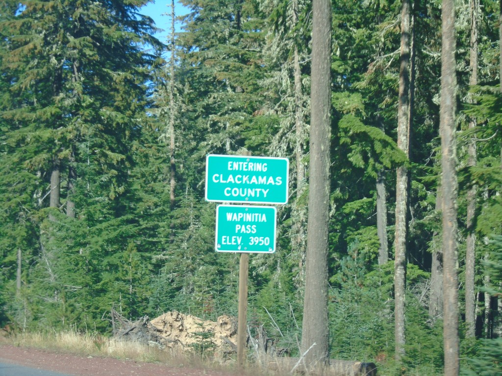
US-26 West - Clackamas County / Wapinita Pass
US-26 West at Clackamas County and Wapinita Pass - Elevation 3952 Feet. Wapinita Pass is at the crest of the Cascade Range.
Taken 10-13-2018
 Government Camp
Clackamas County
Oregon
United States
Government Camp
Clackamas County
Oregon
United States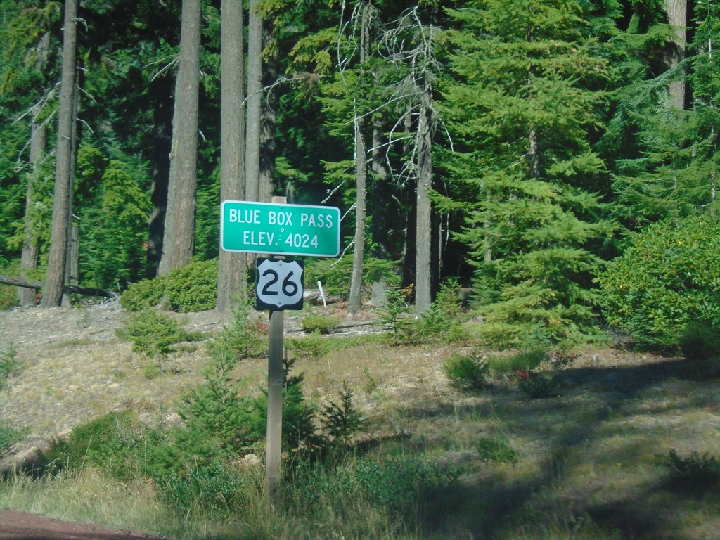
US-26 West - Blue Box Summit
US-26 West at Blue Box Summit - Elevation 4024 Feet.
Taken 10-13-2018
Government Camp
Wasco County
Oregon
United States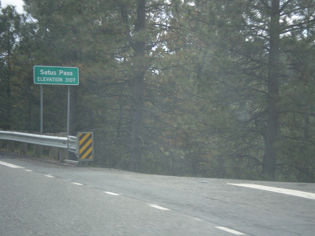
US-97 South - Satus Pass
Satus Pass - Elevation 3107 Feet on US-97 south. Satus Pass is a summit in the Simcoe Mountains.
Taken 04-30-2018
 Goldendale
Klickitat County
Washington
United States
Goldendale
Klickitat County
Washington
United States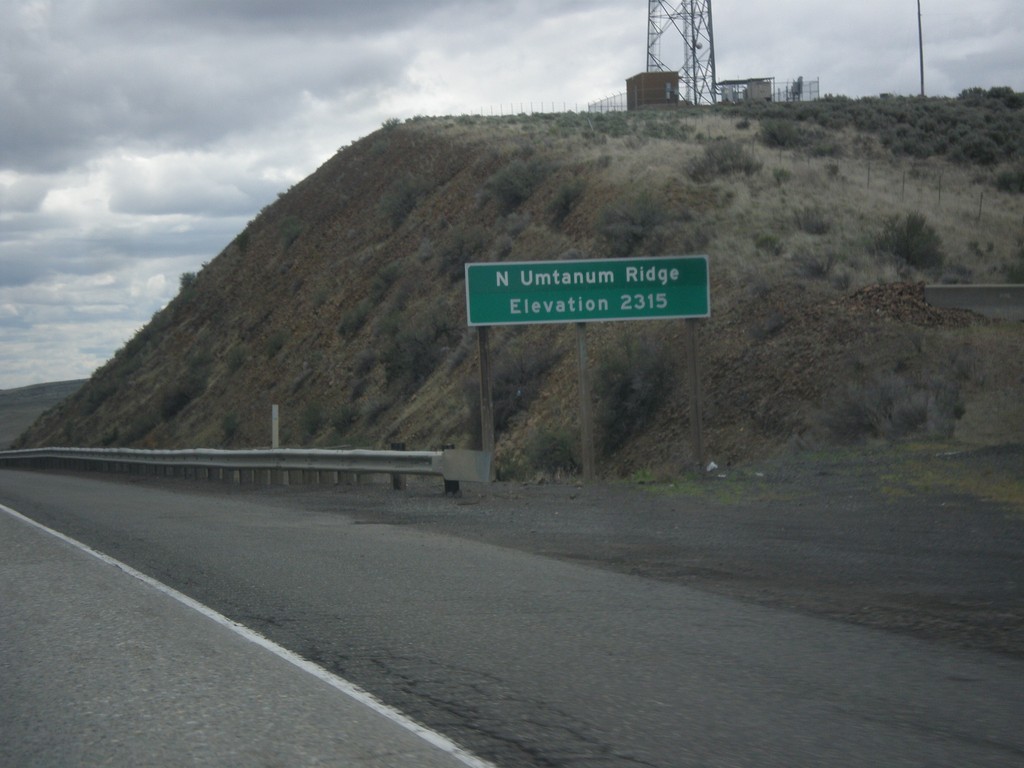
I-82 East - North Umtanum Ridge
I-82 East at North Umtanum Ridge - Elevation 2315 Feet.
Taken 04-30-2018
 Ellensburg
Kittitas County
Washington
United States
Ellensburg
Kittitas County
Washington
United States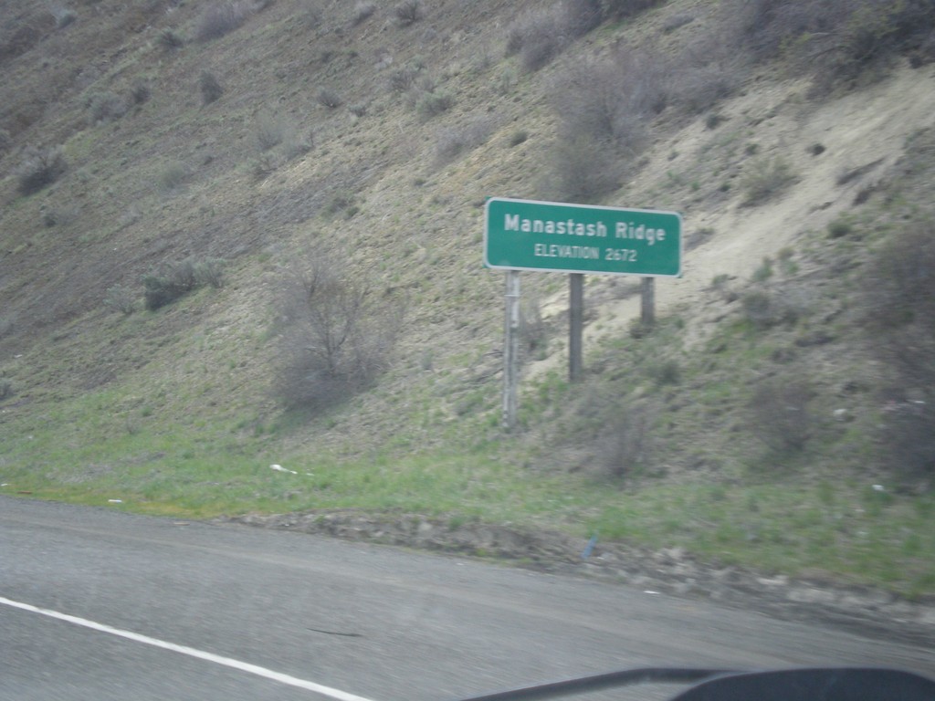
I-82 East - Manastash Ridge
I-82 East at Manastash Ridge - Elevation 2672 Feet.
Taken 04-30-2018
Ellensburg
Kittitas County
Washington
United States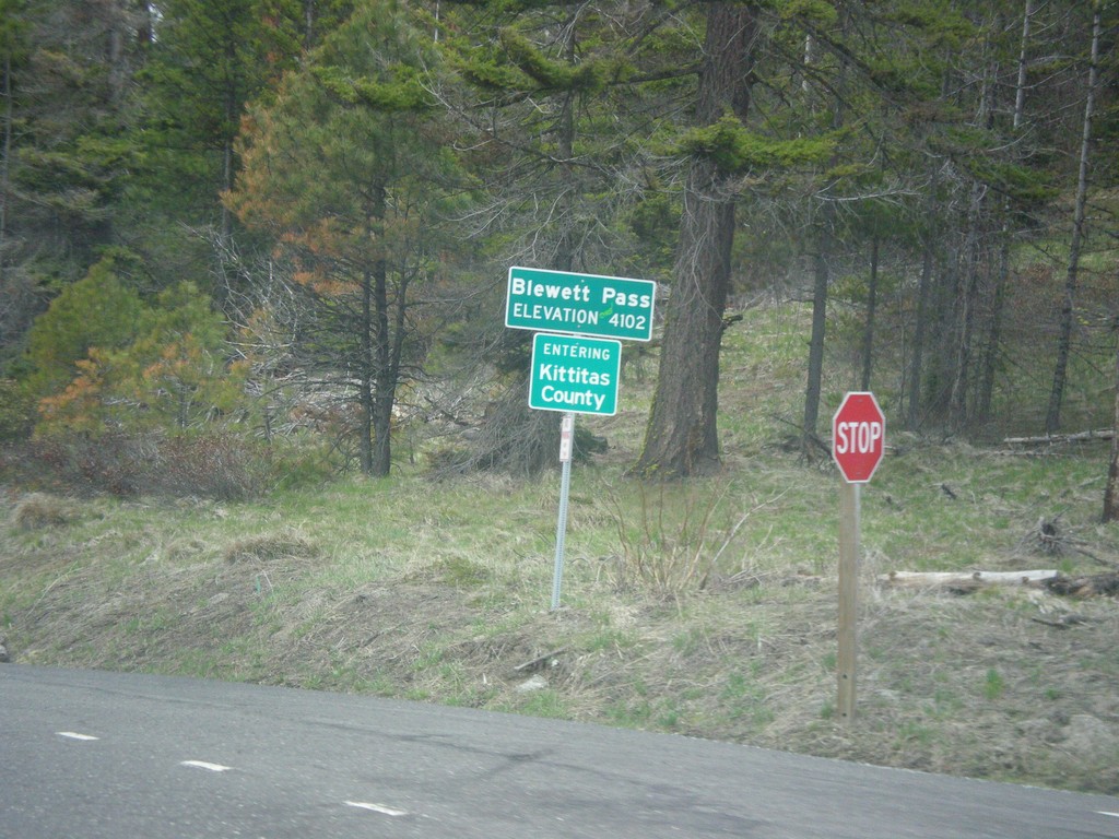
US-97 South - Blewett Pass
US-97 South at Blewett Pass - Elevation 4102 Feet. Entering Kittitas County. Blewett Pass is at the summit of the Wenatchee Mountains.
Taken 04-30-2018
Liberty
Kittitas County
Washington
United States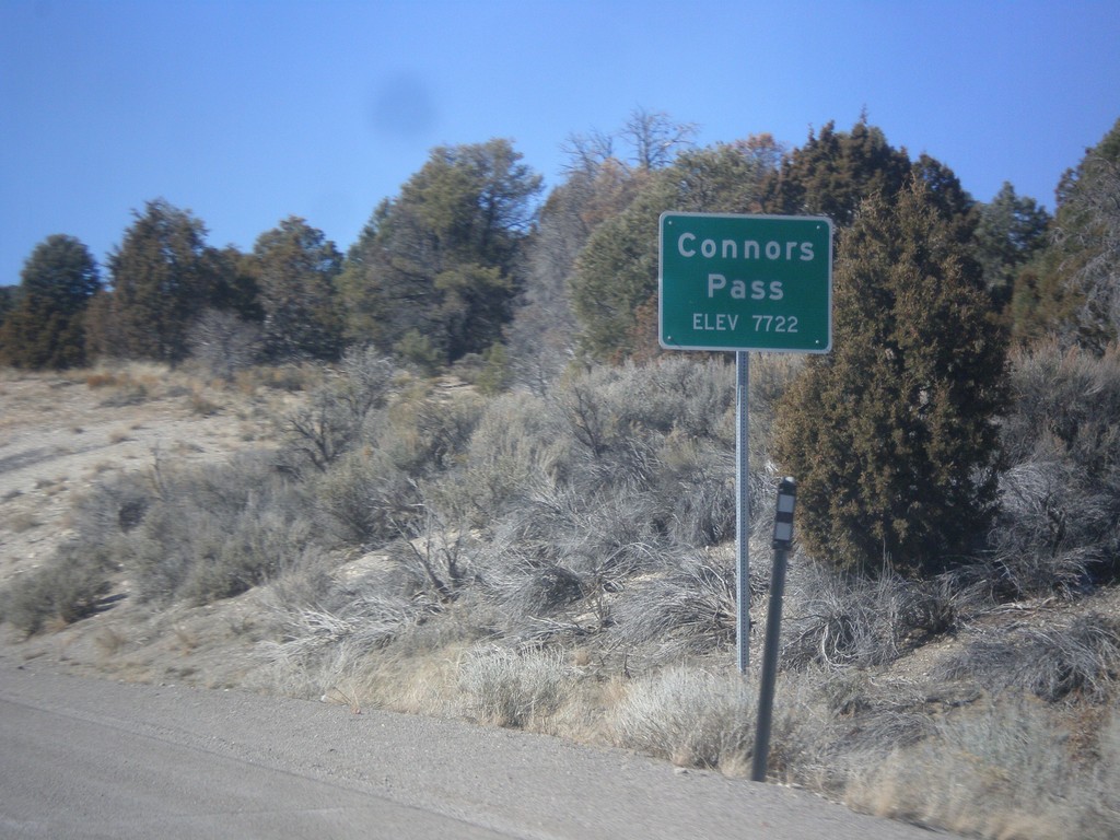
US-6/US-50 West/US-93 North - Connors Pass
US-6/US-50 West/US-93 North at Connors Pass - Elevation 7722 Feet. Connors Pass is a summit in the Schell Creek Range.
Taken 02-13-2018


 Ely
White Pine County
Nevada
United States
Ely
White Pine County
Nevada
United States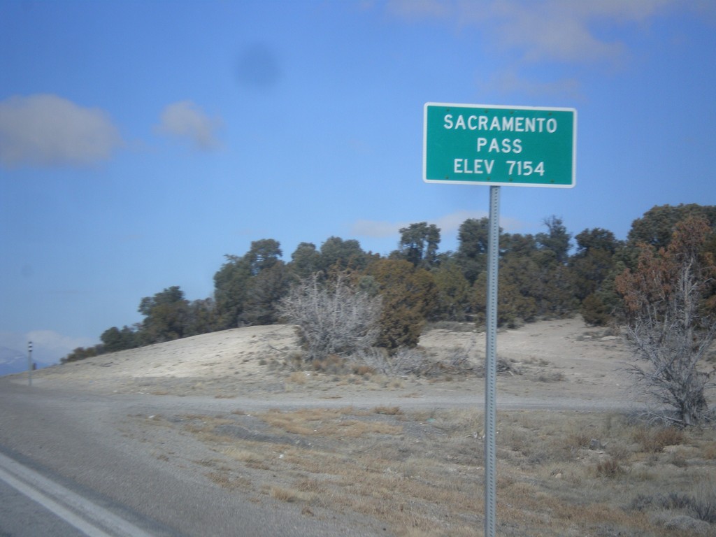
US-6/US-50 West - Sacramento Pass
Sacramento Pass on US-6/US-50 West - Elevation 7154 Feet. Sacramento Pass is a summit in the Snake Range.
Taken 02-13-2018
Osceola
White Pine County
Nevada
United States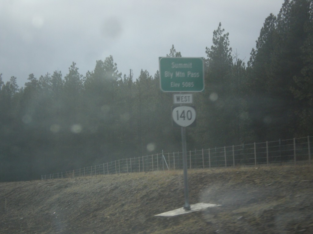
OR-140 West - Bly Mountain Pass
OR-140 west at Bly Mountain Pass. Elevation 5085 Feet.
Taken 11-19-2017
 Beatty
Klamath County
Oregon
United States
Beatty
Klamath County
Oregon
United States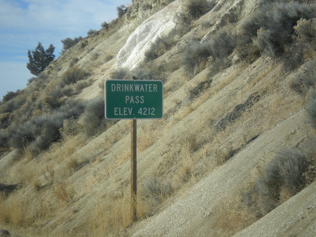
US-20 West - Drinkwater Pass
Drinkwater Pass - Elevation 4212 Feet on US-20 West.
Taken 11-19-2017
 Drewsey
Harney County
Oregon
United States
Drewsey
Harney County
Oregon
United States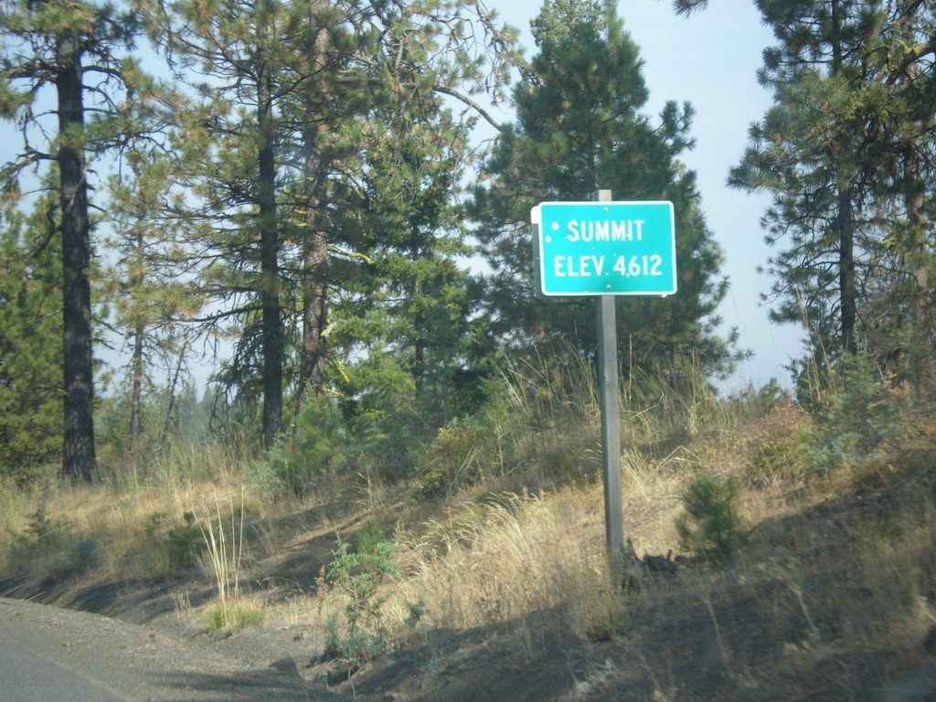
OR-207 North - Summit
Summit on OR-207 north - Elevation 4612 Feet.
Taken 09-09-2017
 Spray
Wheeler County
Oregon
United States
Spray
Wheeler County
Oregon
United States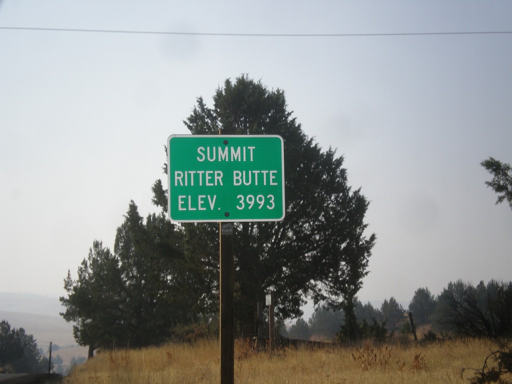
US-395 South - Ritter Butte Summit
US-395 South - Summit Ritter Butte - Elevation 3993 Feet.
Taken 09-09-2017
 Ritter
Grant County
Oregon
United States
Ritter
Grant County
Oregon
United States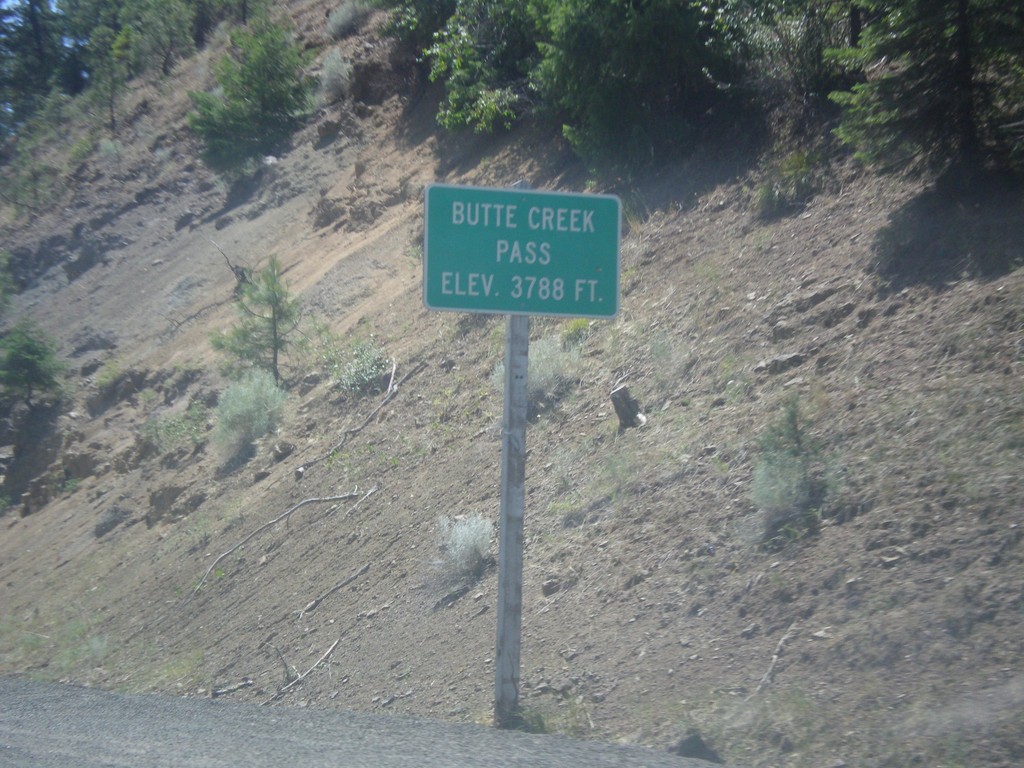
OR-19 South - Butte Creek Pass
OR-19 South - Butte Creek Pass - Elevation 3788 Feet.
Taken 07-15-2017
 Fossil
Wheeler County
Oregon
United States
Fossil
Wheeler County
Oregon
United States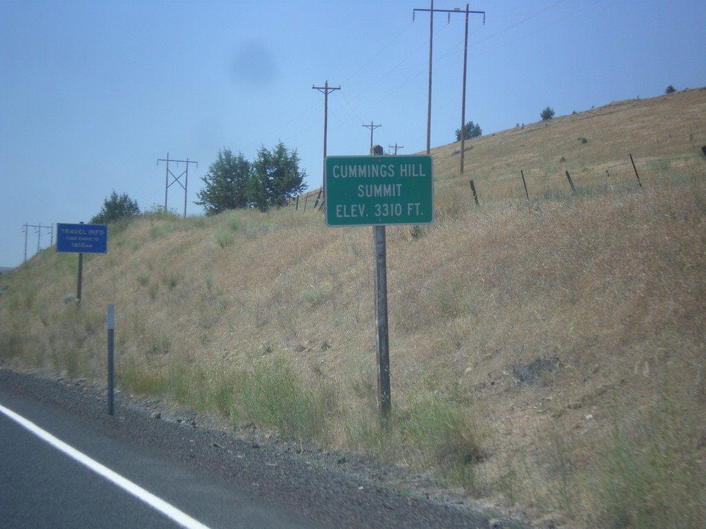
OR-19 South - Cummings Hill Summit
Cummings Hill Summit on OR-19 south - Elevation 3,310 Feet.
Taken 07-15-2017
Fossil
Wheeler County
Oregon
United States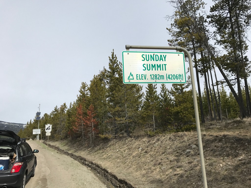
BC-3 East - Sunday Summit
Sunday Summit - Elevation 1282m on BC-3 east. Sunday Summit is a mountain pass in the Cascade Range.
Taken 04-29-2017
 Princeton
Okanagan-Similkameen
British Columbia
Canada
Princeton
Okanagan-Similkameen
British Columbia
Canada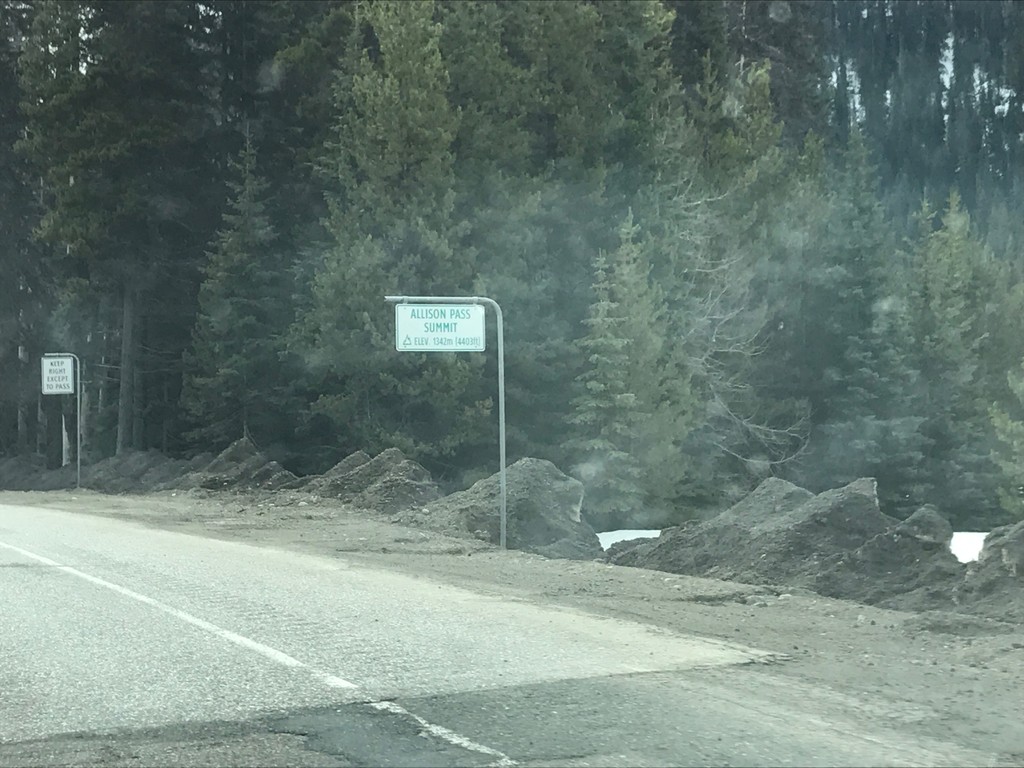
BC-3 East - Allison Pass
BC-3 east at Allison Pass Summit - Elevation 1,342m.
Taken 04-29-2017
Manning Park
Fraser Valley
British Columbia
Canada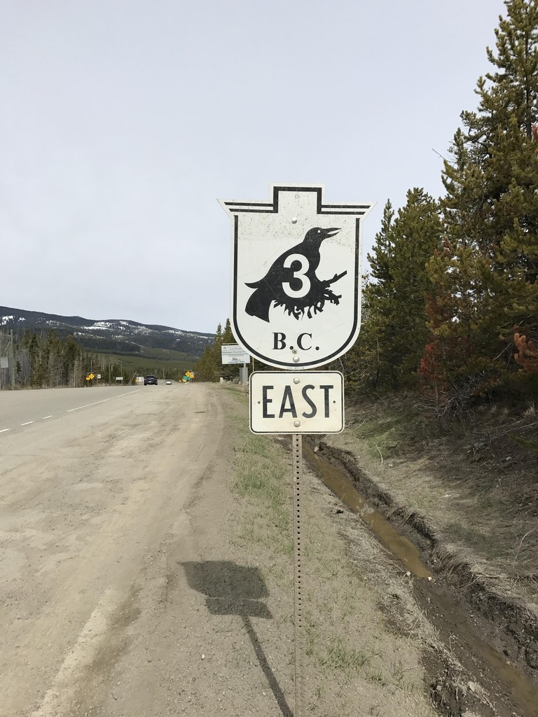
BC-3 East - Sunday Summit
BC-3 East shield at the top of Sunday Summit.
Taken 04-29-2017
Copper Mountain
Okanagan-Similkameen
British Columbia
Canada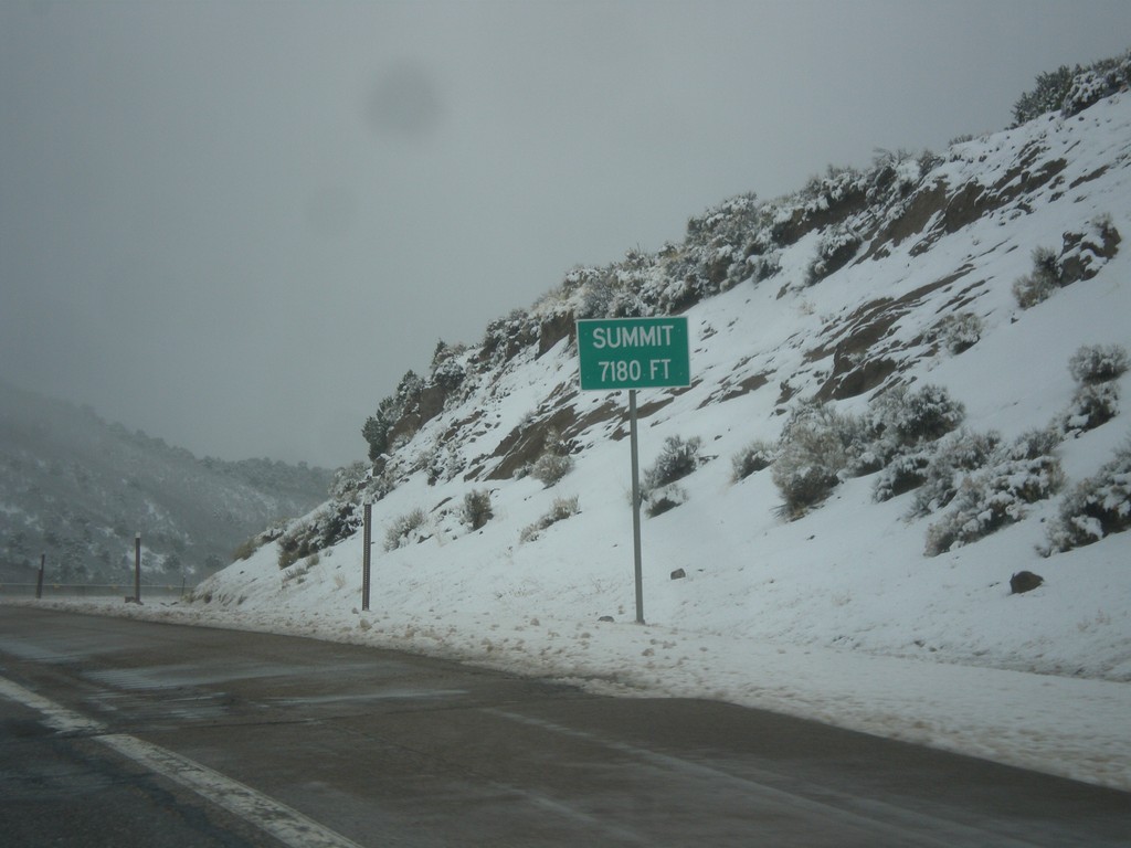
I-70 West - Summit
Summit Elevation 7180 Feet on I-70 west. This is the summit of the Pavant Range.
Taken 03-31-2017
 Sevier
 County
Utah
United States
Sevier
Sevier County
Utah
United States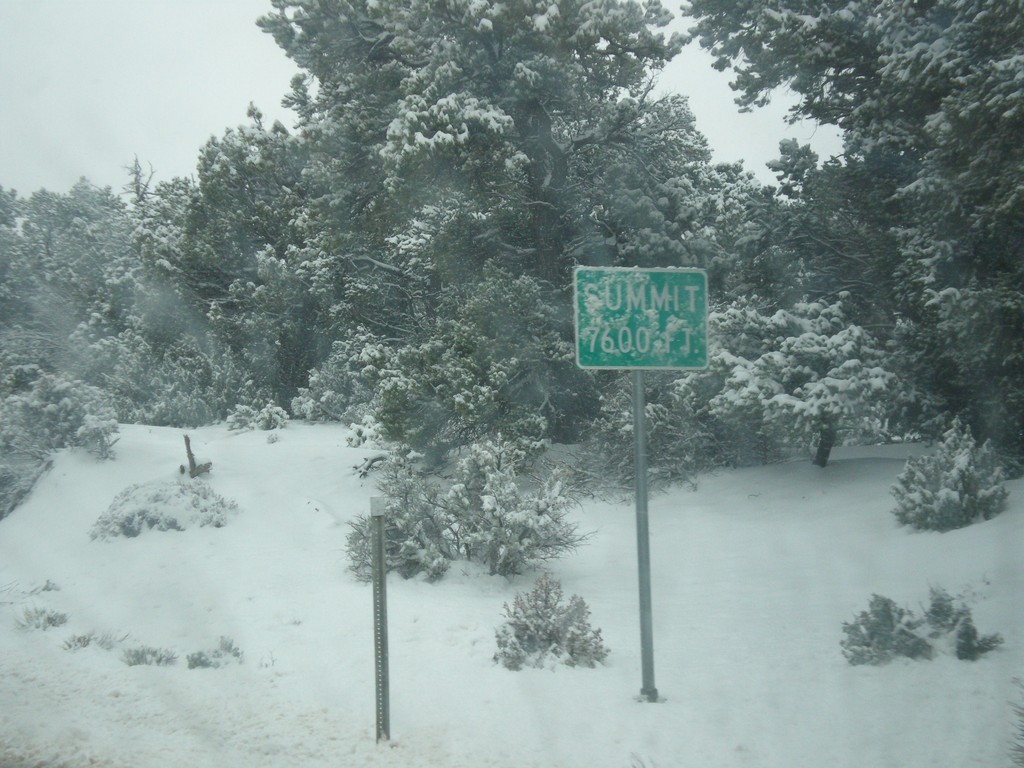
UT-12 West - Summit
Summit - Elevation 7600 Feet on UT-12 west in the Dixie National Forest.
Taken 03-31-2017
 Henrieville
Garfield County
Utah
United States
Henrieville
Garfield County
Utah
United States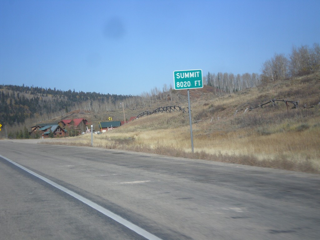
US-40 West - Daniels Summit
Daniels Summit - Elevation 8020 Feet on US-40 west.
Taken 10-09-2016
 Wallsburg
Wasatch County
Utah
United States
Wallsburg
Wasatch County
Utah
United States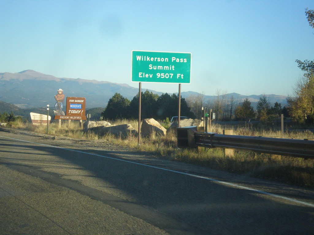
US-24 East - Wilkerson Pass
US-24 East at Wilkerson Pass Summit - Elevation 9507 Feet.
Taken 10-07-2016
 Lake George
Park County
Colorado
United States
Lake George
Park County
Colorado
United States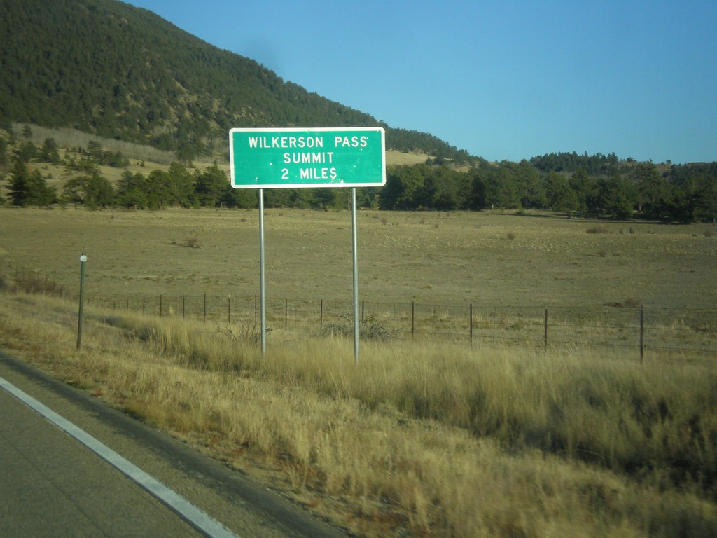
US-24 East - Wilkerson Pass 2 Miles
US-24 East begin climb of Wilkerson Pass. Wilkerson Pass Summit - 2 Miles.
Taken 10-07-2016
Hartsel
Park County
Colorado
United States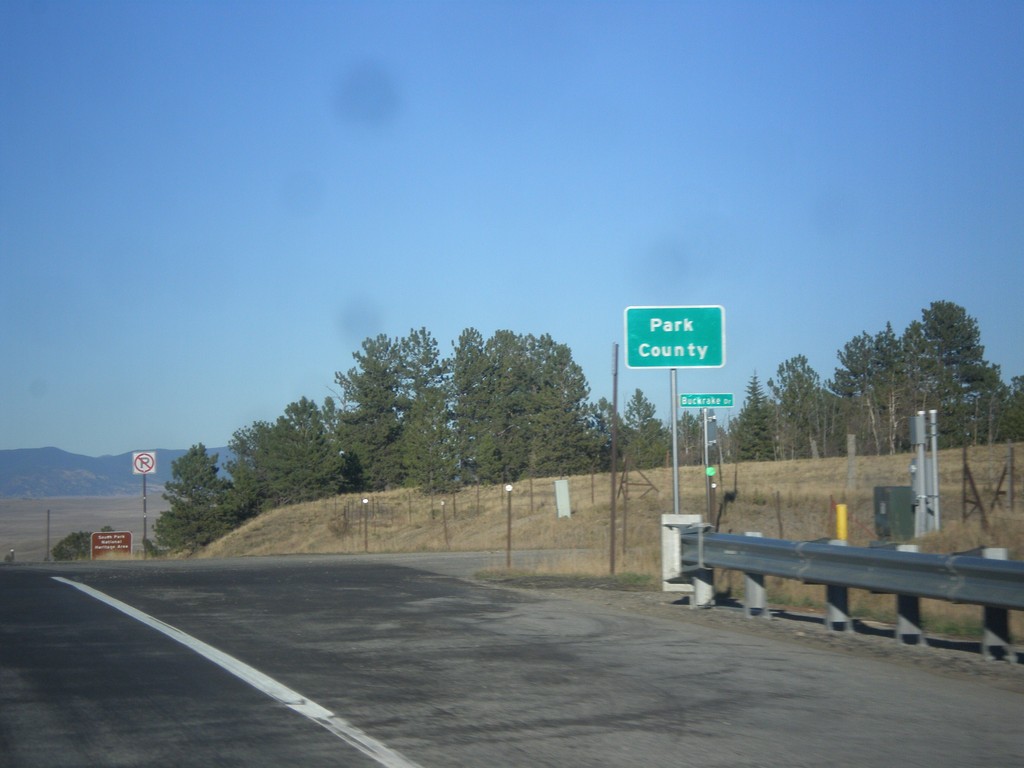
US-24 East/US-285 North - Park County
Entering Park County on US-24 East/US-285 North at Trout Creek Pass - 9,487 Feet.
Taken 10-07-2016
 Hartsel
Park County
Colorado
United States
Hartsel
Park County
Colorado
United States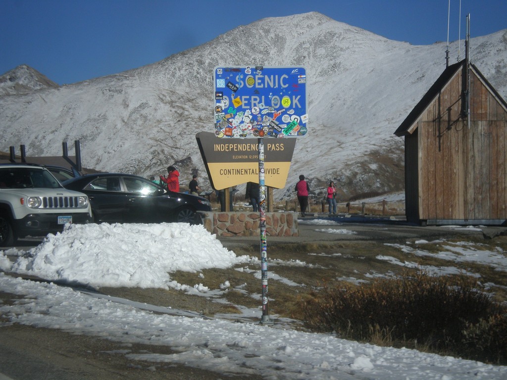
CO-82 East - Independence Pass
Independence Pass on CO-82 east. Independence Pass is 12,095 Feet and on the Continental Divide. Independence Pass is one of the highest mountain passes in Colorado on the state highway system. The only higher pass on the state highway system is US-34 in Rocky Mountain National Park. Independence Pass divides the Arkansas River watershed which flows into the Gulf of Mexico; and the Roaring Fork River which flows into the Colorado River and the Gulf of California.
Taken 10-07-2016
 Pitkin County
Colorado
United States
Pitkin County
Colorado
United States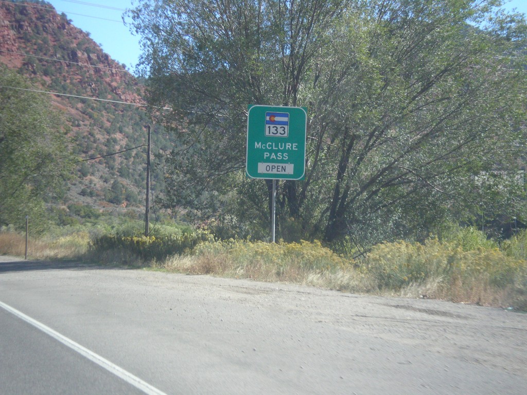
CO-82 East - McClure Pass Status
CO-82 East - CO-133/McClure Pass Status. McClure Pass is located on CO-133 between Redstone and Paonia.
Taken 10-07-2016
 Glenwood Springs
Garfield County
Colorado
United States
Glenwood Springs
Garfield County
Colorado
United States