Signs Tagged With Summit
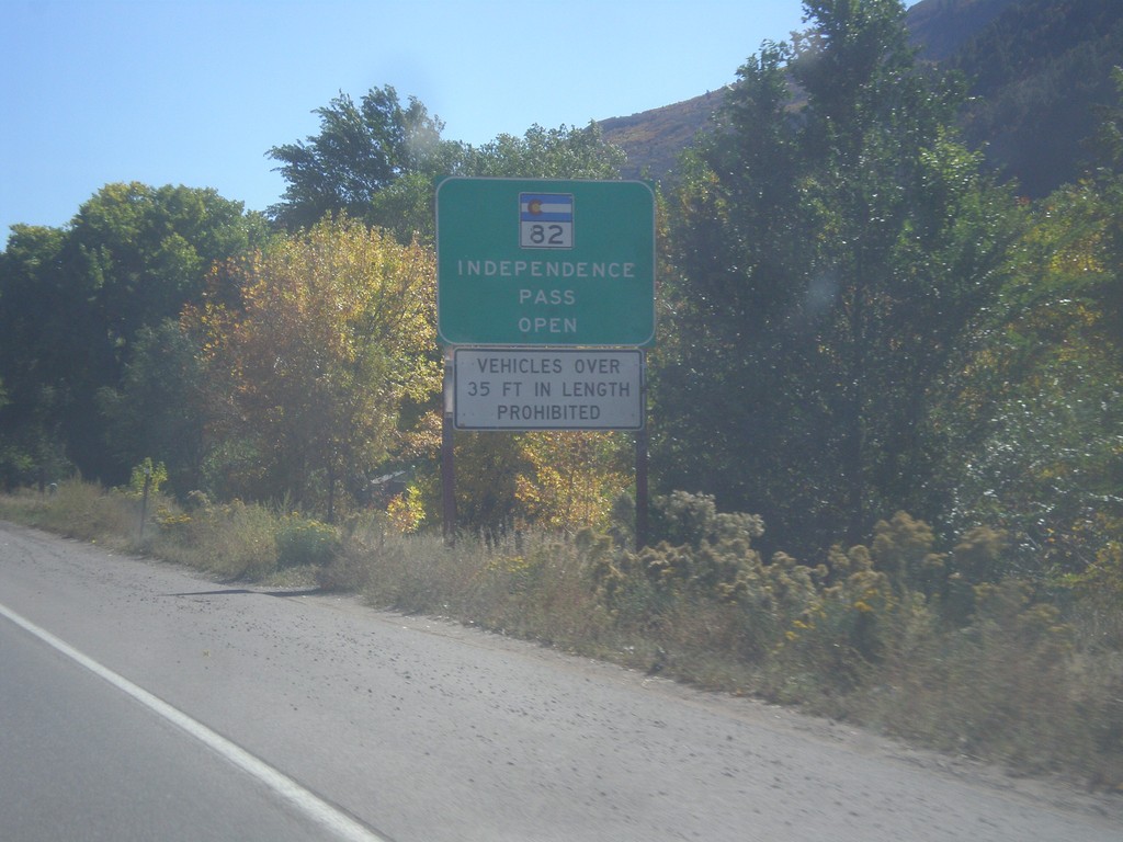
CO-82 East - Independence Pass Status
Independence Pass Status on CO-82 east leaving Glenwood Springs. Typically Independence Pass, just east of Aspen closes between November and May. Independence Pass is one of the highest highway passes in Colorado.
Taken 10-07-2016
 Glenwood Springs
Garfield County
Colorado
United States
Glenwood Springs
Garfield County
Colorado
United States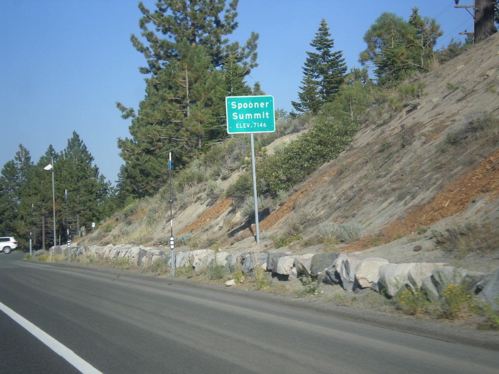
US-50 East - Spooner Summit
Spooner Summit on US-50 east - Elevation 7146 Feet. Spooner Summit is a pass through the Carson Range.
Taken 08-15-2016
 Carson City
Douglas County
Nevada
United States
Carson City
Douglas County
Nevada
United States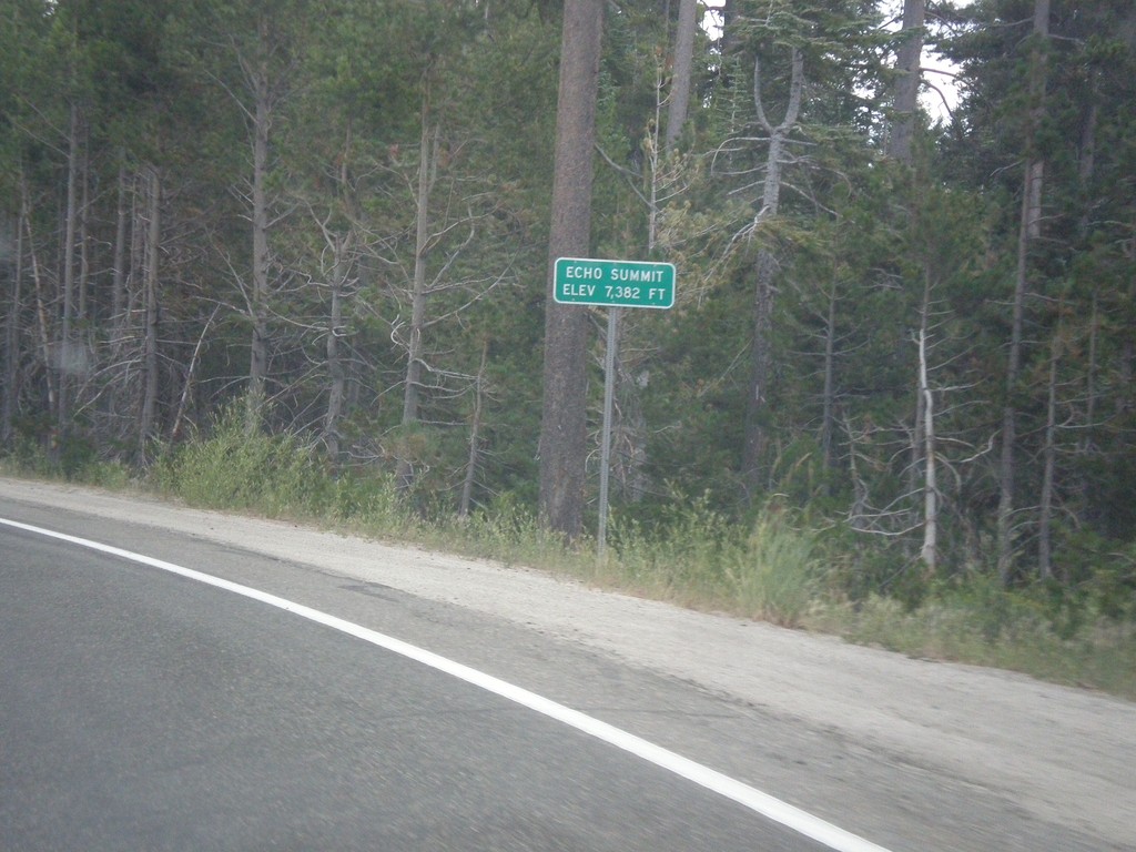
US-50 East - Echo Summit
US-50 each at Echo Summit -Elevation 7382 Feet. This is the summit of the Sierra Nevada on US-50 and the divide between the American River drainage and Lake Tahoe, which drains to the Truckee River.
Taken 08-15-2016
Nebelhorn
El Dorado County
California
United States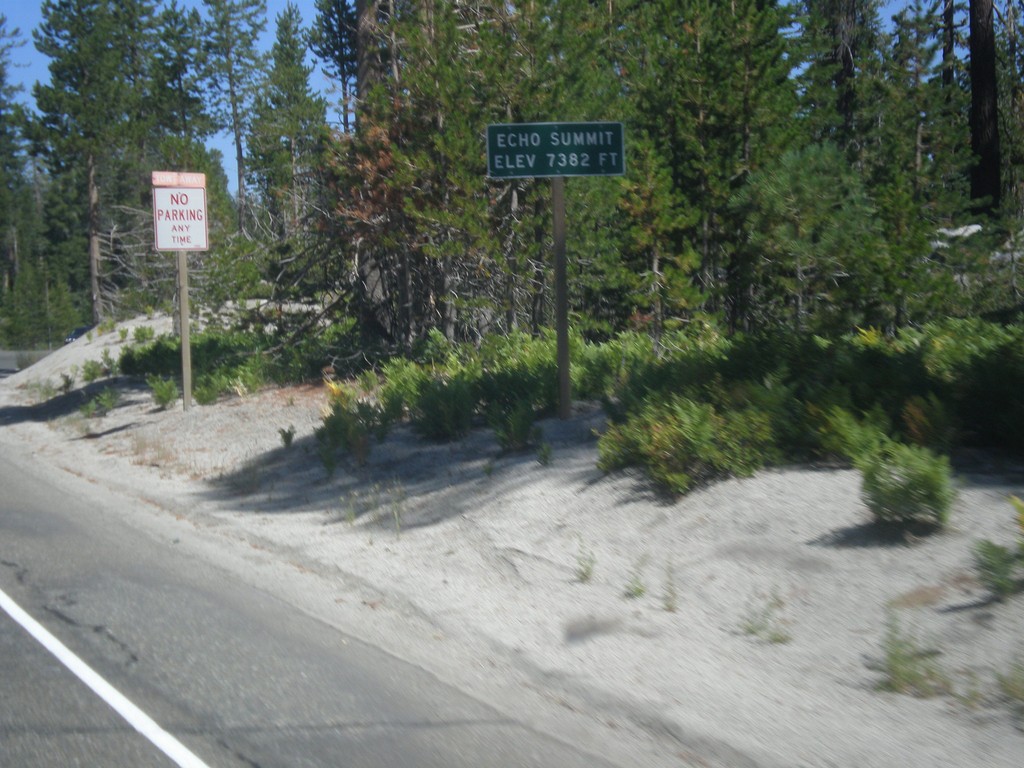
US-50 West - Echo Summit
US-50 west at Echo Summit -Elevation 7382 Feet. This is the summit of the Sierra Nevada on US-50 and the divide between the American River drainage and Lake Tahoe, which drains to the Truckee River.
Taken 08-12-2016
Nebelhorn
El Dorado County
California
United States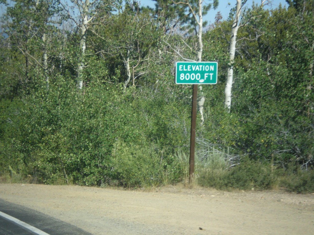
CA-89 North - Elevation 8000 Feet
Elevation 8000 Feet on CA-89 north. Taken on north descent from Monitor Pass.
Taken 08-12-2016
 Markleeville
Alpine County
California
United States
Markleeville
Alpine County
California
United States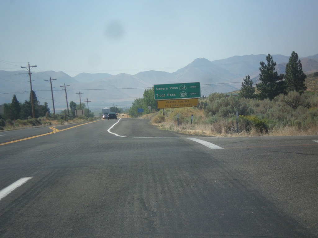
US-395 South - Sierra Pass Information
Sierra pass closure information on US-395 south. Information for Sonora Pass (CA-108) and Tioga Pass (CA-120). At the time this photo was taken both passes were open.
Taken 08-12-2016


 Coleville
Mono County
California
United States
Coleville
Mono County
California
United States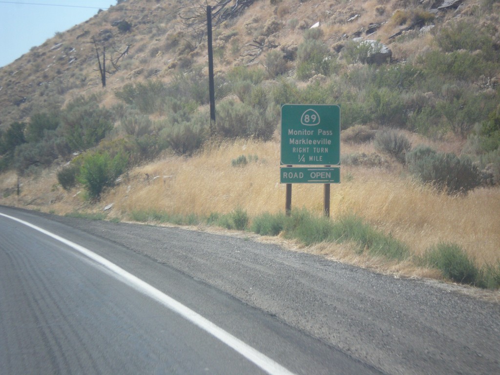
US-395 South at CA-89
US-395 south at CA-89 North to Markleeville and Monitor Pass. Monitor Pass was open when this was taken. This is the southern end of CA-89.
Taken 08-12-2016
Coleville
Mono County
California
United States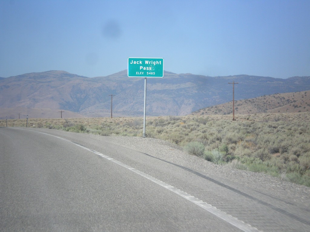
NV-208 West - Jack Wright Pass
Jack Wright Pass - Elevation 5484 Feet.
Taken 08-12-2016
 Smith Valley
Lyon County
Nevada
United States
Smith Valley
Lyon County
Nevada
United States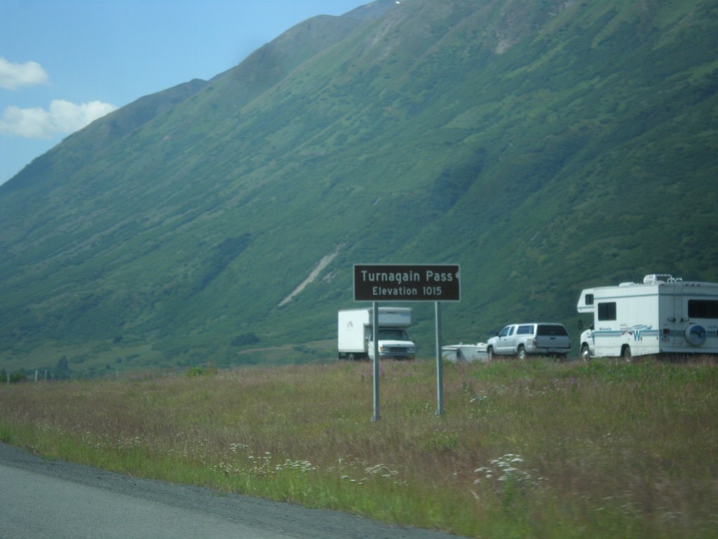
AK-1 South - Turnagain Pass
AK-1 south (Seward Highway) at Turnagain Pass - Elevation 1015 Feet. Turnagain Pass is the highest point on the Seward Highway.
Taken 07-16-2016
 Moose Pass
Kenai Peninsula Borough
Alaska
United States
Moose Pass
Kenai Peninsula Borough
Alaska
United States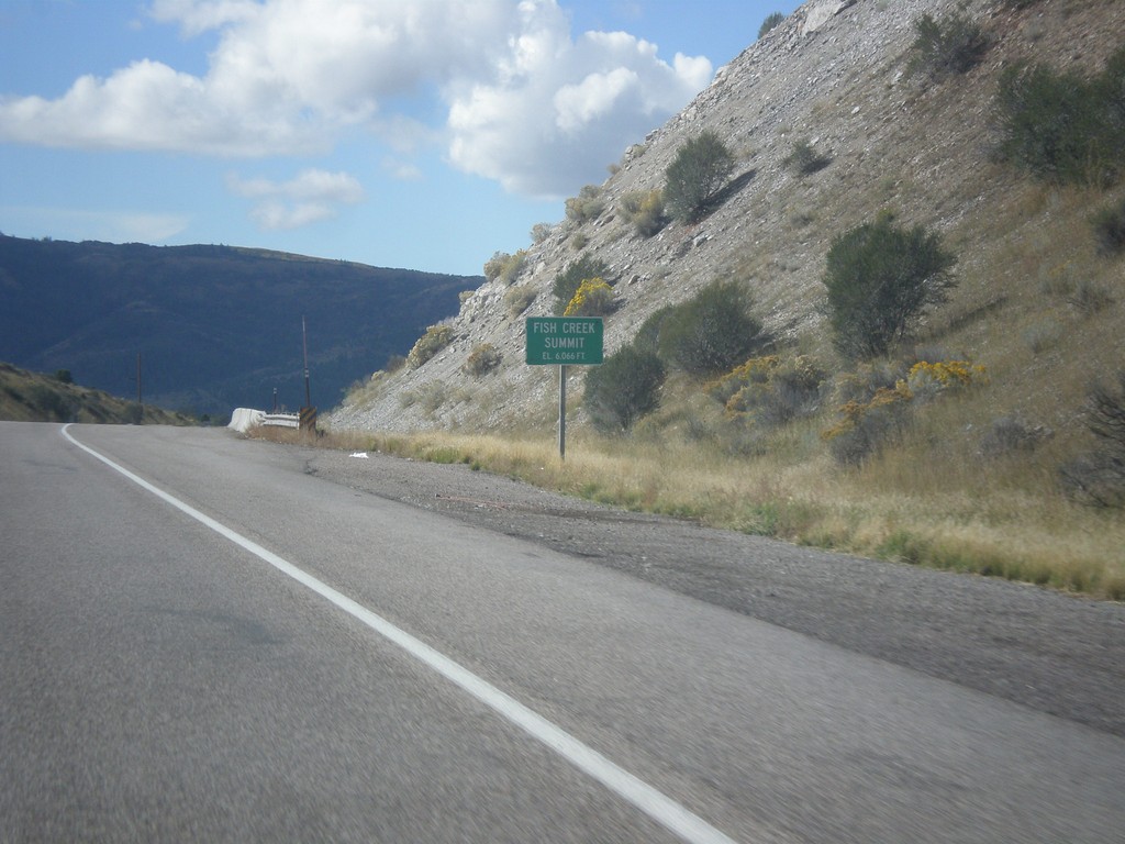
US-30 West - Fish Creek Summit
US-30 west at Fish Creek Summit.
Taken 10-04-2015
 Bancroft
Caribou County
Idaho
United States
Bancroft
Caribou County
Idaho
United States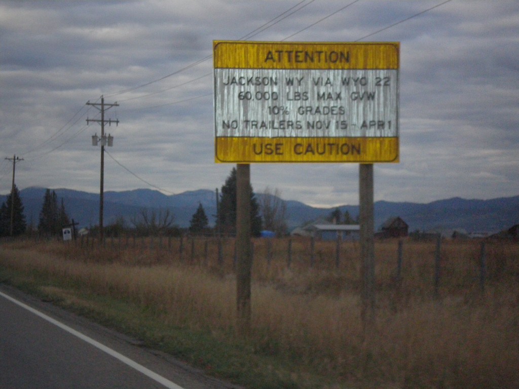
ID-33 East - Teton Pass Restrictions
Sign listing restrictions on Teton Pass in Wyoming. 60,000 lbs GVW over Teton Pass; no trailers 11-15 to 4-1. 10% grades over Teton Pass.
Taken 10-04-2015
 Tetonia
Teton County
Idaho
United States
Tetonia
Teton County
Idaho
United States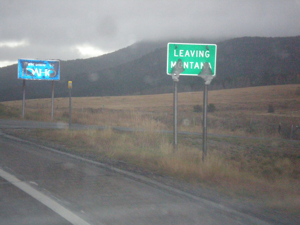
MT-87 South - Raynolds Pass
MT-87 at Raynolds Pass - Leaving Montana. The Idaho welcome sign is in the background. An early season snow storm had just passed through the area, leaving wet snow on all of the signs.
Taken 10-03-2015
 Madison County
Montana
United States
Madison County
Montana
United States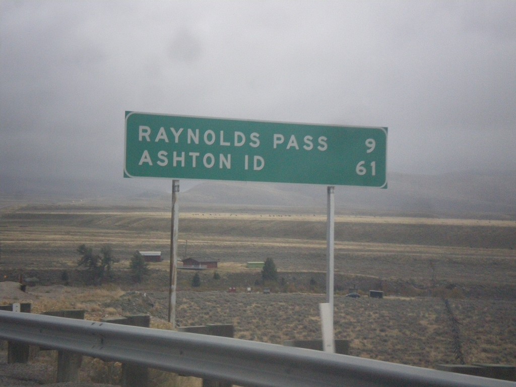
MT-87 South - Distance Marker
Distance marker on MT-87 south. Distance to Raynolds Pass (State Line - Continental Divide) and Ashton, ID.
Taken 10-03-2015
Schusters Place
Madison County
Montana
United States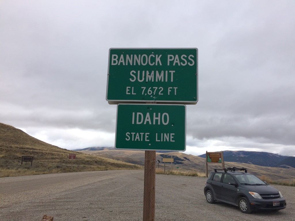
ID-29 West - Bannock Pass - Idaho State Line
Idaho State Line on ID-29 west at Bannock Pass - Elevation 7672 Feet. Bannock Pass is on the Continental Divide located on the Idaho-Montana border.
Taken 10-03-2015
 Leadore
Lemhi County
Idaho
United States
Leadore
Lemhi County
Idaho
United States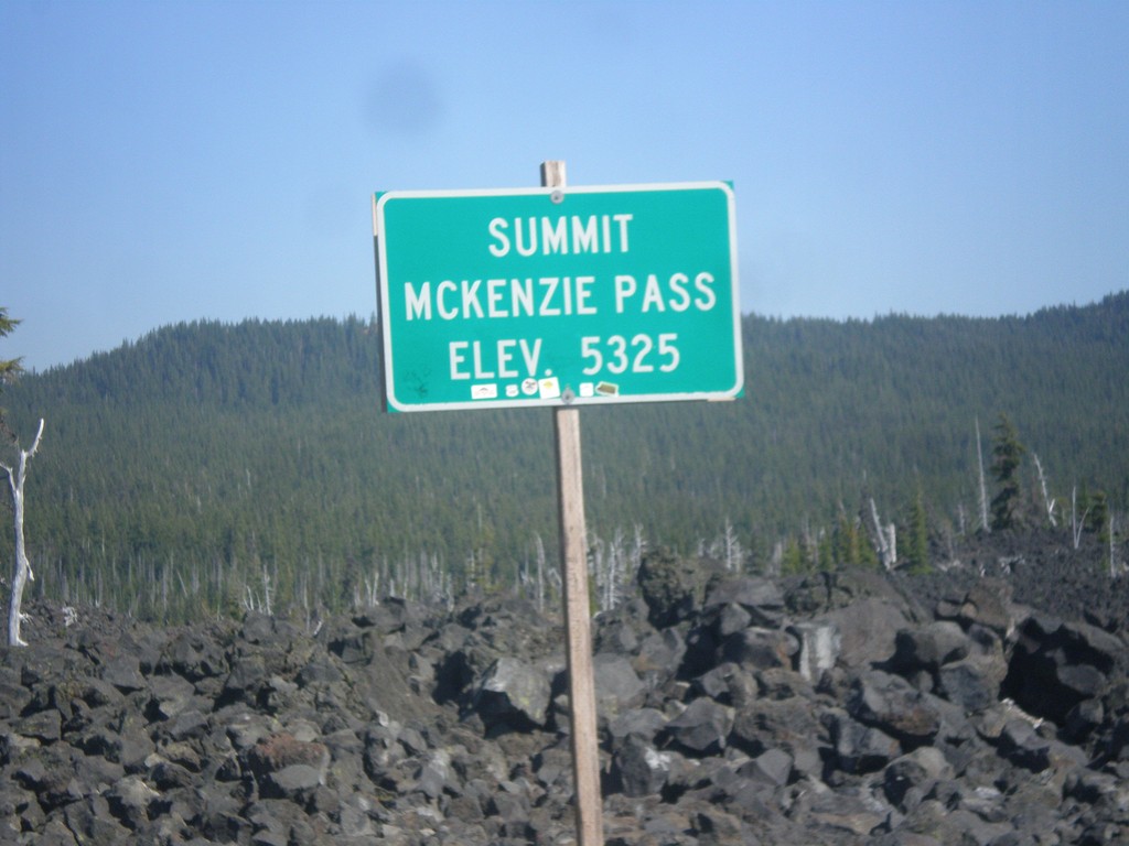
OR-242 East - McKenzie Pass
OR-242 East - McKenzie Pass - Elevation 5325 Feet. McKenzie Pass is closed during the winter months, and is also closed year round to long vehicles. The top of the pass is a lava field, with great views of the area volcanos.
Taken 08-22-2015
 Linn County
Oregon
United States
Linn County
Oregon
United States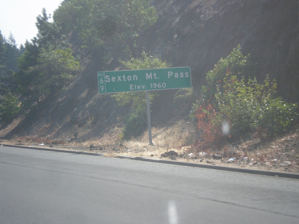
I-5 South - Sexton Mountain Summit
I-5 south at Sexton Mountain Summit - Elevation 1960 Feet. This summit is one a series of passes I-5 crosses between Canyonville and Grants Pass in the Klamath Mountains. The milepost is also attached to the main sign.
Taken 08-17-2015
 Wolf Creek
Josephine County
Oregon
United States
Wolf Creek
Josephine County
Oregon
United States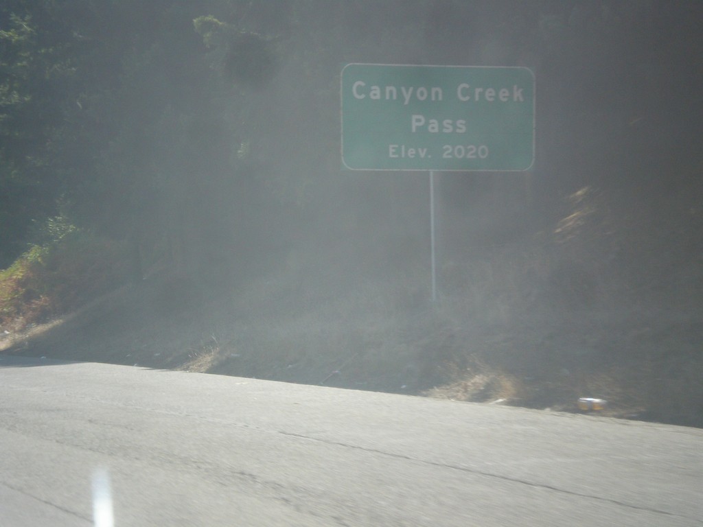
I-5 South - Canyon Creek Summit
I-5 south at Canyon Creek Summit - Elevation 2020 Feet. Canyon Creek Summit is the highest of the series of passes in the Klamath Mountains between Canyonville and Grants Pass along I-5.
Taken 08-17-2015
Glendale
Douglas County
Oregon
United States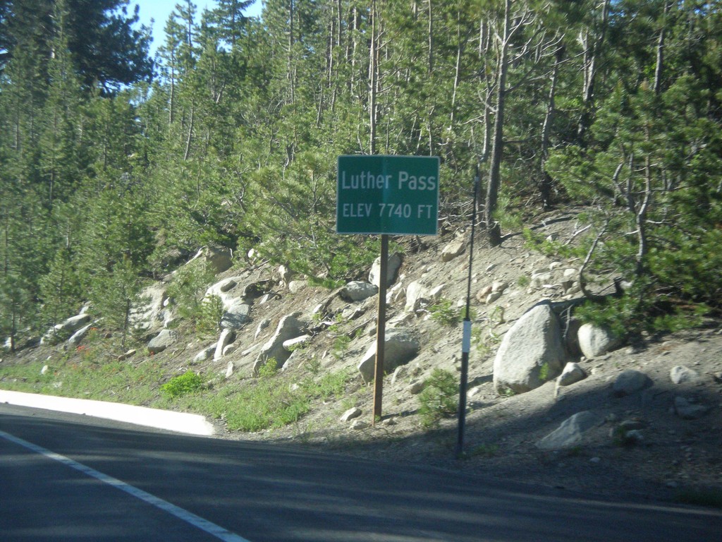
CA-89 South - Luther Pass
Luther Pass - Elevation 7740 Feet. Luther Pass is on the divide between the Lake Tahoe Basin (to the north) and the Carson River.
Taken 06-15-2015
Mesa Vista
Alpine County
California
United States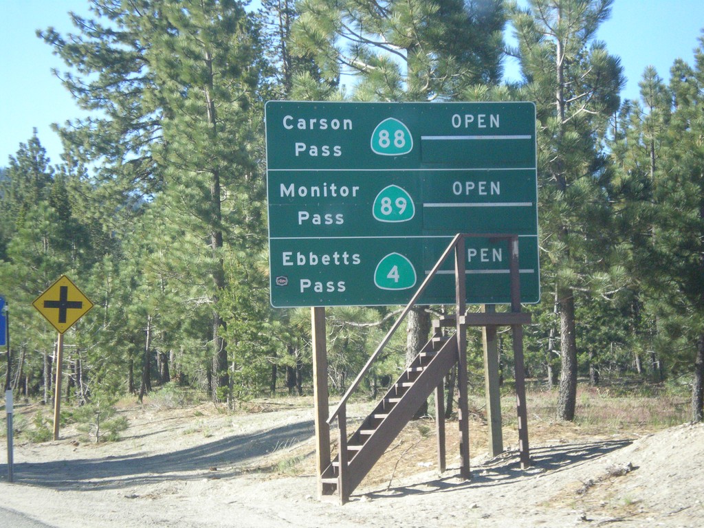
CA-89 South - Summit Information
Summit closure information on CA-89 south. Information for Ebbetts Pass (via CA-4), Monitor Pass (via CA-89) and Carson Pass (via CA-88). This photograph was taken in mid-June, and all of the passes are open. Carson Pass on CA-88 is the only pass that is typically opened year round.
Taken 06-15-2015

 South Lake Tahoe
El Dorado County
California
United States
South Lake Tahoe
El Dorado County
California
United States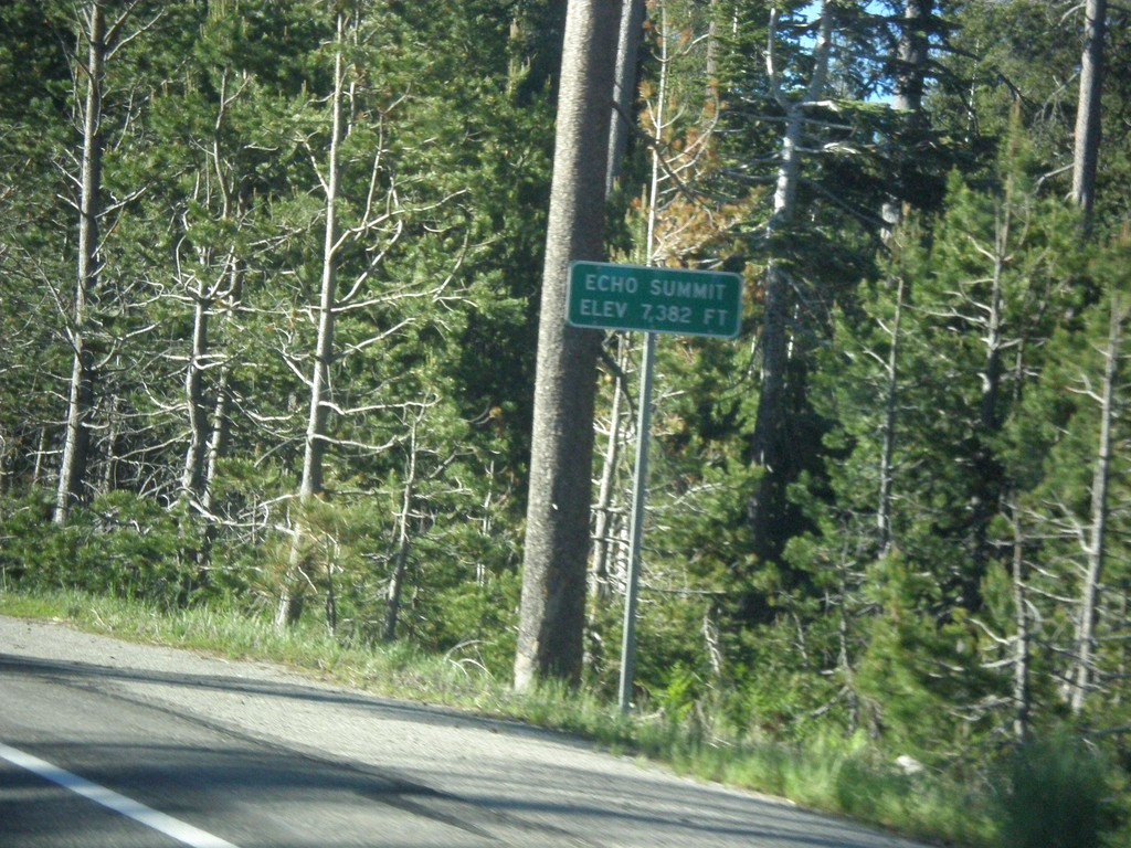
US-50 East - Echo Summit
US-50 each at Echo Summit -Elevation 7382 Feet. This is the summit of the Sierra Nevada on US-50 and the divide between the American River drainage and Lake Tahoe, which drains to the Truckee River.
Taken 06-15-2015
Nebelhorn
El Dorado County
California
United States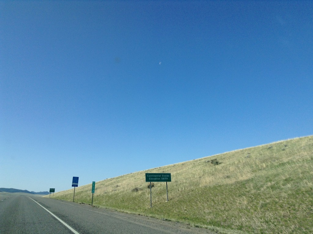
I-15 South - Deer Lodge Pass
I-15 south at Deer Lodge Pass - Elevation 5902 Feet. This is the Continental Divide. Southbound traffic enters the Missouri River drainage (via the Big Hole River, and Jefferson River). Northbound traffic enters the Columbia River drainage (via the Clark Fork, and Pend Oreille River). I-15 crosses the Continental Divide three times in Montana. Once at Monida Pass at the Idaho-Montana state line. Here at Deer Lodge Pass, and north of Butte and Elk Park Pass.
Taken 05-10-2015
 Butte
Silver Bow County
Montana
United States
Butte
Silver Bow County
Montana
United States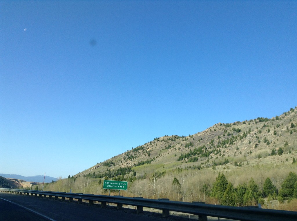
I-15 South - Elk Park Pass
I-15 south at Elk Park Pass (Continental Divide). Elevation 6368 Feet. This is also the county boundary between Silver Bow and Jefferson County.
Taken 05-10-2015
Woodville
Jefferson County
Montana
United States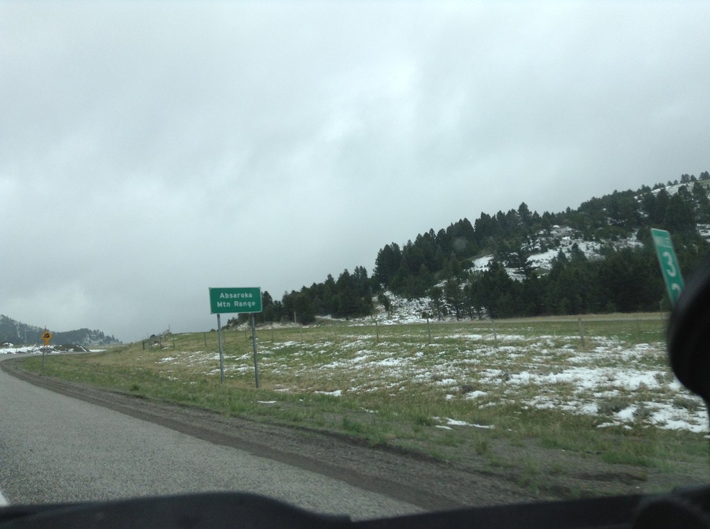
I-90 East - Bozeman Pass
I-90 east at Bozeman Pass. Bozeman Pass is part of the Absaroka Mountain Range. These type of signs are common across Montana, giving name to the many mountain ranges in the state.
Taken 05-08-2015

 Muir
Park County
Montana
United States
Muir
Park County
Montana
United States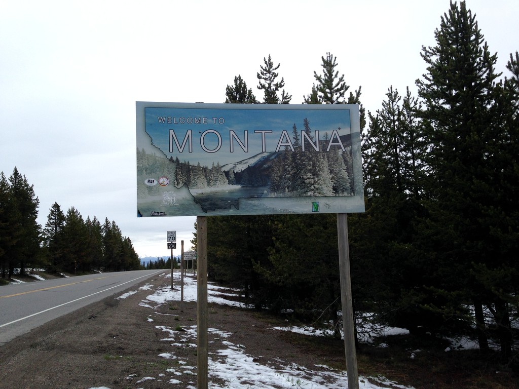
US-20 East - Welcome To Montana
Welcome to Montana on US-20 East at Targhee Pass. Targhee Pass is on the Continental Divide. This style of Montana welcome sign is fairly recent. Previous welcome signs were blue, and were cut-out in the state outline.
Taken 05-08-2015
 West Yellowstone
Gallatin County
Montana
United States
West Yellowstone
Gallatin County
Montana
United States
US-20 East - Welcome To Montana
Welcome to Montana on US-20 East at Targhee Pass. Targhee Pass is on the Continental Divide. West of here water flows into the Henrys Fork, the Snake River, and the Columbia River into the Pacific Ocean. East of here water flows into the Madison River, the Missouri River, the Mississippi River into the Gulf of Mexico.
Taken 05-08-2015
West Yellowstone
Gallatin County
Montana
United States