Signs Tagged With Summit
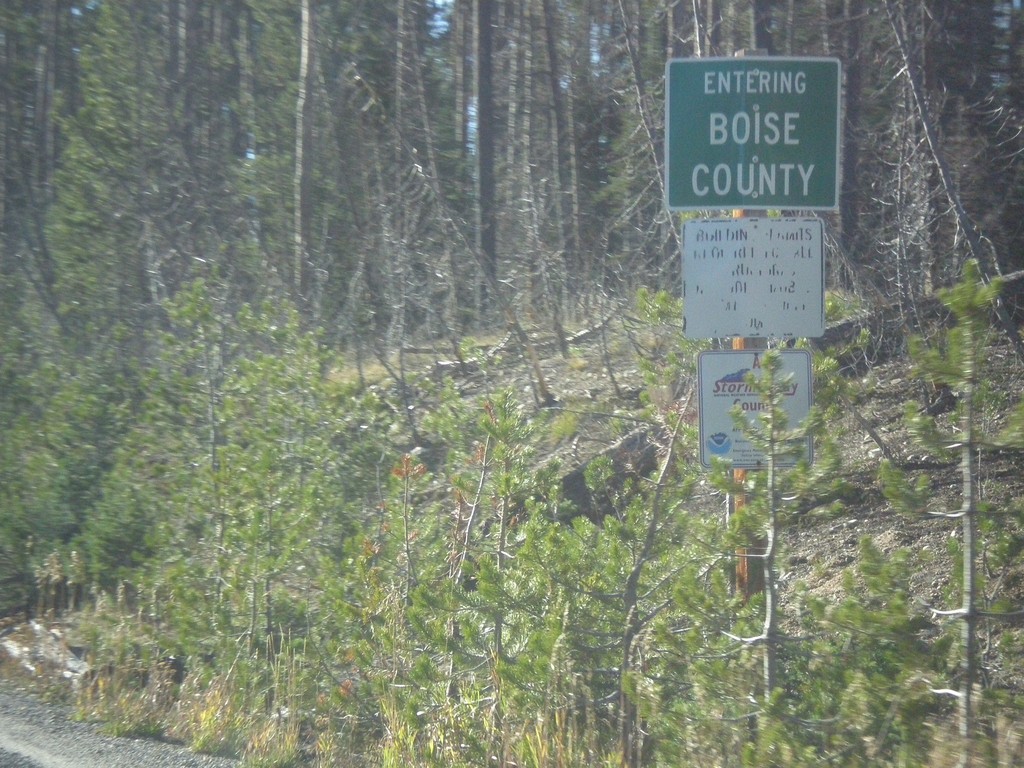
ID-21 - Entering Boise County
Entering Boise County along ID-21 south. The Boise-Custer County Line is located on Banner Summit - Elevation 7037 Feet.
Taken 10-05-2014
 Lowman
Boise County
Idaho
United States
Lowman
Boise County
Idaho
United States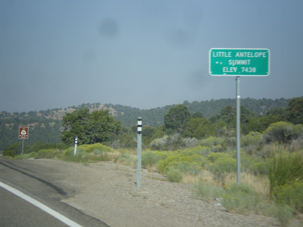
US-50 West - Little Antelope Summit
US-50 west at Little Antelope Summit - Elevation 7,438 Feet. Little Antelope Summit is in the Pine Range.
Taken 08-31-2014
 White Pine County
Nevada
United States
White Pine County
Nevada
United States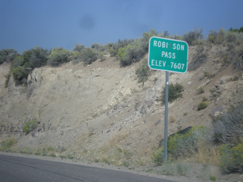
US-50 West - Robinson Summit
US-50 west at Robinson Pass - Elevation 7,607 Feet. Robinson Pass is in the Egan Range.
Taken 08-31-2014
Ely
White Pine County
Nevada
United States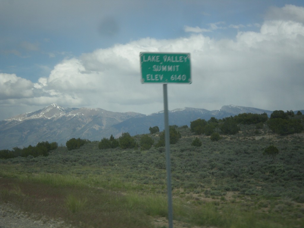
US-93 North - Lake Valley Summit
Lake Valley Summit - Elevation 6,140 Feet on US-93 north. Wheeler Peak is the mountain in the background. Wheeler Peak is the second highest mountain in Nevada and is located in Great Basin National Park.
Taken 05-21-2014
 Ely
White Pine County
Nevada
United States
Ely
White Pine County
Nevada
United States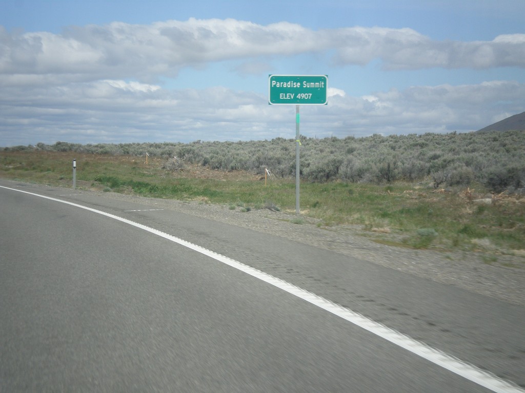
US-95 North - Paradise Summit
Paradise Summit - Elevation 4907 Feet on US-95 North.
Taken 05-06-2014
 Winnemucca
Humboldt County
Nevada
United States
Winnemucca
Humboldt County
Nevada
United States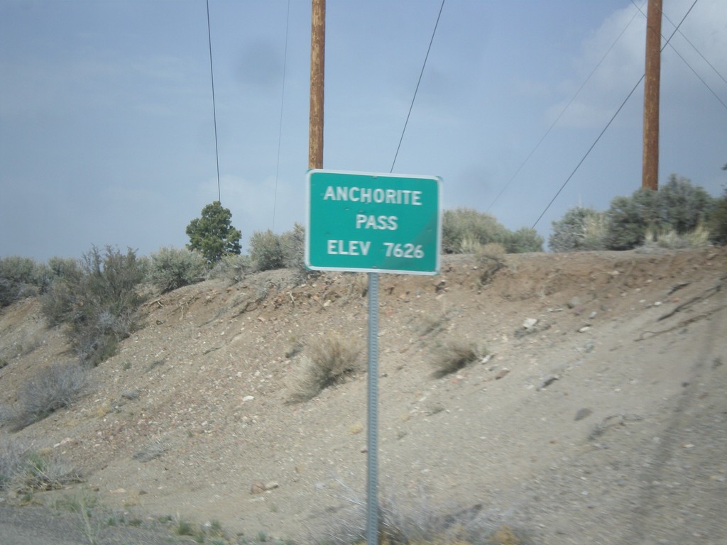
NV-359 North - Anchorite Pass
Anchorite Pass - Elevation 7,626 Feet on NV-359 North.
Taken 05-05-2014
 Mina
Mineral County
Nevada
United States
Mina
Mineral County
Nevada
United States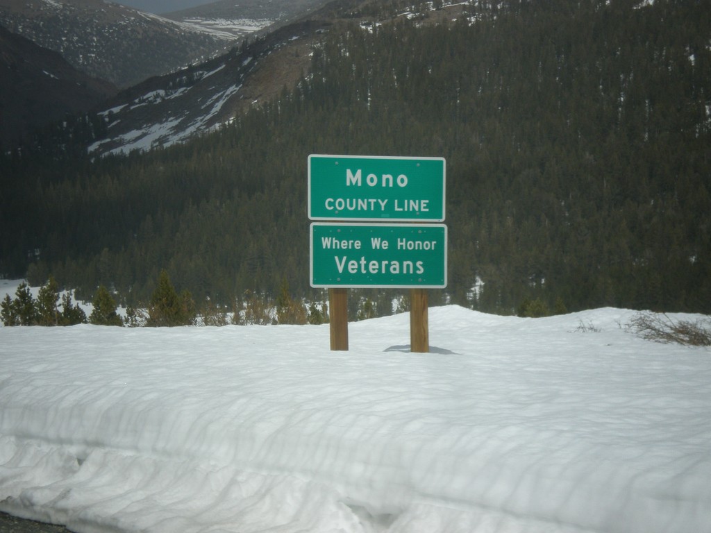
CA-120 East - Mono County Line
Mono County Line on CA-120 east at Tioga Pass.
Taken 05-05-2014
 Lee Vining
Mono County
California
United States
Lee Vining
Mono County
California
United States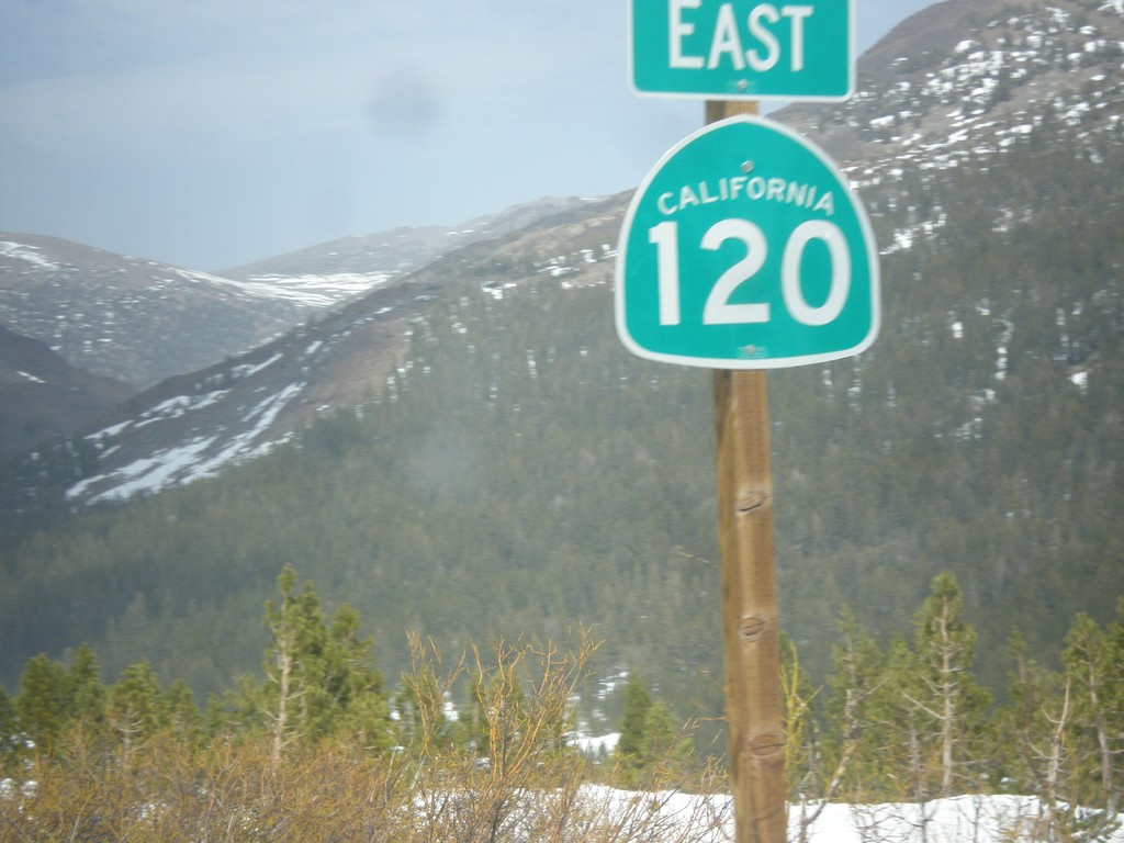
CA-120 East - Tioga Pass
First CA-120 shield after leaving Yosemite National Park at Tioga Pass.
Taken 05-05-2014
Lee Vining
Mono County
California
United States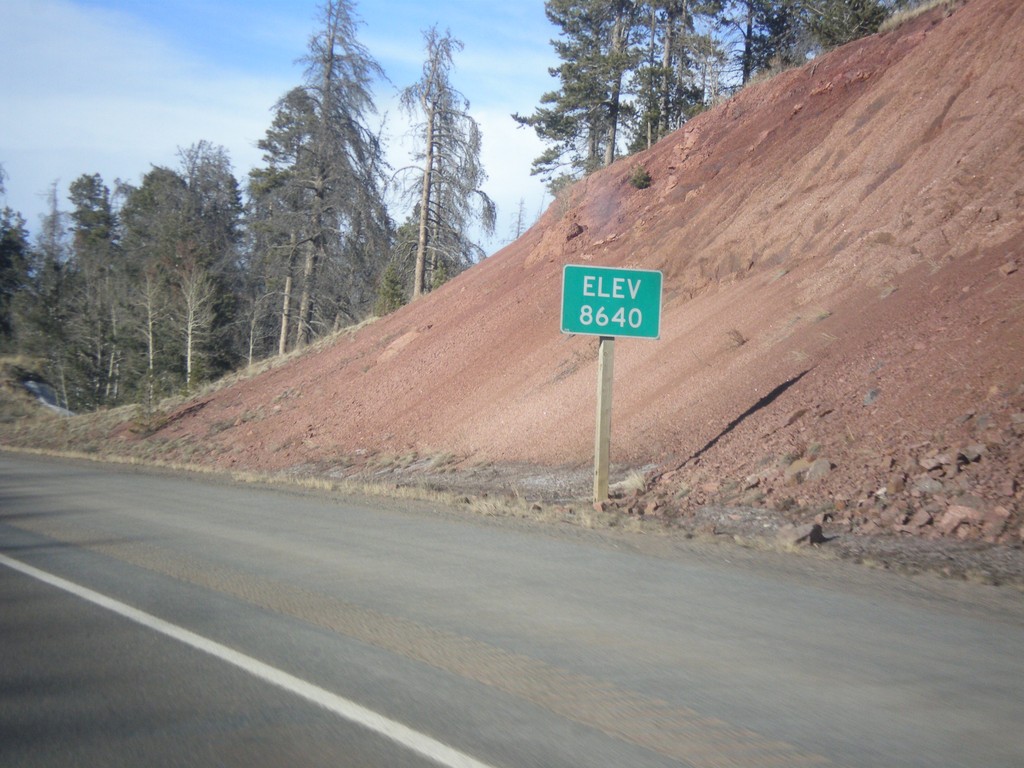
I-80 West - Elevation 8640
I-80 west - Elevation 8640. This is the highest point on all of I-80. The summit lies between Cheyenne and Laramie in the Sherman Mountains.
Taken 03-30-2014

 Laramie
Albany County
Wyoming
United States
Laramie
Albany County
Wyoming
United States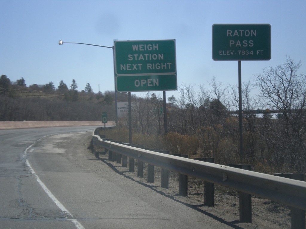
I-25 South - Raton Pass
I-25 south at Raton Pass - Elevation 7,834 Feet. Milemarker 0 is in the background which is the New Mexico - Colorado State Line. The New Mexico Port of Entry is immediately past the state line.
Taken 03-29-2014

 Trinidad
Las Animas County
Colorado
United States
Trinidad
Las Animas County
Colorado
United States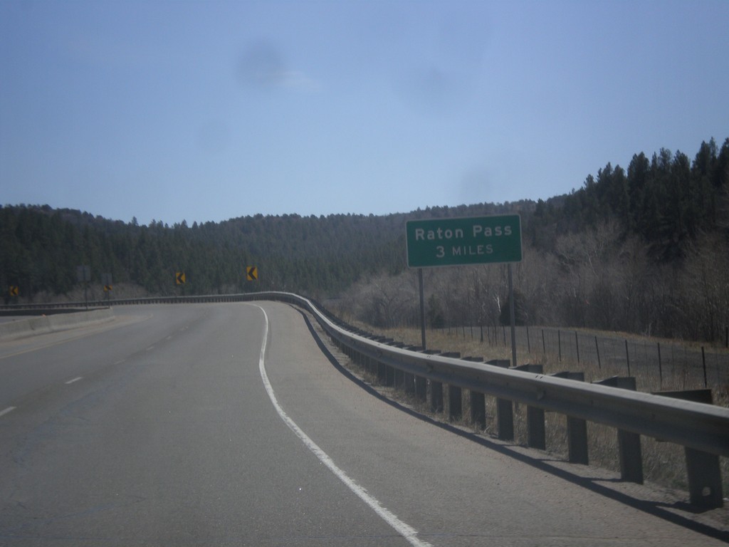
I-25 South - Raton Pass 3 Miles
Distance to top of Raton Pass on I-25 south. Raton Pass - 3 Miles.
Taken 03-29-2014
Trinidad
Las Animas County
Colorado
United States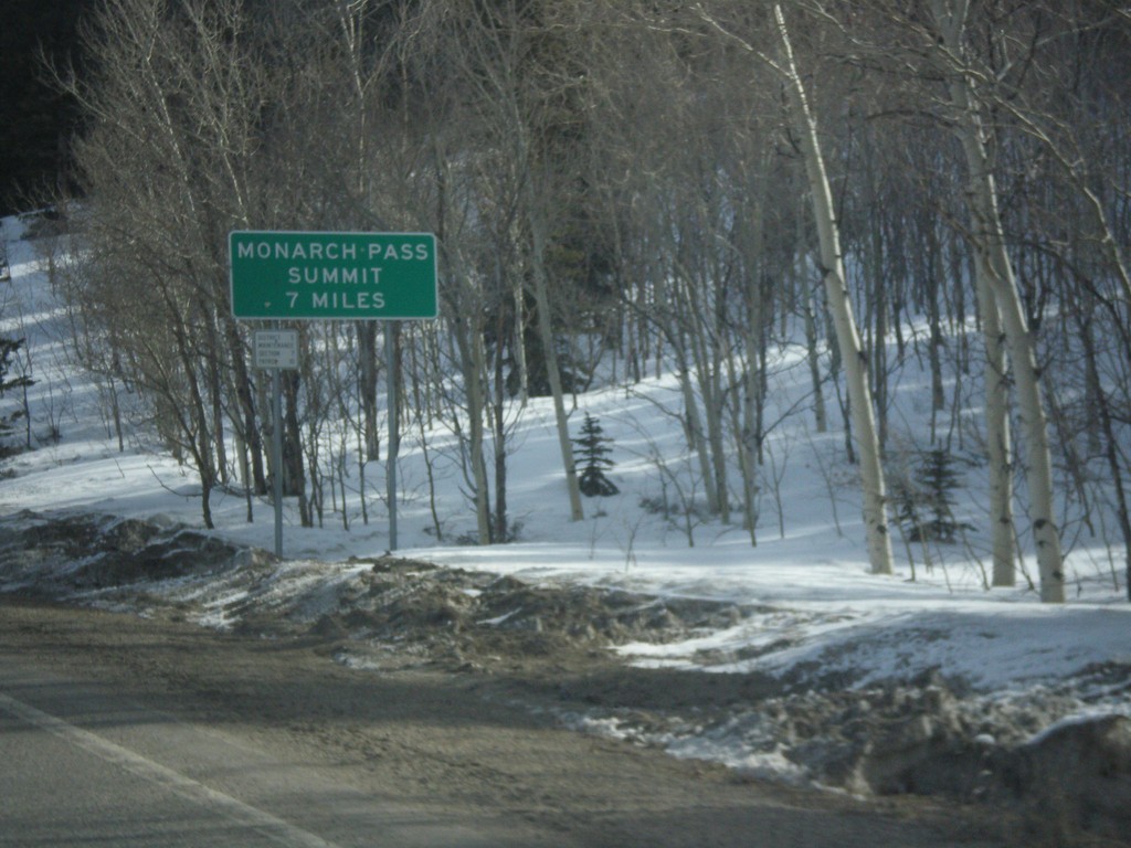
US-50 East - Monarch Pass Summit 7 Miles
Beginning climb up Monarch Pass on US-50 east. Monarch Pass Summit is 7 miles from this point.
Taken 03-29-2014
Sargents
Saguache County
Colorado
United States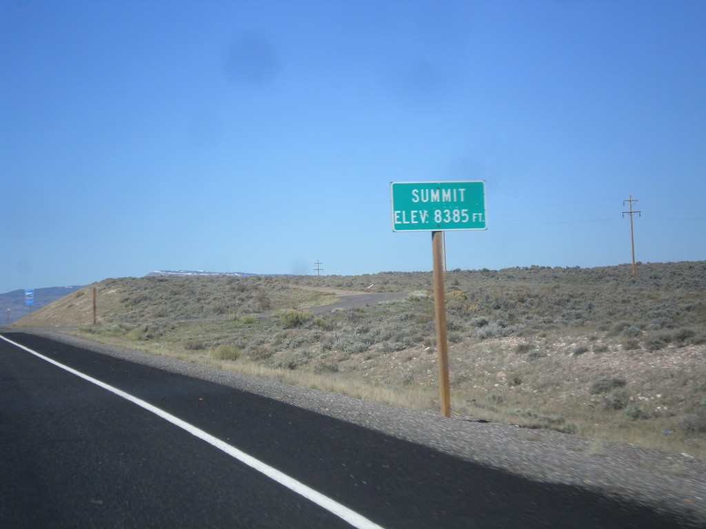
UT-24 West - Summit
Summit 8,385 Feet on UT-24 west. This is the summit of the Awapa Plateau.
Taken 10-18-2013
Koosharem Wayne County Utah United States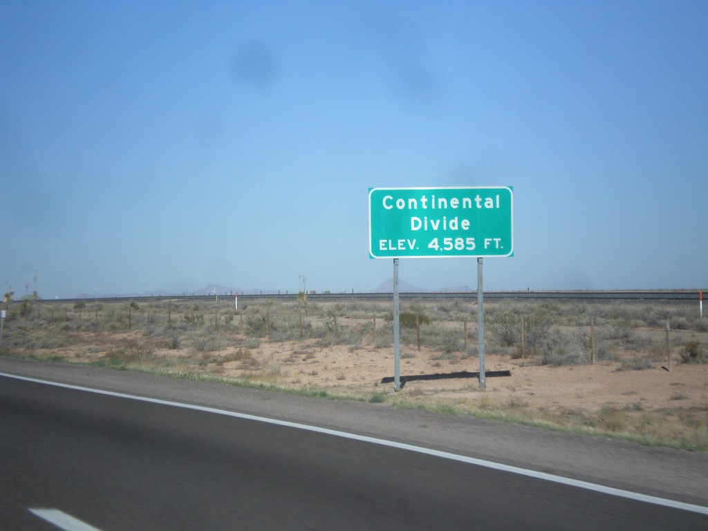
I-10 West - Continental Divide
Continental Divide on I-10 west - Elevation 4,585 Feet. This is the dividing line between the Gila River (flows to Colorado River) and the Mimbres River (flows into a closed basin).
Taken 04-14-2013
 Deming
Luna County
New Mexico
United States
Deming
Luna County
New Mexico
United States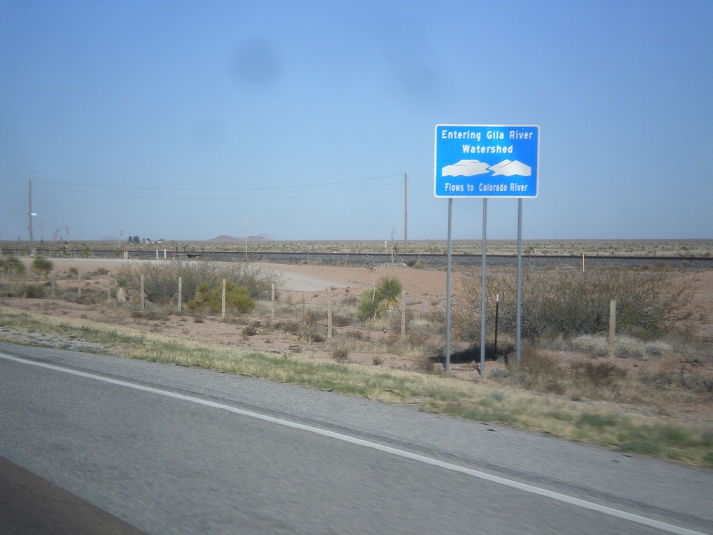
I-10 West - Entering Gila River Watershed
Entering Gila River Watershed on I-10 west. The Gila River flows to the Colorado River. This is the Continental Divide.
Taken 04-14-2013
Wilna
Grant County
New Mexico
United States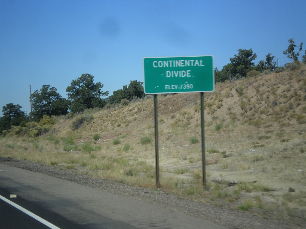
US-550 North - Continental Divide
Continental Divide - Elevation 7380 Feet on US-550 north. This is the divide between the San Juan River drainage and the Rio Grande drainage.
Taken 10-15-2012
 Cuba
Sandoval County
New Mexico
United States
Cuba
Sandoval County
New Mexico
United States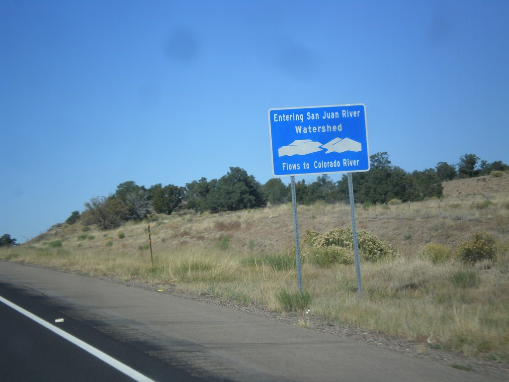
US-550 North - San Juan River Watershed
Entering the San Juan River watershed at the Continental Divide on US-550 north. The San Juan River flows into the Colorado River.
Taken 10-15-2012
Cuba
Sandoval County
New Mexico
United States
NV-431 East - Mount Rose Summit
NV-431 East at Mount Rose Summit - Elevation 8900 Feet. Mount Rose Summit is one of the few Sierra Nevada passes in Nevada, and is the highest pass open year round in the Sierra Nevada.
Taken 07-28-2012
 Reno
Washoe County
Nevada
United States
Reno
Washoe County
Nevada
United States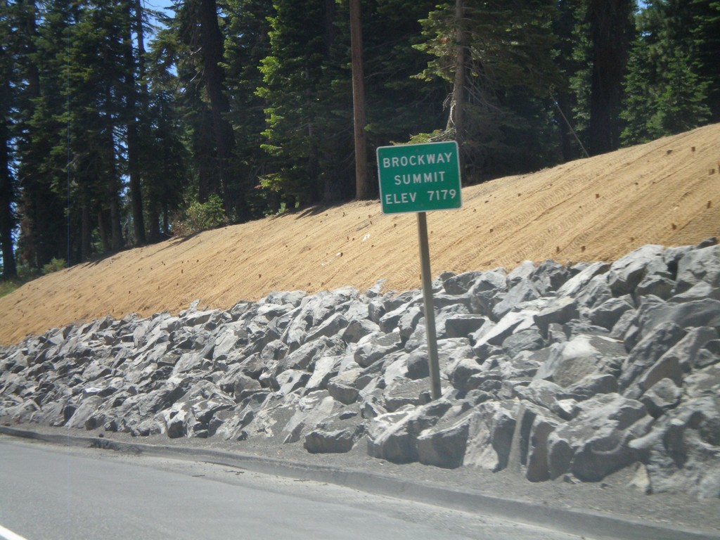
CA-267 South - Brockway Summit
CA-267 South - Brockway Summit (Elevation 7179 Feet). Brockway Summit divides the Truckee area from the Tahoe Basin. CA-267 south quickly descends into Lake Tahoe.
Taken 07-28-2012
 Truckee
Placer County
California
United States
Truckee
Placer County
California
United States
NV-140 East - Sage Hen Hills Summit
NV-140 east -Sage Hen Hills Summit - Elevation 6,349 Feet.
Taken 05-28-2012
 Humboldt County
Nevada
United States
Humboldt County
Nevada
United States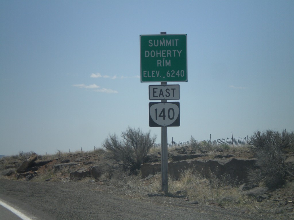
OR-140 East - Summit - Doherty Rim
Doherty Rim Summit, Elevation 6,240 Feet on OR-140 east in rural Lake County.
Taken 05-28-2012
 Adel
Lake County
Oregon
United States
Adel
Lake County
Oregon
United States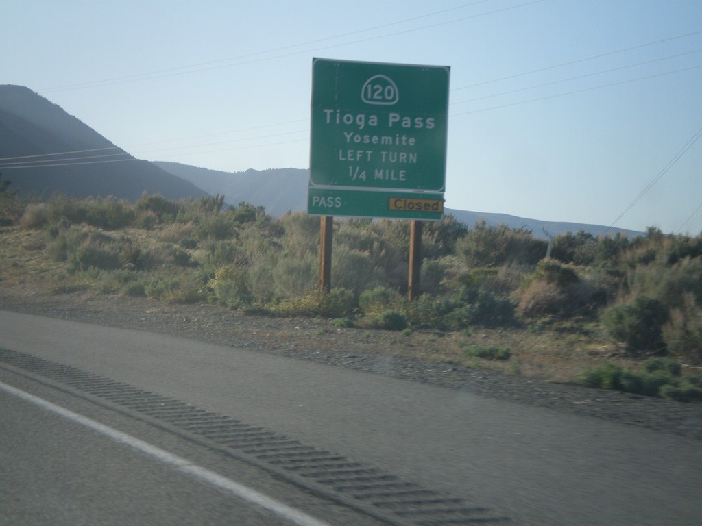
US-395 North Approaching CA-120
US-395 north approaching CA-120 east to Tioga Pass and Yosemite. Tioga Pass was opened the day after this picture was taken.
Taken 05-06-2012
 Lee Vining
Mono County
California
United States
Lee Vining
Mono County
California
United States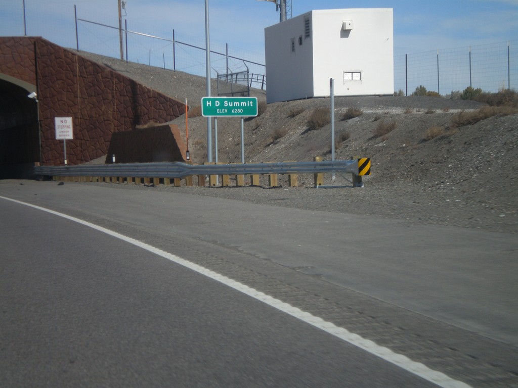
US-93 North - H-D Summit
US-93 north at H-D Summit - Elevation 6,280. The overpass in the background is a recently installed wildlife crossing over the highway. H-D Summit is the northern end of the Great Basin on US-93. North of here all water flows into the Snake River system.
Taken 10-15-2011
Melandco
Elko County
Nevada
United States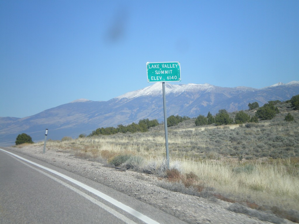
US-93 North - Lake Valley Summit
Lake Valley Summit - Elevation 6,140 Feet on US-93 north. Wheeler Peak is the snow covered mountain in the background.
Taken 10-14-2011
Ely
White Pine County
Nevada
United States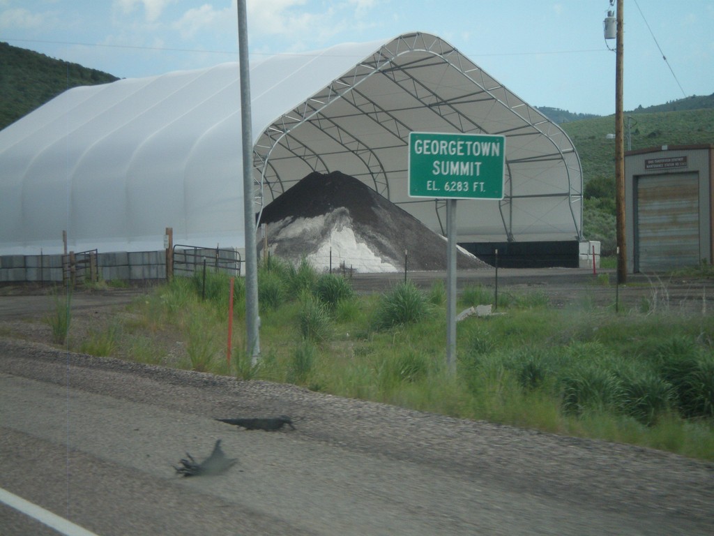
US-30 West - Georgetown Summit
US-30 west at Gorgetown Summit - Elevation 6,283 Feet. Idaho Transportation Maintenance Yard in the background.
Taken 07-05-2011
Montpelier
Bear Lake County
Idaho
United States