Signs Tagged With Summit
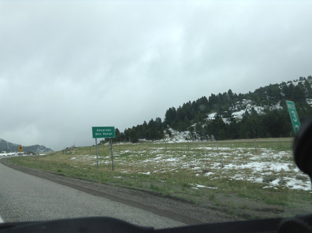
I-90 East - Bozeman Pass
I-90 east at Bozeman Pass. Bozeman Pass is part of the Absaroka Mountain Range. These type of signs are common across Montana, giving name to the many mountain ranges in the state.
Taken 05-08-2015

 Muir
Park County
Montana
United States
Muir
Park County
Montana
United States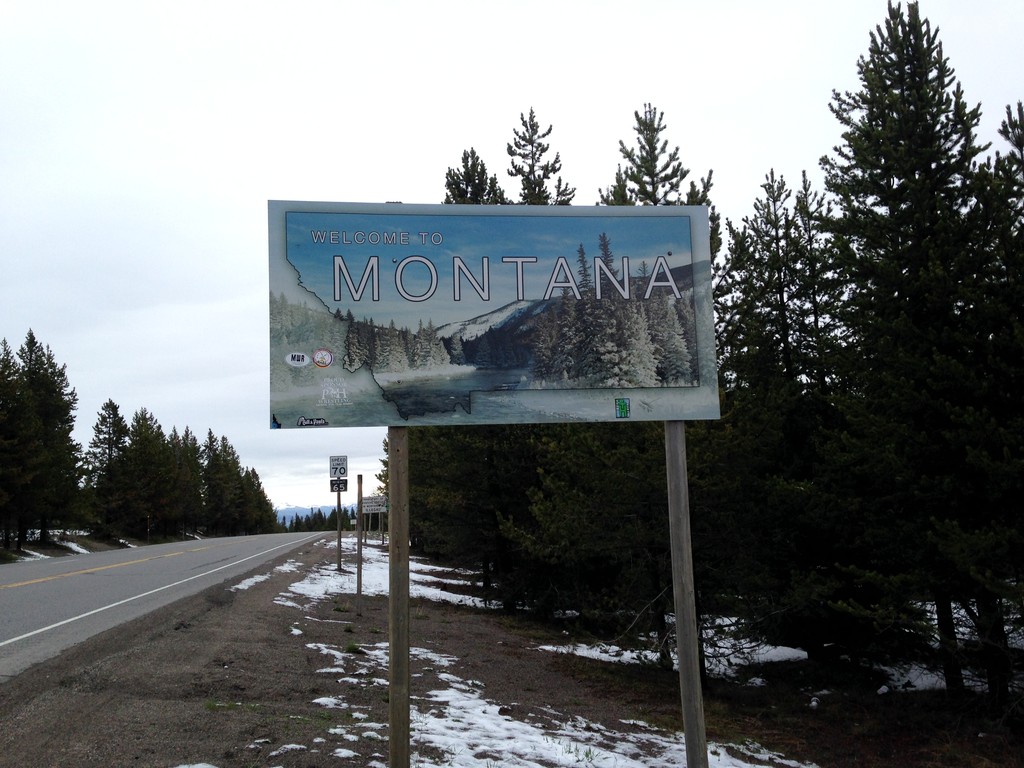
US-20 East - Welcome To Montana
Welcome to Montana on US-20 East at Targhee Pass. Targhee Pass is on the Continental Divide. This style of Montana welcome sign is fairly recent. Previous welcome signs were blue, and were cut-out in the state outline.
Taken 05-08-2015
 West Yellowstone
Gallatin County
Montana
United States
West Yellowstone
Gallatin County
Montana
United States
US-20 East - Welcome To Montana
Welcome to Montana on US-20 East at Targhee Pass. Targhee Pass is on the Continental Divide. West of here water flows into the Henrys Fork, the Snake River, and the Columbia River into the Pacific Ocean. East of here water flows into the Madison River, the Missouri River, the Mississippi River into the Gulf of Mexico.
Taken 05-08-2015
West Yellowstone
Gallatin County
Montana
United States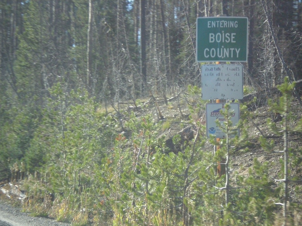
ID-21 - Entering Boise County
Entering Boise County along ID-21 south. The Boise-Custer County Line is located on Banner Summit - Elevation 7037 Feet.
Taken 10-05-2014
 Lowman
Boise County
Idaho
United States
Lowman
Boise County
Idaho
United States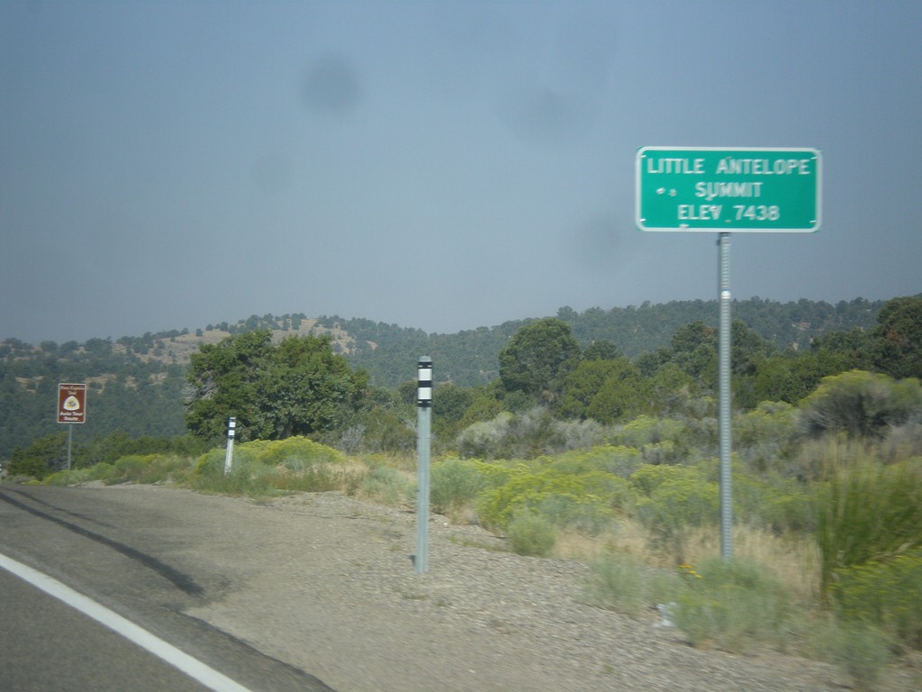
US-50 West - Little Antelope Summit
US-50 west at Little Antelope Summit - Elevation 7,438 Feet. Little Antelope Summit is in the Pine Range.
Taken 08-31-2014
 White Pine County
Nevada
United States
White Pine County
Nevada
United States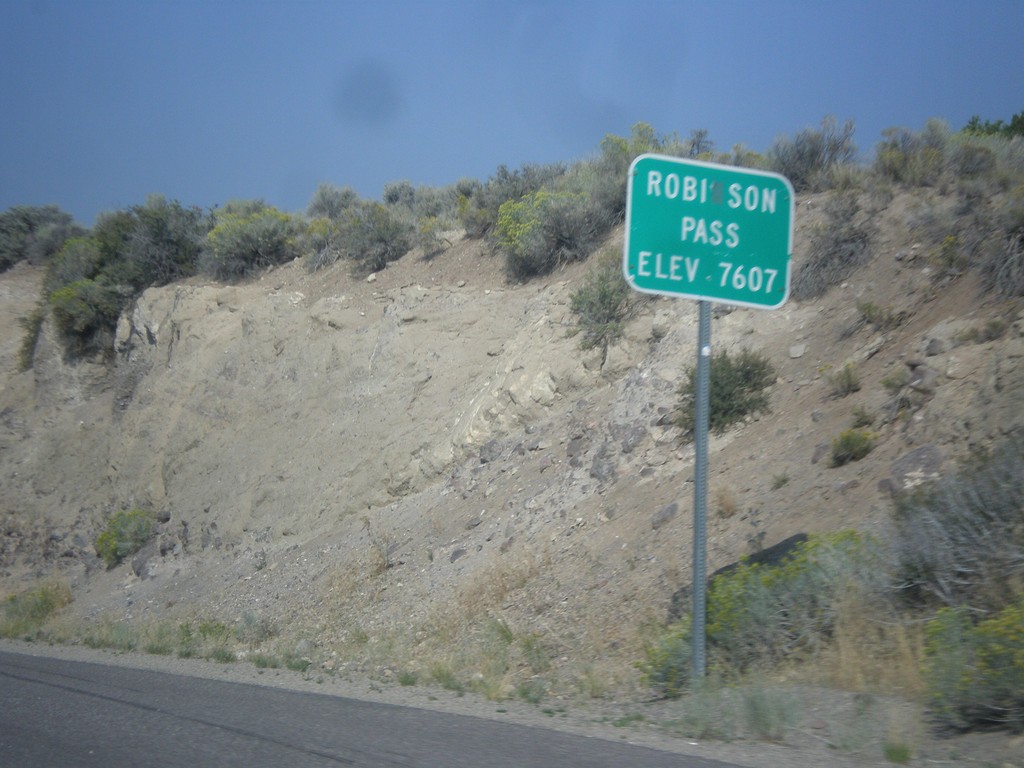
US-50 West - Robinson Summit
US-50 west at Robinson Pass - Elevation 7,607 Feet. Robinson Pass is in the Egan Range.
Taken 08-31-2014
Ely
White Pine County
Nevada
United States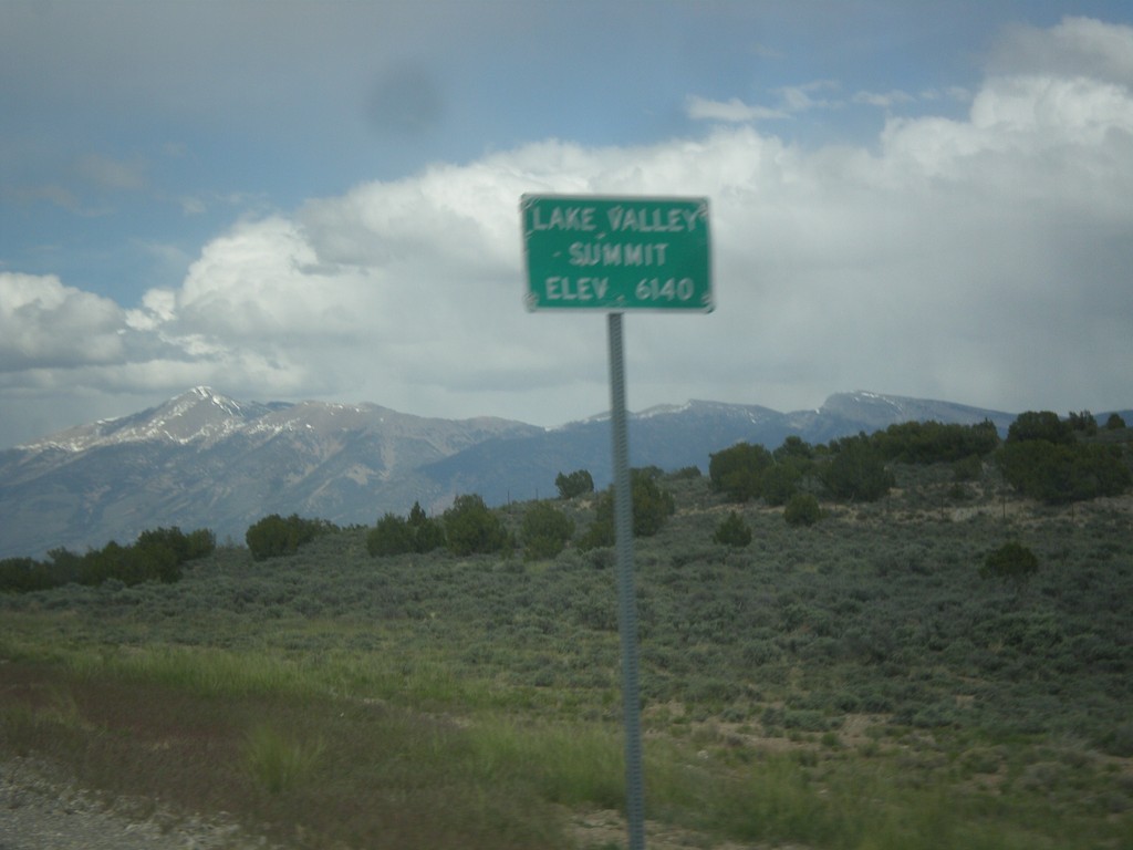
US-93 North - Lake Valley Summit
Lake Valley Summit - Elevation 6,140 Feet on US-93 north. Wheeler Peak is the mountain in the background. Wheeler Peak is the second highest mountain in Nevada and is located in Great Basin National Park.
Taken 05-21-2014
 Ely
White Pine County
Nevada
United States
Ely
White Pine County
Nevada
United States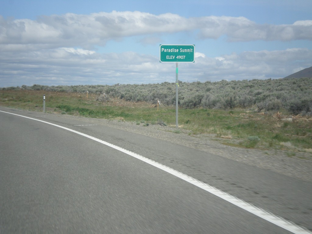
US-95 North - Paradise Summit
Paradise Summit - Elevation 4907 Feet on US-95 North.
Taken 05-06-2014
 Winnemucca
Humboldt County
Nevada
United States
Winnemucca
Humboldt County
Nevada
United States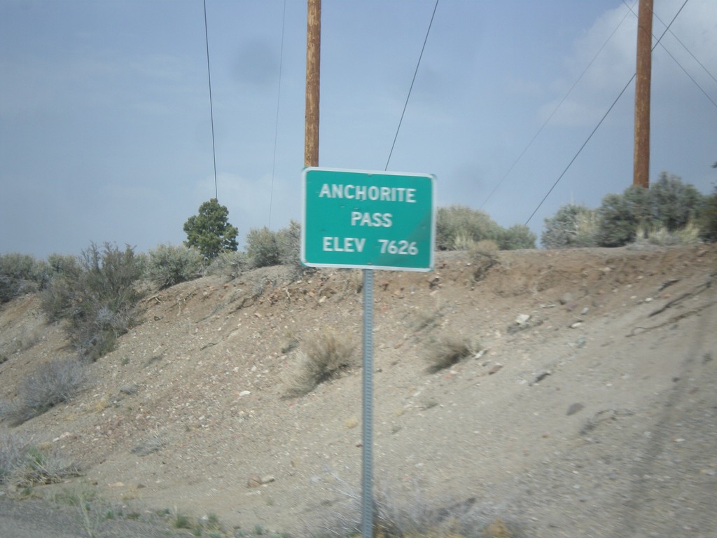
NV-359 North - Anchorite Pass
Anchorite Pass - Elevation 7,626 Feet on NV-359 North.
Taken 05-05-2014
 Mina
Mineral County
Nevada
United States
Mina
Mineral County
Nevada
United States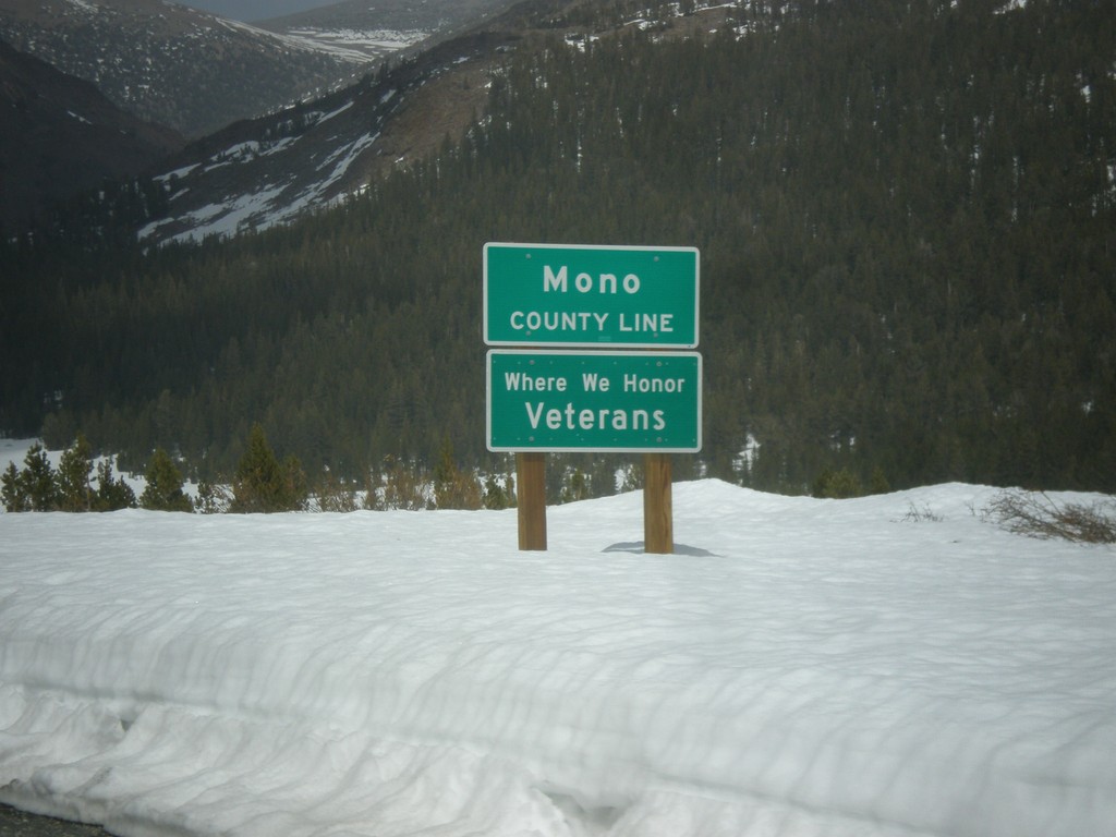
CA-120 East - Mono County Line
Mono County Line on CA-120 east at Tioga Pass.
Taken 05-05-2014
 Lee Vining
Mono County
California
United States
Lee Vining
Mono County
California
United States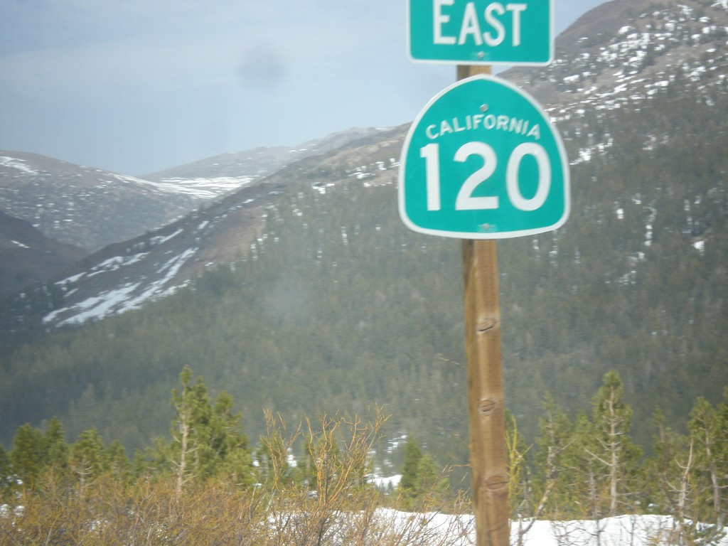
CA-120 East - Tioga Pass
First CA-120 shield after leaving Yosemite National Park at Tioga Pass.
Taken 05-05-2014
Lee Vining
Mono County
California
United States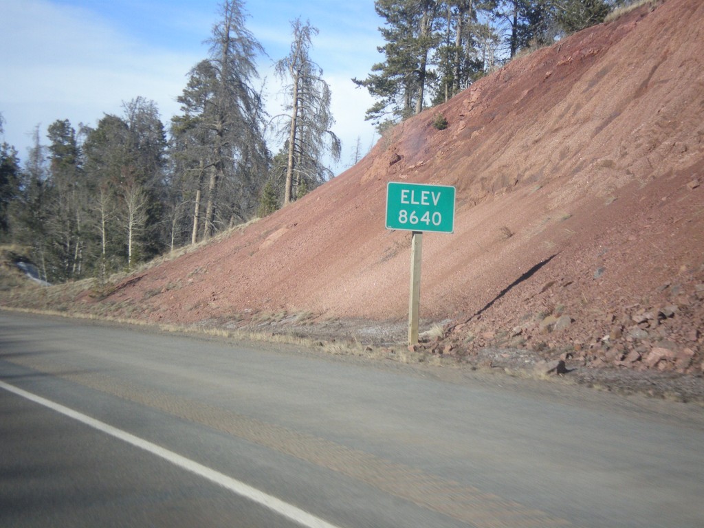
I-80 West - Elevation 8640
I-80 west - Elevation 8640. This is the highest point on all of I-80. The summit lies between Cheyenne and Laramie in the Sherman Mountains.
Taken 03-30-2014

 Laramie
Albany County
Wyoming
United States
Laramie
Albany County
Wyoming
United States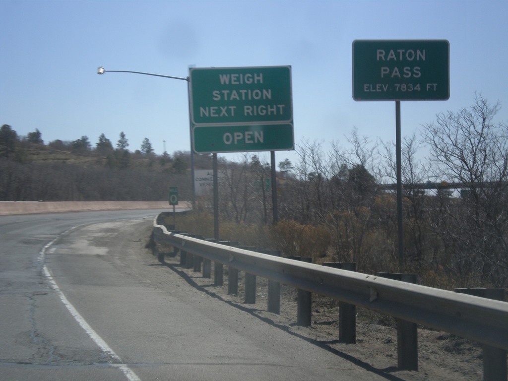
I-25 South - Raton Pass
I-25 south at Raton Pass - Elevation 7,834 Feet. Milemarker 0 is in the background which is the New Mexico - Colorado State Line. The New Mexico Port of Entry is immediately past the state line.
Taken 03-29-2014

 Trinidad
Las Animas County
Colorado
United States
Trinidad
Las Animas County
Colorado
United States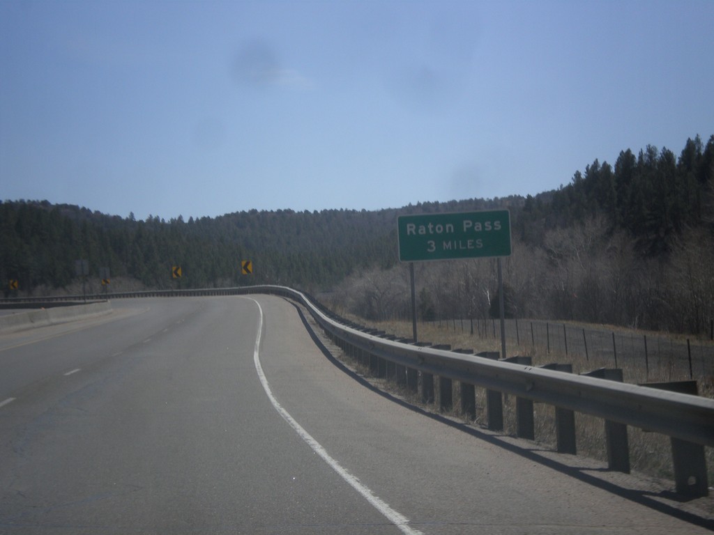
I-25 South - Raton Pass 3 Miles
Distance to top of Raton Pass on I-25 south. Raton Pass - 3 Miles.
Taken 03-29-2014
Trinidad
Las Animas County
Colorado
United States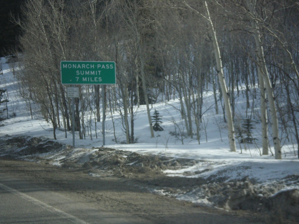
US-50 East - Monarch Pass Summit 7 Miles
Beginning climb up Monarch Pass on US-50 east. Monarch Pass Summit is 7 miles from this point.
Taken 03-29-2014
Sargents
Saguache County
Colorado
United States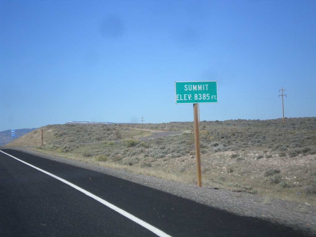
UT-24 West - Summit
Summit 8,385 Feet on UT-24 west. This is the summit of the Awapa Plateau.
Taken 10-18-2013
Koosharem Wayne County Utah United States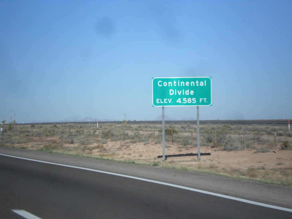
I-10 West - Continental Divide
Continental Divide on I-10 west - Elevation 4,585 Feet. This is the dividing line between the Gila River (flows to Colorado River) and the Mimbres River (flows into a closed basin).
Taken 04-14-2013
 Deming
Luna County
New Mexico
United States
Deming
Luna County
New Mexico
United States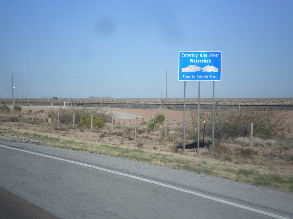
I-10 West - Entering Gila River Watershed
Entering Gila River Watershed on I-10 west. The Gila River flows to the Colorado River. This is the Continental Divide.
Taken 04-14-2013
Wilna
Grant County
New Mexico
United States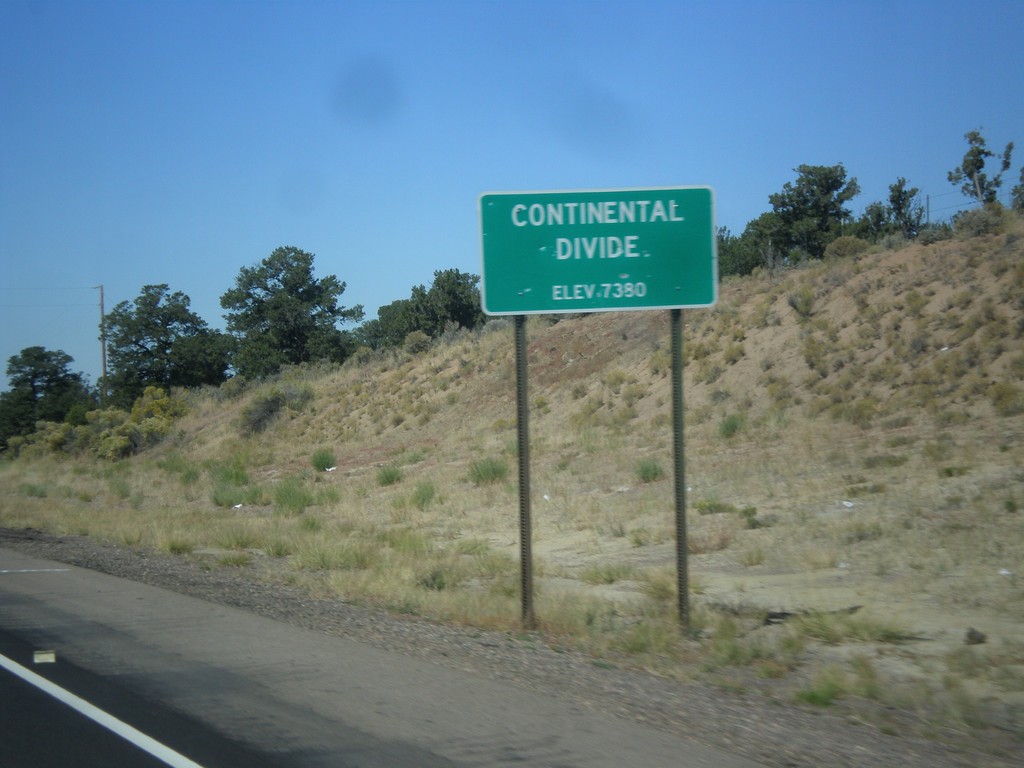
US-550 North - Continental Divide
Continental Divide - Elevation 7380 Feet on US-550 north. This is the divide between the San Juan River drainage and the Rio Grande drainage.
Taken 10-15-2012
 Cuba
Sandoval County
New Mexico
United States
Cuba
Sandoval County
New Mexico
United States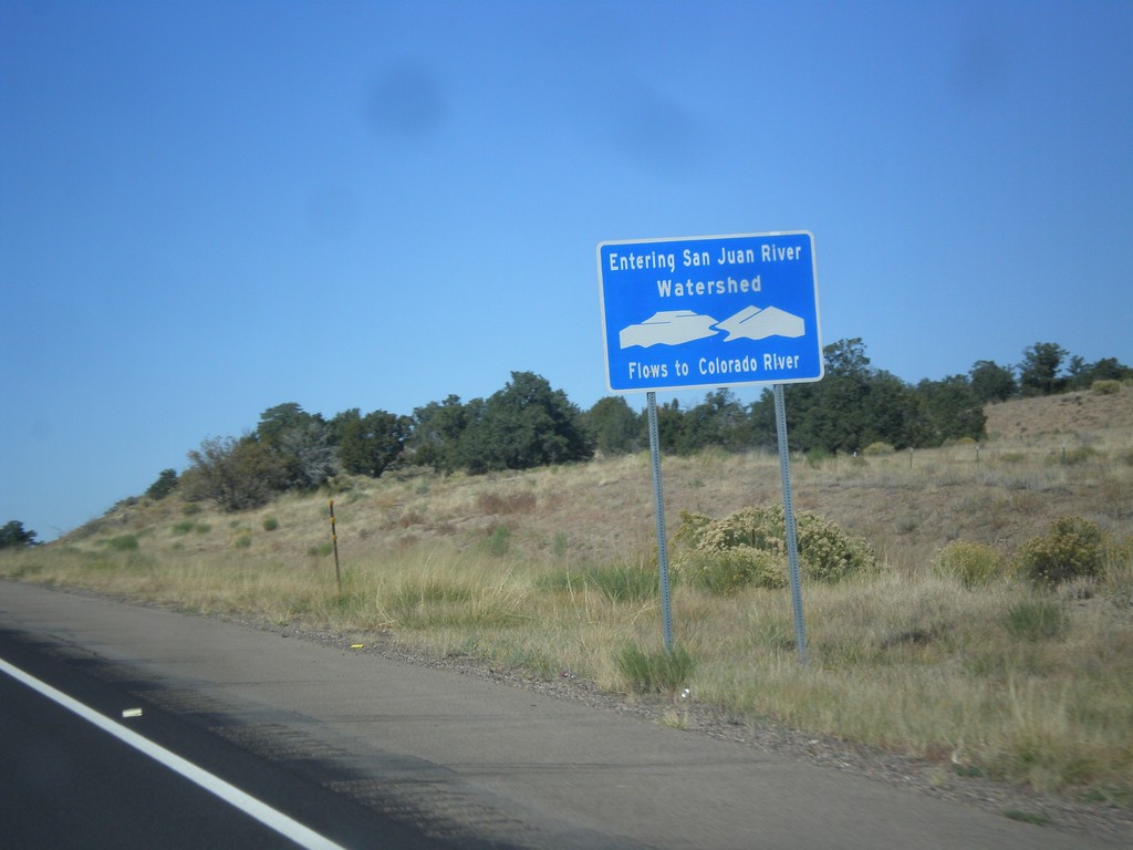
US-550 North - San Juan River Watershed
Entering the San Juan River watershed at the Continental Divide on US-550 north. The San Juan River flows into the Colorado River.
Taken 10-15-2012
Cuba
Sandoval County
New Mexico
United States
NV-431 East - Mount Rose Summit
NV-431 East at Mount Rose Summit - Elevation 8900 Feet. Mount Rose Summit is one of the few Sierra Nevada passes in Nevada, and is the highest pass open year round in the Sierra Nevada.
Taken 07-28-2012
 Reno
Washoe County
Nevada
United States
Reno
Washoe County
Nevada
United States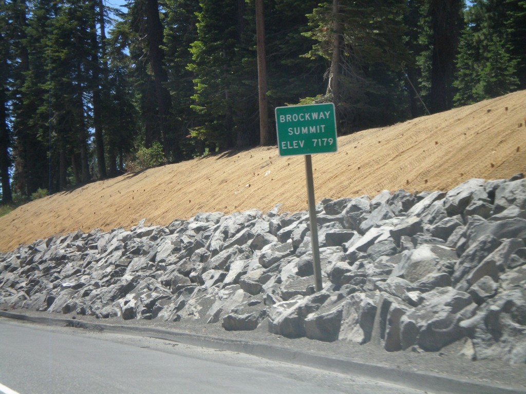
CA-267 South - Brockway Summit
CA-267 South - Brockway Summit (Elevation 7179 Feet). Brockway Summit divides the Truckee area from the Tahoe Basin. CA-267 south quickly descends into Lake Tahoe.
Taken 07-28-2012
 Truckee
Placer County
California
United States
Truckee
Placer County
California
United States
NV-140 East - Sage Hen Hills Summit
NV-140 east -Sage Hen Hills Summit - Elevation 6,349 Feet.
Taken 05-28-2012
 Humboldt County
Nevada
United States
Humboldt County
Nevada
United States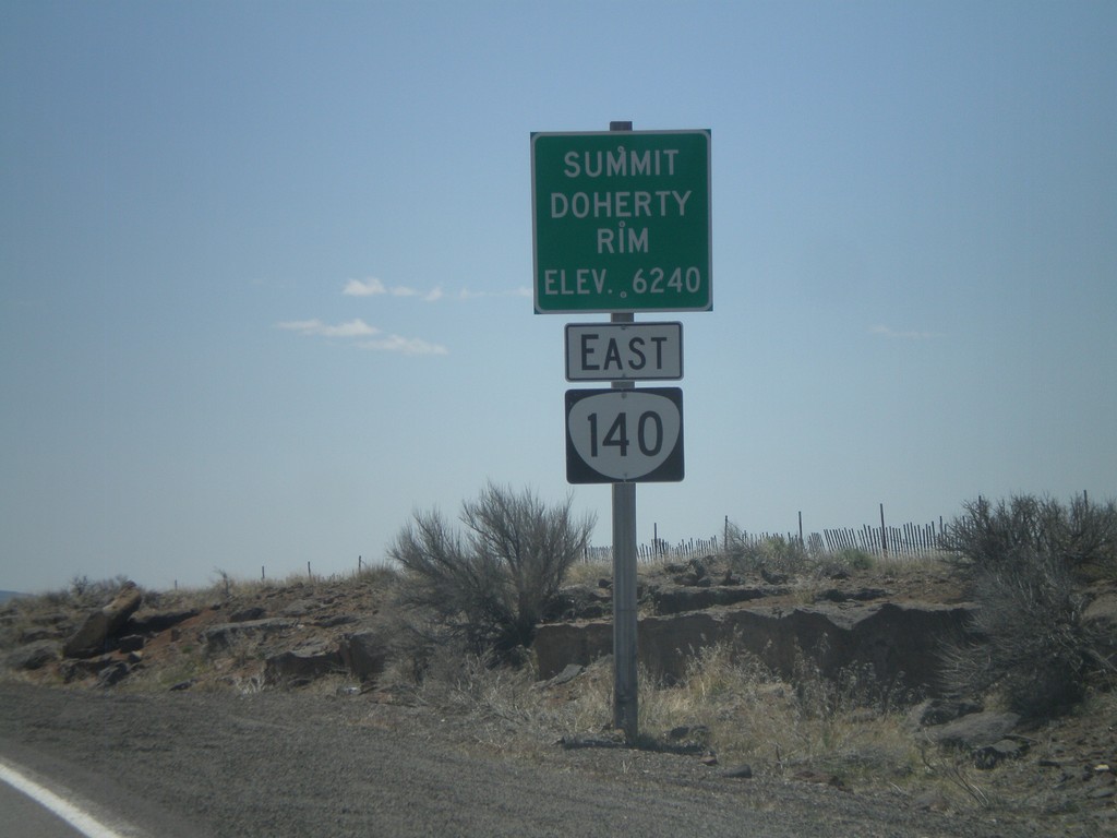
OR-140 East - Summit - Doherty Rim
Doherty Rim Summit, Elevation 6,240 Feet on OR-140 east in rural Lake County.
Taken 05-28-2012
 Adel
Lake County
Oregon
United States
Adel
Lake County
Oregon
United States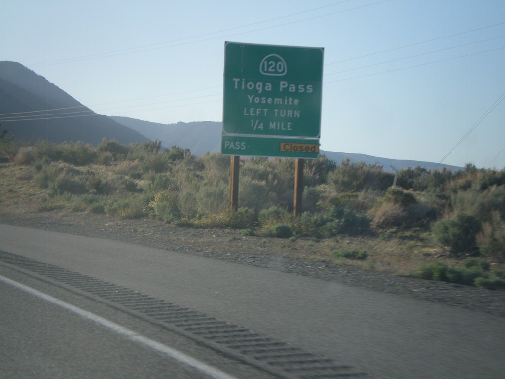
US-395 North Approaching CA-120
US-395 north approaching CA-120 east to Tioga Pass and Yosemite. Tioga Pass was opened the day after this picture was taken.
Taken 05-06-2012
 Lee Vining
Mono County
California
United States
Lee Vining
Mono County
California
United States