Signs Tagged With Summit
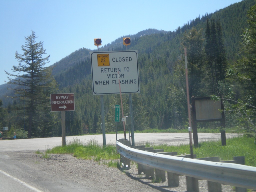
ID-33 East - WY-22 Closure Information
Teton Pass road closure information on ID-33 east approaching the Wyoming state line. When Teton Pass is closed in Wyoming, this is where the road closure starts, just inside of Idaho. All traffic must return to Victor Idaho when the road closure lights are flashing. This is one of the few instances in Idaho of a state highway shield from another state located inside Idaho.
Taken 07-02-2011

 Victor
Teton County
Idaho
United States
Victor
Teton County
Idaho
United States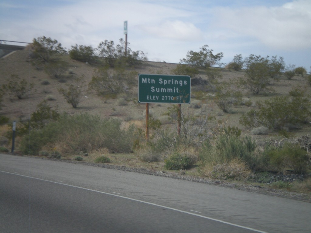
I-40 West - Mountain Springs Summit
I-40 west at Mountain Springs Summit - Elevation 2770 Feet.
Taken 02-25-2011
 Goffs
San Bernardino County
California
United States
Goffs
San Bernardino County
California
United States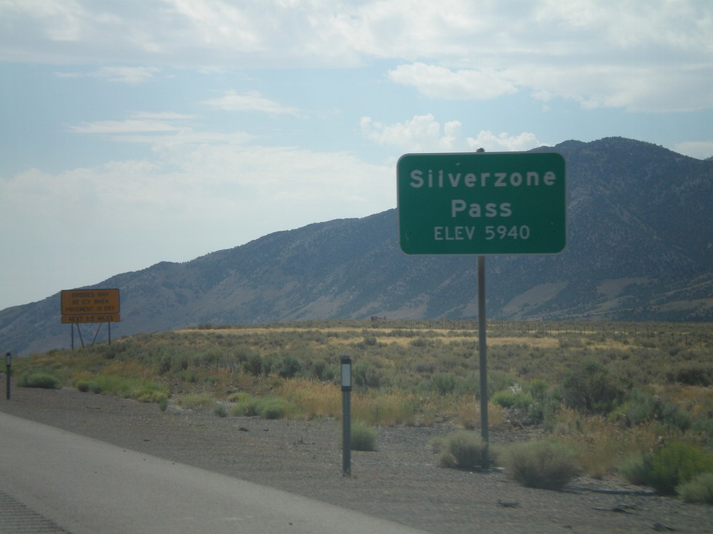
I-80 East - Silverzone Pass
I-80 east at Silverzone Pass - Elevation 5,940 Feet.
Taken 07-31-2010

 Montello
Elko County
Nevada
United States
Montello
Elko County
Nevada
United States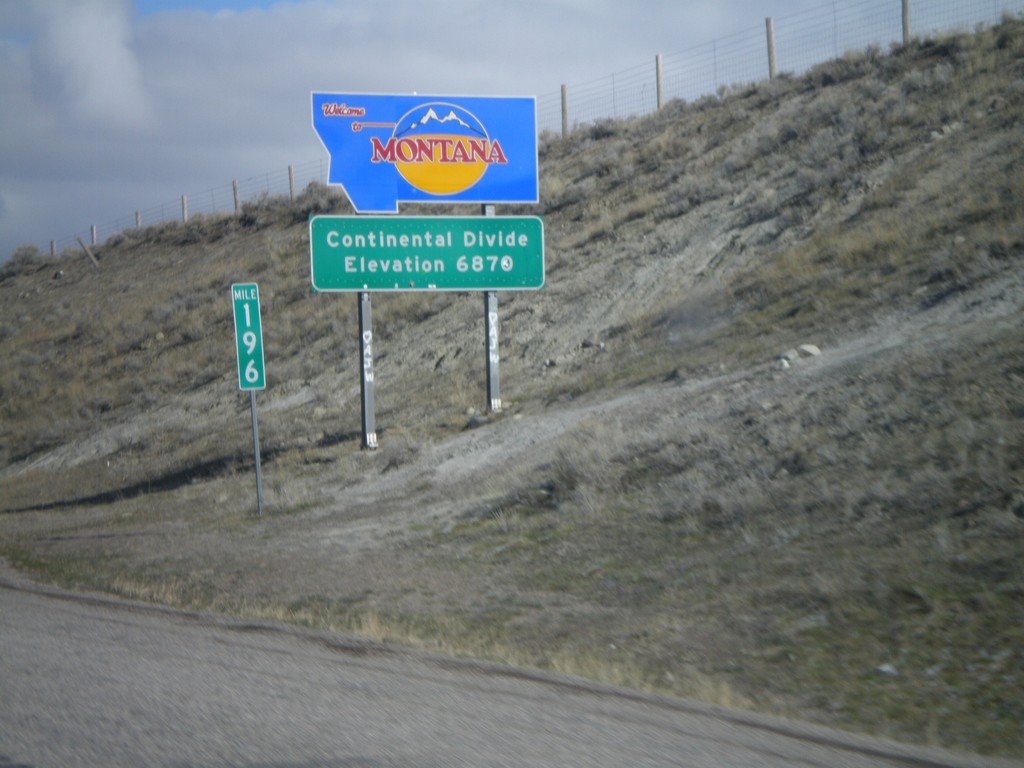
Welcome To Montana - I-15 North
Welcome to Montana on I-15 North at the Idaho-Montana state line on Monida Pass. Monida Pass is the Continental Divide.
Taken 05-02-2010
 Humphrey
Clark County
Idaho
United States
Humphrey
Clark County
Idaho
United States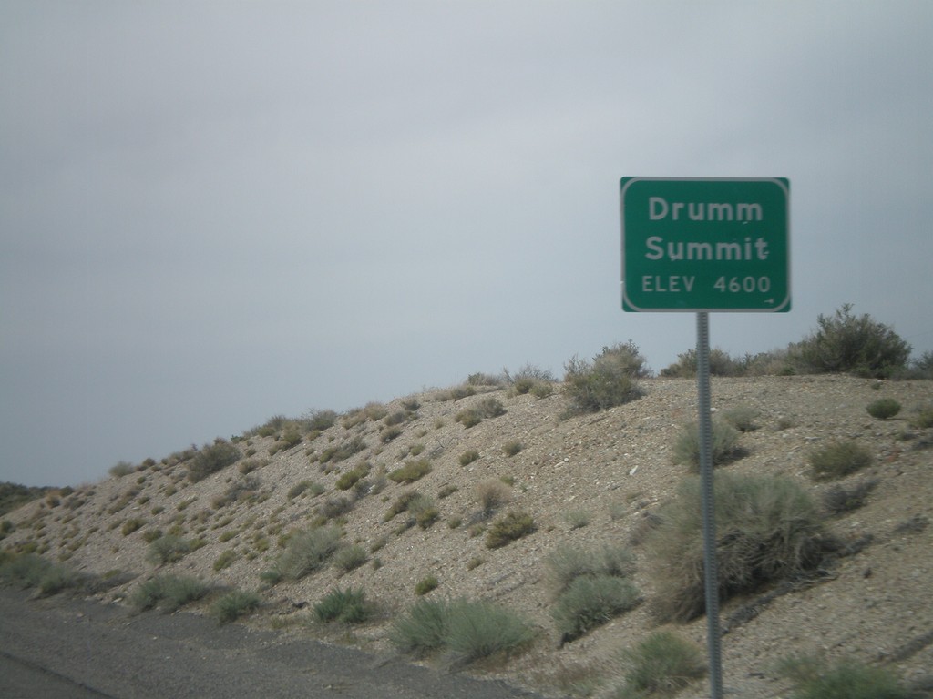
US-50 West - Drumm Summit
US-50 west at Drumm Summit - Elevation 4600 Feet.
Taken 04-15-2010
 Fallon
Churchill County
Nevada
United States
Fallon
Churchill County
Nevada
United States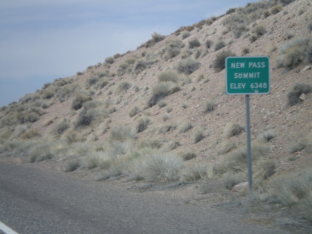
US-50 West - New Pass Summit
US-50 west at New Pass Summit - Elevation 6348 Feet.
Taken 04-15-2010
Fallon
Lander County
Nevada
United States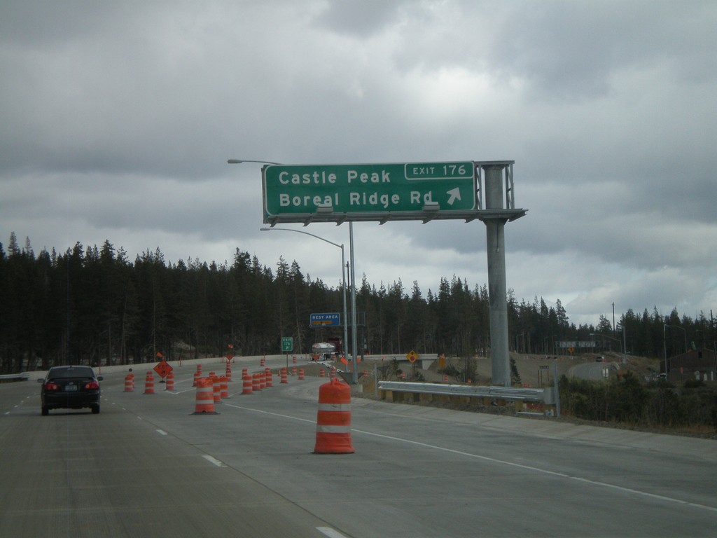
I-80 East - Exit 176
I-80 east at Exit 176 - Castle Peak/Boreal Ridge Road. Exit 176 provides access to Boreal Ski Area. This exit is at the top of Donner Summit, the highest point on I-80 in California.
Taken 10-04-2009
Soda Springs
Nevada County
California
United States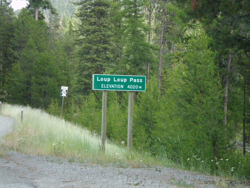
WA-20 East - Loup Loup Pass
WA-20 east at Loup Loup Pass - Elevation 4,020 Feet.
Taken 07-26-2008
 Mowich Illahee
Okanogan County
Washington
United States
Mowich Illahee
Okanogan County
Washington
United States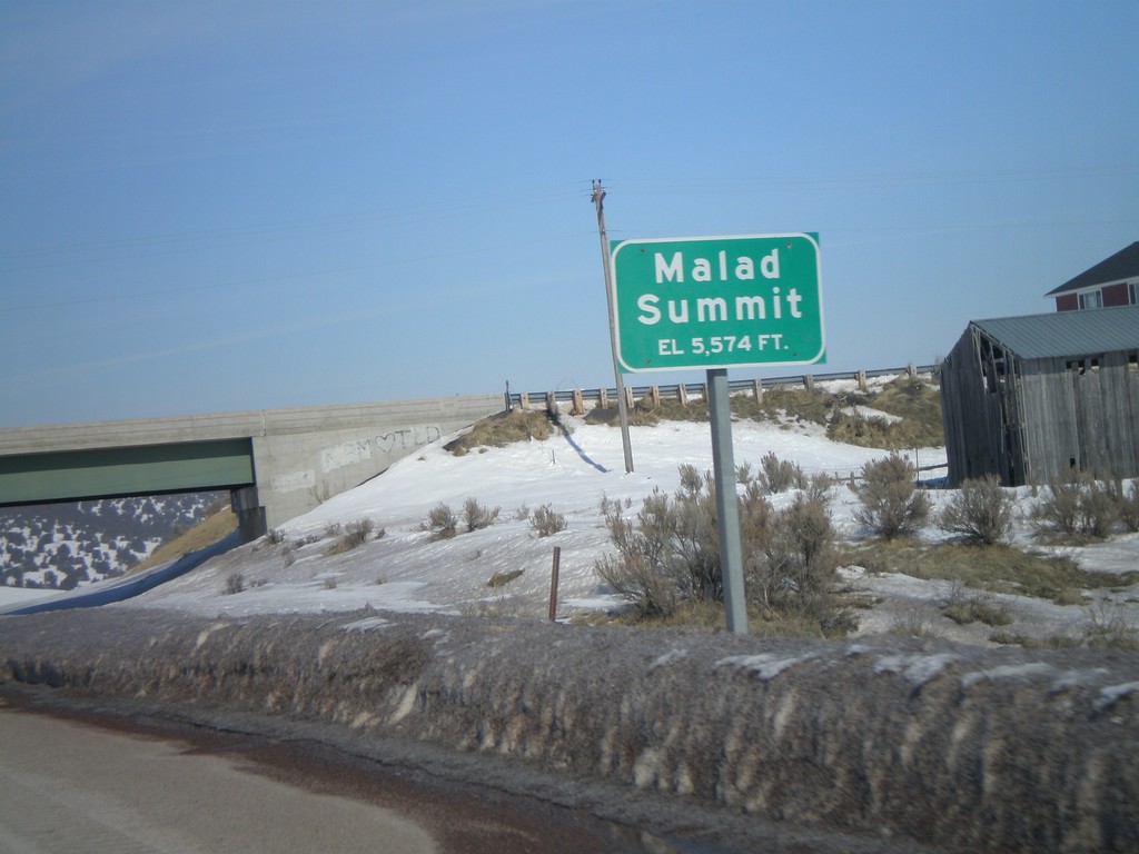
I-15 North - Malad Summit
I-15 north at Malad Summit - Elevation 5,574 Feet.
Taken 02-17-2008
Malad City
Oneida County
Idaho
United States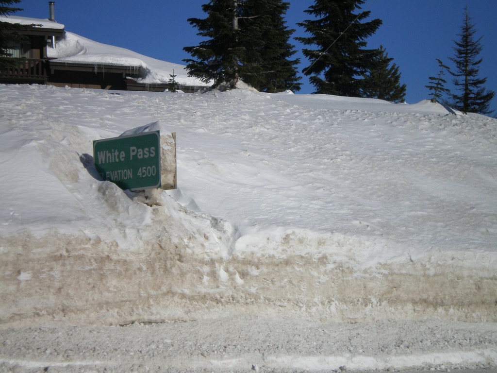
US-12 East - White Pass
US-12 east at White Pass (Elev. 4500 Ft) - the summit of US-12 in the Cascades.
Taken 01-22-2008
 Naches
Yakima County
Washington
United States
Naches
Yakima County
Washington
United States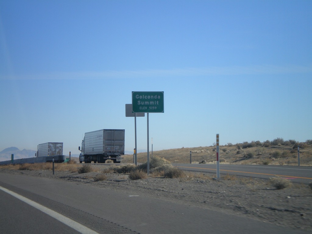
I-80 East - Golconda Summit
I-80 east at Golconda Summit - Elevation 5,159 Feet.
Taken 11-24-2007
Golconda
Humboldt County
Nevada
United States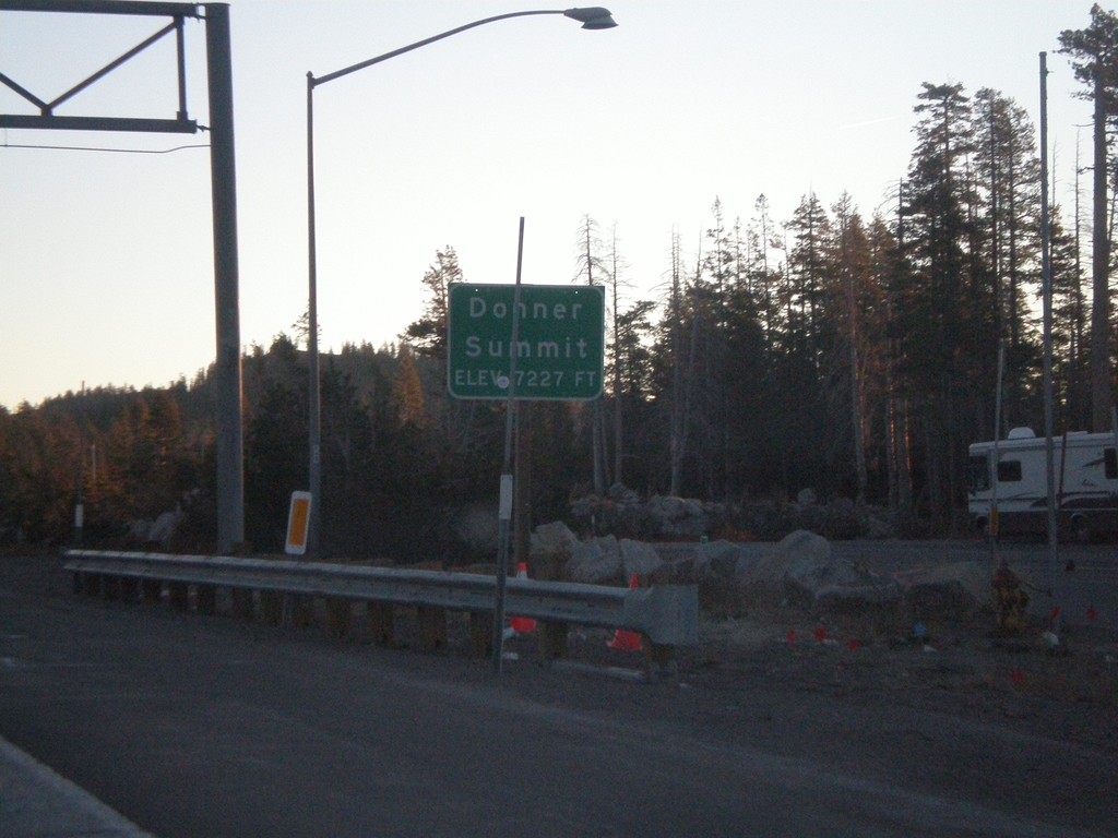
I-80 East - Donner Summit
I-80 east at Donner Pass - Elevation 7,227 Feet. This is the highest point on I-80 in California. The highest point on I-80 nationwide is in Wyoming.
Taken 11-24-2007
Truckee
Nevada County
California
United States
US-12 West - Welcome To Idaho
Welcome to Idaho on US-12 west at Lolo Pass. Entering Pacific Time Zone.
Taken 07-21-2007
Kooskia
Idaho
United States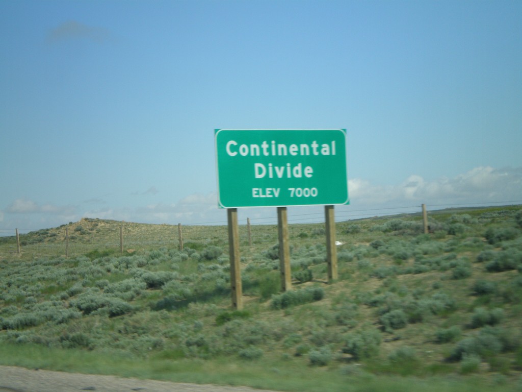
I-80 West - Continental Divide (East)
I-80 west at the eastern Continental Divide, 7000 Feet. I-80 west crosses the Great Divide Basin.
Taken 05-29-2007

 Rawlins
Carbon County
Wyoming
United States
Rawlins
Carbon County
Wyoming
United States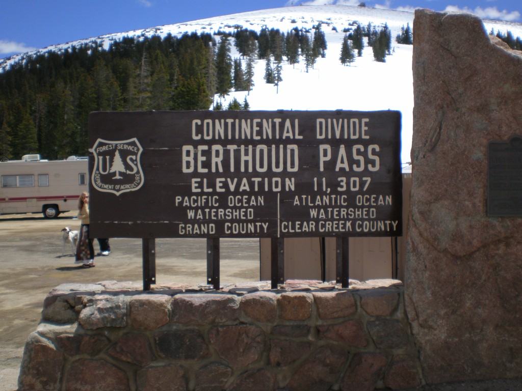
US-40 - Berthoud Pass
US-40 at Berthoud Pass. Continental Divide and Grand-Clear Creek County Line.
Taken 05-25-2007
 Winter Park
Grand County
Colorado
United States
Winter Park
Grand County
Colorado
United States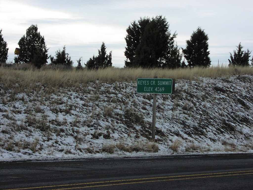
US-26 West - Keyes Creek Summit
US-26 at Keyes Creek Summit, Elevation 4,569 Feet.
Taken 12-01-2006
 Mitchell
Wheeler County
Oregon
United States
Mitchell
Wheeler County
Oregon
United States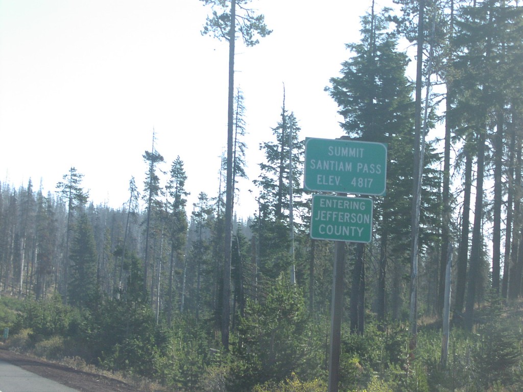
US-20 East - Santiam Pass/Jefferson County Line
US-20/OR-126 east at Santiam Pass, Jefferson-Linn County line.
Taken 10-01-2006

 Sisters
Linn County
Oregon
United States
Sisters
Linn County
Oregon
United States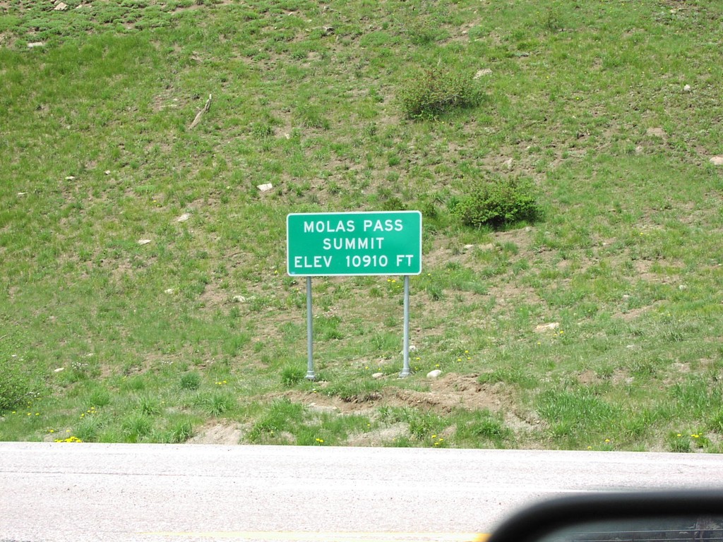
US-550 - Molas Pass Summit
Molas Pass on US-550. Elevation 10,910 Feet.
Taken 05-01-2005
 Silverton
San Juan County
Colorado
United States
Silverton
San Juan County
Colorado
United States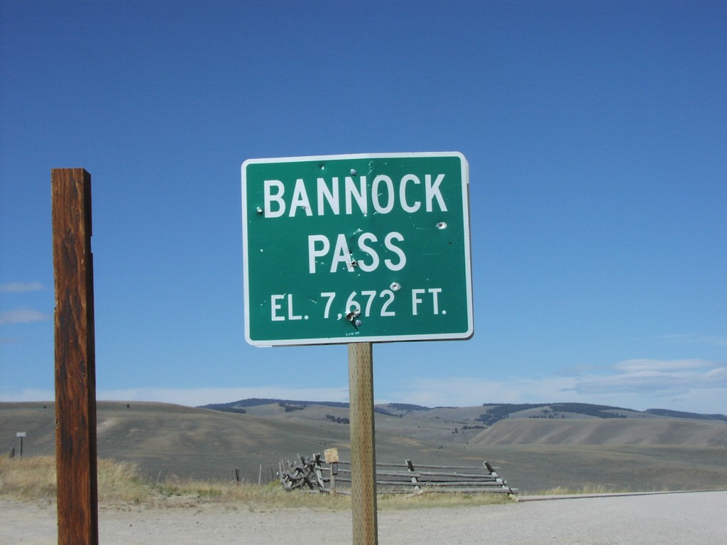
ID-29 - Bannock Pass - ID/MT Border
Bannock Pass at end of ID-29 on ID-MT Border
Taken 09-01-2004
 Leadore
Lemhi County
Idaho
United States
Leadore
Lemhi County
Idaho
United States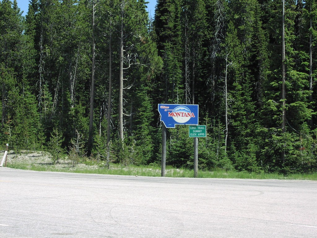
US-93 North - Welcome To Montana
Welcome To Montana at Lost Trail Pass on US-93 North
Taken 07-01-2003
 Sula
Ravalli County
Montana
United States
Sula
Ravalli County
Montana
United States