Signs Tagged With Summit
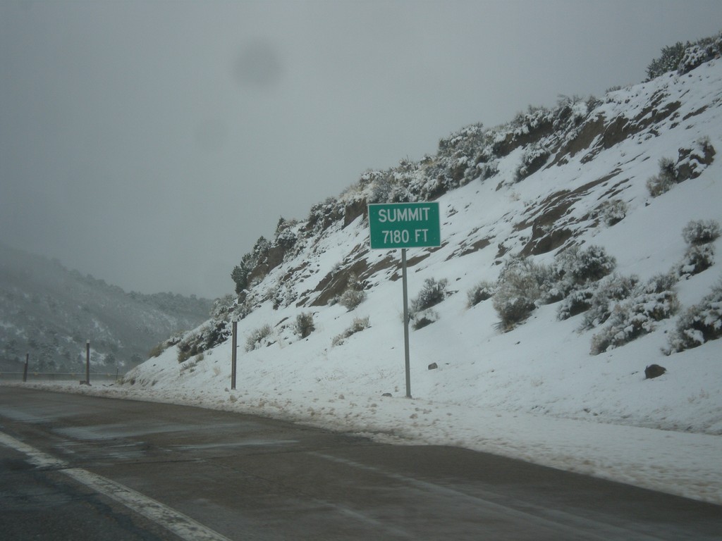
I-70 West - Summit
Summit Elevation 7180 Feet on I-70 west. This is the summit of the Pavant Range.
Taken 03-31-2017
 Sevier
 County
Utah
United States
Sevier
Sevier County
Utah
United States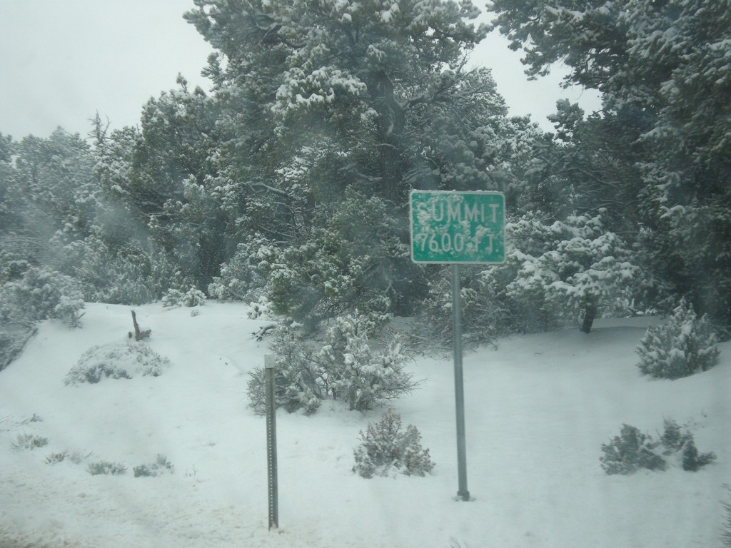
UT-12 West - Summit
Summit - Elevation 7600 Feet on UT-12 west in the Dixie National Forest.
Taken 03-31-2017
 Henrieville
Garfield County
Utah
United States
Henrieville
Garfield County
Utah
United States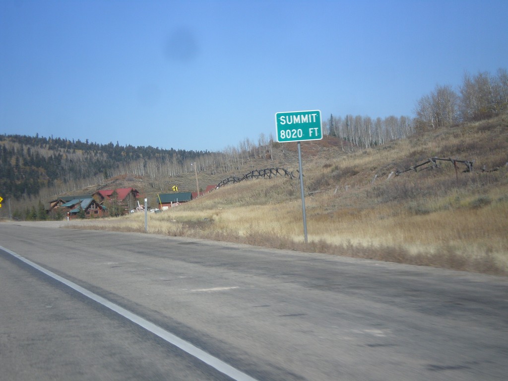
US-40 West - Daniels Summit
Daniels Summit - Elevation 8020 Feet on US-40 west.
Taken 10-09-2016
 Wallsburg
Wasatch County
Utah
United States
Wallsburg
Wasatch County
Utah
United States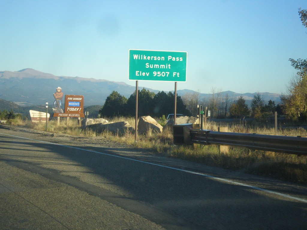
US-24 East - Wilkerson Pass
US-24 East at Wilkerson Pass Summit - Elevation 9507 Feet.
Taken 10-07-2016
 Lake George
Park County
Colorado
United States
Lake George
Park County
Colorado
United States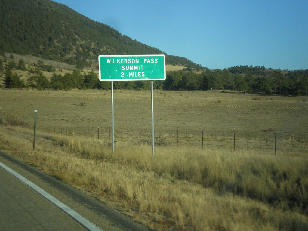
US-24 East - Wilkerson Pass 2 Miles
US-24 East begin climb of Wilkerson Pass. Wilkerson Pass Summit - 2 Miles.
Taken 10-07-2016
Hartsel
Park County
Colorado
United States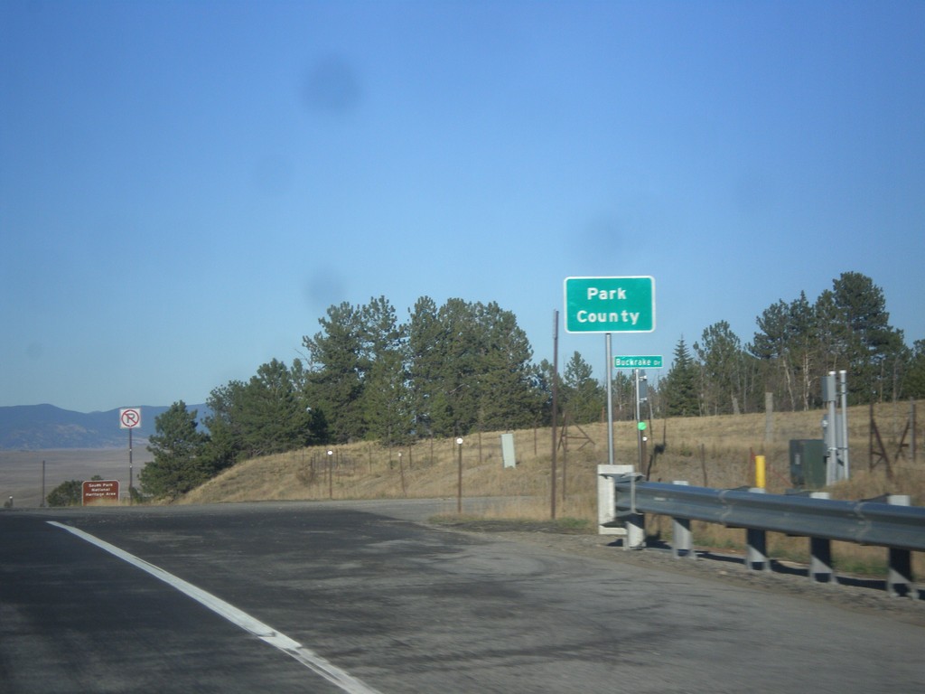
US-24 East/US-285 North - Park County
Entering Park County on US-24 East/US-285 North at Trout Creek Pass - 9,487 Feet.
Taken 10-07-2016
 Hartsel
Park County
Colorado
United States
Hartsel
Park County
Colorado
United States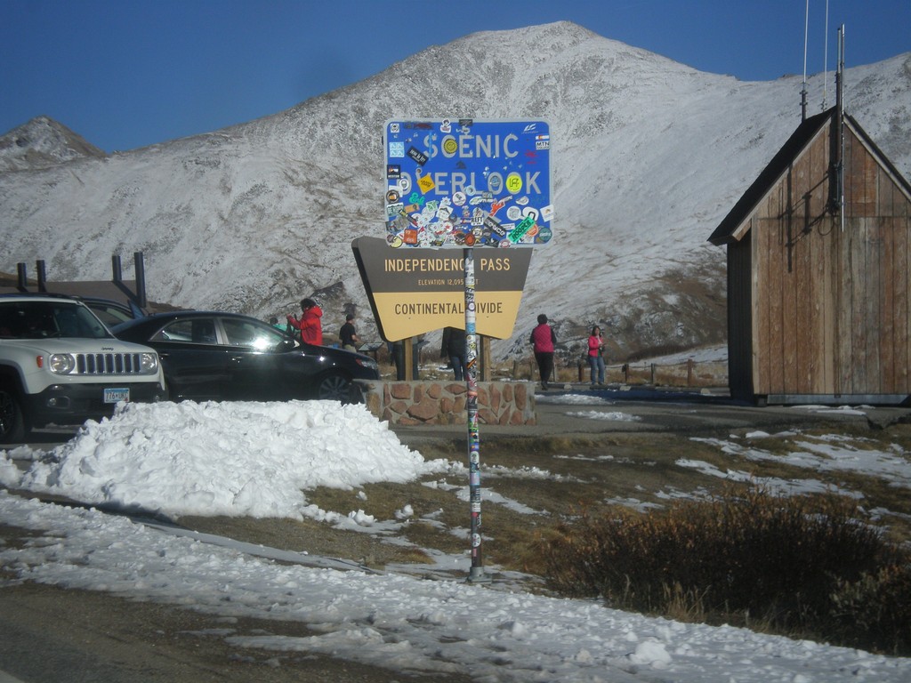
CO-82 East - Independence Pass
Independence Pass on CO-82 east. Independence Pass is 12,095 Feet and on the Continental Divide. Independence Pass is one of the highest mountain passes in Colorado on the state highway system. The only higher pass on the state highway system is US-34 in Rocky Mountain National Park. Independence Pass divides the Arkansas River watershed which flows into the Gulf of Mexico; and the Roaring Fork River which flows into the Colorado River and the Gulf of California.
Taken 10-07-2016
 Pitkin County
Colorado
United States
Pitkin County
Colorado
United States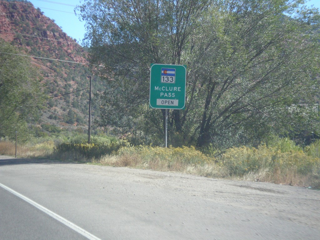
CO-82 East - McClure Pass Status
CO-82 East - CO-133/McClure Pass Status. McClure Pass is located on CO-133 between Redstone and Paonia.
Taken 10-07-2016
 Glenwood Springs
Garfield County
Colorado
United States
Glenwood Springs
Garfield County
Colorado
United States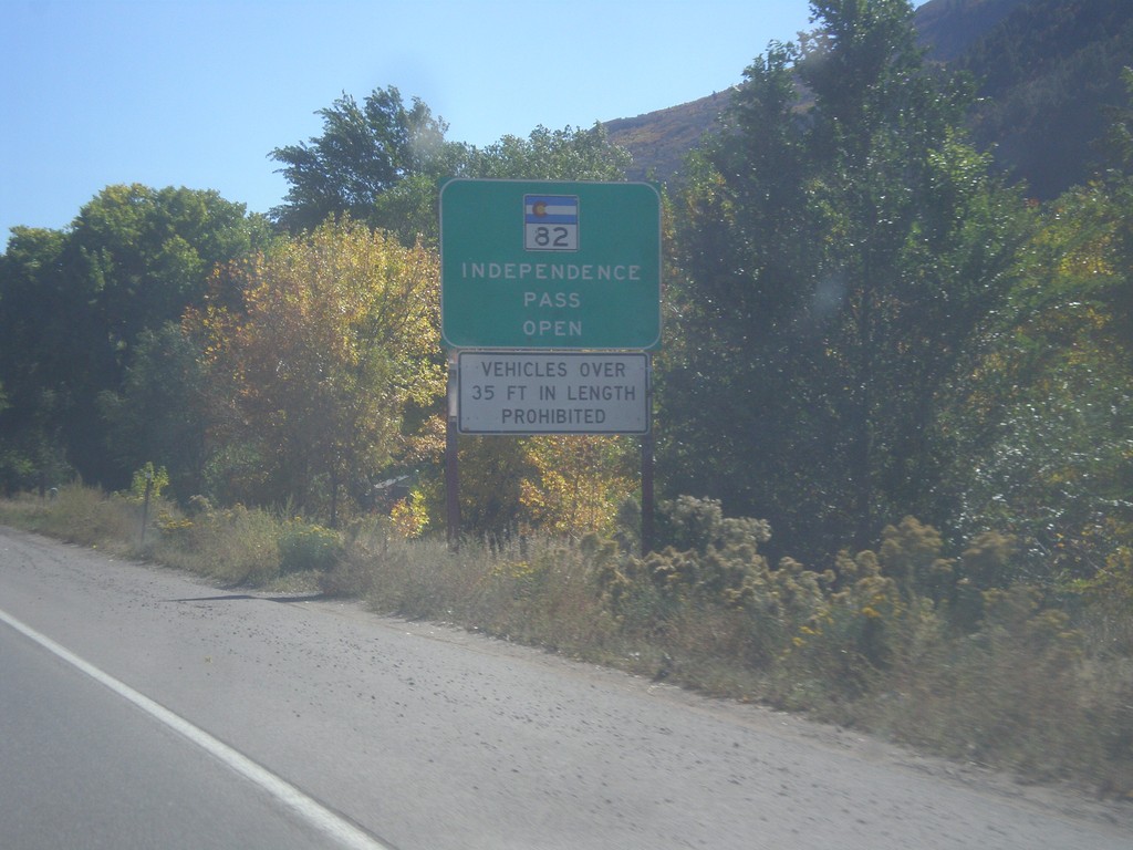
CO-82 East - Independence Pass Status
Independence Pass Status on CO-82 east leaving Glenwood Springs. Typically Independence Pass, just east of Aspen closes between November and May. Independence Pass is one of the highest highway passes in Colorado.
Taken 10-07-2016
Glenwood Springs
Garfield County
Colorado
United States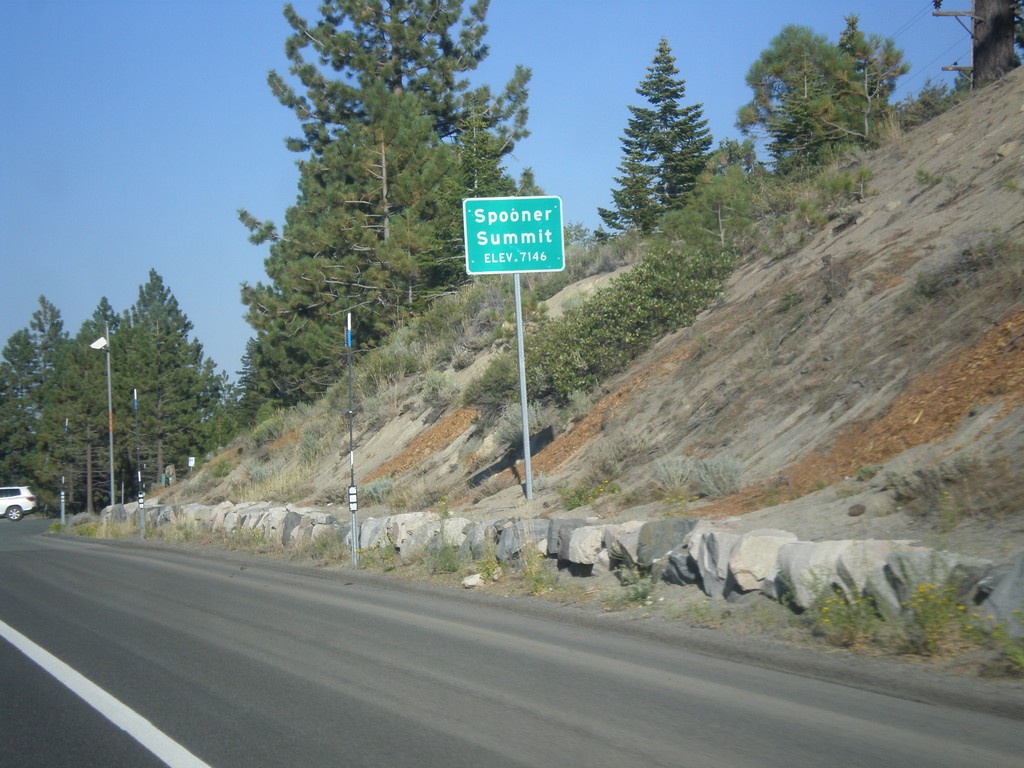
US-50 East - Spooner Summit
Spooner Summit on US-50 east - Elevation 7146 Feet. Spooner Summit is a pass through the Carson Range.
Taken 08-15-2016
 Carson City
Douglas County
Nevada
United States
Carson City
Douglas County
Nevada
United States