Signs Tagged With Summit
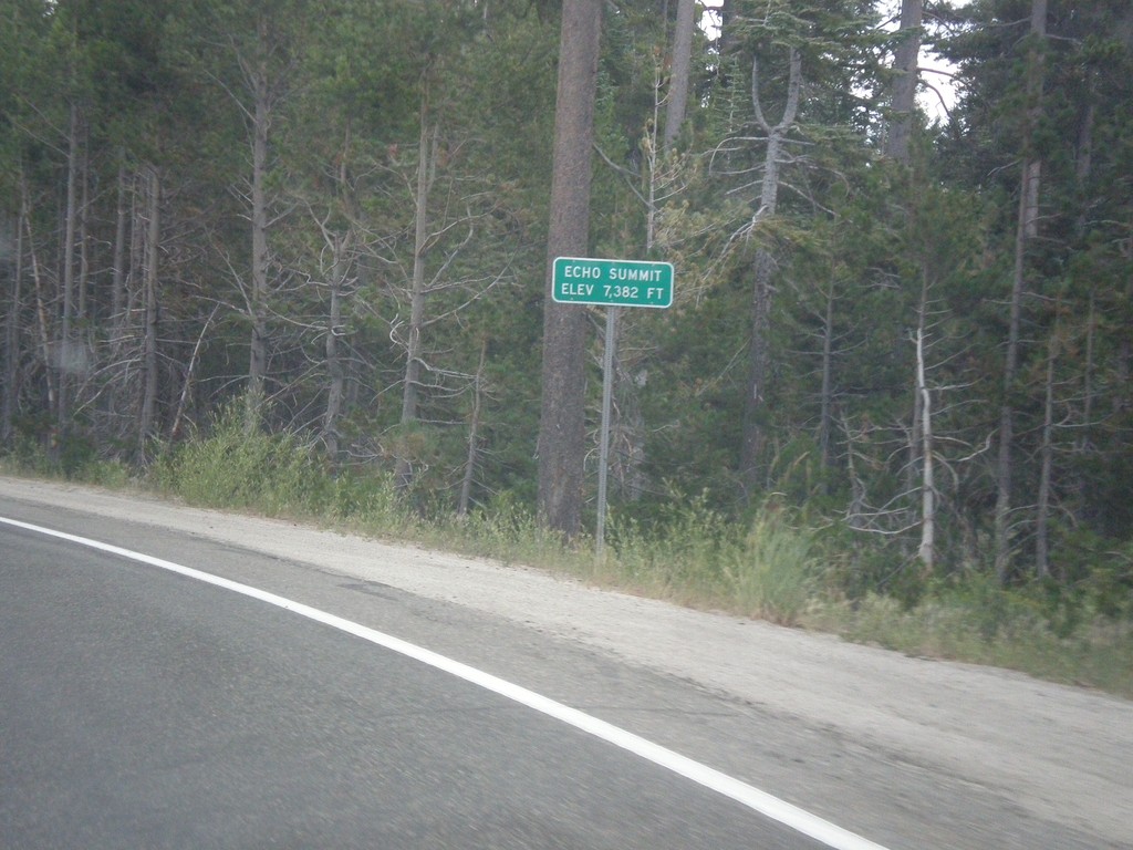
US-50 East - Echo Summit
US-50 each at Echo Summit -Elevation 7382 Feet. This is the summit of the Sierra Nevada on US-50 and the divide between the American River drainage and Lake Tahoe, which drains to the Truckee River.
Taken 08-15-2016
 Nebelhorn
El Dorado County
California
United States
Nebelhorn
El Dorado County
California
United States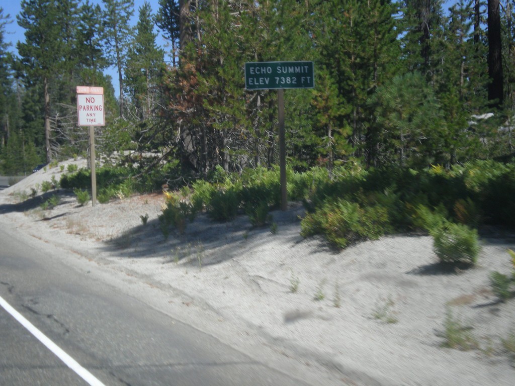
US-50 West - Echo Summit
US-50 west at Echo Summit -Elevation 7382 Feet. This is the summit of the Sierra Nevada on US-50 and the divide between the American River drainage and Lake Tahoe, which drains to the Truckee River.
Taken 08-12-2016
Nebelhorn
El Dorado County
California
United States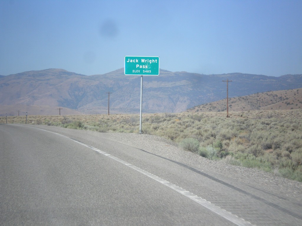
NV-208 West - Jack Wright Pass
Jack Wright Pass - Elevation 5484 Feet.
Taken 08-12-2016
 Smith Valley
Lyon County
Nevada
United States
Smith Valley
Lyon County
Nevada
United States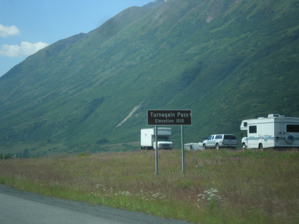
AK-1 South - Turnagain Pass
AK-1 south (Seward Highway) at Turnagain Pass - Elevation 1015 Feet. Turnagain Pass is the highest point on the Seward Highway.
Taken 07-16-2016
 Moose Pass
Kenai Peninsula Borough
Alaska
United States
Moose Pass
Kenai Peninsula Borough
Alaska
United States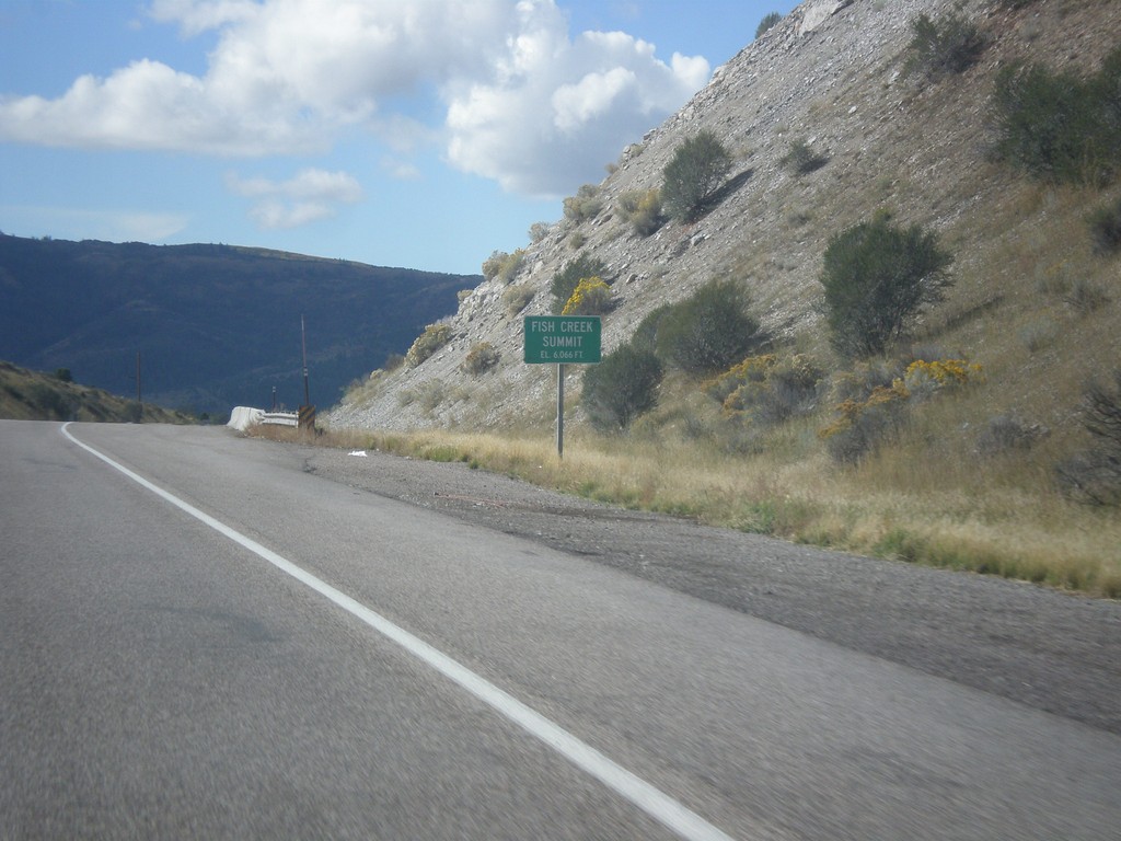
US-30 West - Fish Creek Summit
US-30 west at Fish Creek Summit.
Taken 10-04-2015
 Bancroft
Caribou County
Idaho
United States
Bancroft
Caribou County
Idaho
United States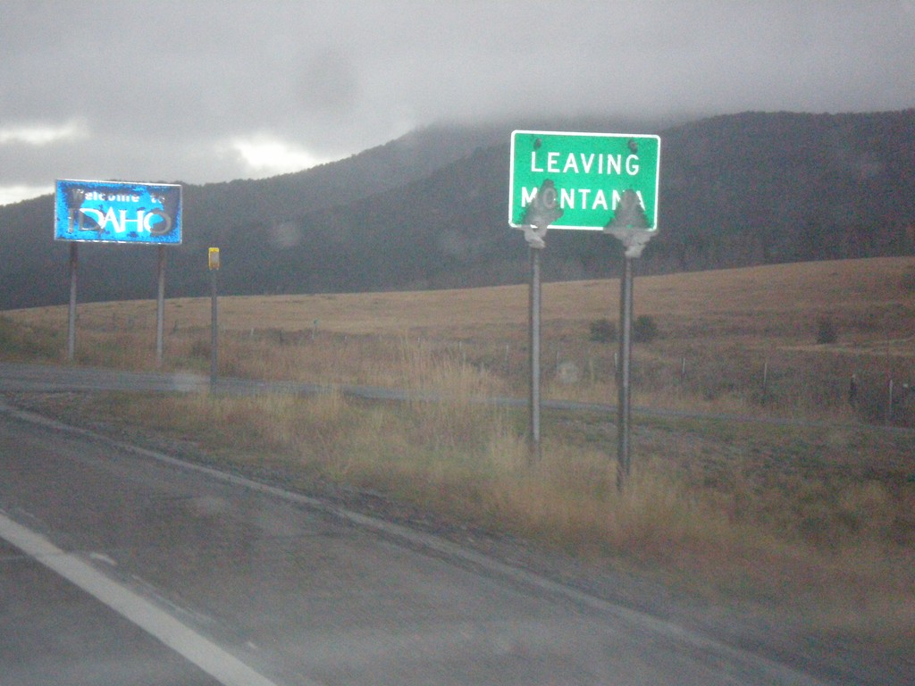
MT-87 South - Raynolds Pass
MT-87 at Raynolds Pass - Leaving Montana. The Idaho welcome sign is in the background. An early season snow storm had just passed through the area, leaving wet snow on all of the signs.
Taken 10-03-2015
 Madison County
Montana
United States
Madison County
Montana
United States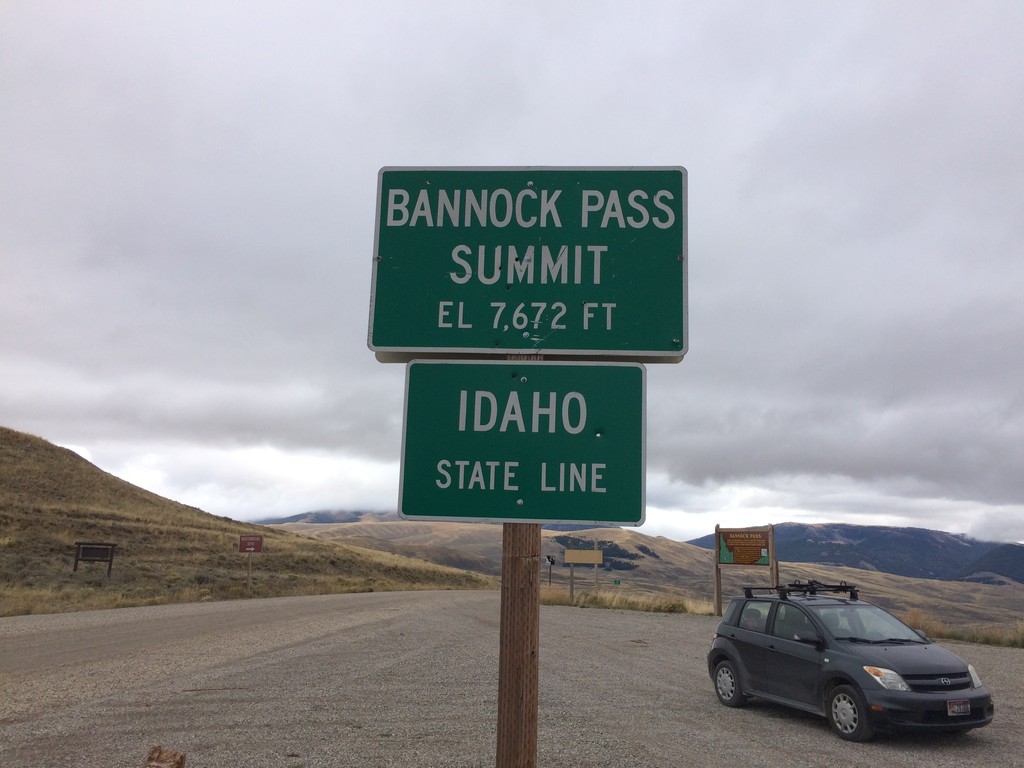
ID-29 West - Bannock Pass - Idaho State Line
Idaho State Line on ID-29 west at Bannock Pass - Elevation 7672 Feet. Bannock Pass is on the Continental Divide located on the Idaho-Montana border.
Taken 10-03-2015
 Leadore
Lemhi County
Idaho
United States
Leadore
Lemhi County
Idaho
United States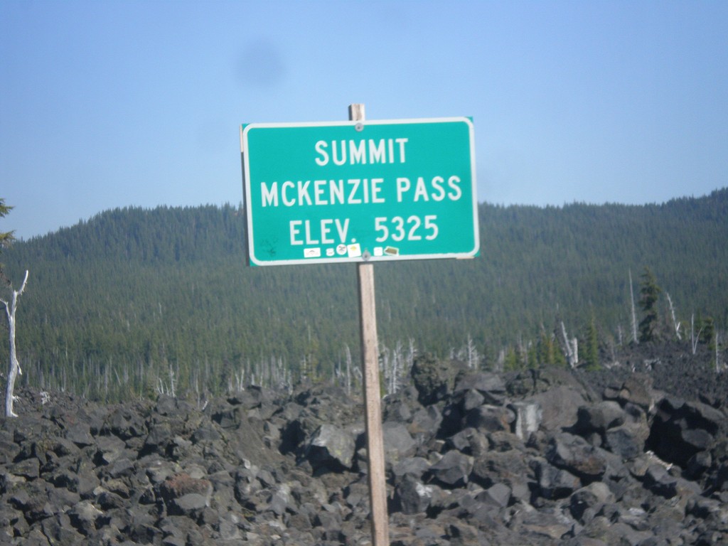
OR-242 East - McKenzie Pass
OR-242 East - McKenzie Pass - Elevation 5325 Feet. McKenzie Pass is closed during the winter months, and is also closed year round to long vehicles. The top of the pass is a lava field, with great views of the area volcanos.
Taken 08-22-2015
 Linn County
Oregon
United States
Linn County
Oregon
United States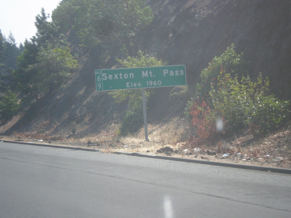
I-5 South - Sexton Mountain Summit
I-5 south at Sexton Mountain Summit - Elevation 1960 Feet. This summit is one a series of passes I-5 crosses between Canyonville and Grants Pass in the Klamath Mountains. The milepost is also attached to the main sign.
Taken 08-17-2015
 Wolf Creek
Josephine County
Oregon
United States
Wolf Creek
Josephine County
Oregon
United States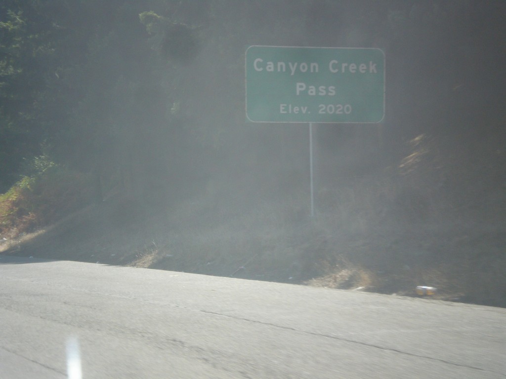
I-5 South - Canyon Creek Summit
I-5 south at Canyon Creek Summit - Elevation 2020 Feet. Canyon Creek Summit is the highest of the series of passes in the Klamath Mountains between Canyonville and Grants Pass along I-5.
Taken 08-17-2015
Glendale
Douglas County
Oregon
United States