Signs Tagged With Summit
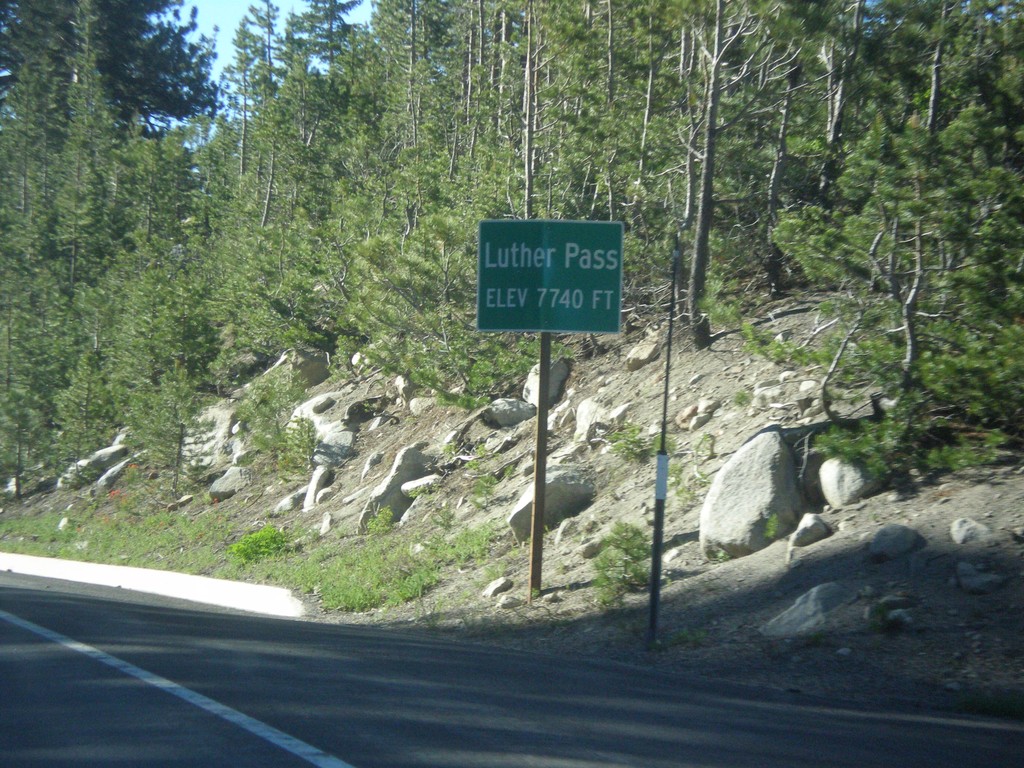
CA-89 South - Luther Pass
Luther Pass - Elevation 7740 Feet. Luther Pass is on the divide between the Lake Tahoe Basin (to the north) and the Carson River.
Taken 06-15-2015
 Mesa Vista
Alpine County
California
United States
Mesa Vista
Alpine County
California
United States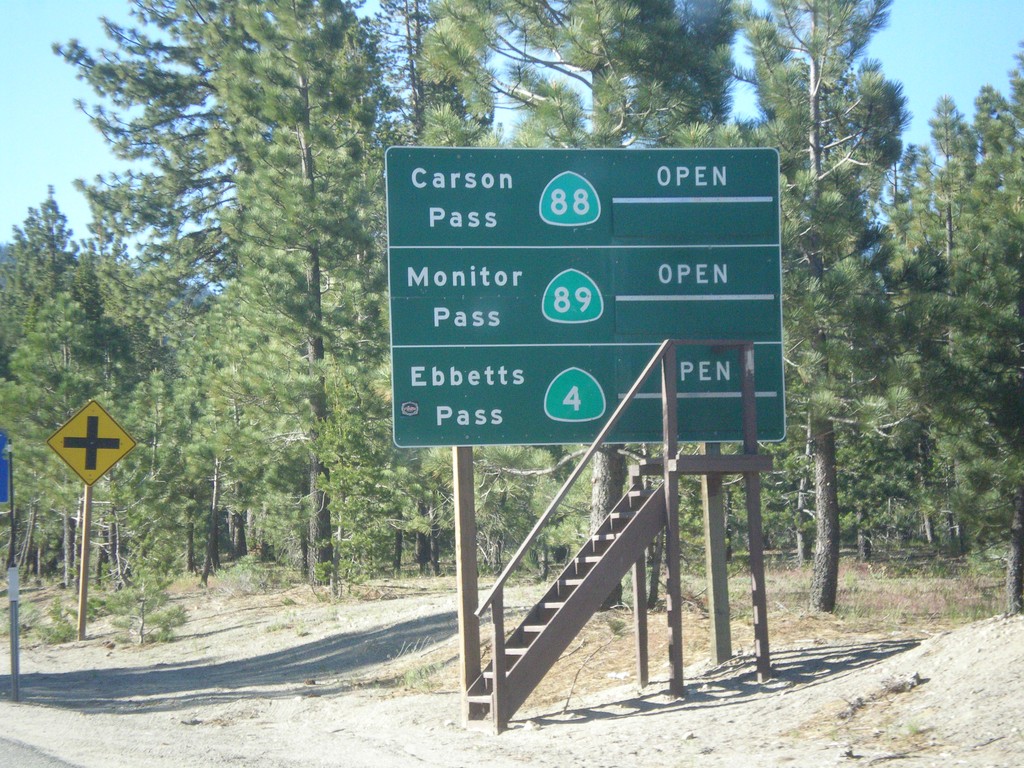
CA-89 South - Summit Information
Summit closure information on CA-89 south. Information for Ebbetts Pass (via CA-4), Monitor Pass (via CA-89) and Carson Pass (via CA-88). This photograph was taken in mid-June, and all of the passes are open. Carson Pass on CA-88 is the only pass that is typically opened year round.
Taken 06-15-2015

 South Lake Tahoe
El Dorado County
California
United States
South Lake Tahoe
El Dorado County
California
United States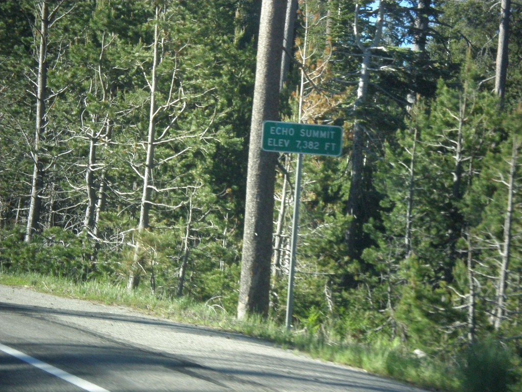
US-50 East - Echo Summit
US-50 each at Echo Summit -Elevation 7382 Feet. This is the summit of the Sierra Nevada on US-50 and the divide between the American River drainage and Lake Tahoe, which drains to the Truckee River.
Taken 06-15-2015
 Nebelhorn
El Dorado County
California
United States
Nebelhorn
El Dorado County
California
United States
I-15 South - Deer Lodge Pass
I-15 south at Deer Lodge Pass - Elevation 5902 Feet. This is the Continental Divide. Southbound traffic enters the Missouri River drainage (via the Big Hole River, and Jefferson River). Northbound traffic enters the Columbia River drainage (via the Clark Fork, and Pend Oreille River). I-15 crosses the Continental Divide three times in Montana. Once at Monida Pass at the Idaho-Montana state line. Here at Deer Lodge Pass, and north of Butte and Elk Park Pass.
Taken 05-10-2015
 Butte
Silver Bow County
Montana
United States
Butte
Silver Bow County
Montana
United States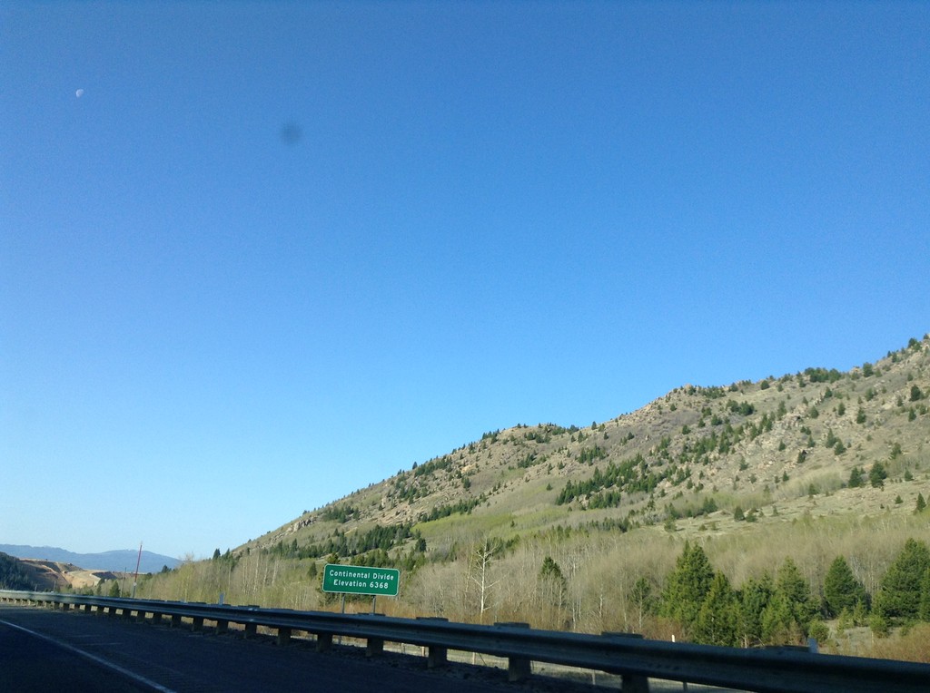
I-15 South - Elk Park Pass
I-15 south at Elk Park Pass (Continental Divide). Elevation 6368 Feet. This is also the county boundary between Silver Bow and Jefferson County.
Taken 05-10-2015
Woodville
Jefferson County
Montana
United States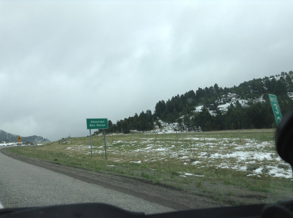
I-90 East - Bozeman Pass
I-90 east at Bozeman Pass. Bozeman Pass is part of the Absaroka Mountain Range. These type of signs are common across Montana, giving name to the many mountain ranges in the state.
Taken 05-08-2015

 Muir
Park County
Montana
United States
Muir
Park County
Montana
United States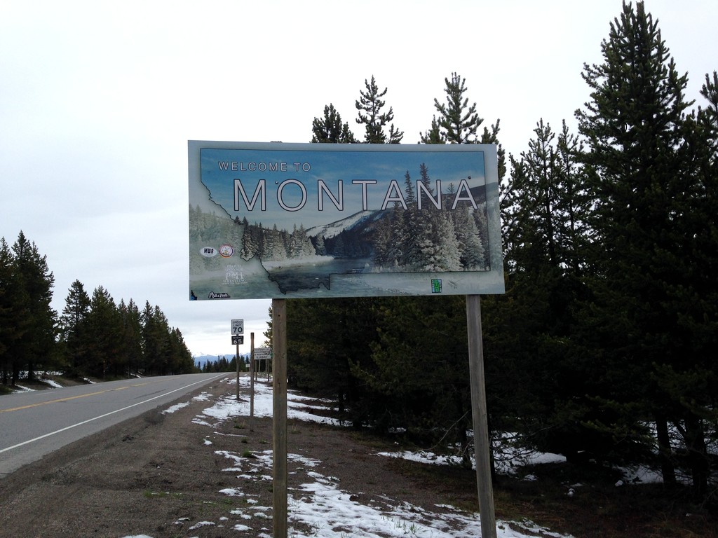
US-20 East - Welcome To Montana
Welcome to Montana on US-20 East at Targhee Pass. Targhee Pass is on the Continental Divide. This style of Montana welcome sign is fairly recent. Previous welcome signs were blue, and were cut-out in the state outline.
Taken 05-08-2015
 West Yellowstone
Gallatin County
Montana
United States
West Yellowstone
Gallatin County
Montana
United States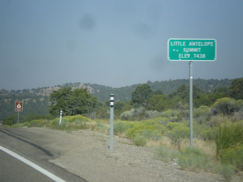
US-50 West - Little Antelope Summit
US-50 west at Little Antelope Summit - Elevation 7,438 Feet. Little Antelope Summit is in the Pine Range.
Taken 08-31-2014
White Pine County
Nevada
United States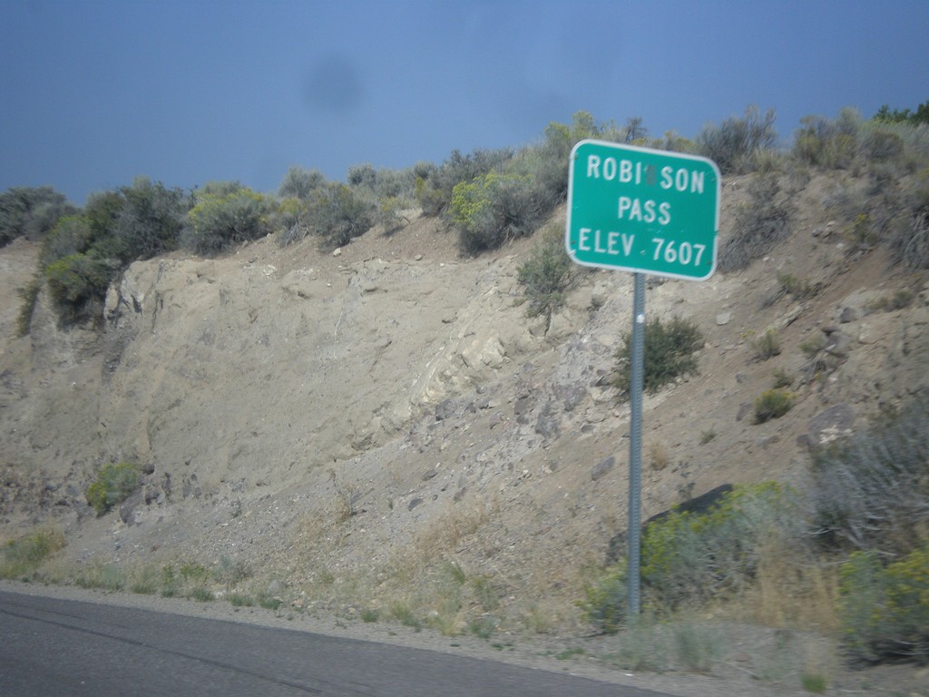
US-50 West - Robinson Summit
US-50 west at Robinson Pass - Elevation 7,607 Feet. Robinson Pass is in the Egan Range.
Taken 08-31-2014
Ely
White Pine County
Nevada
United States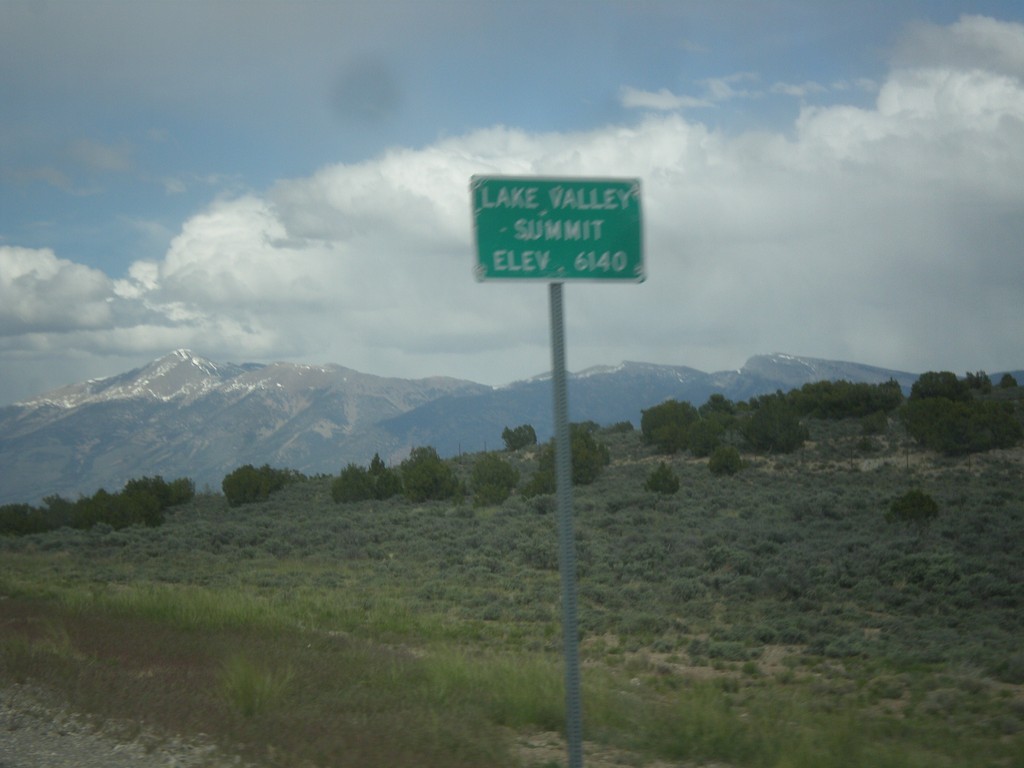
US-93 North - Lake Valley Summit
Lake Valley Summit - Elevation 6,140 Feet on US-93 north. Wheeler Peak is the mountain in the background. Wheeler Peak is the second highest mountain in Nevada and is located in Great Basin National Park.
Taken 05-21-2014
 Ely
White Pine County
Nevada
United States
Ely
White Pine County
Nevada
United States