Signs Tagged With Terminus
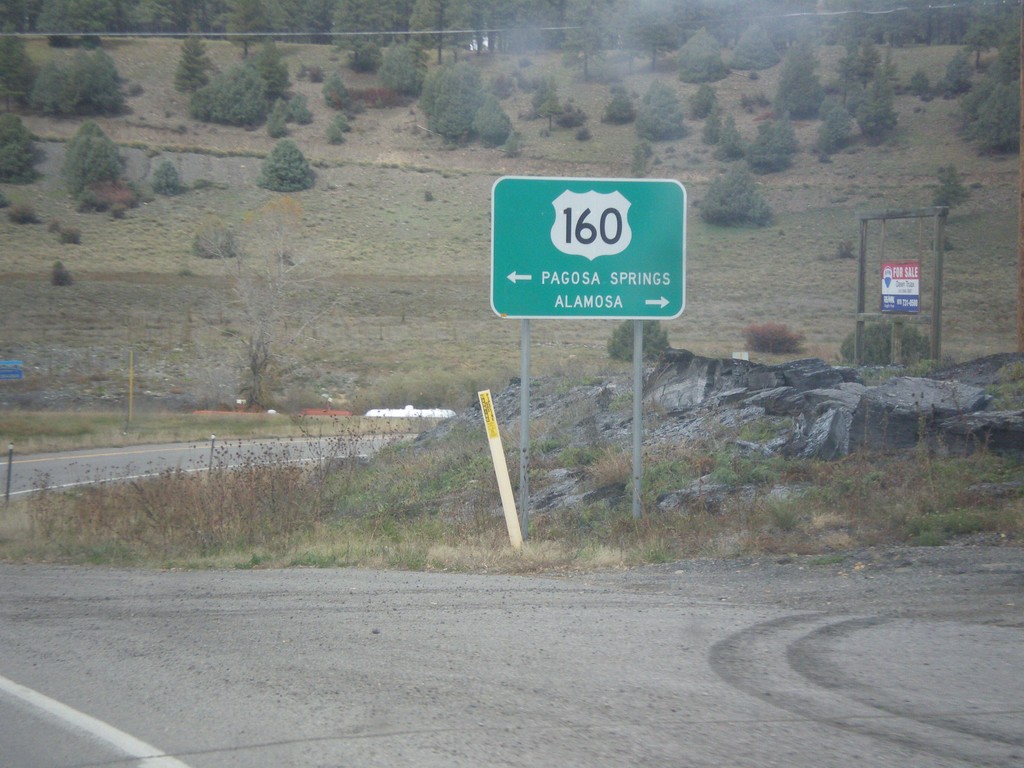
End US-84 at US-160
End US-84 at US-160 in Pagosa Springs. Turn right on US-160 east for Alamosa. Turn left on US-160 west for Pagosa Springs.
Taken 10-13-2013

 Pagosa Springs
Archuleta County
Colorado
United States
Pagosa Springs
Archuleta County
Colorado
United States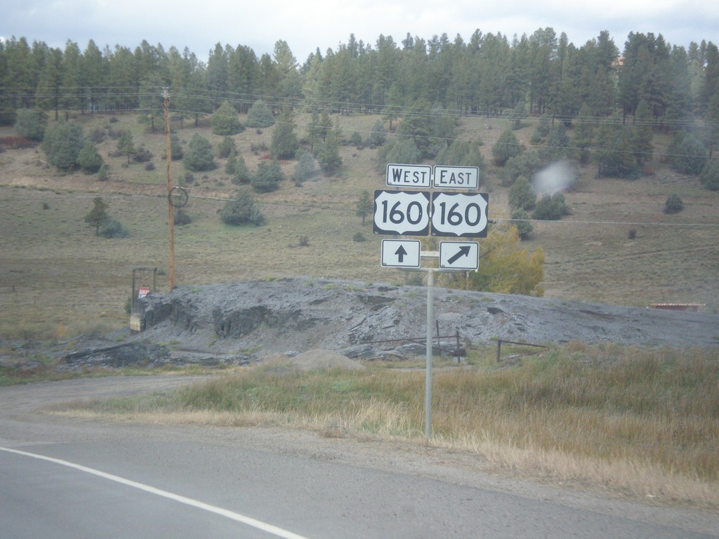
End US-84 West at US-160
End US-84 west at US-160 in Pagosa Springs. There is no END US-84 sign at this junction.
Taken 10-13-2013
Pagosa Springs
Archuleta County
Colorado
United States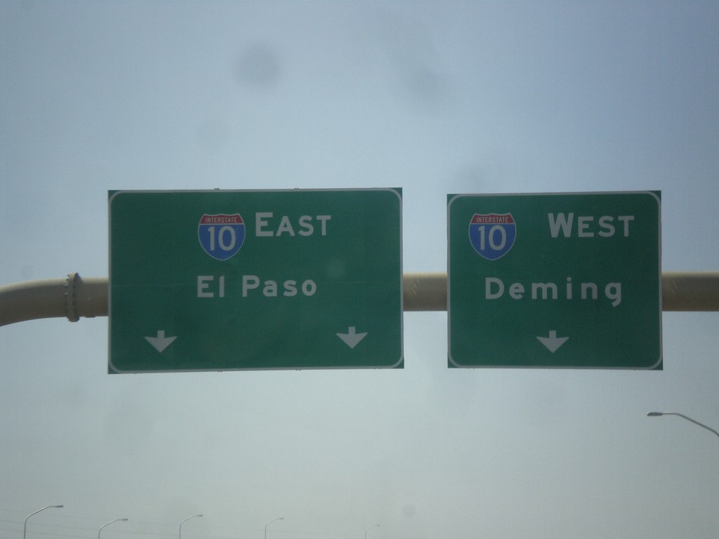
End I-25 South at I-10
End I-25 south at I-10. Merge right for I-10 west to Deming; merge left for I-10 east to El Paso.
Taken 04-15-2013

 Las Cruces
Doña Ana County
New Mexico
United States
Las Cruces
Doña Ana County
New Mexico
United States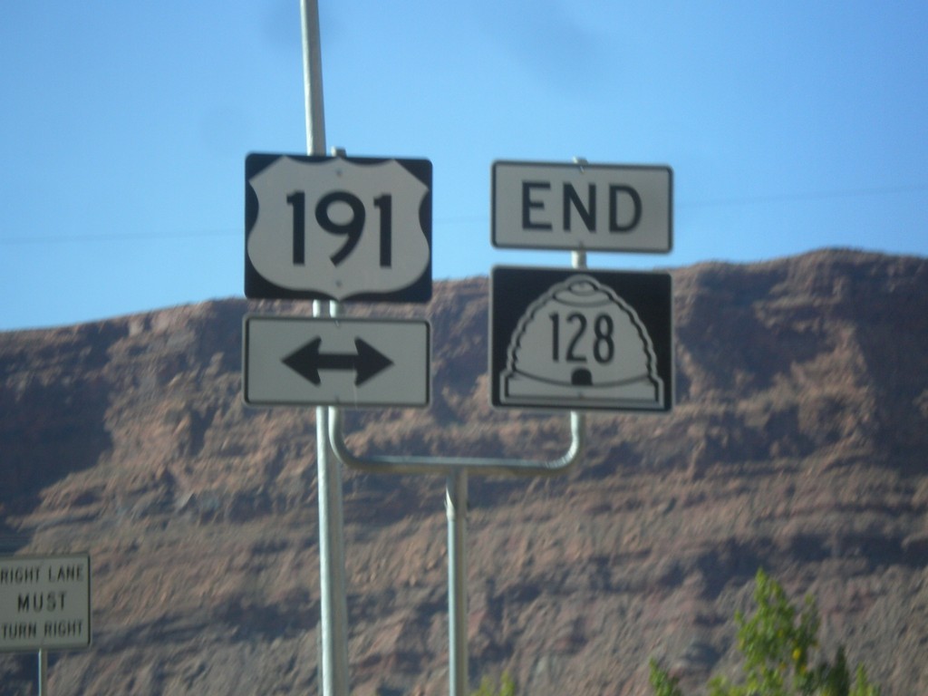
End UT-128 East at US-191
End UT-128 east at US-191 in Moab. This intersection has been replaced with a stoplight in recent years. UT-128 follows the south side of the Colorado River east from Moab towards Colorado.
Taken 10-17-2012

 Moab
Grand County
Utah
United States
Moab
Grand County
Utah
United States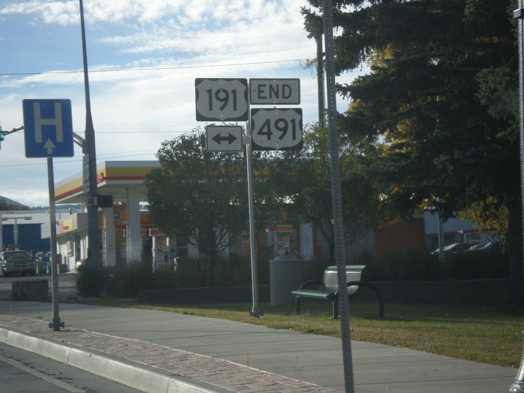
End US-491 North at US-191
End US-491 north at US-191 in Monticello. US-491 is former highway US-666, and runs from Gallup, New Mexico to Monticello, Utah. This is the northern terminus of US-491.
Taken 10-15-2012
 Monticello
San Juan County
Utah
United States
Monticello
San Juan County
Utah
United States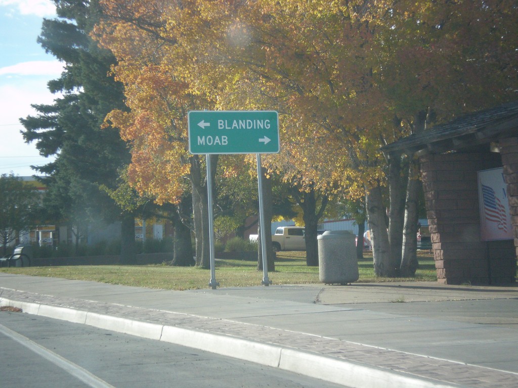
End US-491 at US-191
End US-491 at US-191. Use US-191 north for Moab; US-191 south for Blanding.
Taken 10-15-2012
Monticello
San Juan County
Utah
United States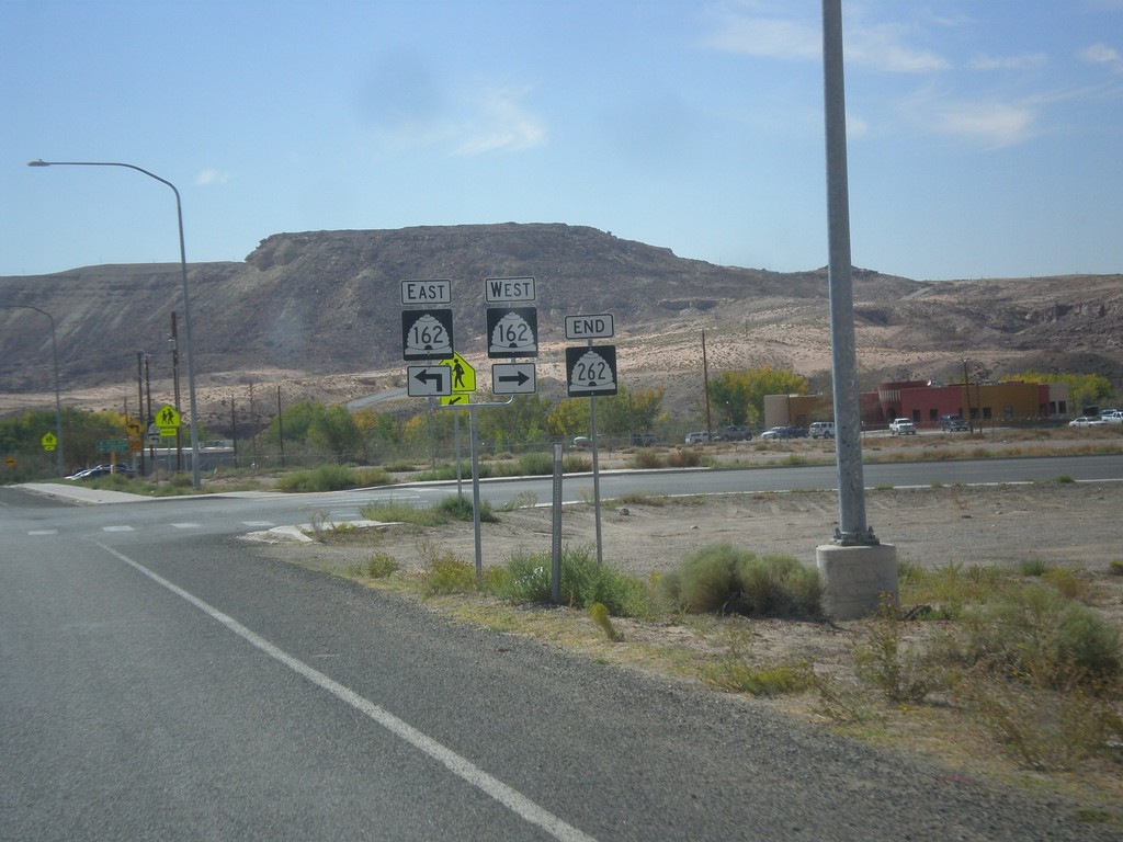
End UT-262 at UT-162
End UT-262 at UT-162. Turn right for UT-162 west; continue ahead for UT-162 east.
Taken 10-10-2012

 Montezuma Creek
San Juan County
Utah
United States
Montezuma Creek
San Juan County
Utah
United States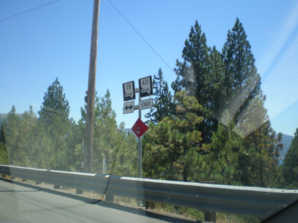
End NV-431 West at NV-28
End NV-431 West at NV-28 in Incline Village.
Taken 07-28-2012

 Incline Village
Washoe County
Nevada
United States
Incline Village
Washoe County
Nevada
United States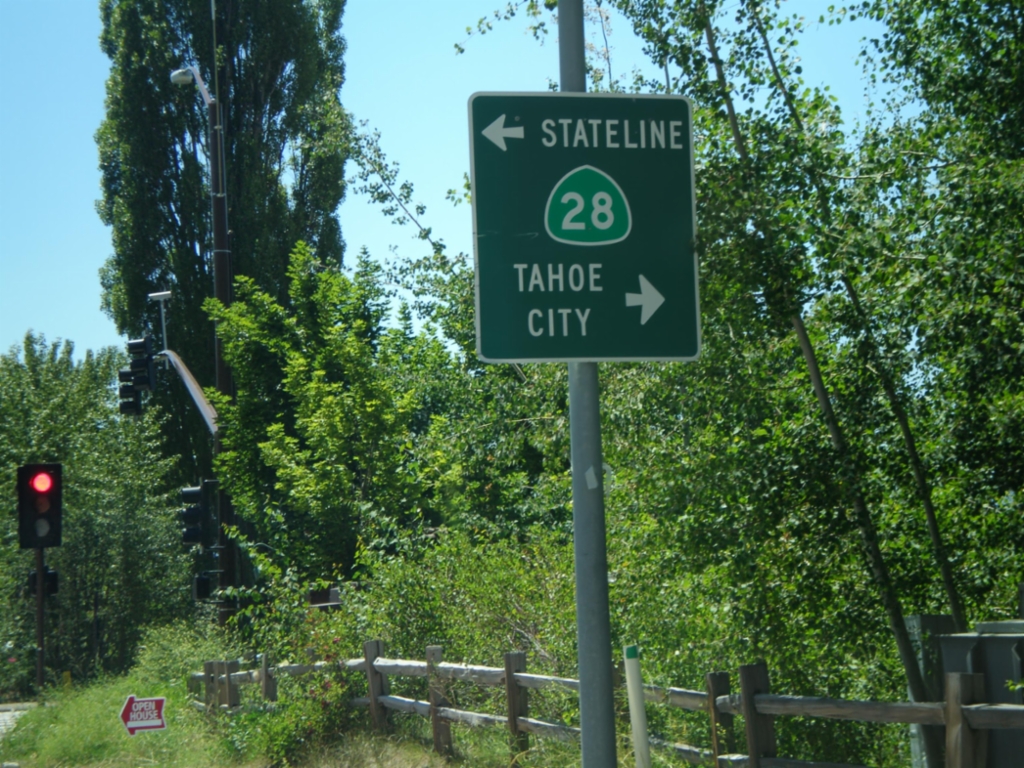
End CA-267 South at CA-28
End CA-267 south at CA-28 in Kings Beach. Turn right for CA-28 west to Tahoe City; turn left for CA-28 east to Stateline.
Taken 07-28-2012

 Kings Beach
Placer County
California
United States
Kings Beach
Placer County
California
United States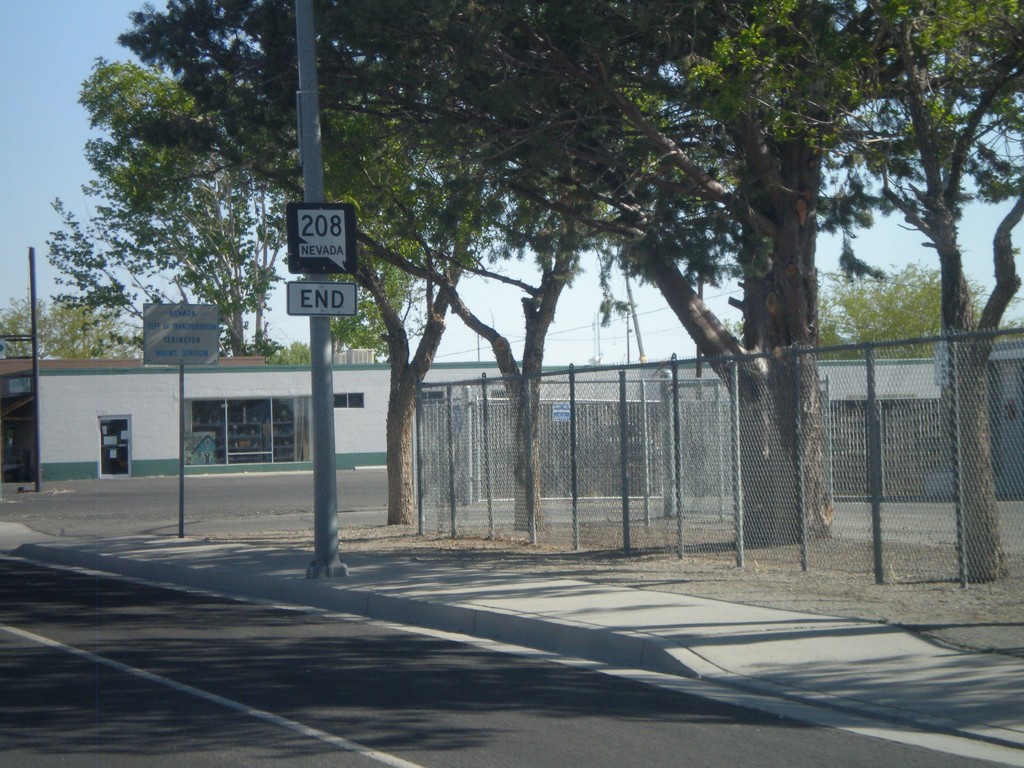
End NV-208 North
End NV-208 north at Alt. US-95 junction in Yerrington.
Taken 05-07-2012

 Yerington
Lyon County
Nevada
United States
Yerington
Lyon County
Nevada
United States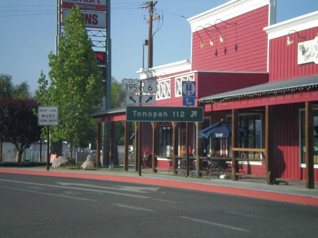
US-395 North at US-6
US-395 north at US-6 in Bishop. Use US-6 east for Tonopah (Nevada). This is the western terminus of US-6. The eastern end of US-6 is Provincetown, MA.
Taken 05-06-2012

 Bishop
Inyo County
California
United States
Bishop
Inyo County
California
United States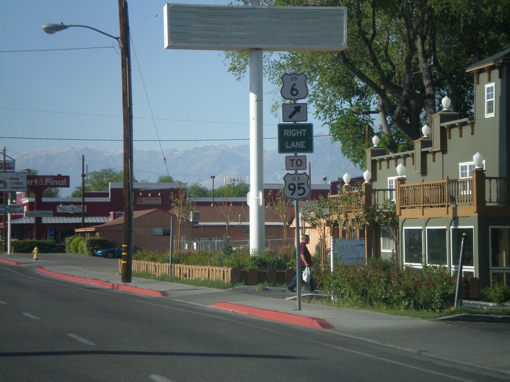
US-395 North Approaching US-6
US-395 north approaching US-6 in Bishop. Use US-6 east for US-95. This is the western terminus of US-6.
Taken 05-06-2012
 Bishop
Inyo County
California
United States
Bishop
Inyo County
California
United States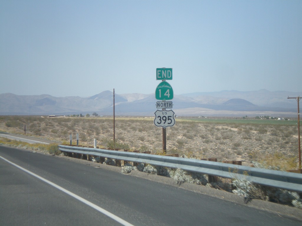
End CA-14 North at US-395
End CA-14 north at US-395. CA-14 starts in Los Angeles, and runs 116 miles to US-395 in Kern County.
Taken 05-06-2012
 Inyokern
Kern County
California
United States
Inyokern
Kern County
California
United States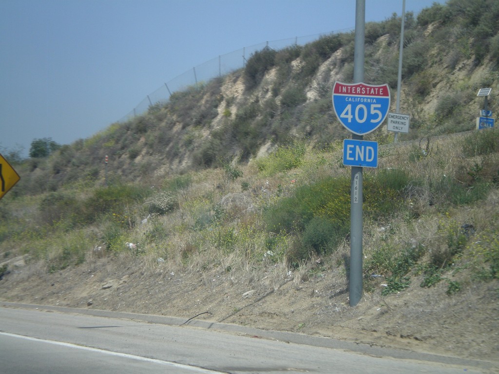
End I-405 North at I-5
End I-405 north at I-5 junction in the San Fernando Valley.
Taken 05-06-2012

 Los Angeles
 County
California
United States
Los Angeles
Los Angeles County
California
United States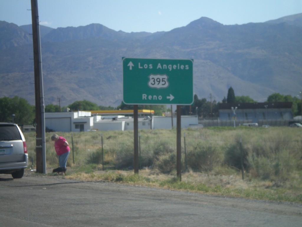
US-6 West Approaching US-395
Approaching western end of US-6 at US-395 junction. Turn right for US-395 north towards Reno (Nevada). Continue ahead for US-395 south towards Los Angeles.
Taken 05-04-2012
Bishop
Inyo County
California
United States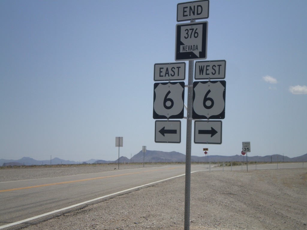
End NV-376 South at US-6
End NV-376 south at US-6.
Taken 05-04-2012
 Tonopah
Nye County
Nevada
United States
Tonopah
Nye County
Nevada
United States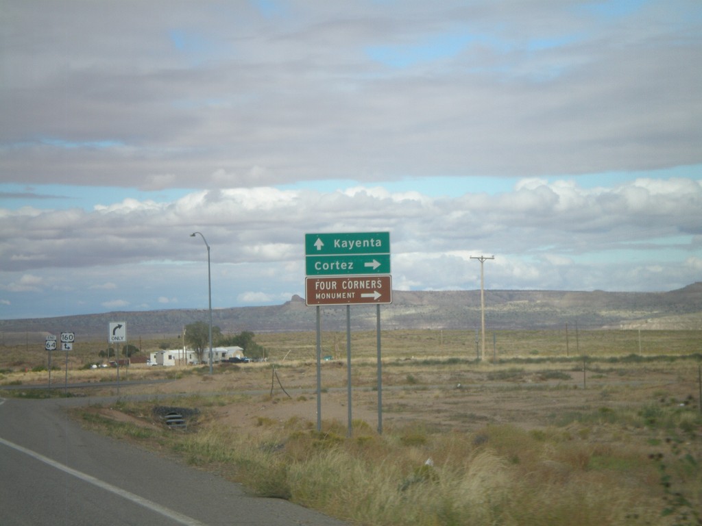
End US-64 West Approaching US-160
End US-6A4 west approaching US-160. Turn right for US-160 east to Cortez (Colorado) and Four Corners National Monument. Continue ahead for US-160 east to Kayenta.
Taken 10-08-2011
 Teec Nos Pos
Apache County
Arizona
United States
Teec Nos Pos
Apache County
Arizona
United States
US-64 West Approaching US-160
US-64 West approaching US-160. This is the western end of US-64. The eastern end of US-64 is in Nags Head, North Carolina.
Taken 10-08-2011
Teec Nos Pos
Apache County
Arizona
United States
End NM-68 South at US-285/US-84
End NM-68 South at US-84/US-285 South. Traffic for US-84/US-285 North turned right a block north of here. The traffic on the right side of the pictures is US-285/US-84 merging onto NM-68.
Taken 10-03-2011

 Española
Santa Fe County
New Mexico
United States
Española
Santa Fe County
New Mexico
United States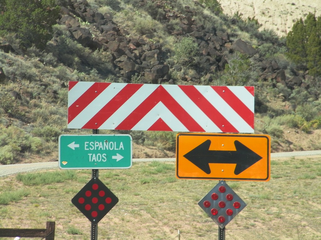
End NM-75 East at NM-68
End NM-75 east at NM-68 west near the community of Embudo. Turn right (north) on NM-68 for Taos; turn left (south) on NM-68 for Española.
Taken 10-03-2011
 Dixon
Rio Arriba County
New Mexico
United States
Dixon
Rio Arriba County
New Mexico
United States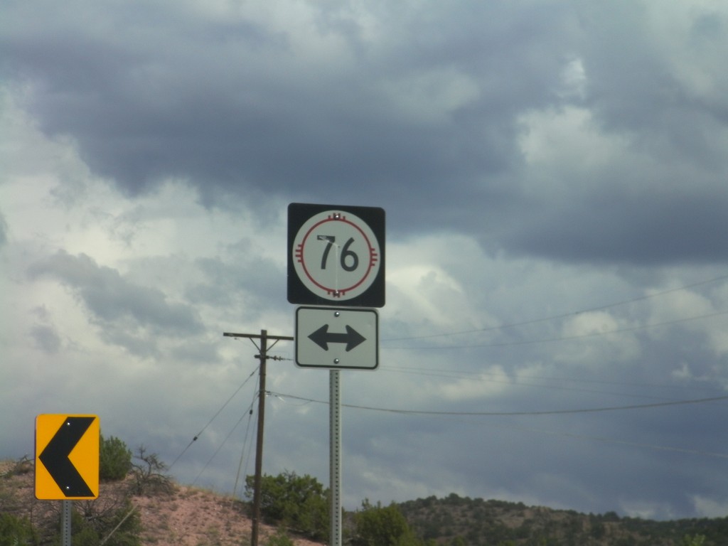
End NM-503 East at NM-76
End NM-503 East at NM-76 in rural Rio Arriba County. NM-76 is the High Road To Taos Scenic Byway.
Taken 10-03-2011

 Chimayo
Rio Arriba County
New Mexico
United States
Chimayo
Rio Arriba County
New Mexico
United States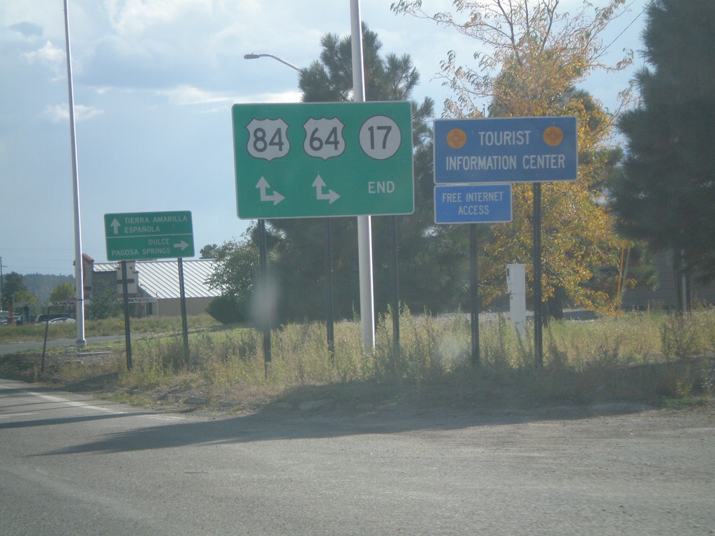
End NM-17 South at US-64/US-84
End NM-17 South at US-64/US-84 in Chama. Turn right for US-64 West/US-84 North to Dulce and Pagosa Springs (Colorado); continue ahead for US-64 East/US-84 South to Tierra Amarilla and Española.
Taken 10-02-2011
 Chama
Rio Arriba County
New Mexico
United States
Chama
Rio Arriba County
New Mexico
United States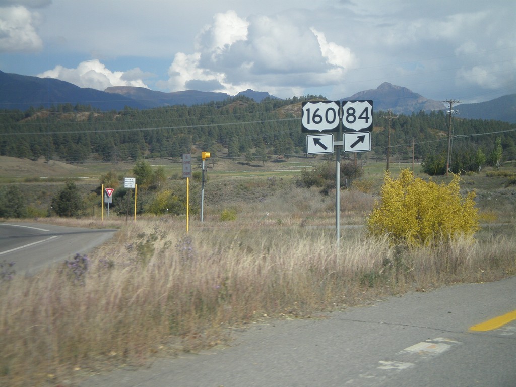
US-160 East at US-84
US-160 east at US-84 in Pagosa Springs. Merge right for US-84. This is the western terminus of US-84. The eastern end of US-84 is in Midway, Georgia.
Taken 10-02-2011
Pagosa Springs
Archuleta County
Colorado
United States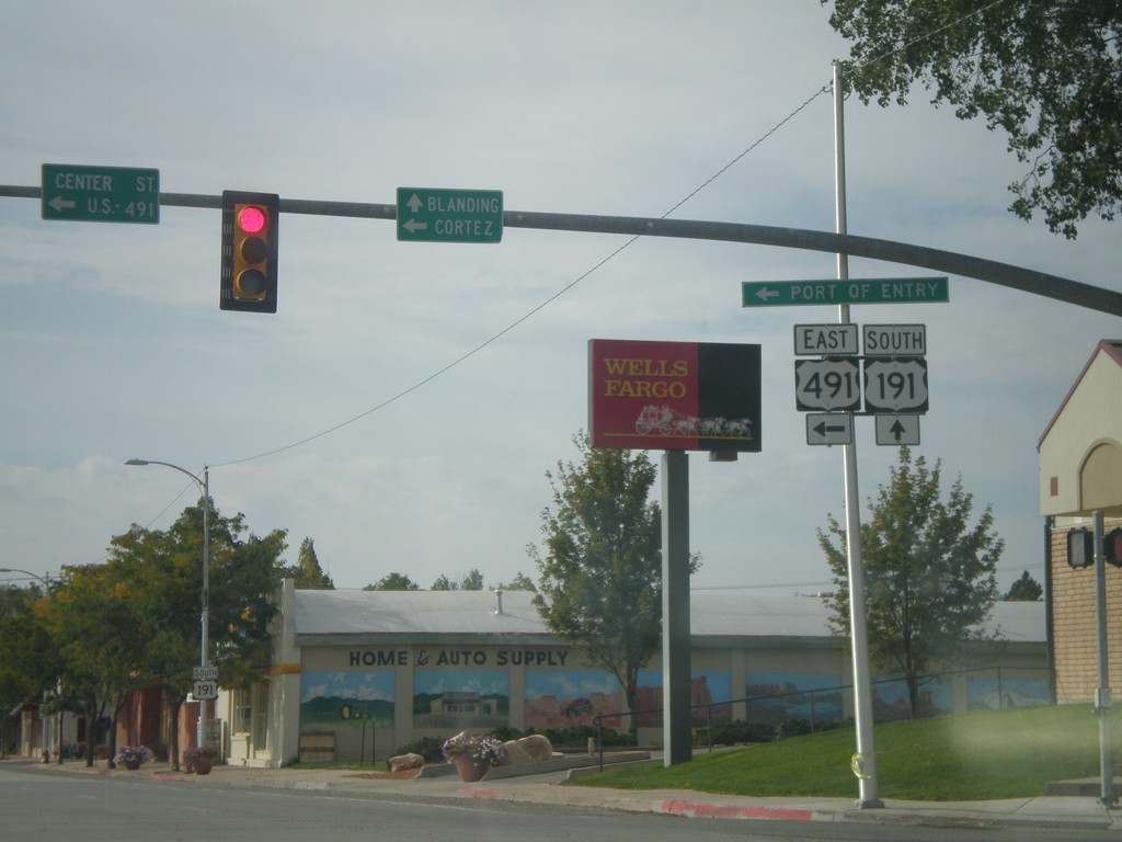
US-191 South at US-491
US-191 South at US-491. Use US-491 east for Cortez (Colorado); continue south on US-191 for Blanding. This is the northern end of US-491. Also US-491 east for the (Utah) Port of Entry.
Taken 10-02-2011
Monticello
San Juan County
Utah
United States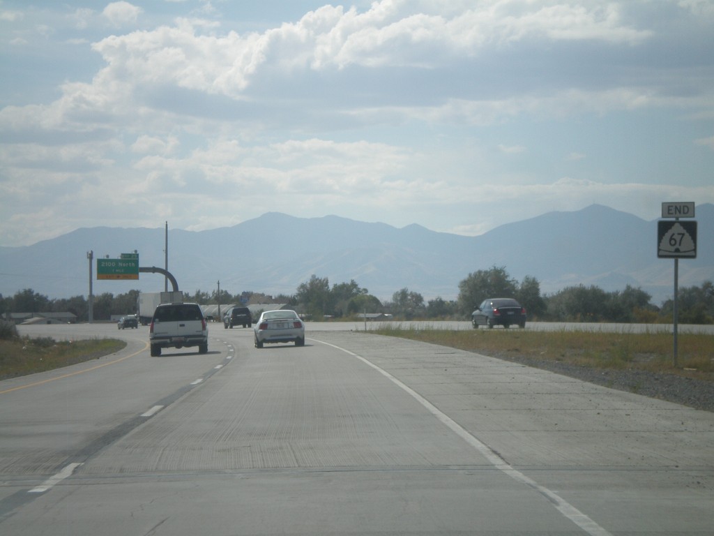
End UT-67 South
End UT-67 south at I-215. There are no ramps for UT-67 south to I-215, just a left merge lane.
Taken 10-01-2011

 North Salt Lake
Davis County
Utah
United States
North Salt Lake
Davis County
Utah
United States