Signs Tagged With Warning
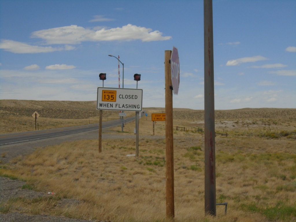
WY-135 North - Road Closed When Flashing
WY-135 North - Road Closed When Flashing at Sweetwater Junction.
Taken 08-13-2020
 Lander
Fremont County
Wyoming
United States
Lander
Fremont County
Wyoming
United States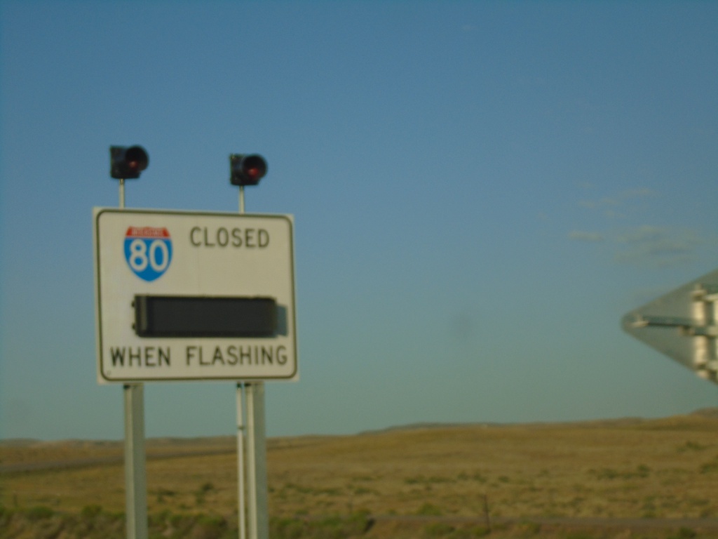
US-189 South - I-80 Closed When Flashing
I-80 Closed When Flashing on US-189 South.
Taken 07-18-2020

 Kemmerer
Lincoln County
Wyoming
United States
Kemmerer
Lincoln County
Wyoming
United States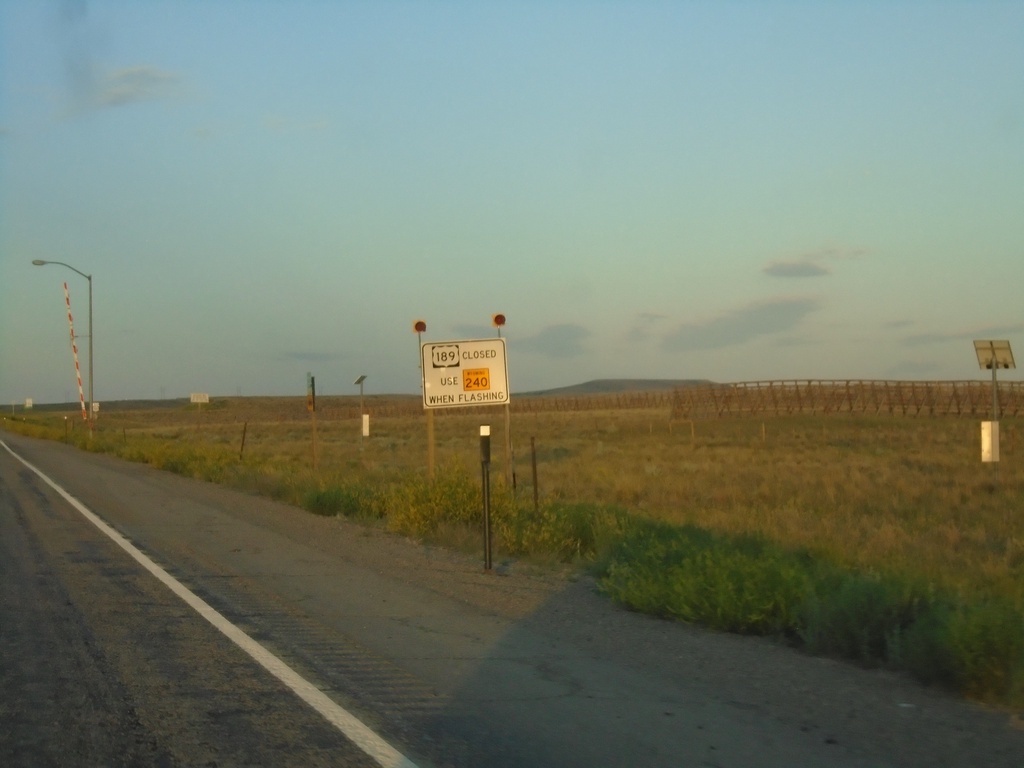
US-189 South - Road Closure Information
US-189 south approaching WY-240. When lights are flashing US-189 is closed - use WY-240.
Taken 07-18-2020
 Kemmerer
Lincoln County
Wyoming
United States
Kemmerer
Lincoln County
Wyoming
United States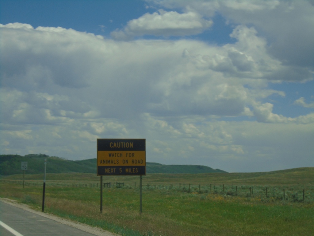
US-189 South/US-191 South - Wildlife on Roadway
Wildlife on Roadway next 5 miles on US-189/US-191 South.
Taken 07-17-2020
 Bondurant
Sublette County
Wyoming
United States
Bondurant
Sublette County
Wyoming
United States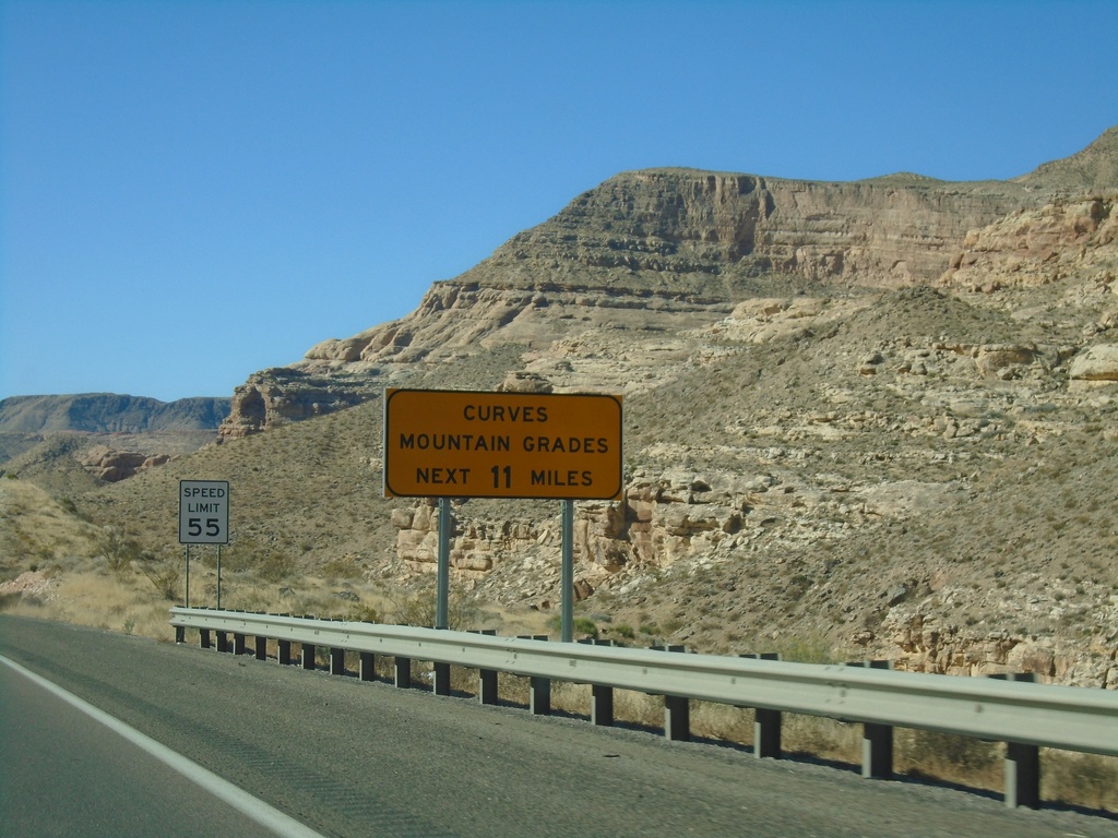
I-15 South - Curves/Mountain Grades
Entering Virgin River Gorge on I-15 south. Curves/Mountain Grades Next 11 Miles.
Taken 11-26-2019
 Littlefield
Mohave County
Arizona
United States
Littlefield
Mohave County
Arizona
United States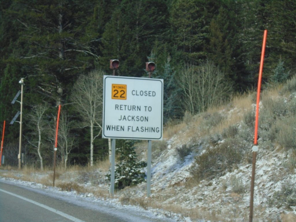
WY-22 West - Return To Jackson When Flashing
WY-22 west at the base of Teton Pass. Return to Jackson When Flashing.
Taken 10-27-2019
 Wilson
Teton County
Wyoming
United States
Wilson
Teton County
Wyoming
United States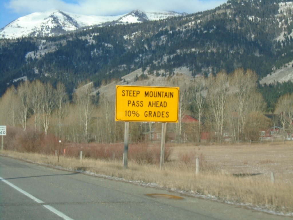
WY-22 West Approaching Teton Pass
WY-22 west approaching Teton Pass. Steep Mountain Pass Ahead - 10% Grades.
Taken 10-27-2019
Wilson
Teton County
Wyoming
United States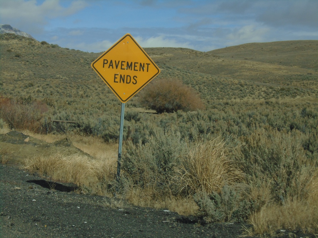
End NV-766 North
End NV-766 North. Pavement ends here and Maggie Creek Road begins.
Taken 10-20-2019
 Carlin
Eureka County
Nevada
United States
Carlin
Eureka County
Nevada
United States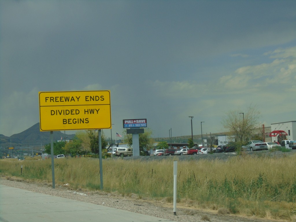
UT-201 West - End Freeway
Freeway Ends/Divided Highway Begins on UT-201 west.
Taken 08-03-2019
 Magna
Salt Lake County
Utah
United States
Magna
Salt Lake County
Utah
United States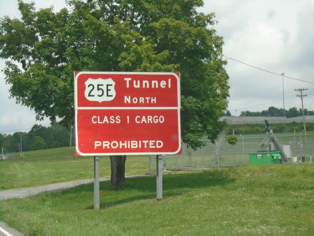
US-58 West/US-421 North - Cumberland Gap Tunnel Information
US-58 West/US-421 North - Cumberland Gap Tunnel Information. Class 1 cargo through the Cumberland Gap Tunnel on US-25E North is prohibited.
Taken 06-24-2019


 Duffield
Scott County
Virginia
United States
Duffield
Scott County
Virginia
United States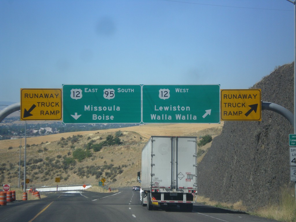
US-95 South at US-12
US-95 south at US-12 junction. Merge right for US-12 West/Lewiston/Walla Walla (Washington). Use left lane for US-95 South/US-12 East/Missoula (Montana)/Boise. Use either lane for access to Runaway Truck Ramps.
Taken 07-30-2017

 Lewiston
Nez Perce County
Idaho
United States
Lewiston
Nez Perce County
Idaho
United States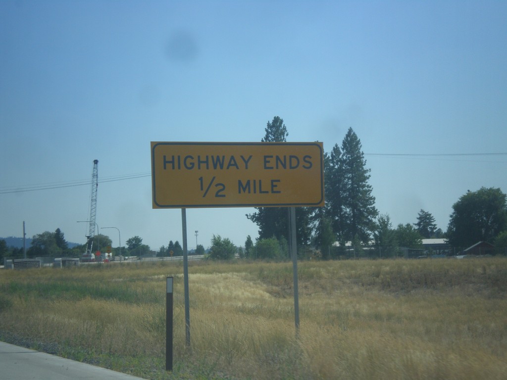
Approaching End Freeway on Future US-395 South
Highway Ends on Future US-395 South
Taken 07-29-2017

 Spokane
 County
Washington
United States
Spokane
Spokane County
Washington
United States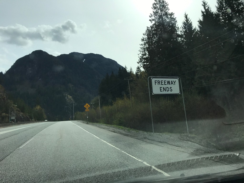
BC-3 East - Freeway Ends
Freeway Ends eastbound on BC-3 East (Crowsnest Highway). Highway begins climb towards Allison Pass. Highway remains four lanes eastbound for the next 10 km.
Taken 04-29-2017
 Hope
Fraser Valley
British Columbia
Canada
Hope
Fraser Valley
British Columbia
Canada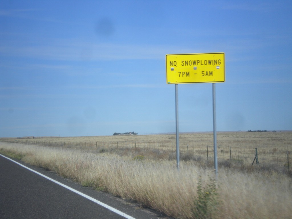
CO-71 North - Snowplow Hours
No Snowplowing on CO-71 north of Ordway between the hours of 7 PM and 5 AM.
Taken 10-08-2016
 Ordway
Crowley County
Colorado
United States
Ordway
Crowley County
Colorado
United States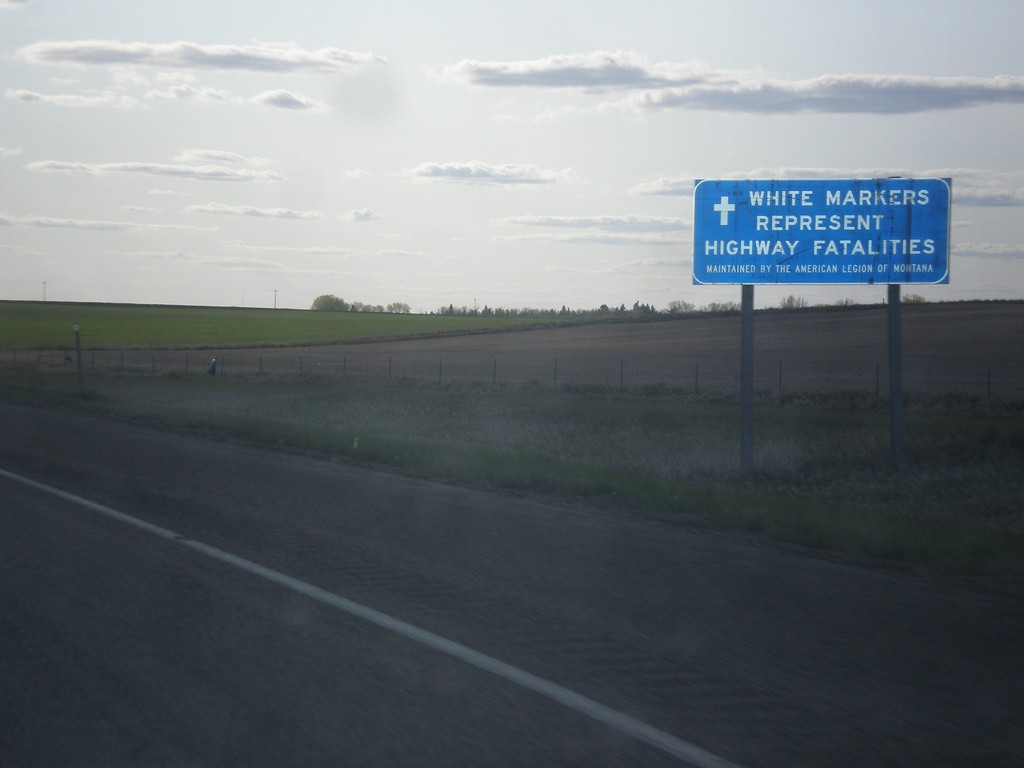
I-94 West - White Markers Represent Highway Fatalities
I-94 West - White Markers Represent Highway Fatalities. The American Legion of Montana maintains erects small white crosses along the highways of Montana where a highway fatality has occurred.
Taken 05-14-2016
 Yates
Wibaux County
Montana
United States
Yates
Wibaux County
Montana
United States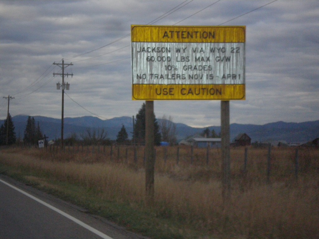
ID-33 East - Teton Pass Restrictions
Sign listing restrictions on Teton Pass in Wyoming. 60,000 lbs GVW over Teton Pass; no trailers 11-15 to 4-1. 10% grades over Teton Pass.
Taken 10-04-2015
 Tetonia
Teton County
Idaho
United States
Tetonia
Teton County
Idaho
United States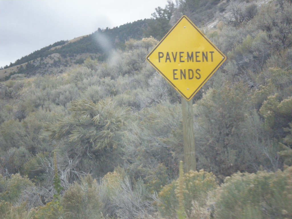
ID-29 - Pavement Ends
Pavement Ends on ID-29 east. ID-29 is one of two state highways in Idaho (the other is ID-64) that has segments that are not paved.
Taken 10-03-2015
 Leadore
Lemhi County
Idaho
United States
Leadore
Lemhi County
Idaho
United States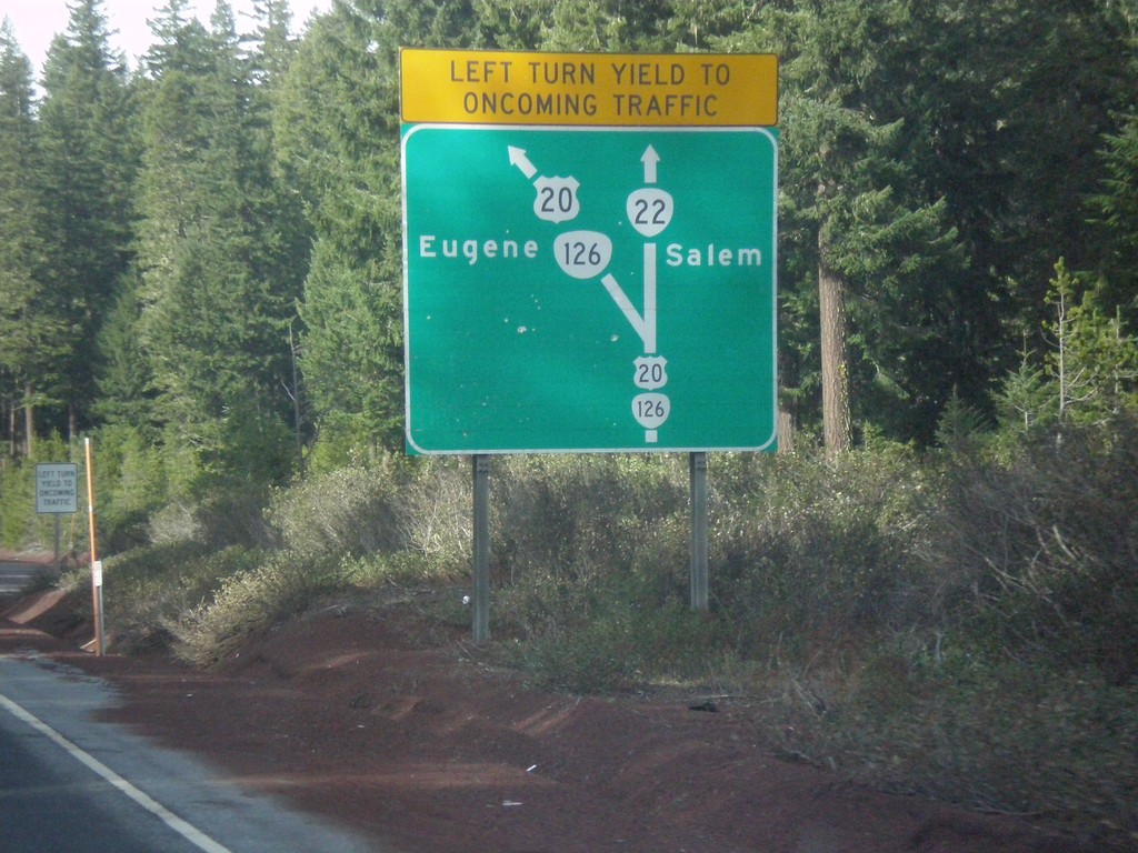
Diagram of US-20/OR-126/OR-22 Junction - US-20/OR-126 West
Map diagram of junction at US-20/OR-126/OR-22 junction on US-20/OR-126 West. Continue straight for OR-22 west to Salem; merge left to continue west on US-20/OR-126 West to Eugene.
Taken 02-13-2015


 Santiam Junction
Linn County
Oregon
United States
Santiam Junction
Linn County
Oregon
United States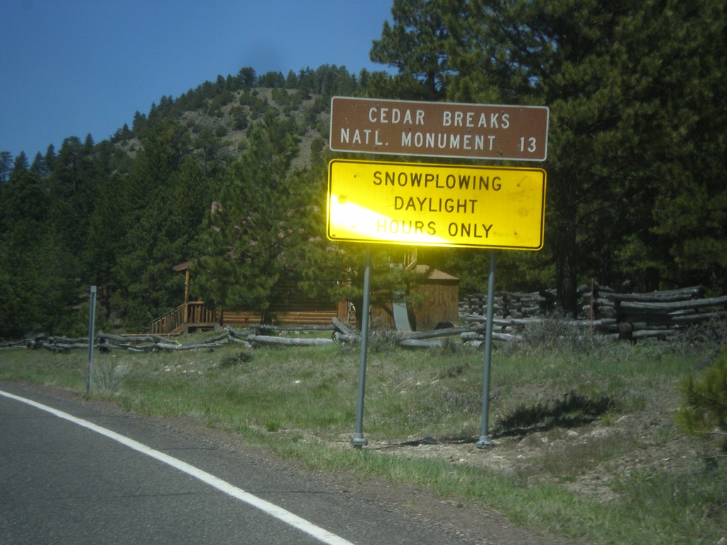
UT-143 - Distance Marker
Distance marker on UT-143 south. Distance to Cedar Breaks National Monument. Below distance marker is another sign reading Snow Plowing Daylight Hours Only.
Taken 05-21-2014
 Panguitch
Garfield County
Utah
United States
Panguitch
Garfield County
Utah
United States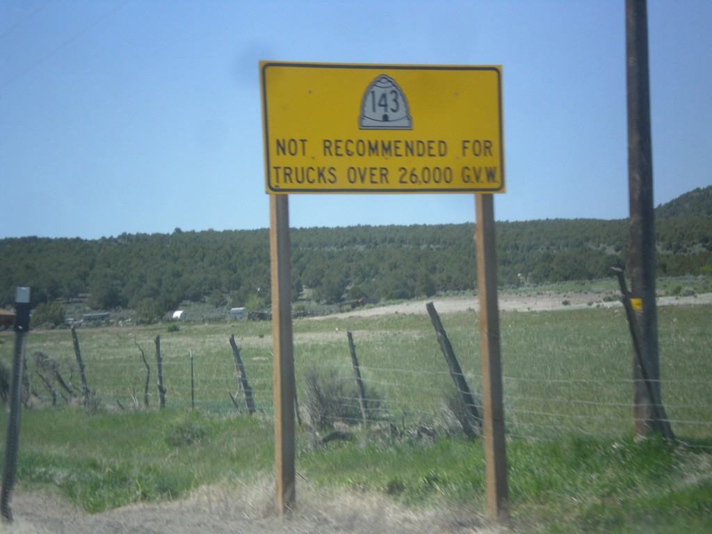
UT-143 - Truck Restrictions
UT-143 not recommended for trucks over 26,000 GVW. UT-143 is a steep, winding mountain road over the Markagunt Plateau.
Taken 05-21-2014
Panguitch
Garfield County
Utah
United States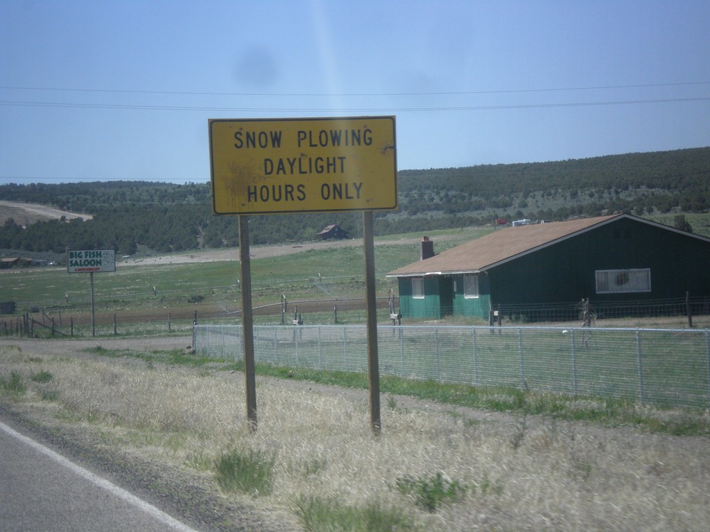
UT-143 South - Snow Plowing Hours
Snow Plowing Daylight Hours Only on UT-143 south. UT-143 south is a very mountainous road that goes over the Markagunt Plateau.
Taken 05-21-2014
Panguitch
Garfield County
Utah
United States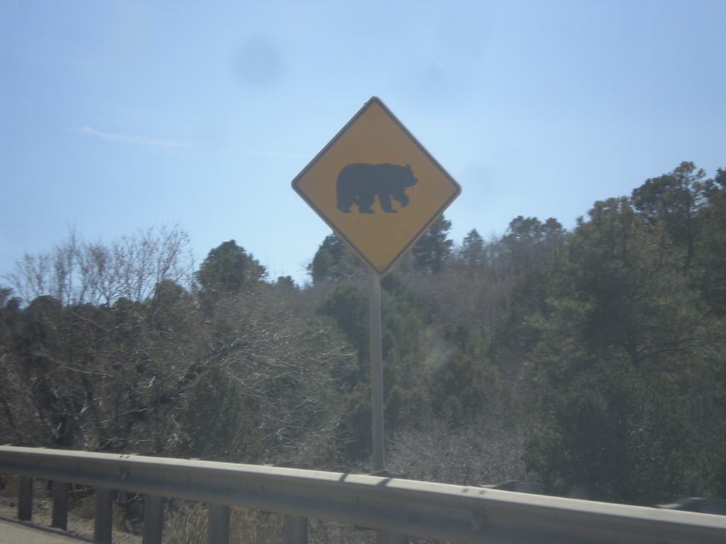
I-25 South - Bear Crossing
Bear crossing on I-25 south on Raton Pass in Las Animas County.
Taken 03-29-2014

 Trinidad
Las Animas County
Colorado
United States
Trinidad
Las Animas County
Colorado
United States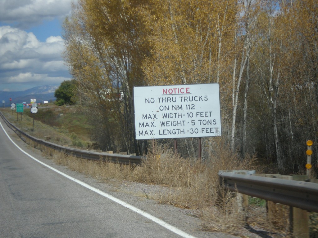
US-64 West/US-84 North - No Thru Trucks on NM-112
US-64 West/US-84 North approaching NM-531 junction. No thru trucks on NM-112.
Taken 10-13-2013
 Tierra Amarilla
Rio Arriba County
New Mexico
United States
Tierra Amarilla
Rio Arriba County
New Mexico
United States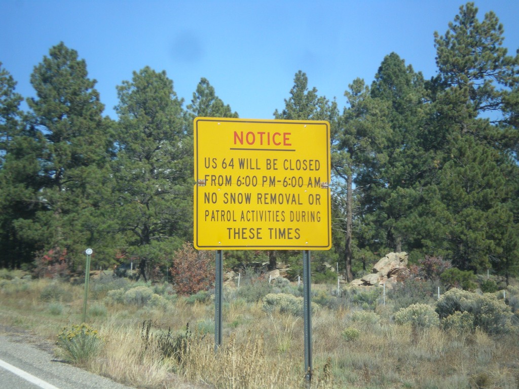
US-64 West Closure Hours
US-64 will be closed from 6:00 PM to 6:00 AM (between Tres Piedras and Tierra Amarilla). No snow removal or patrol activities during these times.
Taken 10-13-2013
Tres Piedras
Taos County
New Mexico
United States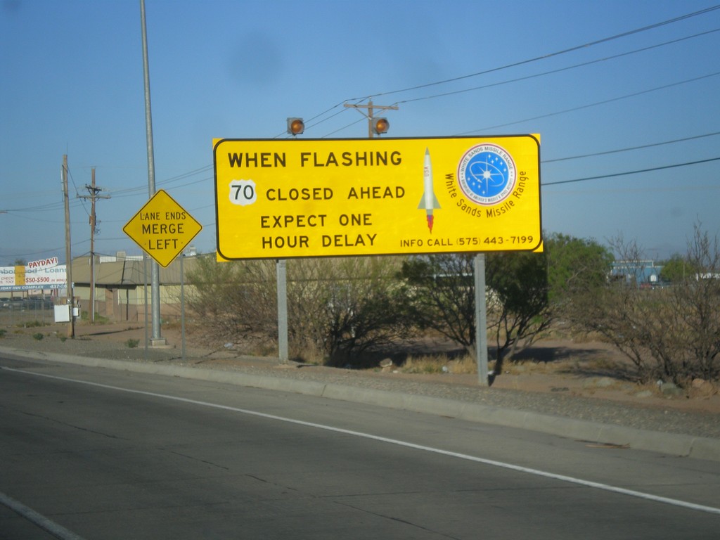
US-70 West - White Sands Missile Range Warning
Warning on US-70 west leaving Alamogordo: When flashing US-70 closed ahead. Expect one hour delay.
Taken 04-15-2013
 Alamogordo
Otero County
New Mexico
United States
Alamogordo
Otero County
New Mexico
United States