Signs Tagged With Warning
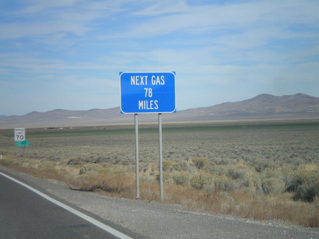
US-93 North - Next Gas 78 Miles
Next Gas 78 Miles on US-93 north. Taken just north of the Alt. US-93/US-93 intersection. Wells is the next city with gas.
Taken 10-15-2011
 Ely
White Pine County
Nevada
United States
Ely
White Pine County
Nevada
United States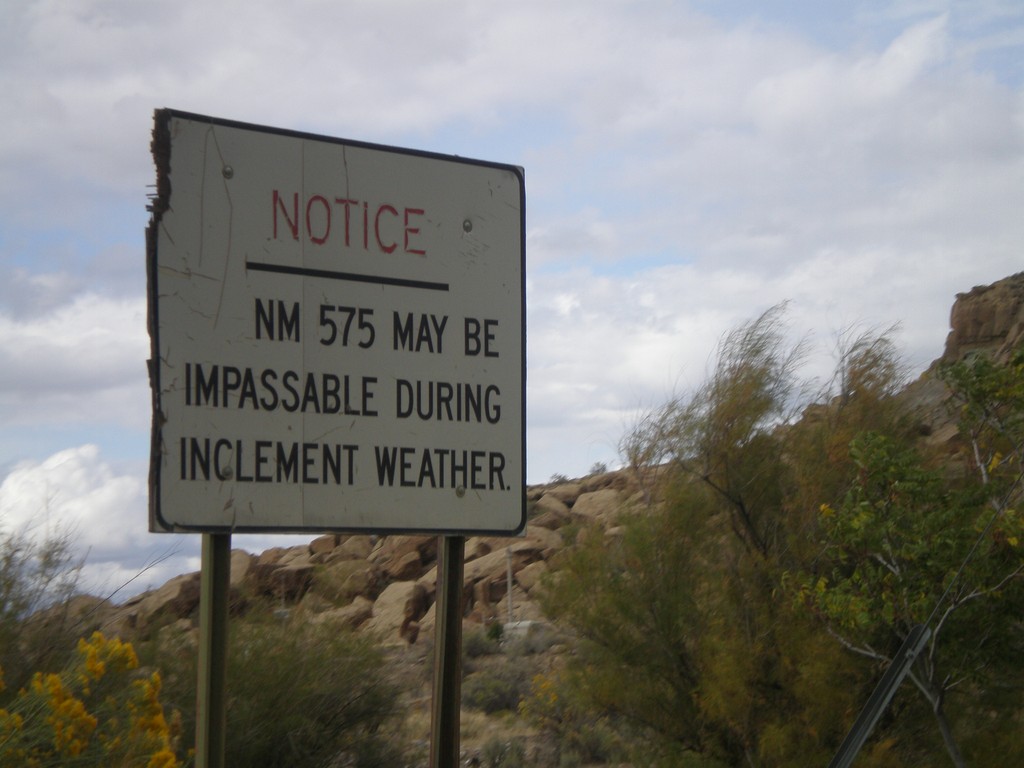
NM-575 - Inclement Weather Warning
NM-575 may be impassable in inclement weather, notice on NM-575 north. The author attempted to drive NM-575 north from Blanco to Aztec a few days after rains in the fall and was turned back by a section of deep mud.
Taken 10-07-2011
 Blanco
San Juan County
New Mexico
United States
Blanco
San Juan County
New Mexico
United States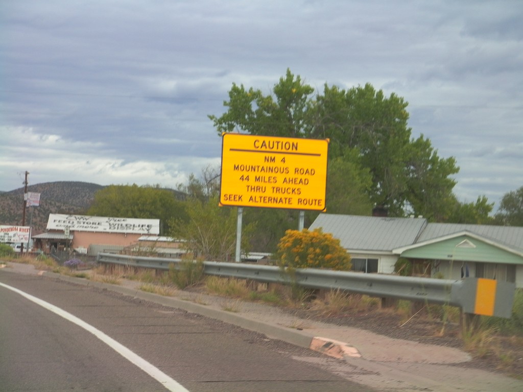
US-550 North Approaching NM-4
US-550 north approaching NM-4. NM-4 is a mountainous road 44 miles north of here and is not advised for trucks.
Taken 10-06-2011

 San Ysidro
Sandoval County
New Mexico
United States
San Ysidro
Sandoval County
New Mexico
United States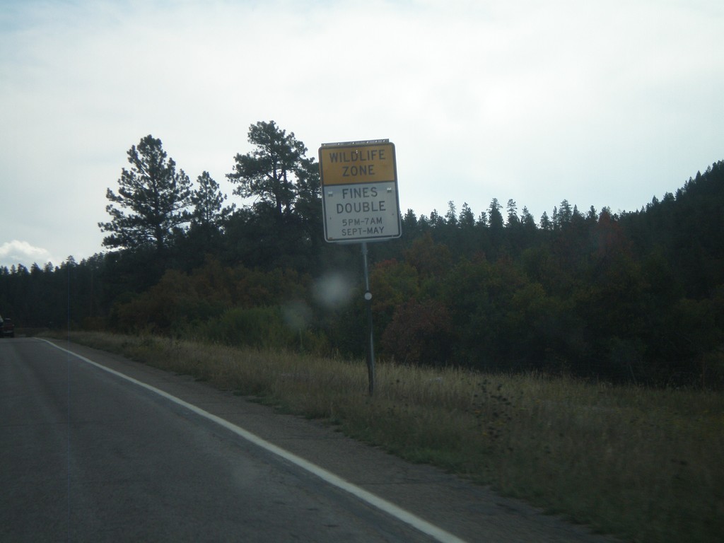
US-160 East - Wildlife Zone
Wildlife Zone on US-160 east in Archueta County. Fines double for any speed violations in the Wildlife Zone between 5PM and 7AM September through May.
Taken 10-02-2011
 Pagosa Springs
Archuleta County
Colorado
United States
Pagosa Springs
Archuleta County
Colorado
United States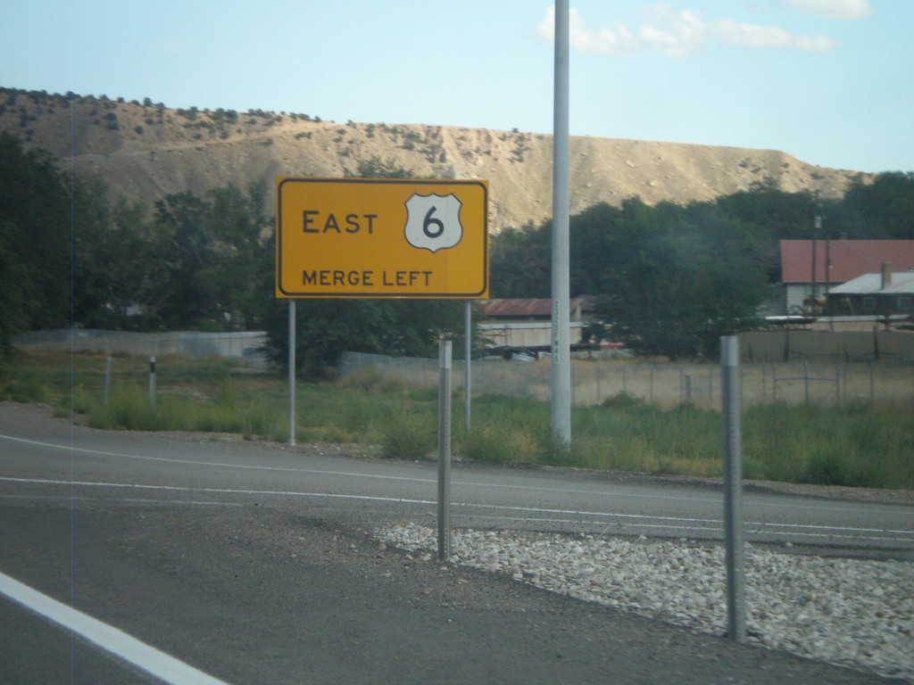
Merge Left For US-6 East
Merge left for US-6 east on US-6 East/US-191 South in Helper. The right lane becomes an exit only lane for Exit 232.
Taken 10-01-2011

 Helper
Carbon County
Utah
United States
Helper
Carbon County
Utah
United States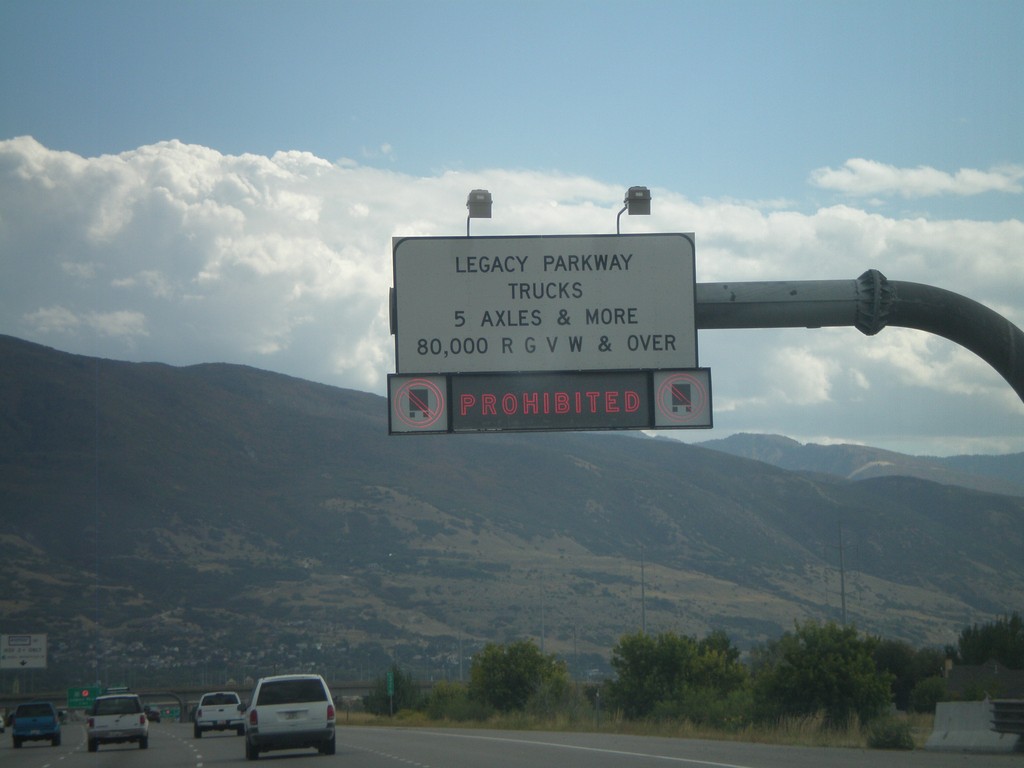
I-15 South Approaching Legacy Parkawy
I-15 south approaching Legacy Parkway. Trucks with more than 5 axles or greater than 80,000 pounds are prohibited for using Legacy Parkway.
Taken 10-01-2011

 Kaysville
Davis County
Utah
United States
Kaysville
Davis County
Utah
United States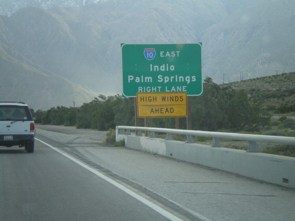
End CA-62 Approaching I-10
Approaching the west end of CA-62 at I-10. Use right lanes for I-10 east for Indio and Palm Springs.
Taken 02-25-2011

 Whitewater
Riverside County
California
United States
Whitewater
Riverside County
California
United States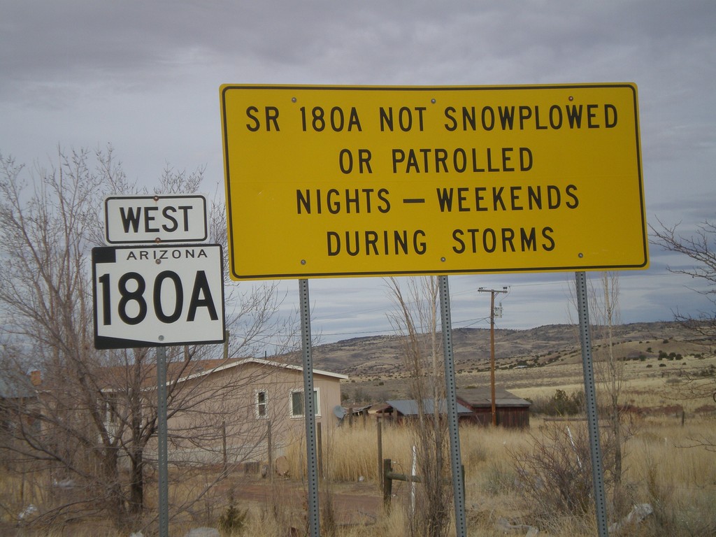
AZ-180A West - Winter Driving Warning
Warning on AZ-180A that the highway is not plowed nights or on weekends during storms.
Taken 02-24-2011
 Concho
Apache County
Arizona
United States
Concho
Apache County
Arizona
United States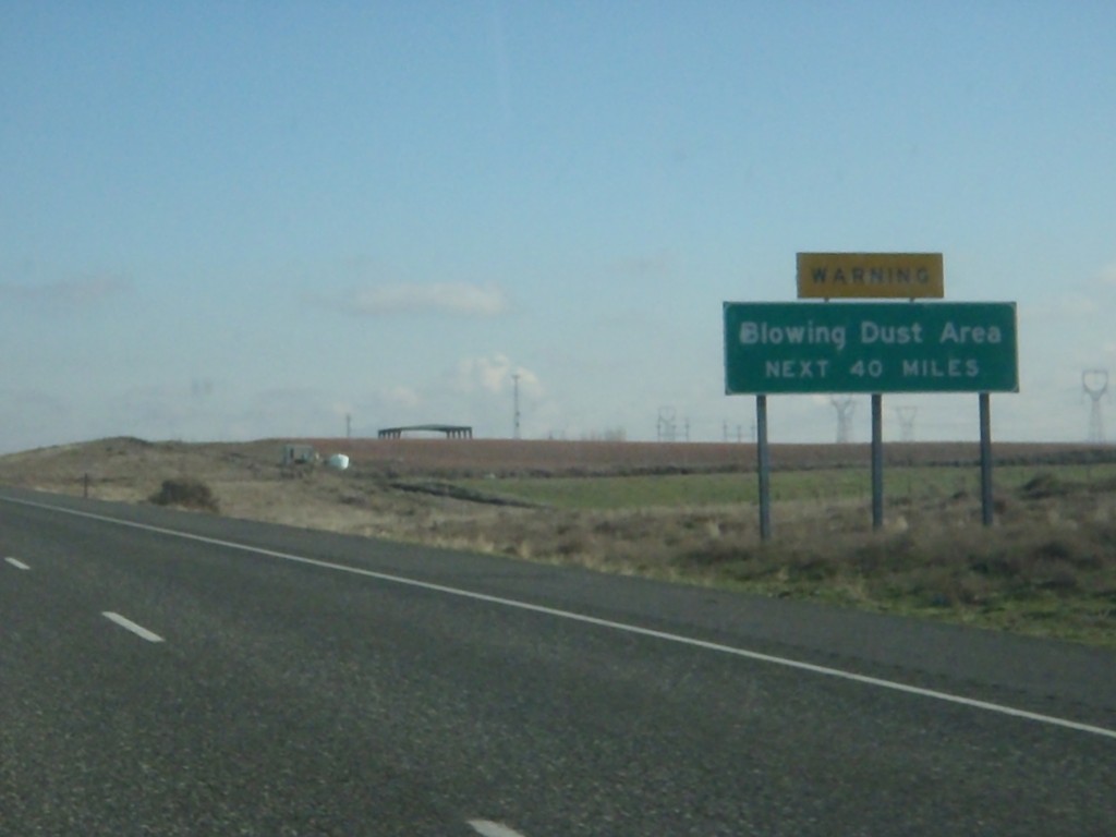
I-84 East - Blowing Dust Area
Blowing Dust Area next 40 miles on I-84 east. This area is roughly between Boardman and Pendleton.
Taken 01-19-2011

 Boardman
Morrow County
Oregon
United States
Boardman
Morrow County
Oregon
United States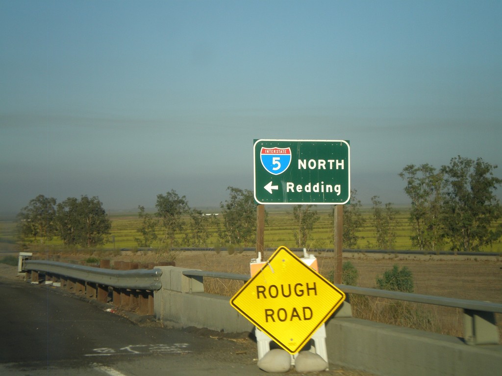
CA-20 East at I-5 North
CA-20 east at I-5 north to Redding.
Taken 09-25-2009

 Williams
Colusa County
California
United States
Williams
Colusa County
California
United States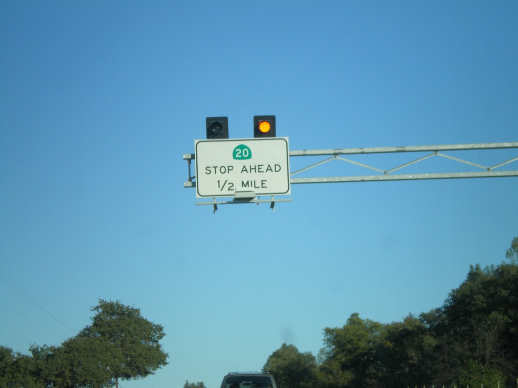
CA-20 East Traffic Must Stop Ahead
CA-20 East approaching CA-53 south. This intersection is controlled by a stop sign on CA-20.
Taken 09-25-2009
 Clearlake Oaks
Lake County
California
United States
Clearlake Oaks
Lake County
California
United States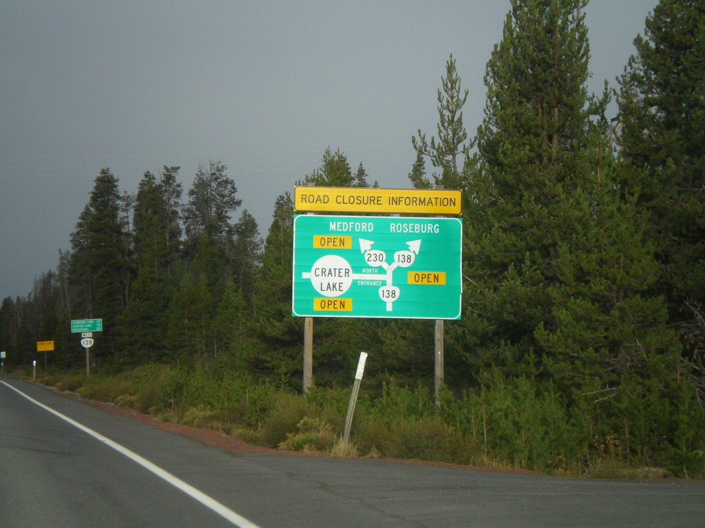
Cascades Closure Information
Road closure information for OR-230, OR-138, and Crater Lake in the Oregon Cascades. Closures are listed in a simple route diagram.
Taken 09-20-2009
 Chemult
Klamath County
Oregon
United States
Chemult
Klamath County
Oregon
United States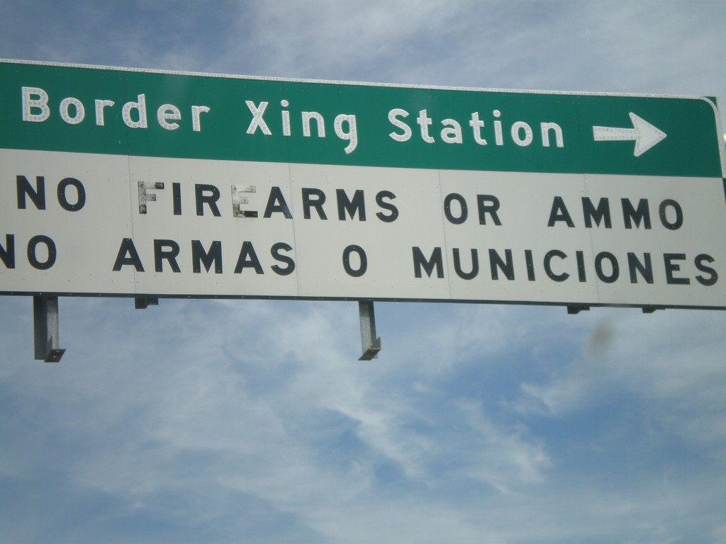
I-19 at Crawford St. - Border Crossing Station
I-19 at Crawford St. Turn left on Crawford St. for the Border Crossing Station. There is a bilingual warning about bringing firearms and ammunition into Mexico.
Taken 03-22-2009
 Nogales
Santa Cruz County
Arizona
United States
Nogales
Santa Cruz County
Arizona
United States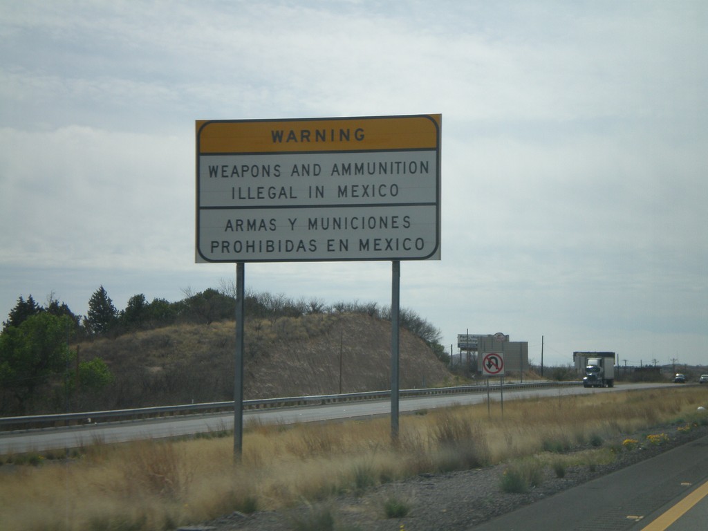
I-19 South - Weapons Illegal In Mexico
Bilingual warning about prohibition of weapons and ammunition in Mexico on I-19 south. There is another warning further south on I-19.
Taken 03-22-2009
Nogales
Santa Cruz County
Arizona
United States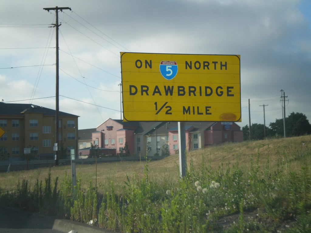
I-5 North Exit 307 Onramp - Drawbridge
Exit 307 onramp onto I-5 north. Warning sign for drawbridge on I-5 north over the Columbia River.
Taken 07-24-2008
Portland
Multnomah County
Oregon
United States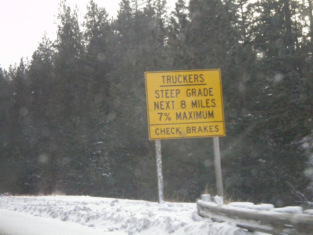
US-95 South - Trucker Warning on White Bird Hill
Trucker warning on US-95 south at the top of White Bird Hill. White Bird Grade is a 8 mile grade with steepness up to 7%.
Taken 12-26-2007
 Grangeville
Idaho County
Idaho
United States
Grangeville
Idaho County
Idaho
United States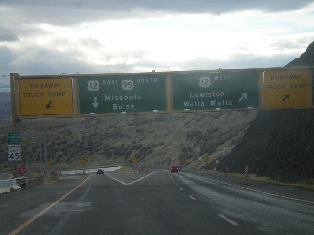
US-95 South at US-12
US-95 south at US-12 at the bottom of the Lewiston Hill. The welcome to Lewiston sign is right above the speed limit sign on the left side of the photo. Lewiston is the lowest city in Idaho - 738 feet. There are Runaway Truck Ramps on either side of the photo.
Taken 12-26-2007
 Lewiston
Nez Perce County
Idaho
United States
Lewiston
Nez Perce County
Idaho
United States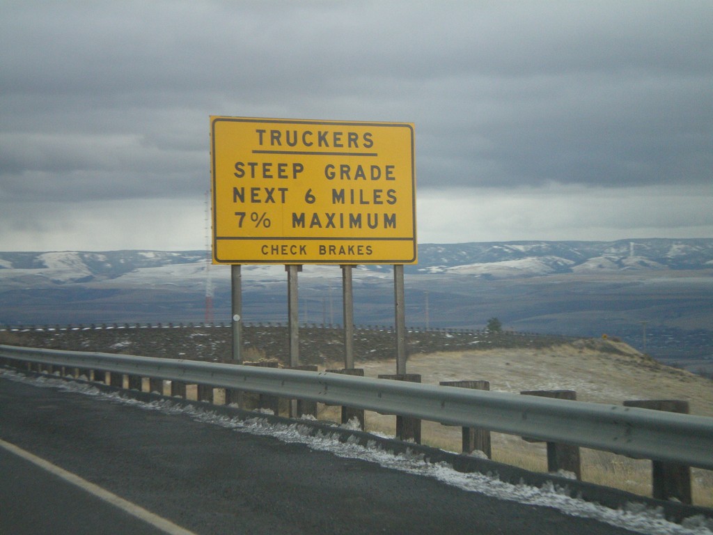
US-95 South - Lewiston Hill Trucker Warning
Trucker information on US-95 south at the top of Lewiston Hill. Lewiston Hill goes from 2,756 feet at the summit to 738 feet in Lewiston in about 6 miles.
Taken 12-26-2007
Genesee
Nez Perce County
Idaho
United States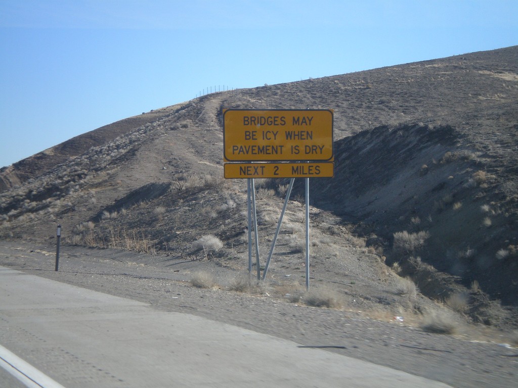
I-80 East - Bridges May Be Icy When Pavement Is Dry
I-80 east approaching Humboldt River. Bridges May Be Icy When Pavement Is Dry.
Taken 11-24-2007
 Rixies
Eureka County
Nevada
United States
Rixies
Eureka County
Nevada
United States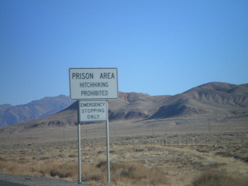
I-80 East Exit 112 - Prison Area
I-80 east approaching Exit 112. Prison Area - No Hitchhiking. Near Lovelock Prison.
Taken 11-24-2007
Woolsey
Pershing County
Nevada
United States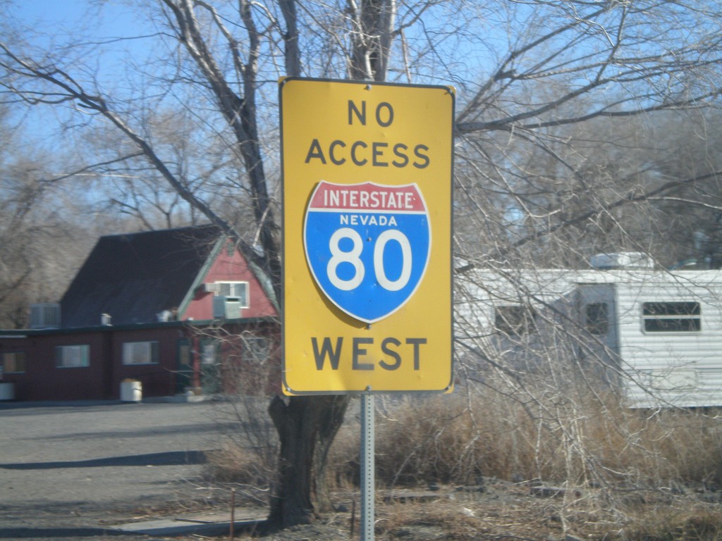
No Access To I-80 East on NV-856
No access to I-80 west on NV-856/BL-80 east.
Taken 11-24-2007
 Lovelock
Pershing County
Nevada
United States
Lovelock
Pershing County
Nevada
United States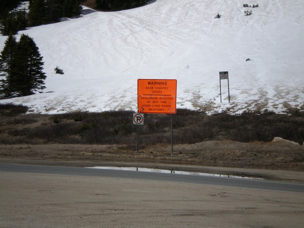
US-40 East - Berthoud Pass Skiers Warning
US-40 at Berthoud Pass. Backcountry skiers warning.
Taken 05-25-2007
 Grand County
Colorado
United States
Grand County
Colorado
United States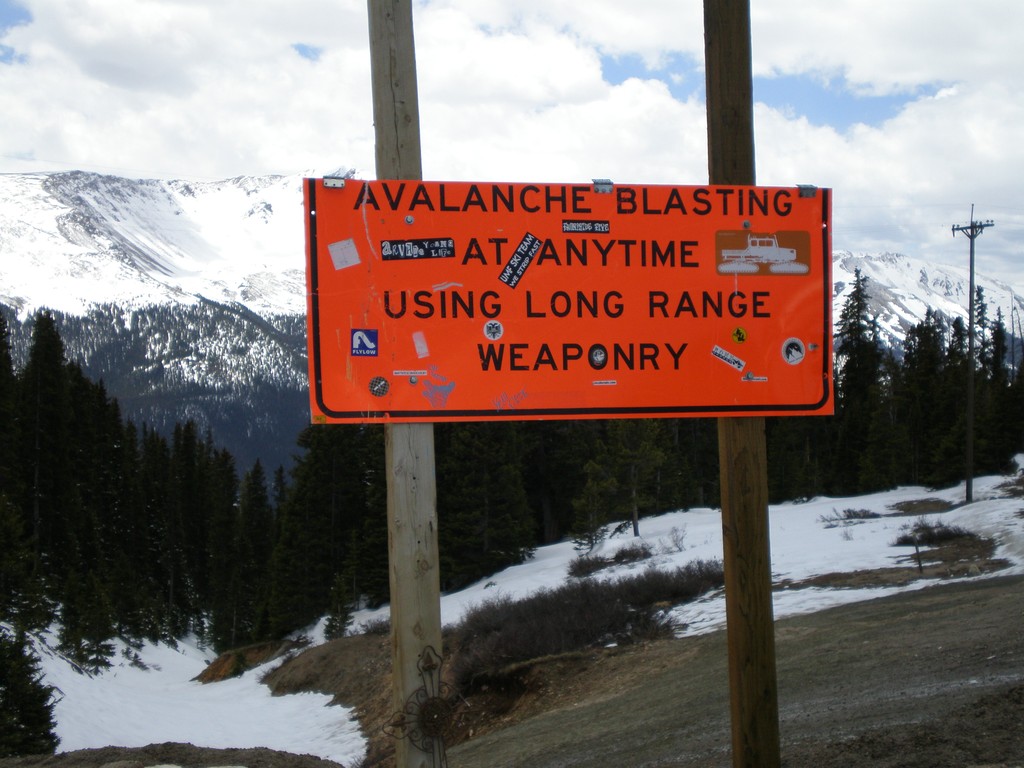
US-40 - Berthoud Pass Backcountry Ski Information
US-40 at Berthoud Pass. Backcountry ski warning. Avalanche blasting at any time using long range weaponry.
Taken 05-25-2007
Winter Park
Grand County
Colorado
United States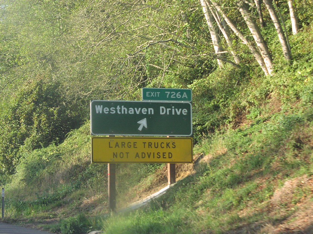
US-101 North Exit 726A
US-101 north at Exit 726A, Westhaven Drive.
Taken 10-01-2006
 Trinidad
Humboldt County
California
United States
Trinidad
Humboldt County
California
United States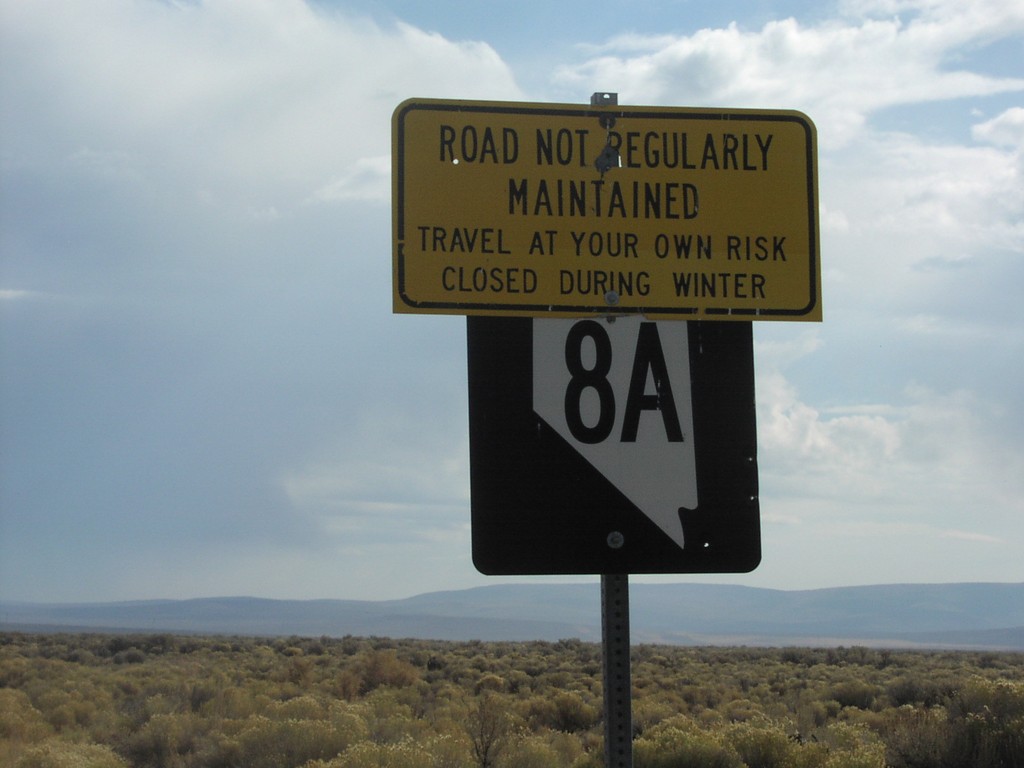
NV-8A East - Travel At Your Own Risk
NV-8A east, just east of NV-34. Sign warns to travel at own risk.
Taken 10-01-2006
 Vya
Washoe County
Nevada
United States
Vya
Washoe County
Nevada
United States