Signs Tagged With Winter Closure
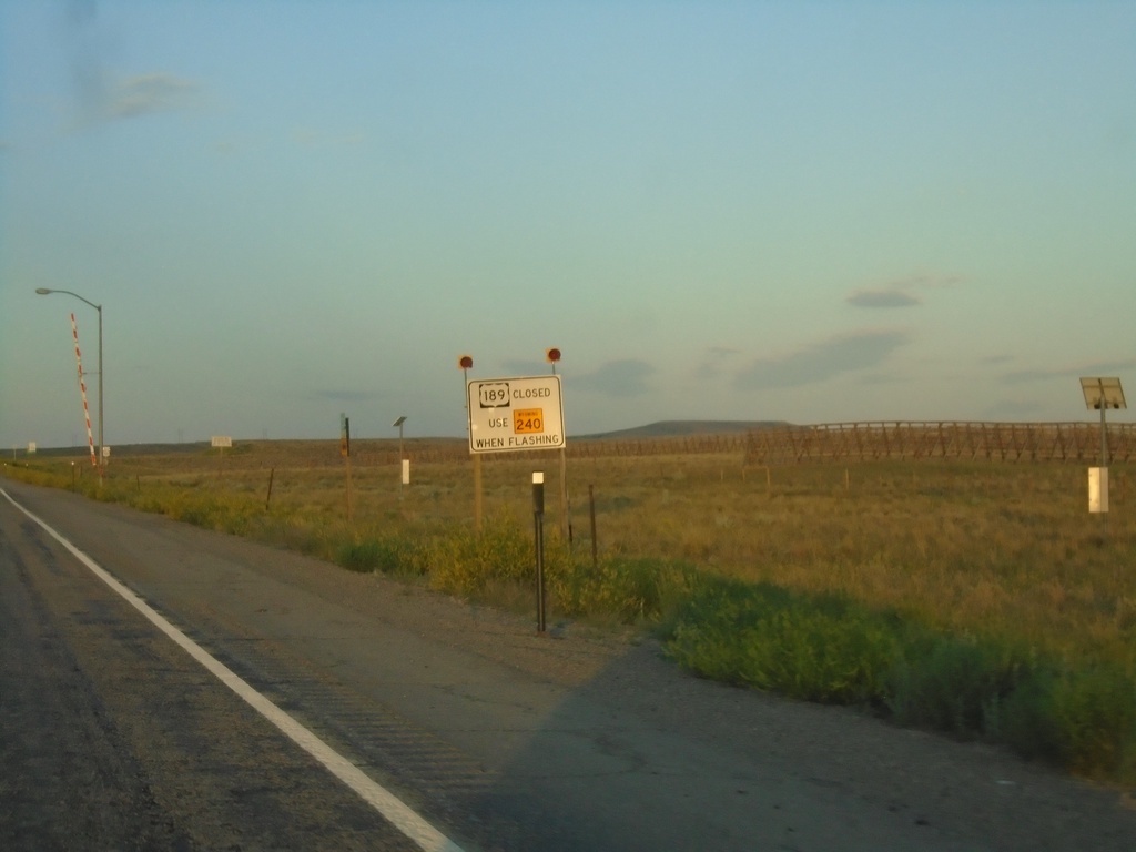
US-189 South - Road Closure Information
US-189 south approaching WY-240. When lights are flashing US-189 is closed - use WY-240.
Taken 07-18-2020

 Kemmerer
Lincoln County
Wyoming
United States
Kemmerer
Lincoln County
Wyoming
United States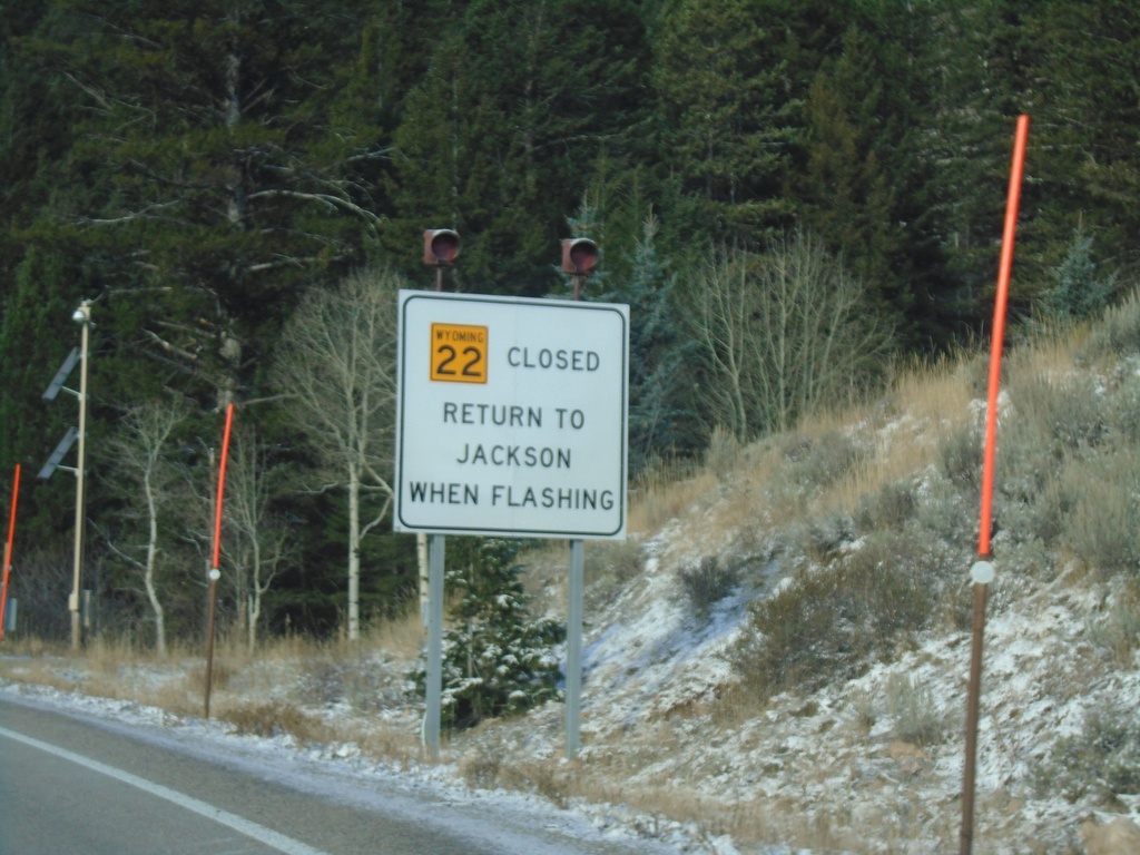
WY-22 West - Return To Jackson When Flashing
WY-22 west at the base of Teton Pass. Return to Jackson When Flashing.
Taken 10-27-2019
 Wilson
Teton County
Wyoming
United States
Wilson
Teton County
Wyoming
United States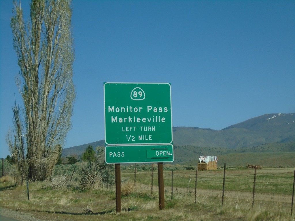
US-395 North Approaching CA-89
US-395 North approaching CA-89 to Markleeville and Monitor Pass. Monitor Pass was open when this picture was taken.
Taken 04-27-2019

 Coleville
Mono County
California
United States
Coleville
Mono County
California
United States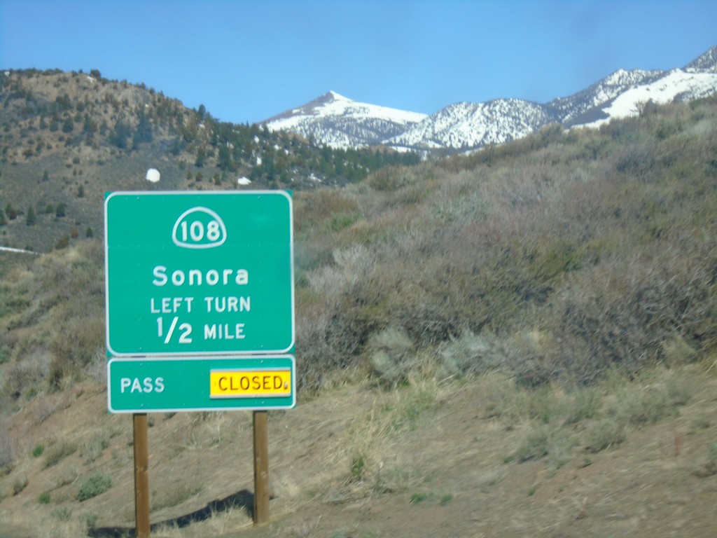
US-395 North Approaching CA-108
US-395 North approaching CA-108/Sonora. Sonora Pass was closed when this picture was taken.
Taken 04-27-2019
 Bridgeport
Mono County
California
United States
Bridgeport
Mono County
California
United States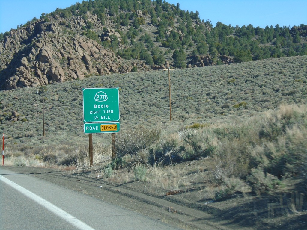
US-395 South Approaching CA-270
US-395 South Approaching CA-270 east to Bodie. CA-270 east was closed at the time this photo was taken.
Taken 04-27-2019
 Bridgeport
Mono County
California
United States
Bridgeport
Mono County
California
United States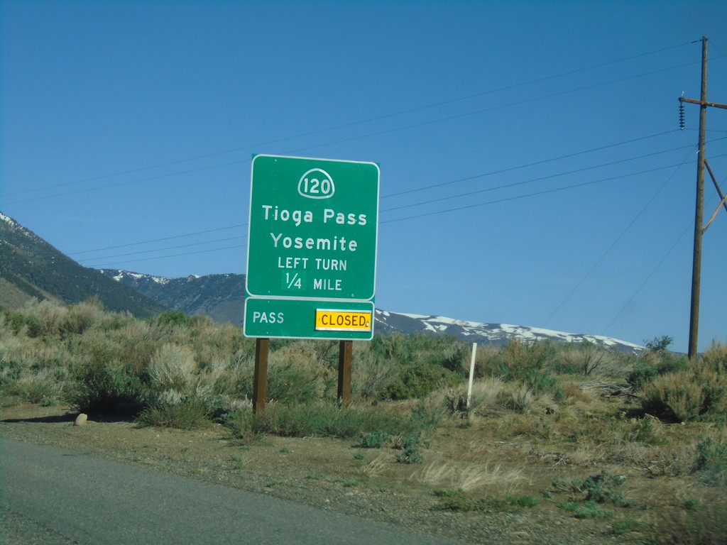
US-395 North Approaching CA-120
US-395 north approaching CA-120 east to Tioga Pass and Yosemite. Tioga Pass is closed when this picture was taken.
Taken 04-27-2019
 Lee Vining
Mono County
California
United States
Lee Vining
Mono County
California
United States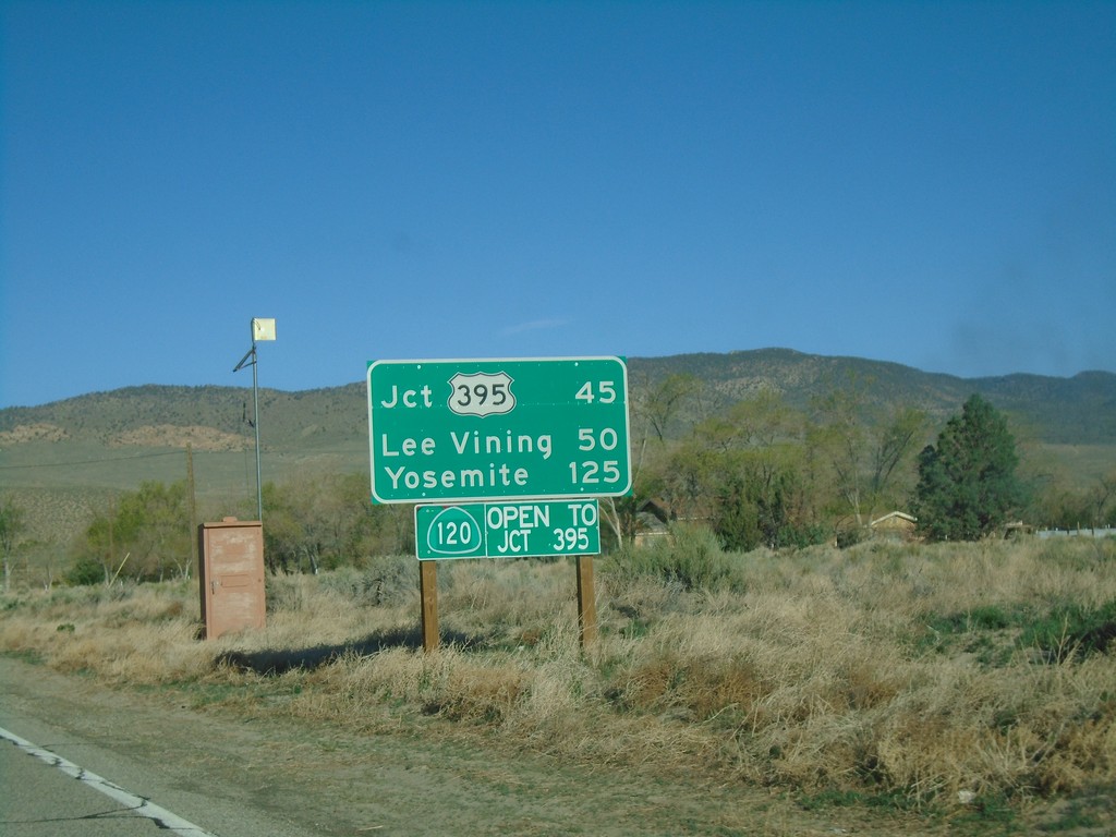
CA-120 West - Distance Marker
Distance marker on CA-120 west. Distance to US-395, Lee Vining, and Yosemite. CA-120 is open to US-395. This stretch of CA-120 is closed during the winter months.
Taken 04-27-2019
Benton
Mono County
California
United States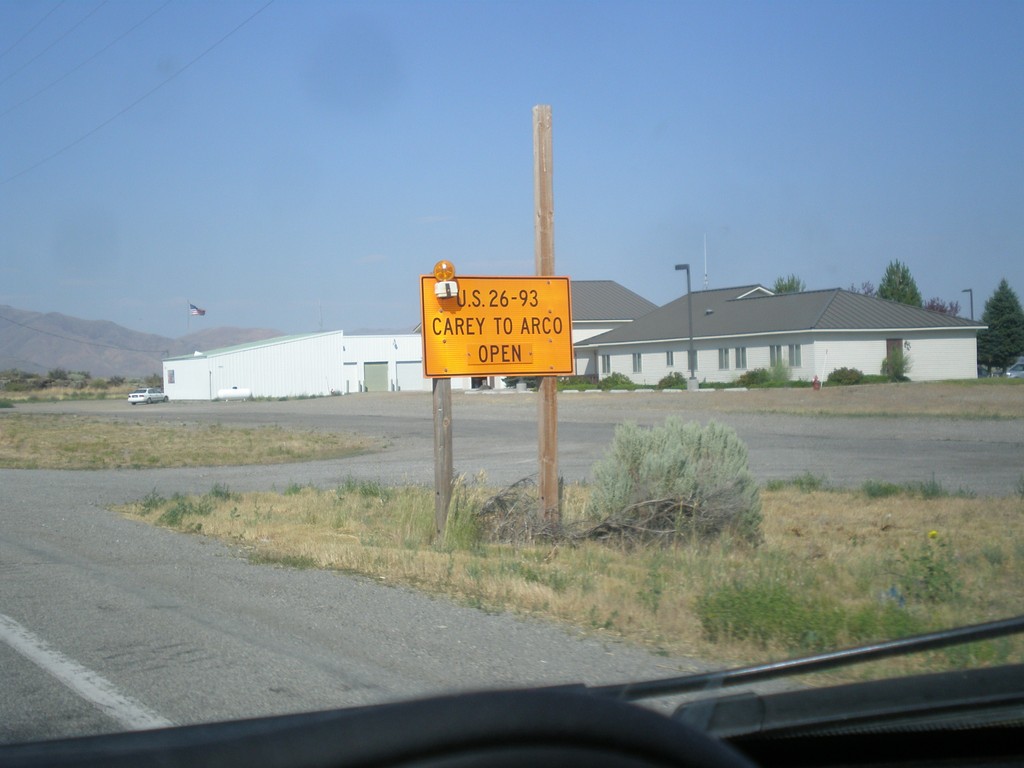
US-20 East/US-26 East/US-93 North - Road Closure Info
US-20 East/US-26 East/US-93 North - Road Closure Information in Carey. US-26/US-26/US-93 between Carey and Arco is open.
Taken 07-21-2018


 Carey
Blaine County
Idaho
United States
Carey
Blaine County
Idaho
United States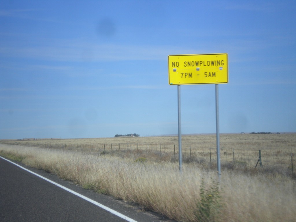
CO-71 North - Snowplow Hours
No Snowplowing on CO-71 north of Ordway between the hours of 7 PM and 5 AM.
Taken 10-08-2016
 Ordway
Crowley County
Colorado
United States
Ordway
Crowley County
Colorado
United States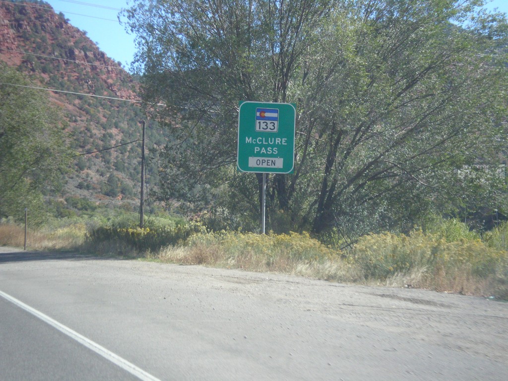
CO-82 East - McClure Pass Status
CO-82 East - CO-133/McClure Pass Status. McClure Pass is located on CO-133 between Redstone and Paonia.
Taken 10-07-2016

 Glenwood Springs
Garfield County
Colorado
United States
Glenwood Springs
Garfield County
Colorado
United States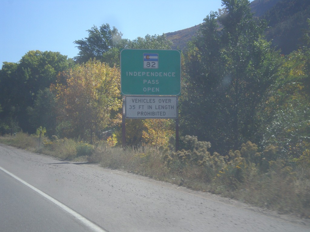
CO-82 East - Independence Pass Status
Independence Pass Status on CO-82 east leaving Glenwood Springs. Typically Independence Pass, just east of Aspen closes between November and May. Independence Pass is one of the highest highway passes in Colorado.
Taken 10-07-2016
Glenwood Springs
Garfield County
Colorado
United States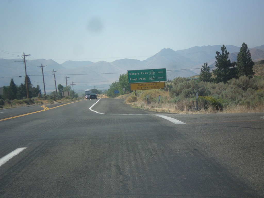
US-395 South - Sierra Pass Information
Sierra pass closure information on US-395 south. Information for Sonora Pass (CA-108) and Tioga Pass (CA-120). At the time this photo was taken both passes were open.
Taken 08-12-2016
Coleville
Mono County
California
United States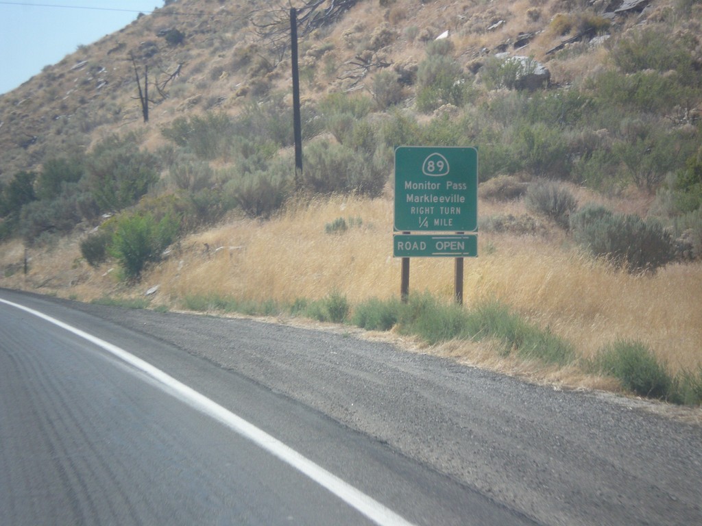
US-395 South at CA-89
US-395 south at CA-89 North to Markleeville and Monitor Pass. Monitor Pass was open when this was taken. This is the southern end of CA-89.
Taken 08-12-2016
Coleville
Mono County
California
United States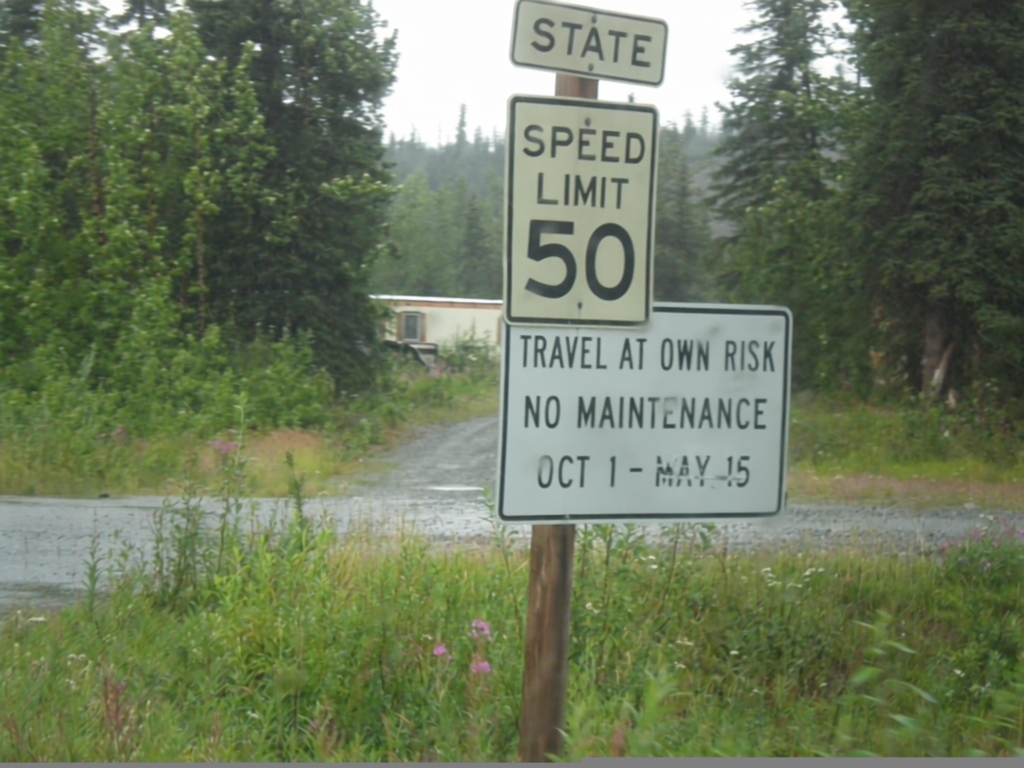
AK-8 West - State Speed Limit
AK-8 West (Denali Highway) - State Speed Limit 50 MPH. Denali Highway is closed durning the winter months. The first 20 miles from Paxson to Tangle Lakes are paved. The remaining 114 miles are gravel.
Taken 07-22-2016
 Delta Junction
Copper River Census Area
Alaska
United States
Delta Junction
Copper River Census Area
Alaska
United States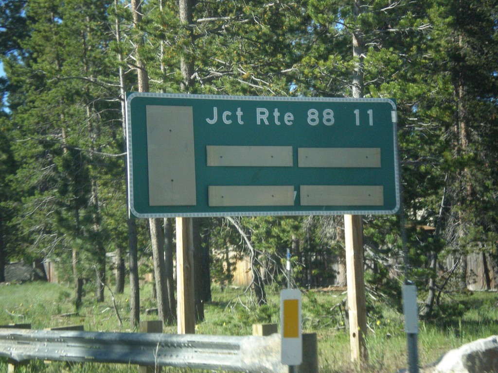
CA-89 South - Distance Marker
Distance marker on CA-89 south. Distance to CA-88 Junction.
Taken 06-15-2015
South Lake Tahoe
El Dorado County
California
United States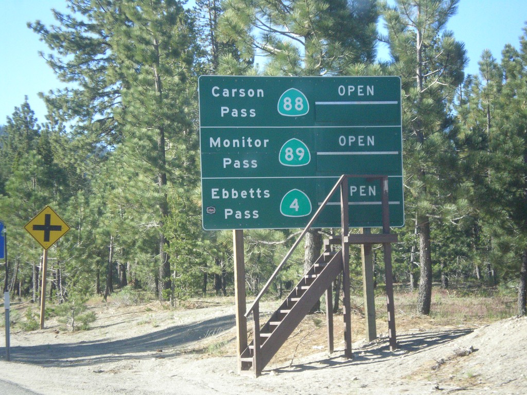
CA-89 South - Summit Information
Summit closure information on CA-89 south. Information for Ebbetts Pass (via CA-4), Monitor Pass (via CA-89) and Carson Pass (via CA-88). This photograph was taken in mid-June, and all of the passes are open. Carson Pass on CA-88 is the only pass that is typically opened year round.
Taken 06-15-2015

 South Lake Tahoe
El Dorado County
California
United States
South Lake Tahoe
El Dorado County
California
United States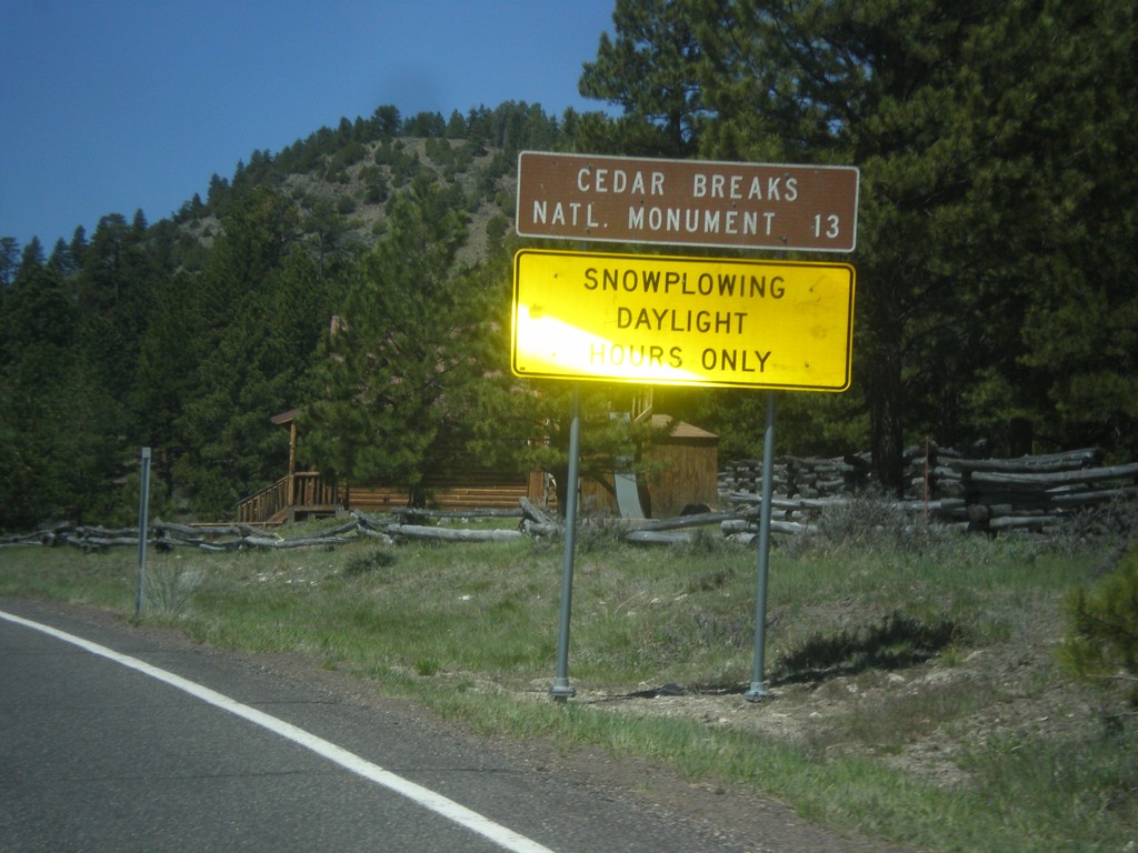
UT-143 - Distance Marker
Distance marker on UT-143 south. Distance to Cedar Breaks National Monument. Below distance marker is another sign reading Snow Plowing Daylight Hours Only.
Taken 05-21-2014
 Panguitch
Garfield County
Utah
United States
Panguitch
Garfield County
Utah
United States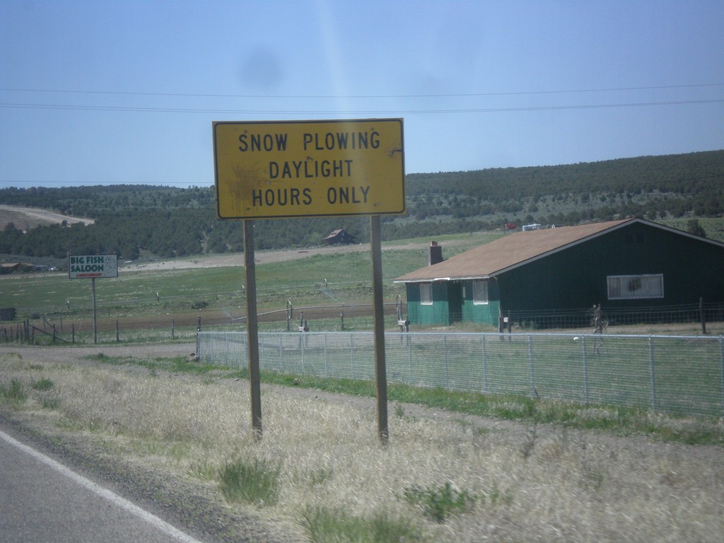
UT-143 South - Snow Plowing Hours
Snow Plowing Daylight Hours Only on UT-143 south. UT-143 south is a very mountainous road that goes over the Markagunt Plateau.
Taken 05-21-2014
Panguitch
Garfield County
Utah
United States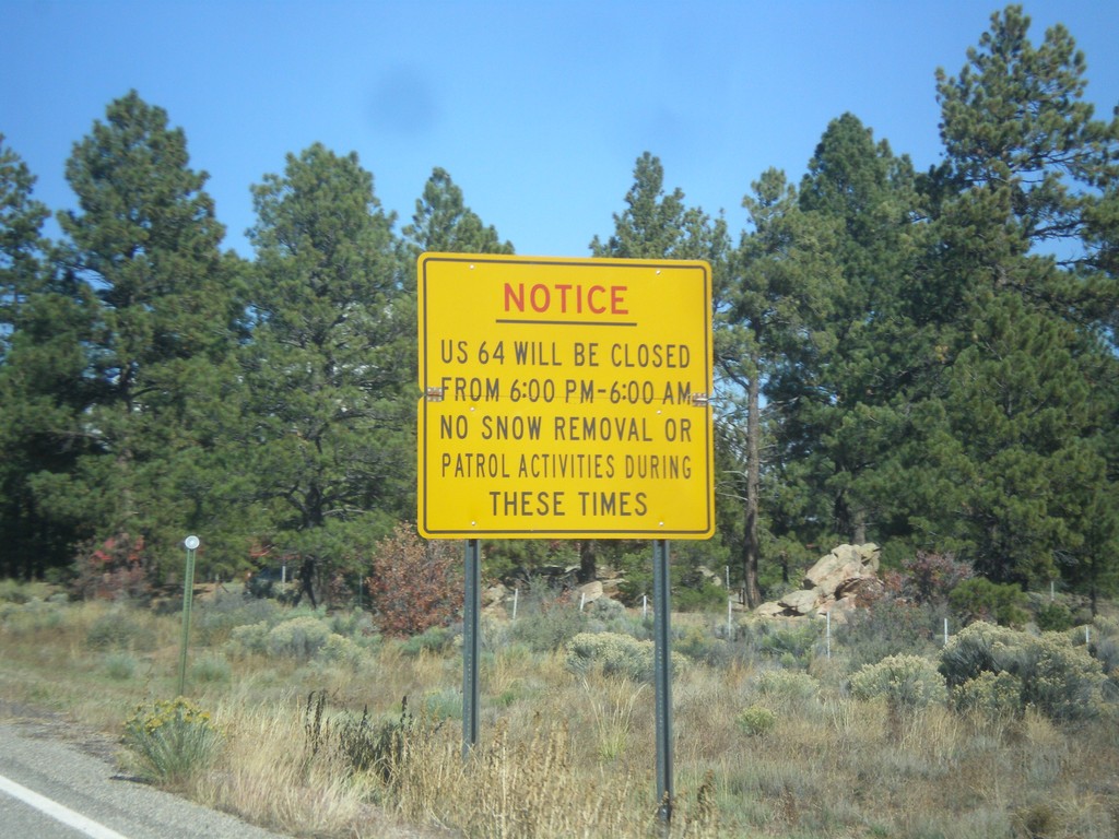
US-64 West Closure Hours
US-64 will be closed from 6:00 PM to 6:00 AM (between Tres Piedras and Tierra Amarilla). No snow removal or patrol activities during these times.
Taken 10-13-2013
 Tres Piedras
Taos County
New Mexico
United States
Tres Piedras
Taos County
New Mexico
United States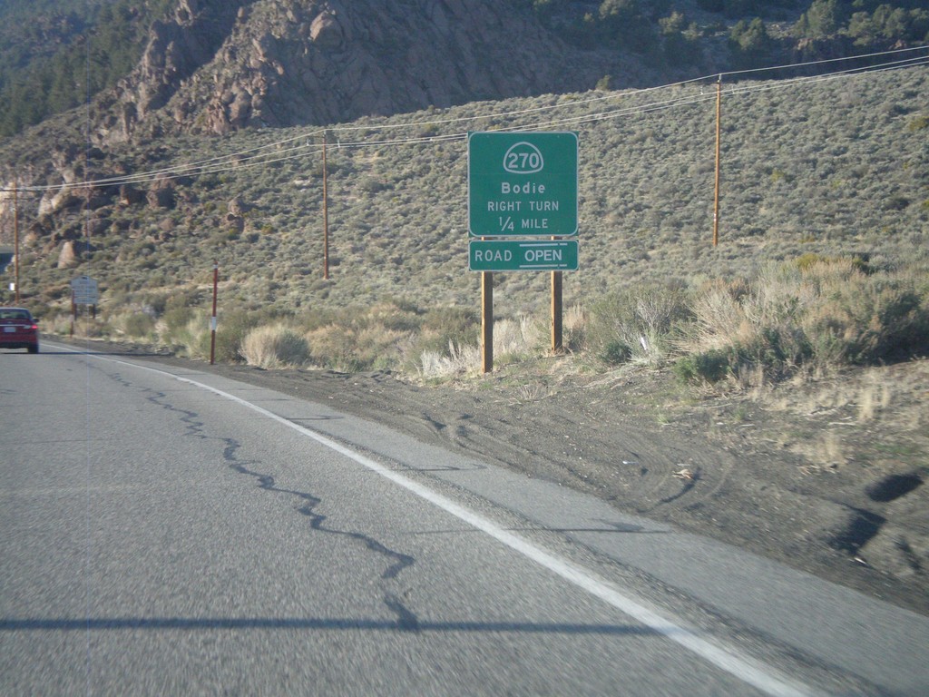
US-395 South Approaching CA-270
US-395 South Approaching CA-270 east to Bodie.
Taken 05-06-2012
Bridgeport
Mono County
California
United States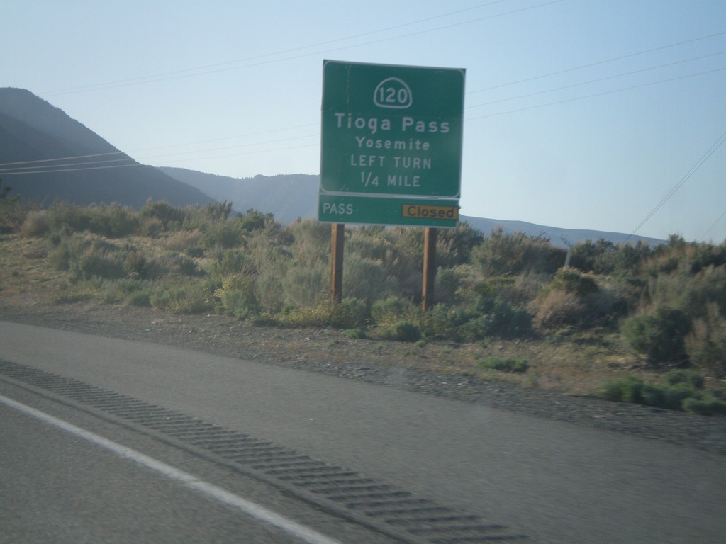
US-395 North Approaching CA-120
US-395 north approaching CA-120 east to Tioga Pass and Yosemite. Tioga Pass was opened the day after this picture was taken.
Taken 05-06-2012
Lee Vining
Mono County
California
United States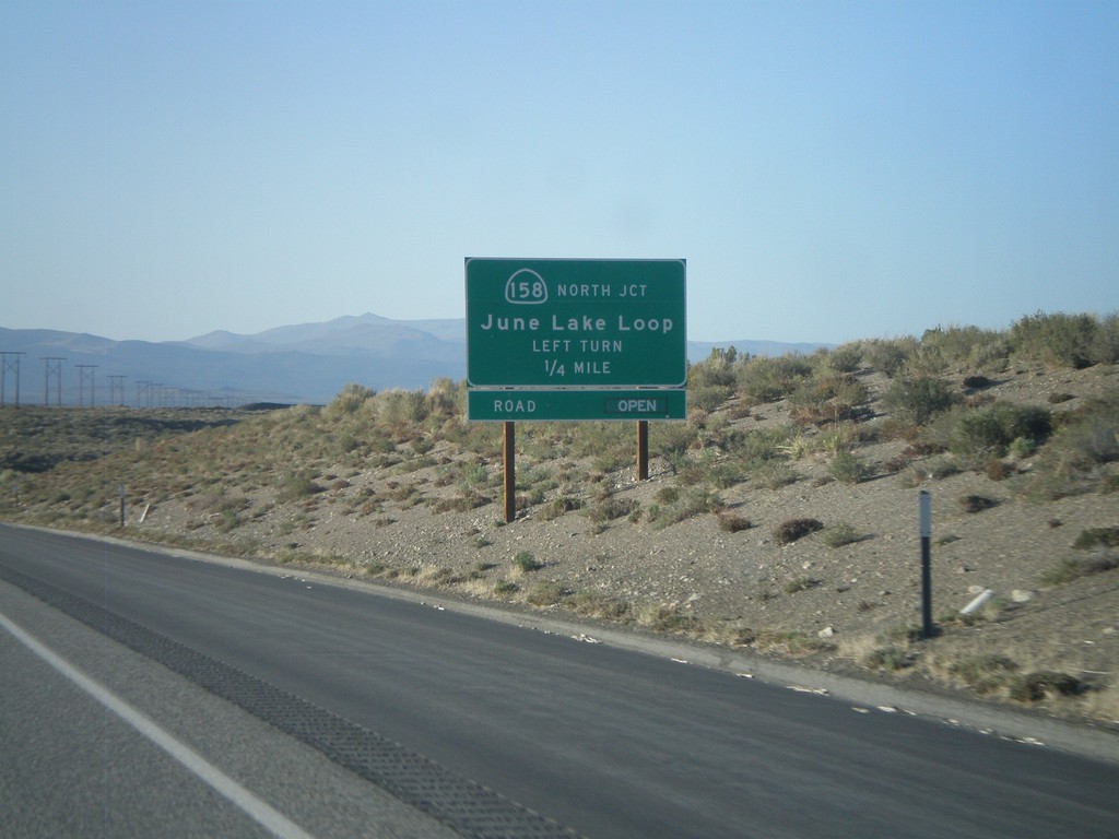
US-395 North Approaching CA-158
US-395 North Approaching CA-158 - June Lake Loop (north end).
Taken 05-06-2012
 Lee Vining
Mono County
California
United States
Lee Vining
Mono County
California
United States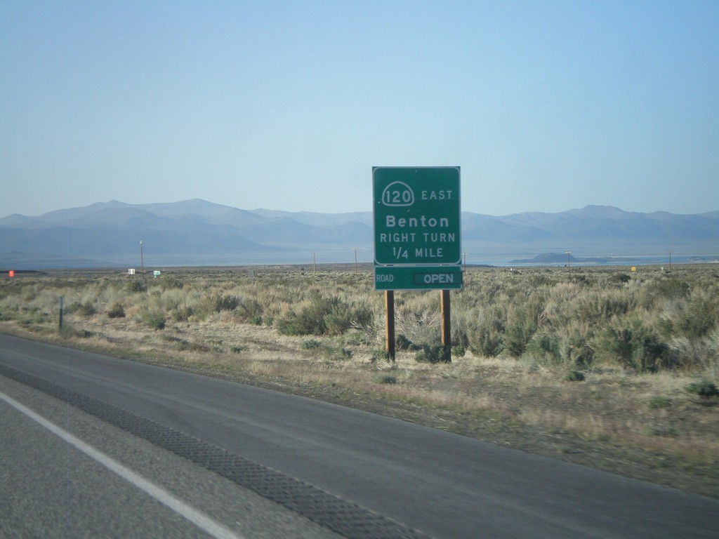
US-395 North Approaching CA-120 East
US-395 North Approaching CA-120 East to Benton. CA-120 west joins US-395 north to Lee Vining.
Taken 05-06-2012
Lee Vining
Mono County
California
United States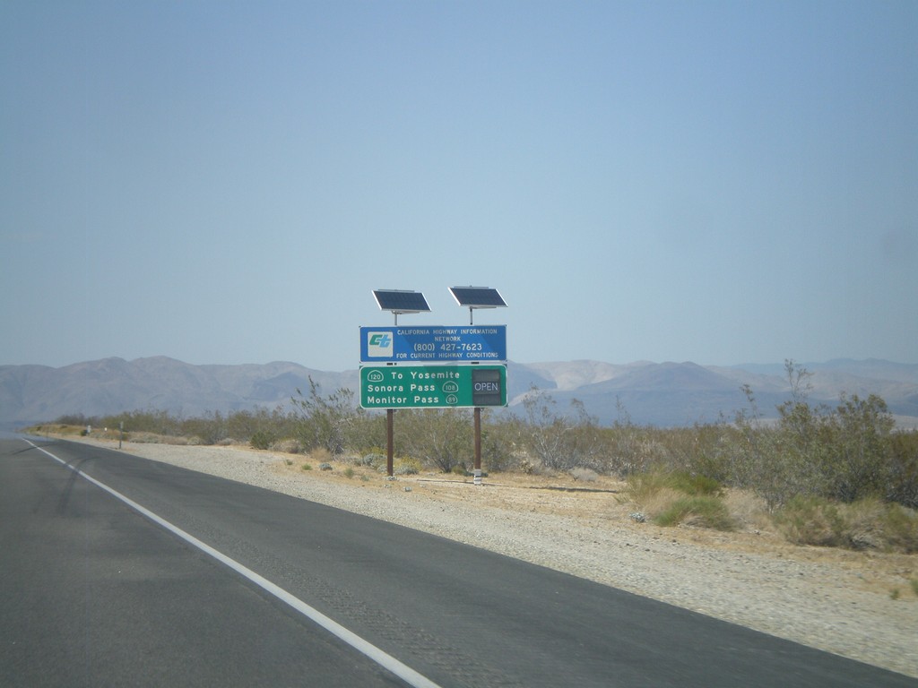
US-395 North - Sierra Nevada Pass Information
Sierra Nevada mountain pass information on US-395 north. This sign shows the status of CA-120 (Tioga Pass), CA-108 (Sonora Pass), and CA-89 (Monitor Pass). At the time this picture was taken, the only pass still closed was Tioga Pass.
Taken 05-06-2012
Inyokern
Kern County
California
United States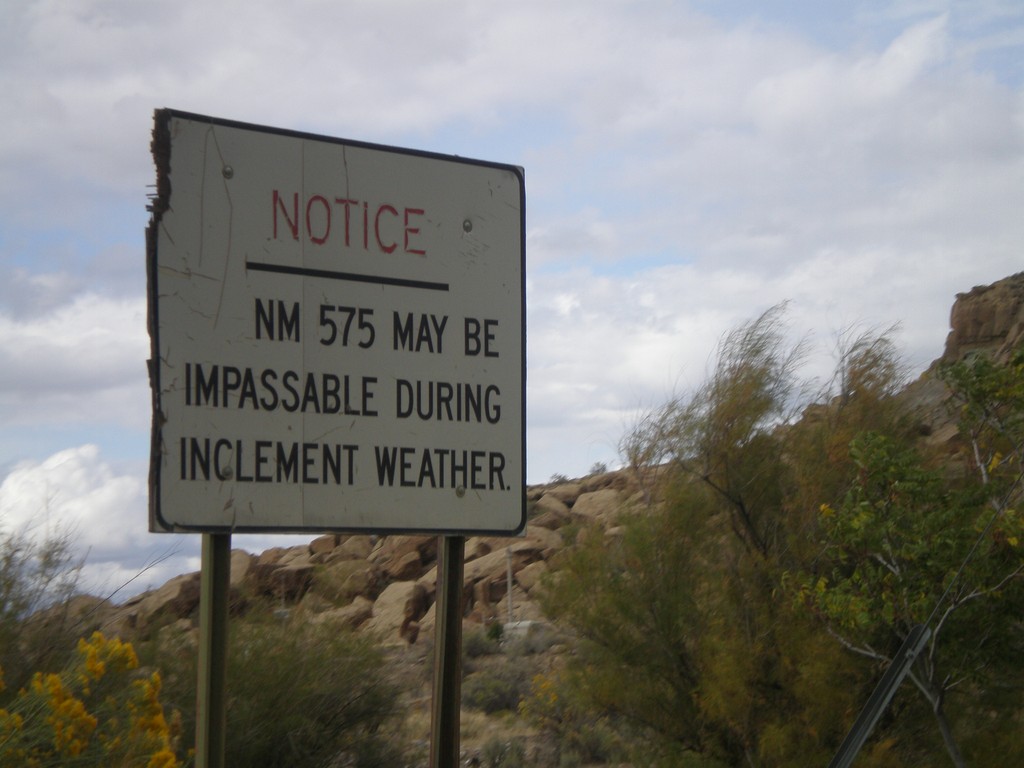
NM-575 - Inclement Weather Warning
NM-575 may be impassable in inclement weather, notice on NM-575 north. The author attempted to drive NM-575 north from Blanco to Aztec a few days after rains in the fall and was turned back by a section of deep mud.
Taken 10-07-2011
 Blanco
San Juan County
New Mexico
United States
Blanco
San Juan County
New Mexico
United States