Signs Tagged With Wooden Sign
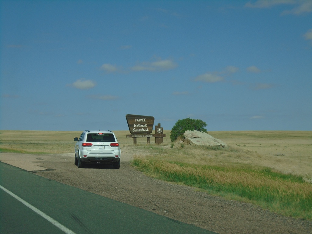
CO-14 West - Pawnee National Grasslands
Entering Pawnee National Grasslands on CO-14 West.
Taken 07-11-2022
 Sterling
Weld County
Colorado
United States
Sterling
Weld County
Colorado
United States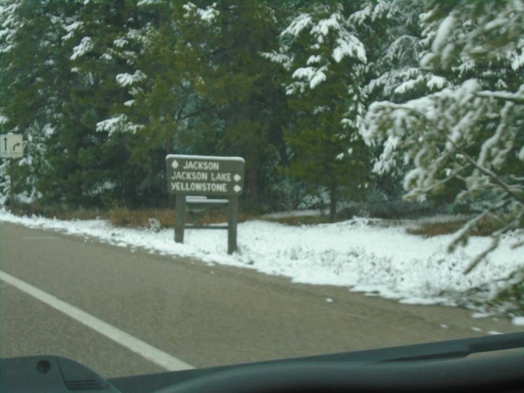
US-26 West/US-287 North Approaching US-89/US-191 at Moran Junction
US-26 West/US-287 North Approaching US-89/US-191 at Moran Junction. Turn right for US-89/US-191/US-287 North to Yellowstone and Jackson Lake. Continue straight for US-26 West/US-191 South/US-89 South to Jackson.
Taken 05-03-2022


 Moran
Teton County
Wyoming
United States
Moran
Teton County
Wyoming
United States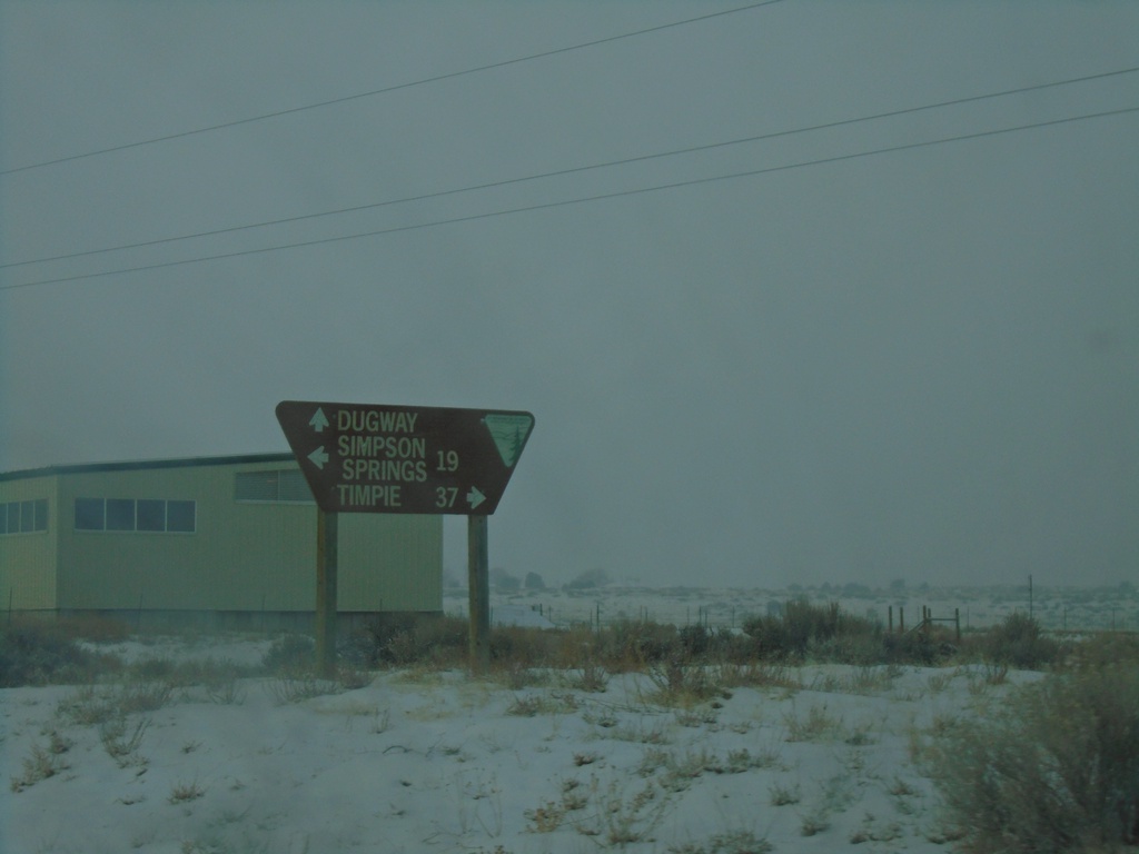
UT-199 West at Government Creek Road
UT-199 West at Government Creek Road to Simpson Springs. Continue straight for Dugway; turn right to UT-196 and Timpie.
Taken 12-31-2020

 Dugway
Tooele County
Utah
United States
Dugway
Tooele County
Utah
United States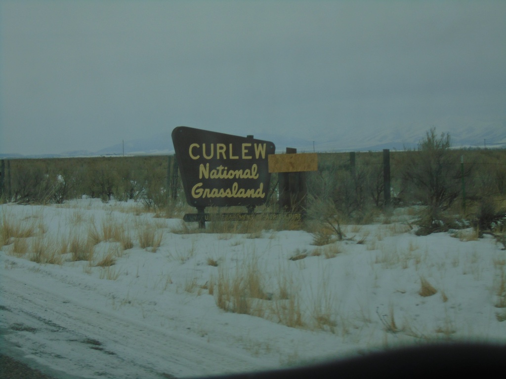
Entering Curlew National Grasslands on 23000 W
Entering Curlew National Grasslands on 23000 W near Stone, Idaho. Curlew is the only national grassland in Idaho and is administered by the Caribou-Targhee National Forest.
Taken 12-30-2020
Stone Oneida County Idaho United States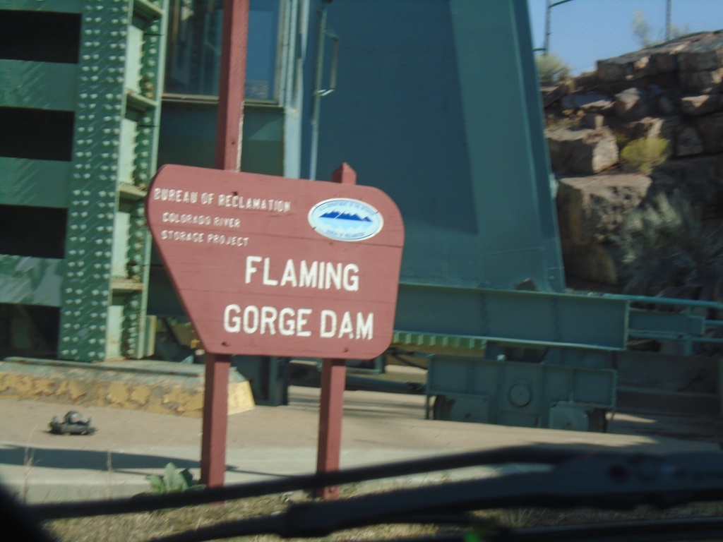
US-191 North - Flaming Gorge Dam
Flaming Gorge Dam on US-191 north. The Flaming Gorge Dam is on the Green River. Behind the dam is Flaming Gorge Reservoir which is part in Utah, and part in Wyoming.
Taken 10-03-2020
Dutch John
Daggett County
Utah
United States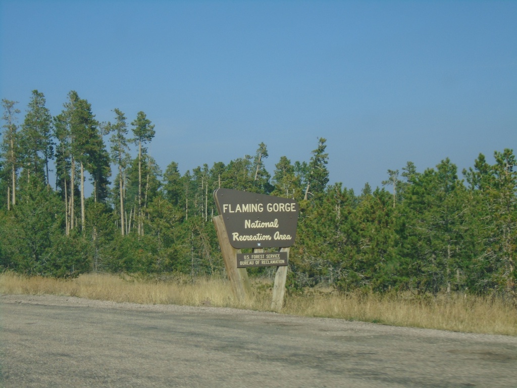
US-191 North - Flaming Gorge National Recreation Area
Entering the Flaming Gorge National Recreation Area on US-191 north.
Taken 10-03-2020
Dutch John
Daggett County
Utah
United States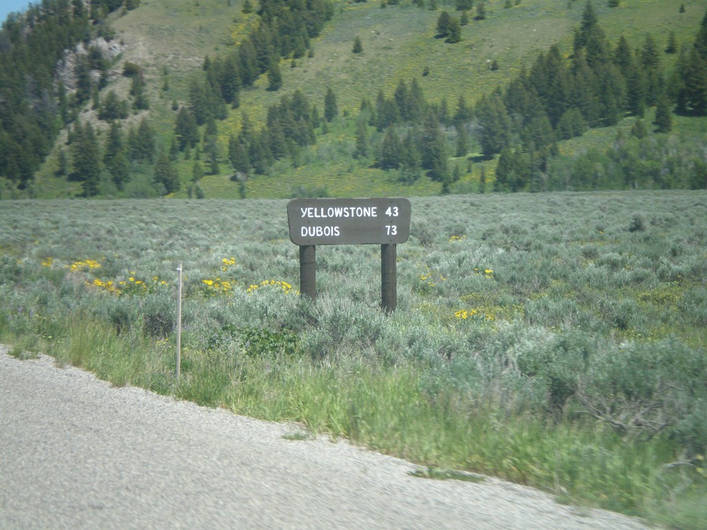
US-26 East/US-191 North - Distance Marker
Distance marker on US-26 East/US-191 North to Yellowstone and Dubois. The sign is a wooden style common inside both Grand Teton and Yellowstone National Park. This marker is just inside Grand Teton National Park.
Taken 07-02-2011
Jackson
Teton County
Wyoming
United States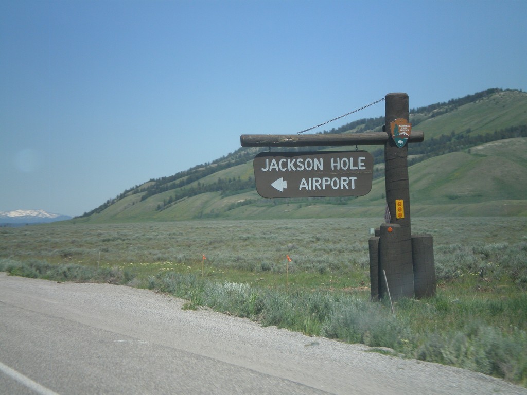
US-26 East/US-191 North at Jackson Hole Airport
US-26 East/US-191 North at Jackson Hole Airport in Grand Teton National Park.
Taken 07-02-2011
Jackson
Teton County
Wyoming
United States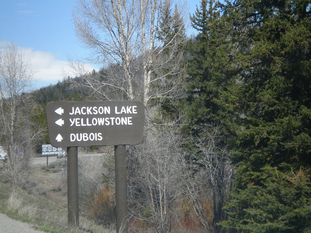
US-26 East and US-89/US-191 North approaching US-287 - Moran Jct.
US-26 East and US-89/US-191 North at US-287 - Moran Jct. Turn left for US-89/US-191/US-287 North to Jackson Lake and Yellowstone. Continue straight for US-26 East/US-287 south to Dubois.
Taken 05-15-2008
Moran
Teton County
Wyoming
United States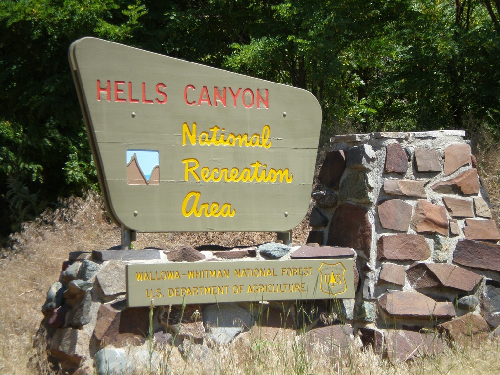
NFH-39 North Hells Canyon NRA
Entering Hells Canyon National Recreation Area on NFH-39 north.
Taken 06-30-2007
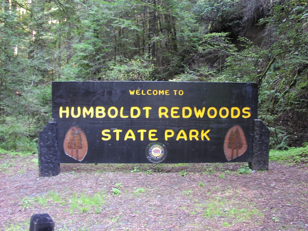
CA-254 North - Humboldt Redwoods SP
CA-254 north, Humboldt Redwoods State Park.
Taken 04-01-2006
 Phillipsville
Humboldt County
California
United States
Phillipsville
Humboldt County
California
United States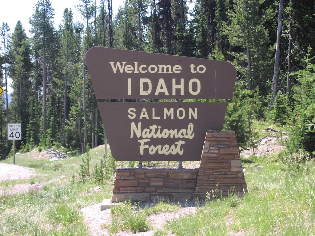
US-93 - Welcome To Idaho
Welcome To Idaho/Salmon National Forest at Lost Trail Pass
Taken 07-01-2003
 Gibbonsville
Lemhi County
Idaho
United States
Gibbonsville
Lemhi County
Idaho
United States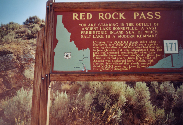
US-91 - Red Rock Pass Historical Marker
Historical Marker on Red Rock Pass, US-91 South. All highways in Idaho have these historical markers. To see all of them check out the Idaho State Historical Marker Guide. Red Rock Pass is where ancient Lake Bonneville - an inland sea, which covered most of the great basin, overflowed into the Snake Plain. Evidence of this great flood is everywhere along the Snake and Columbia Rivers in the Pacific Northwest. This pass marks the divide between the Great Basin and the Snake/Columbia River drainages.
Taken 08-01-2000
 Red Rock Junction
Bannock County
Idaho
United States
Red Rock Junction
Bannock County
Idaho
United States